MOTHER LODE TRAILS
  • Home
  • About
  • Contact
  • Volunteer
  • Links
    • Law Enforcement Emergency
    • Federal, State, County Districts Parks & Trails
    • Running Clubs
    • Equestrian Clubs
    • Mt. Bike Clubs
    • Hiking Clubs
    • Trail Advocacy Organizations
    • Phone Numbers State & Federal Parks, Trails & Lands
    • Where to Eat on the Trails
  • News
  • Alerts

Last day of the year for tax deductible donations to trails nonprofits

12/31/2022

 
Picture
LAST DAY! END OF YEAR DONATIONS TO TRAILS FOUNDATIONS - DO IT NOW!!
At the end of the year we make decisions to either give money to the tax man, or donate it to nonprofits that do what we love: create, maintain and love our trails.

Go to our page for a complete list:
Mother Lode Trails "Trail Advocacy Organizations" 
http://www.motherlodetrails.org/trail-advocacy-organizations.html


Here are some of our favorites -
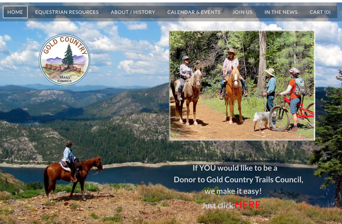
Gold Country Trails Council - GCTC
www.GoldCountryTrailsCouncil.org

Placer County Land Trust
https://placerlandtrust.org/

Bear Yuba Land Trust - BYLT
https://www.bylt.org/

WESTERN STATES TRAIL FOUNDATION
https://teviscup.org/

Back Country Horsemen of California - BCHA
https://www.bcha.org/blog/chapters/bch-of-california-mother-lode/

PACIFIC CREST TRAIL FOUNDATION
https://www.pcta.org/

Tree down on Tevis trail near Francisco's, not passable for most users

12/24/2022

 
Picture
Big tree down near Francisco's. It pretty much blocks the trail heading out to Francisco's towards river/Drivers Flat.  

Trail rider has reported to Parks but there is no maintenance crew back until January 2, 2023. 

Bear River Headwaters Preserve permanently protected by Placer Land Trust

12/22/2022

 
Picture
"Bear River Headwaters Preserve
1,200 acres protected for forest and watershed health, wildlife habitat, forestry research, recreation, and more. We are pleased to announce the permanent protection of 1,200 acres of the Bear River headwaters! Placer Land Trust just recorded a perpetual conservation easement to protect this property, located north of Interstate 80 from Alta to Blue Canyon.
The preserve will be open to the public for recreation.


The property was transferred from Pacific Gas & Electric Company to CAL FIRE, and represents the final phase of a multi-part project to create a permanently protected Demonstration State Forest spanning the Upper Bear & American River watersheds. Demonstration State Forests serve as "living laboratories" where researchers, scientists, landowners and citizens can learn about forest management strategies. And as our second-largest project to date, completion of this project also gets us closer to our goal to protect at least 25,000 acres in Placer County by 2030! 


Quick Facts:
  • 1,200-acre property is located northwest of Interstate 80 between Alta and Emigrant Gap
  • Owned by CAL FIRE as a Demonstration State Forest, serving to help California continue to learn about forests, timber harvest, public use, wildfire, and climate change
  • Protected in 2022 by Conservation Easement granted to Placer Land Trust

Protecting Sierra Nevada Forest Land
The conservation easement for this property was donated to Placer Land Trust by the California Department of Forestry and Fire Protection (CAL FIRE) through partnership with Pacific Gas and Electric Company (PG&E) Land Conservation Commitment Program and the Pacific Forest and Watershed Lands Stewardship Council to guarantee the land is protected forever from subdivision and development. The Conservation Easement protects the property as open space scenery, wildlife habitat, recreation land, and as a landscape for learning about sustainable forest management.  

Learning from the Land
The property is one of 11 forests – and the first in the Placer County region – owned and managed by CAL FIRE as a “living laboratory” for learning how to better care for our forests for multiple public benefits, including:
  • forest health
  • wood products and timber production
  • public recreation
  • watershed protection
  • wildlife protection and habitat restoration
  • climate adaptation strategies related to wildfire
For more information about Demonstration State Forests, click here.

The project helps meet global, federal, and State goals to protect natural and working lands as nature-based solutions to climate change and expand public access to natural areas. To do its part locally, Placer Land Trust is working with willing landowners to protect at least 25,000 acres in Placer County by 2030.

Wildlife & SceneryThe property is part of the headwaters of the Bear River, which contributes to the high quality of drinking water in Placer County.  Much of the property contains Sierran mixed conifer forests and mixed conifer-hardwood forests and mixed-chaparral. The forest also provides habitat for a diverse range wildlife, from large mammals (bear, deer, coyote) to reptiles, amphibians, fish, birds and insects. The property provides scenic value as it protects the hillsides and views from adjacent and nearby public roadways including Interstate 80.

Recreation
In addition to quiet enjoyment and study of nature, active recreation allowed in the forest includes fishing, hiking, picnicking, hunting, sightseeing, birdwatching and the enjoyment and study of nature.

Partnership
The property was formerly owned by Pacific Gas and Electric Company (PG&E). Through PG&E’s Land Conservation Commitment in partnership with the Pacific Forest and Watershed Lands Stewardship Council, the property has been transferred to CAL FIRE. Funding to ensure the property’s permanent protection was provided to Placer Land Trust by the Stewardship Council. 
CAL FIRE’s Demonstration State Forests are managed for multiple-use objectives, and public recreation is a priority. The land will be stewarded under a Forest Management Plan to be approved by the Board of Forestry and Fire Protection; CAL FIRE Sacramento Resource Management will be managing the property. CAL FIRE retains the right to build forest and fire management structures on less than 1% of the 1,200-acre property, such as a fire station, fire lookouts, or barracks for fire/forestry personnel working in the area. Placer Land Trust holds the conservation easement that permanently prohibits subdivision and limits development.

Click here to see the original note from PLT.


Trail networks in the Salmon Lake and Loch Leven Lakes area bought and added to Tahoe National Forest

12/21/2022

 
Picture
As Part of the Sierra Checkerboard Initiative, the Huysink Lake Project Marks the Protection by TPL, U.S. Forest Service and Local Partners of over 120,000 acres to Date in Consolidating Public Lands in the Sierra Nevada  (see map below)
San Francisco, CA – Trust for Public Land [TPL] in partnership with the United States Forest Service [USFS] announced today the permanent protection of Huysink Lake and the surrounding 760 acres in Placer County south of Cisco Grove, that will be purchased by the U.S. Forest Service and become a part of the Tahoe National Forest in a deal facilitated by TPL.

The protection of the Huysink Lake property will allow for improvements to the Salmon Lake trailhead and enhance trail access to one of the Tahoe National Forest’s most popular backcountry camping and trail networks in the Salmon Lake and Loch Leven Lakes area. 

 “This addition to the Tahoe National Forest will expand recreational opportunities while protecting important natural resources in the Sierra Nevada,” said Tahoe National Forest Supervisor Eli Ilano. “It has been an exciting endeavor to work with partners to protect and improve the ecological resilience of Sierra watersheds.”

“To be able to take one-time private property and not only protect it permanently but to turn it over for the full enjoyment of the public, is one of the great joys in delivering on TPL’s mission of connecting everyone to the outdoors,” said Guillermo Rodriguez, California State Director for The Trust for Public Land. “For nearly 50 years, TPL has worked in the Sierra acquiring private land to not only to connect critical linkages and increase public access but to inspire people to explore the great outdoors while providing critical watershed habitat in a changing climate.”

The Huysink Lake property is a keystone parcel that will greatly improve trail connectivity. The now publicly owned Huysink Lake property contains the Salmon Lake trailhead and a portion of the Salmon Lake system trail that offers a less challenging and less crowded alternative for users to access the popular Loch Leven and Salmon Lakes Basin.  

“The West and much of California’s Sierra Nevada mountains are literally diced up into alternating square-mile sections of federally managed land, public and private ground, but through the Sierra Checkerboard Initiative, TPL and partners have now protected over 120,000 acres in the Sierra,” continued Guillermo Rodriguez. “Huysink Lake is one more critical piece to unlocking the lands puzzle that has been presented by history and past industry” 

When work began on the Transcontinental Railroad in 1863, the Federal government granted railroad companies ownership of every other square mile of land, keeping the squares in between. The grant allowed railroads to pay for construction by selling their sections. In the mountains, railroads companies held on to their private sections, while many public sections became part of the national forests. Timber companies eventually acquired close to 75 percent of the private land, creating a checkerboard pattern of alternating private and public land across the central Sierra region. The Sierra Checkerboard Initiative is a multi-year plan to consolidate and protect the remnant checkerboard lands such as Huysink Lake. 

The Huysink Lake project will protect 760 acres within the Sierra Checkerboard, an area of focused conservation investment by TPL and partners that has led to the protection of over 120,000 acres to date. 

In addition to enhanced recreational access and better connectivity of public lands, the conservation efforts at Huysink Lake protect critical wildlife habitat and increase climate resiliency in the region by maintaining healthy wetlands and meadows. Protecting Huysink Lake and surrounding property ensures that an estimated 57 acres of wetlands, including the lake, two mountain meadows, and two miles of perennial streams will forever be safeguarded. The property straddles the divide between the North Fork American River and the South Yuba River watersheds and contains the majority of the headwaters of one of the major tributaries of the North Fork American Wild and Scenic River.

“Forested watersheds in the Sierra Nevada, like Huysink Lake and surrounding meadows, provide critical habitat as well as groundwater recharge areas that feed the rivers and communities of Northern California. Maintaining these meadows and wetlands in a healthy, connected state and increasing the resiliency of these watersheds will ensure these ecosystems continue to play a crucial role in maintaining climate resilience,” said Heidi Krolick, Conservation Director for the Sierra Nevada and Central Valley. 

During summer months, wetlands and mountain meadows are considered the most important habitat in the Sierra Nevada for birds, as almost every bird species that breeds in or migrates through the region uses wetlands and meadows at some point in their life cycle. Protection of the Huysink Lake property will enhance these and other nearby efforts to protect critical habitat for wildlife in the Tahoe-Donner region. 
​

The $1.7 million purchase and transfer of Huysink Lake was made possible by Forest Service appropriated funding from the Land and Water Conservation Fund (LWCF). Created by Congress in 1964, LWCF is a bipartisan commitment to safeguard natural areas, water resources, and our shared cultural heritage. California’s Congressional delegation was instrumental in the recent passage of the Great American Outdoors Act, which permanently funded the LWCF. This public funding was complemented by generous private support to TPL from the Bella Vista Foundation and Sierra Nevada Brewing Company. ​

Click here to see the original article at the Trust for Public Land website.

=====================================
From the SF Chronicle:
A tract of alpine forest near Donner Pass will soon be added to Tahoe National Forest as part of a sale brokered by conservationists and finalized Monday.


The 760-acre parcel, located just south of Interstate 80 about 30 miles west of Truckee, fills a gap in the heart of the 1,360-square-mile national forest that was owned by a timber company logging the land for decades.

The land encompasses Huysink Lake, a local fishing and swimming spot, as well as trails that access the forest’s most popular backcountry campsites at the Salmon Lake and Loch Leven Lakes areas. It also contains much of the North Fork American River's headwaters.

The $1.7 million purchase, and ensuing transfer, were coordinated by the U.S. Forest Service and San Francisco’s Trust for Public Land with money allocated via the Land and Water Conservation Fund, a federal mechanism of natural resource protection supported by royalties from offshore oil and gas operations.

“This is a keystone piece in the Truckee-Donner region,” said Heidi Krolick, Trust for Public Land's conservation director for the Sierra Nevada and Central Valley. “A key benefit is improving trail connectivity and accessibility in an area that is heavily used in Tahoe National Forest.”

Currently, the main-line hike into the Loch Leven Lakes area leaves from a trailhead near Soda Springs, leading people on a grueling 3.5-mile trudge uphill. The newly acquired territory contains a separate trail with a more gradual vertical profile, Krolick said.

Trust for Public Land is working to acquire the square-mile tracts of private land that blanket this region of the Sierra in a checkerboard pattern. The unique composition is a relic of federal government land grants handed out during the planning and construction of the Transcontinental Railroad 160 years ago.

The land trust was instrumental in securing 3,000 acres in the same area 10 years ago - the so-called Royal Gorge tracts, which had been slated for development but were instead folded into the adjacent national forest.
​

“This project is about connecting dots,” said Guillermo Rodriguez, the land trust’s California state director. “Anybody who’s gone hiking in the Sierras has had to figure out how to stay on public property. It’s fun to be able to rebuild the checkerboard so visitors can really, truly enjoy the great outdoors."

Go here for the original article and photos in the San Francisco Chronicle:

Picture

Major climb for The Canyons: 100K endurance run in UTMB World Series April 28-29, 2023

12/16/2022

 
Picture
New 100K endurance run is named Americas Major for UTMB World Series
100K endurance run is named Americas Major for UTMB World Series


Auburn will be home to ultra-running history in April, as it will become the first city in the Americas to host a UTMB World Series Major when The Canyons comes to town this spring.
The race will give runners an opportunity to qualify for the UTMB World Series Finals at the UTMB Mont-Blanc, one of the biggest trail running events in the world.

Chaz Sheya, founder and race director for The Canyons, said in a news release: “I am thrilled to share that The Canyons Endurance Runs by UTMB is now the Americas Major. It is an honor to be one of three Majors in the UTMB World Series, with double Running Stones and many more entries to the World Finals in Chamonix! I am also excited to share the history of the Canyons and the Western States Trail, where modern-day mountain ultra trail running started. We look forward to putting on a great event next April in Auburn, California, the endurance capital of the world!”

"We are thrilled with this historic announcement by UTMB and the IRONMAN Group, further solidifying Auburn and Placer County as the Endurance Capital of the World," said Visit Placer CEO Rob Haswell. "Last year, Auburn's incredible landscapes, canyons, trails and the city's legendary friendliness were on full display to the international community, which really led to this moment."

"The Canyons 100 becoming the UTMB World Series Race of the Americas is just huge for Auburn and the endurance community. Our team has been working really hard with The Canyons, IRONMAN and UTMB over the past months to modify the routes and firm up the strategy which made this all come together," said Auburn City Manager John Donlevy. "To become the number one race in the World Series for our hemisphere is a recognition of Auburn’s place in the running world and to the efforts of the entire team who have been working on this. As this has been announced, runners from all over the world will be setting their calendars to be here in April."

Donlevy also gave praise to those from the county as well as Sheya for their part in the race: "Enough cannot be said for the work of Visit Placer, Chaz Sheya from Canyons 100 and Jonathan Wright from the city for getting this done. We appreciate the fact that UTMB/Iron Man recognize our efforts and want us to be their representative for North America."

The Canyons will also once again serve as one of seven Golden Ticket Races for the world-famous Western States Endurance Run in June. The top two male and female finishers in each event will receive an automatic qualification for Western States.

The course is unique in that it travels the historic Western States Trail, much like its summer counterpart, but sees its runners travel from Auburn into the canyons rather than the opposite.

“This course is a different type of challenge. There's close to the same amount of climbing as Western States has in two-thirds of the distance,” Sheya said about the course before last year’s race, adding the course gives runners the unique ability to experience part of the Western States Trail. “It gives people the opportunity to get on the course and prepare for Western States. That was the whole reason I started the race was to give people the opportunity to learn the trail in the canyons.”

Last year’s Canyons 100K winner, Adam Peterman of Missoula, Montana, won Western States as well. Peterman shattered the course record by nearly 40 minutes. Runners in the 2023 Canyons who complete the 100K in under 20 hours will be automatically entered into the 2024 Western States lottery.

The Canyons began as a 50K race in 2014 before adding the 100K the next year and then earning Western States qualifying status in 2016. The event will add a 100-mile race for the first time in 2023.
"The reality is that Auburn is the running capital of North America and Chamonix for Europe. A pretty awesome combination of beautiful places who host the top athletes for the biggest prizes," Donlevy said.

The Canyons will take place April 28-29 in Auburn.
CLICK HERE to see the original article in Gold Country Media.

E-Bikes Recalled Due to Fire, Explosion and Burn Hazards

12/16/2022

 
Picture
This E-bike recall involves Ancheer e-bikes with model number AM001907. The model number can be found on the e-bike packaging and in the instruction manual but cannot be found on the bike itself. A water bottle shaped cylindrical battery distinguishes model AM001907 from other models. The bikes are black and have 26-inch wheels. “Ancheer” is printed on the downtube.
Remedy:Consumers should stop using the recalled e-bikes immediately and contact Ancheer for a free replacement battery and battery mount.
Incidents/Injuries:Ancheer has received six reports of incidents involving fire, explosions, or sparks, including four reports of burn injuries.
Sold At: Online at www.aliexpress.com, www.ancheer.shop, www.amazon.com, www.ebay.com, www.newegg.com, www.overstock.com, www.rakuten.com, www.sears.com, www.walmart.com and www.wish.com from January 2016 through June 2022 for between $280 and $930.
Distributor(s):
Shenzhen Sailvan Network Technology Ltd. d/b/a Ancheer, of China
Manufactured In:
China
​
CLICK HERE for original US safety recall information.


Temporary closure of WST at No Hands Bridge

12/9/2022

 
Picture
​STATE OF CALIFORNIA DEPARTMENT OF PARKS AND RECREATION GOLD FIELDS DISTRICT AUBURN SECTOR ORDER NO. 690 - 062 -2022
December 8, 2022 Temporary Closure Mountain Quarries Railroad Bridge/Western States Trail
​The Western States Trail, including the Mountain Quarries Railroad Bridge (No Hands Bridge) will be closed to public access from Highway 49 west approximately .4 miles to the intersection with the .52 Access Trail, as depicted on the attached map, during the following time periods:
1. December 12th at 6:00a.m. through December 16th at 5 p.m.
2. December 19th at 6:00a.m through December 23 at 5 p.m.


This closure will be in effect for the safety of the public during a construction project on the Mountain Quarries Railroad Bridge and adjacent trail segments. This order will expire December 23, 2022 at 5 p.m.  

​Map below.

To see the complete Order, go here:

https://www.parks.ca.gov/pages/502/files/690-062-2022%20Temp%20Closure%20Mountain%20Quarrie%20Bridge-WST.pdf​


Picture

Nevada CO recreation and trails plan first of its kind, community input sought

12/8/2022

 
Picture
Nevada County is embarking on the development of a countywide Recreation and Resiliency Master Plan. The plan is not only a first for Nevada County, but also one of the first of its kind in the state of California to comprehensively integrate solutions for adapting to extreme weather, wildfire, drought and other impacts as part of planning for parks, trails, open spaces and recreation amenities.

Interested community members are invited to sign up to receive an invitation to take the online survey and notifications on the plan’s progress and opportunities to contribute at www.NevadaCountyCA.gov/Recreation

Sierra Nevada Conservancy has awarded $200,000 through the Vibrant Recreation and Tourism Grant Program for this effort. Nevada County has also allocated $250,000 through American Rescue Plan Act funds.


“The Recreation and Resiliency Master Plan will be an essential tool to further sustainability and quality of life in Nevada County,” explains Supervisor Hardy Bullock. “Our recreation infrastructure can promote climate and wildfire resilience as well as community health and carry out our community’s vision of how we want to live, work and play.”

Over the next 12- to 18-months, input from all residents is needed – including seniors, students, families, youth, regional partners, and more. Interested community members are invited to sign up to receive an invitation to take the online survey and notifications on the plan’s progress and opportunities to contribute at www.NevadaCountyCA.gov/Recreation

“Participation will be key to ensuring this plan is successful and widely reflects our community’s needs and values,” said Board Chair Sue Hoek. “We are prioritizing ways to make participation easy through personal outreach, online surveys and in-person or virtual workshops. Currently, we are conducting stakeholder interviews and focus groups with over 90 organizations.”
 
About the Recreation and Resiliency Master Plan
In addition to identifying recreation needs and articulating a long-term vision for managing open spaces and recreation resources, the plan’s recommendation and projects will integrate strategies to do the following:
  • Reduce the county’s risk of natural disasters like wildfire, flooding, and extreme heat;
  • Provide support for state and federal first responders in the event of a disaster;
  • Facilitate healthy lifestyles; and
  • Establish compelling public spaces that contribute to the county’s economy and sense of place.
Inspired by the spirit of Nevada County, the plan will identify specific project recommendations along with funding sources and strategies to implement them. Partnerships with tribal interests, recreation districts, Tahoe National Forest, California State Parks, BLM, Nevada Irrigation District, land trusts, and non-profit organizations engaged in local recreation, arts, health and wellness, conservation, forest health, and management of open space and trails will be developed and leveraged to move projects forward.

Design Workshop, based in South Lake Tahoe, is the prime consultant for the Nevada County Recreation and Resiliency Master Plan. The national firm is a planning and design studio with over 25 years of experience working with counties, cities, and towns to integrate landscape architecture, recreation planning, and strategic services.

About Nevada County’s Recreation Objective
Recreation became the Board of Supervisors’ newest objective in 2022 to promote recreation with our partners, enhance recreational access, support health and safety, preserve our natural resources and support economic growth from jobs to tourism that all benefit from recreation. The Recreation and Resiliency Master Plan will serve as a tool to organize and prioritize county-wide recreational resources that can sustain our environment, people and economy. 

CLICK HERE to see the original article and photos at YubaNet.net


Nevada City resident guilty of driving motor vehicle off designated routes in Tahoe National Forest

12/6/2022

 
Nevada City man guilty of driving in protected forest areaAppeal-Democrat, Marysville, Calif.
Dec. 6—A U.S. judge found a Nevada City man guilty for operating a vehicle in a protected area of the Tahoe National Forest, officials said Monday.
According to Lauren Faulkenberry with Tahoe National Forest, U.S. Magistrate Judge Deborah Barnes found 36-year-old Ross McKnight of Nevada City guilty of driving a motorized vehicle off designated routes determined by the federal government.
Officials said McKnight was operating a vehicle in a protected riparian area along Greenhorn Creek. That area serves as "vital habitat" for the Foothill yellow-legged frog, a species that officials said was a federal concern and is considered an endangered species in California.
On March 27, U.S. Forest Service officers encountered McKnight about .5 miles south of the designated route in an area where motor vehicles are not allowed, Faulkenberry said. He was educated and ticketed on site. He later received additional fines in court.
"It is the responsibility of the motor vehicle user to tread lightly and know where they are allowed to go on National Forest lands," Tahoe National Forest Patrol Captain Gerald Parker said in a statement. "Driving off designated routes causes the degradation of resources and could potentially harm wildlife, as in this case. Tahoe National Forest takes irresponsible motor vehicle use on public lands seriously from the lens of both public safety and the protection of habitat."
The forest service said the Greenhorn Creek area has historically been heavily visited by motor vehicle users and other recreationists.
"Illegal fires during high-fire danger, abandoned burned-out vehicles and irresponsible recreation are often reported. Tahoe National Forest has ramped up patrol of the area in order to protect environmental resources and the surrounding communities," officials said. "Over several years, Tahoe National Forest has engaged with the community through a variety of outlets including both public and media outreach to help educate motor vehicle users on the requirements of recreating responsibly on National Forest lands. Signage along designated routes is also installed where possible, but often defaced or removed by members of the public."
For those unsure about where to travel, Tahoe National Forest issued motor vehicle use maps in 2010. Those maps outline designated roads and trails that are open to motorized travel, including any vehicle class restrictions and seasonal allowances in place. By law, motor vehicle users on National Forest System lands are required to only operate on designated routes identified in those maps.
Motor vehicle use maps for the Tahoe National Forest and other neighboring forests can be found at district offices and on the Tahoe National Forest website at
 https://www.fs.usda.gov/detail/tahoe/maps-pubs/?cid=fseprd638275.

---------------------------------
FROM News4 Reno:
NEVADA CITY, CA. — 
A Nevada City resident was found guilty of driving a motorized vehicle in Tahoe National Forest earlier this year.


After an investigation by Tahoe National Forest law enforcement officers, U.S. Magistrate Judge Deborah Barnes found a Nevada City resident guilty of driving a motorized vehicle off designated routes determined by the federal government. Officials say the driver was operating a vehicle in a protected riparian area along Greenhorn Creek that serves as vital habitat for the Foothill yellow-legged frog, a federal species of concern and California endangered species.

On March 27, 2022, Forest Service officers encountered an individual approximately one-half mile south of the designated route in an area where motor vehicles are prohibited. The individual was educated and ticketed on site, later receiving additional fines in court.

“It is the responsibility of the motor vehicle user to tread lightly and know where they are allowed to go on National Forest lands,” said Tahoe National Forest Patrol Captain Gerald Parker. “Driving off designated routes causes the degradation of resources and could potentially harm wildlife, as in this case. Tahoe National Forest takes irresponsible motor vehicle use on public lands seriously from the lens of both public safety and the protection of habitat.”

Historically, the area of Greenhorn Creek was heavily visited by motor vehicle users and other recreationists. Illegal fires during high-fire danger, abandoned burned-out vehicles and irresponsible recreation are often reported. Tahoe National Forest has ramped up patrol of the area in order to protect environmental resources and the surrounding communities.

In 2010, the Tahoe National Forest completed its motorized travel management analysis and issued motor vehicle use maps (MVUM). The MVUM outlines designated roads and trails open to motorized travel including any vehicle class restrictions and seasonal allowances.


Motor vehicle users on National Forest System lands are required by law to only operate vehicles on designated routes identified on the MVUM. The MVUM for the Tahoe and neighboring forests can be found at district offices and on the Tahoe National Forest website.


CLICK HERE to see the original article at News4 Reno.

Example of Vehicle Use Map. These maps are available online:
www.fs.usda.gov/detail/tahoe/maps-pubs/?cid=fseprd638275
Picture

Sinkhole at Empire Mine: Hardrock Trail closed, use Stacey Lane bypass

12/2/2022

 
Picture
​Public Safety Notice:
A section of the Hardrock Trail at Empire Mine State Historic Park, between Stacey Lane Trail and the Sand Dam spillway, is closed until further notice due to the rapid development of a sinkhole.

The closed trail section is extremely unstable, and any area within the closed section may be vulnerable to collapse without warning. Park visitors, hikers and equestrians are strongly advised to utilize the trail bypass, along the main Stacey Lane Trail and the Stacey Lane Crosscut Trail, which safely circumvents the area.

The length of affected trail within the closed area, and the sinkhole stabilization timeframe, is not currently known. Park staff and geologic consultants are currently assessing the situation and a reopening date will be announced when determined.

For updates and information, visit the park webpage at www.parks.ca.gov, follow us on Facebook and Instagram @EmpireMineSHP, or call the Empire Mine State Historic Park visitor center at (530) 273-8522.

From the Empire Mine SHP Facebook page here:
https://www.facebook.com/113179243675318/photos/a.119824276344148/675872424072661/​
<<Previous

    Archives

    March 2023
    February 2023
    January 2023
    December 2022
    November 2022
    October 2022
    September 2022
    August 2022
    July 2022
    June 2022
    May 2022
    April 2022
    March 2022
    February 2022
    January 2022
    December 2021
    November 2021
    October 2021
    September 2021
    August 2021
    July 2021
    June 2021
    May 2021
    April 2021
    March 2021
    February 2021
    January 2021
    December 2020
    November 2020
    October 2020
    September 2020
    August 2020
    July 2020
    June 2020
    May 2020
    April 2020
    March 2020
    February 2020
    January 2020
    December 2019
    November 2019
    October 2019
    September 2019
    August 2019
    July 2019
    June 2019
    May 2019
    April 2019
    March 2019
    February 2019
    January 2019
    December 2018
    November 2018
    October 2018
    September 2018
    August 2018
    July 2018
    June 2018
    May 2018
    April 2018
    March 2018
    February 2018
    January 2018
    December 2017
    November 2017
    October 2017
    September 2017
    August 2017
    July 2017
    June 2017
    May 2017
    April 2017
    March 2017
    February 2017
    January 2017
    December 2016
    November 2016
    October 2016
    September 2016
    August 2016
    July 2016
    June 2016
    May 2016
    April 2016
    March 2016
    February 2016
    January 2016
    December 2015
    November 2015
    October 2015
    September 2015
    August 2015
    July 2015

    Categories

    All

    RSS Feed

Home
Contact
 Mother Lode Trails is YOUR local volunteer-run trail information and resource website. Here you can find
up-to-the minute information on trail alerts, links and trail news for Placer,  Yuba, and Nevada counties.
Mother Lode Trails is trademarked.