Foresthill, Calif. June 3, 2019 – The American River Ranger District is continuing fuel reduction treatments on approximately 455 acres in the vicinity of the China Wall Staging Area through the mastication of small trees and brush. Work will begin June 17, 2019 and will continue through the summer of 2019. In order to ensure public safety,
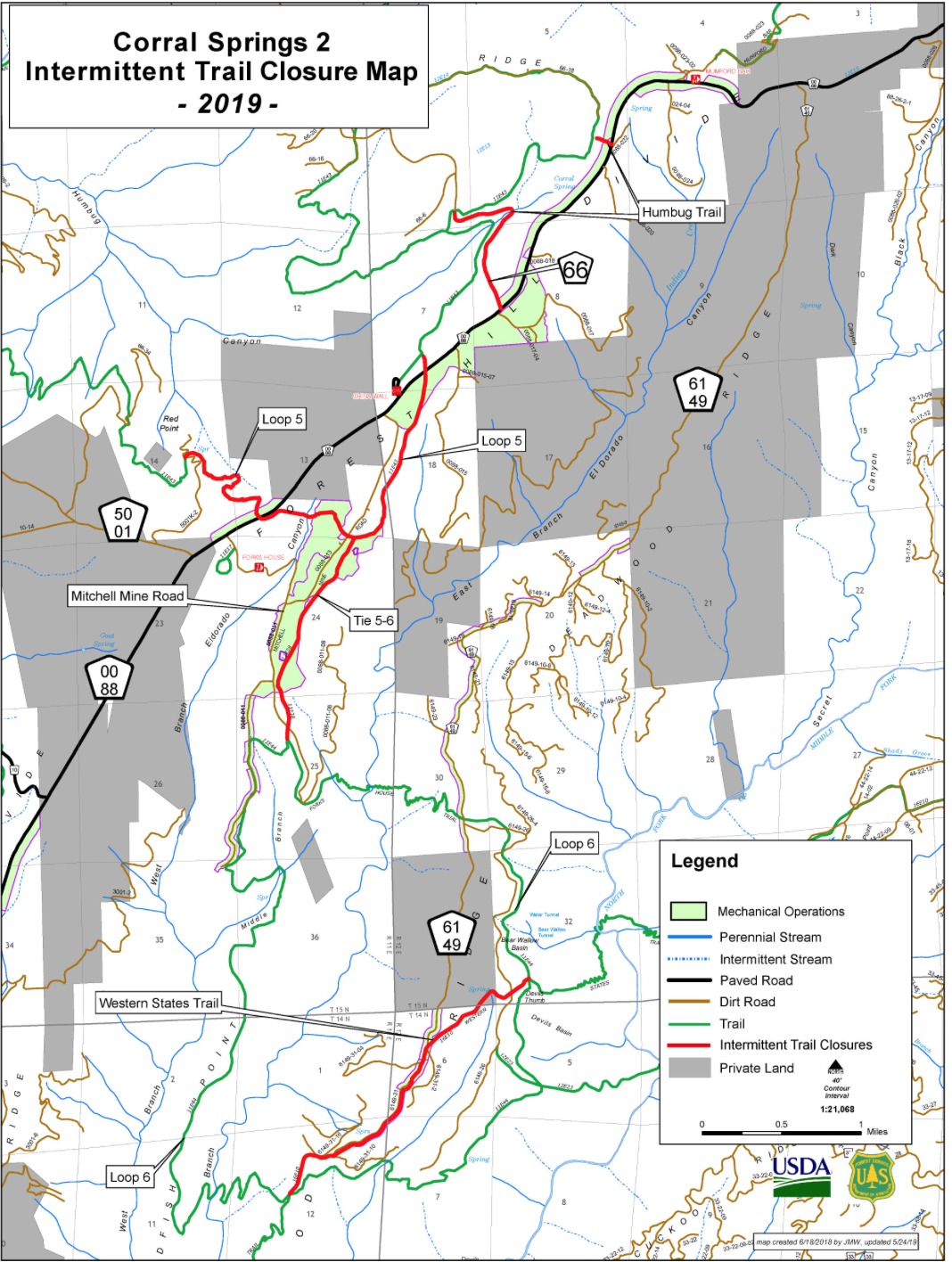
Off Highway Vehicle and Western States Trail users may be affected by sections of periodic, intermittent trail closure on Loop 5, Trail 5-6 and the Western States Trail. This will only occur when treatment areas are actively in progress near the trail. Work will not occur on Fridays, Saturdays and Sundays.
Public notices and maps will be posted at the China Wall, Parker Flat and Sugar Pine OHV Staging Areas. Information will be updated regularly as work progresses. Intermittent closure signs will be posted at the access point of the affected trail sections while work is in progress. Traffic signs and flaggers will be in place where work is occurring within 300 feet of Foresthill Road (88 Rd.) and Mitchell Mine Road (88-13 Rd.). Please see the attached map.
While traveling or recreating in the area, please stay alert for signs warning of the activity, watch for personnel and equipment. Do not approach operations.
For more information, please contact Kelly Bowdoin at the American River Ranger District at (530) 367-2224 or view the Forest website at www.fs.fed.us/r5/tahoe/. Future closures will be posted on the ARRD District office recreation recording at the phone number listed above. Staging Area bulletin boards will also be updated regularly.
For more information about the Tahoe National Forest, go to www.fs.usda.gov/tahoe. Join the conversation by following us on Twitter at twitter.com/Tahoe_NF and Facebook at www.facebook.com/TahoeNF.
 RSS Feed