MOTHER LODE TRAILS
  • Home
  • About
  • Contact
  • Volunteer
  • Links
    • Law Enforcement Emergency
    • Federal, State, County Districts Parks & Trails
    • Running Clubs
    • Equestrian Clubs
    • Mt. Bike Clubs
    • Hiking Clubs
    • Trail Advocacy Organizations
    • Phone Numbers State & Federal Parks, Trails & Lands
    • Where to Eat on the Trails
  • News
  • Alerts

McClintock’s Trojan horse of mountain bike bill would put ‘wheels over wilderness’

2/28/2018

 
Picture
"There is pressure on public lands from development, energy extraction and climate change. H.R 1349 is simply another attack, a Trojan horse couched in false claims of denied access for bicycles."

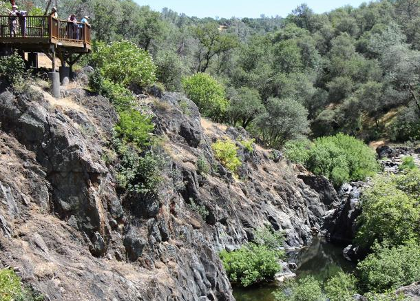
Hiking in the Sierra Nevada, arguably the West’s greatest mountain range, is a California birthright. It’s also the birthright of every American. When you walk along the crest of these majestic mountains, you likely are traveling on the Pacific Crest Trail, a 2,650-mile path for hikers and horseback riders that provides access to acres of public land in California, Oregon and Washington.
In 1968, a bipartisan Congress passed the National Trails System Act, creating the National Trails System and designating the Pacific Crest and Appalachian trails as the first two national scenic trails. Four years earlier, the Wilderness Act sought to preserve the country’s best landscapes from mechanization and development. Today there are 11 national scenic trails, 19 national historic trails and 109 million acres of protected wilderness.
There is pressure on public lands from development, energy extraction and climate change. H.R 1349 is simply another attack, a Trojan horse couched in false claims of denied access for bicycles.

This is our American legacy.

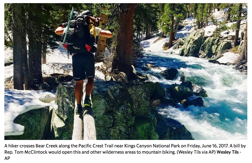
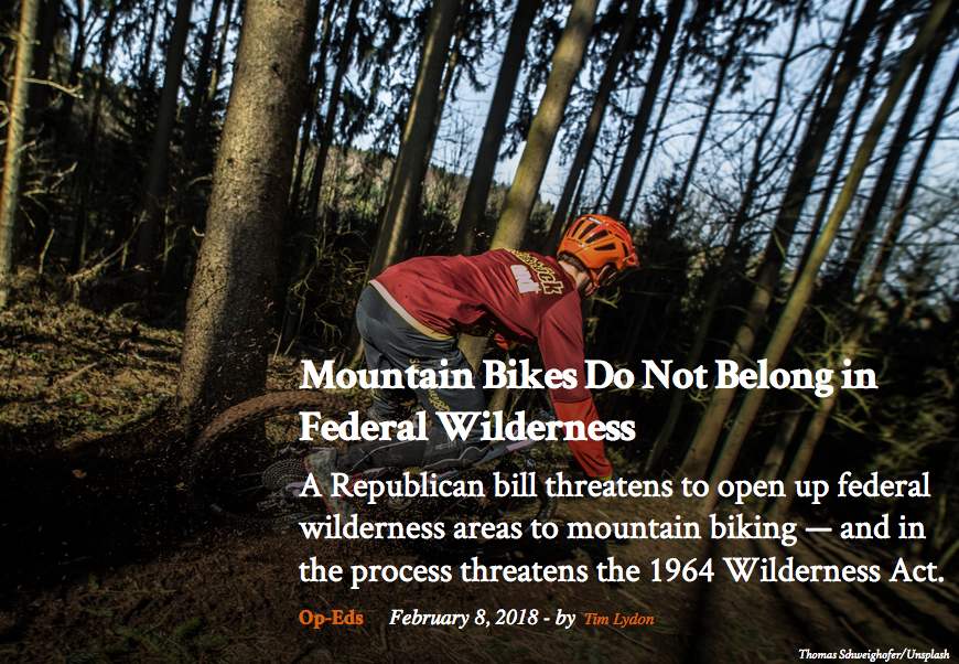
There is a looming threat to these protections. A fringe group of mountain bikers selfishly hopes to renegotiate the high standard enshrined in the Wilderness Act. H.R. 1349, a bill by Rep. Tom McClintock, R-Elk Grove, seeks to open wilderness trails to mechanized travel under the guise of fair access to public lands.

The so-called “Wheels over Wilderness” bill would undermine the character of wilderness as it’s so clearly defined by Congress. The act states: “...there shall be no temporary road, no use of motor vehicles, motorized equipment or motorboats, no landing of aircraft, no other form of mechanical transport...”

This is part of a larger scheme. Some in Congress are doing all they can to undermine protections for our public lands and the agencies charged with managing them. And the Trump administration has curtailed the boundaries of two national monuments and proposed massive cuts to federal budgets for maintaining trails.

There is pressure on public lands from development, energy extraction and climate change. H.R 1349 is simply another attack, a Trojan horse couched in false claims of denied access for bicycles. But cycling is well accommodated on public lands. The U.S. Forest Service says that 98 percent of its non-wilderness trails are open to bicycles.

The Pacific Crest Trail Association and others, Including the International Mountain Bicycling Association, oppose this bill because we value the wilderness as it is. Half of the PCT is wilderness, so there is much at stake for the trail and the 48 wilderness areas it crosses. Only three percent of federal land in the lower 48 states is protected wilderness. The rest is open in a variety of ways to all forms of recreation.

The PCT was built by and for people on horseback as well as hikers. A fast, silent bike can easily spook a horse that might see it as a predator. What would happen on a narrow trail with steep drop-offs?
We are not against mountain biking. We think the PCT and wilderness should remain free of bikes because that’s exactly what Congress intended. We are committed to working with cyclists to ensure their needs are met. But H.R. 1349 drives a wedge between groups that should be partnering to protect public lands. It would give hundreds of local land managers discretion over how wilderness trails are used. Cue the conflict.

It is becoming more difficult to escape technology and crowded cities. Wilderness, which provides clean air and water and allows wildlife to thrive, must be saved for future generations.
Any erosion of these protections would be a mistake. Opening the door on debate may be opening a Pandora’s box on the idea of wilderness itself.
--
Liz Bergeron is executive director and CEO of the Pacific Crest Trail Association.
Reach her at [email protected].


CLICK HERE to see the original article in the Sacramento Bee newspaper.


Ranch Trail enjoyed by mt. bikers and others

2/24/2018

 
Picture
Behind gate 116 in the Auburn State Recreation area is Ranch Trail, and is enjoyed predominantly by mountain bike riders. It runs alongside the Mammoth Bar OHV park currently closed due to erosion from last winter’s storms. The sweeping views of the middle fork of the American River are worth the short trek from the Foresthill Road to the edge of the canyon. A small shade structure used to house a picnic table beneath but it has been moved up closer to the road.

A rock outcropping (photo credit - Mary West) that had even better view now has a discouraging fence in front of it. If you continue down and around the hill, another shade structure and picnic table are here. On a clear day you can see the Sierra Nevada Mountains to the east and Folsom and even Sacramento to the west.

Some like the trail because it isn’t popular. There are no waterfalls or water access. Just a wide dirt trail, easy slope and great view. In spring there are a variety of wildflowers and lush grass. In winter, it can be chilly with the no windbreak of trees. I like to take my dog out here and enjoy watching the sun move across the canyon. The light and shadows change as the day passes. Other trails branch off from this one to make your hike as long as you like.

To get there from Auburn, take Interstate 80 to the Foresthill exit. Drive over the Foresthill Bridge and look for gate 116 on the right. It is down off the shoulder of the road so be cautious parking completely over the white line on the edge of the road near the railing. Take the trail behind the gate and to the right.
--By Mary West

To read the complete unedited article in the Auburn Journal newspaper,  CLICK HERE.

Mary West is a retired radio personality and news reporter with a longtime love of the outdoors, sharing her favorite day hikes in Placer, Nevada, El Dorado and Yuba counties. Learn more about local trails by following Mary on Facebook, Twitter, Instagram, and YouTube.


Wildlife Conservation Board awards Dry Creek Watershed $350,000 in grant funds

2/22/2018

 
Picture
The State of California Wildlife Conservation Board met on February 22, 2018 and approved approximately $17.9 million in grants to help restore and protect fish and wildlife habitat throughout California. Included in the 15 projects was the Dry Creek Forest Restoration Project, outside Truckee in Nevada County, for $350,000 in grant funds to thin 140 acres of forest.

This proposal is to consider the allocation for a grant to the National Forest Foundation (NFF) for a cooperative project with United States Forest Service (USFS), National Fish and Wildlife Foundation (NFWF), and Lahontan Regional Water Quality Control Board (LRWQCB) to thin 140 acres of forest, located within the Tahoe National Forest (TNF) 10 miles northeast of Truckee in Nevada County.

LOCATION
The proposed project is located in the Dry Creek Watershed, near the small rural residential development of Hobart Mills, in the Truckee Ranger District of the TNF. The project boundaries lie within the Tahoe Headwaters Treasured Landscapes-Unforgettable Experiences site, defining it as a region of priority for the USFS as well as the NFF to thin forests, prescribe fire,restore meadows, improve water flows, and repair trails.The Dry Creek Watershed is a complex modified landscape caused by early era logging and railroad grades, pockets of high severity historic wildfire with post-fire salvage logging,terracing, and uniform plantings. The watershed is now a mosaic of developed and wi areas, with roadways, residential development, utility corridors for gas, electricity and fiber optics, and reservoir construction and operation. It has also become a popular location for outdoor recreation enthusiasts including equestrians, off-highway vehicle users, mountain bikers, and hikers.

PROJECT DESCRIPTION
The USFS 2013 Dry Creek Watershed Assessment was conducted to provide an overview of the current condition of the watershed and to consider past activities and impacts. It identified opportunities for restoration actions that would reduce sediment production, improve hydrologic connectivity and function,and improve the overall health and resiliency of the natural resources in the watershed. The Watershed Assessment identified more than 30 specific areas within a 2,772-acre area where improvements to roads, drainage networks, and stream channels would slow or stop erosion. Many of the identified improvements are associated with roads, such as elimination,conversion, relocation, and rehabilitation and have already been completed.

Other recommended improvements, especially those for forest ecosystem (ecological) restoration and watershed improvement projects, have been completed. This project aims to increase the overall forest resiliency to fire, disease, and climate change by increasing heterogeneity (i.e. forest stand diversity), and to identify areas that can be treated by a reintroduction of prescribed fire. The project will also promote wildlife diversity by incorporating untreated areas and snags essential for local populations of terrestrial, aquatic,and sensitive avian indicator species. The watershed enhancements will focus on actions to improve habitat condition, reduce sediment delivery to streams, improve hydrologic function of upland areas, and reduce erosion.

The Wildlife Conservation Board’s (WCB)grant funding will assist with completing the last unfunded unit, 140 acres, within the Dry Creek project area’s 2,772-acres. Specifically, WCB’s funding will support the project by providing additional on-the-ground implementation through contracting to perform hand thinning within a specific 140-acre project unit. This project will restore native vegetation heterogeneity,improve wildlife habitat, reduce uncharacteristic severe wildfire risk, and improve recreational access via tree thinning and fuels reduction activities.

CLICK HERE to see all the grants awarded.

The birth of California's State Park system

2/21/2018

 
Picture
California is home to some of the most dramatic landscapes anywhere in the world, so it’s no surprise that the Golden State boasts eight national parks encompassing more than 6 million acres of land teeming with biodiversity (and a few tourists, too). Landscapes nearly as sublime in scenery and as rich in ecological value are also found within California’s 88 state parks, which collectively preserve another 1.2 million acres, from the desert badlands of Anza-Borrego Desert State Park to the fog-shrouded forests of Humboldt Redwoods State Park.

The First State Park
California’s first state park was born amid the national turmoil of the Civil War. In 1864, California’s congressional delegation championed and President Lincoln signed a bill ceding two tracts and 39,000 acres of federal land in the Sierra Nevada to the state, to "be held for public use, resort, and recreation." One tract included a spectacular granite gorge — the other a grove of ancient giant sequoia trees. The Yosemite Grant was California's — and the nation's — first state park.

Why not a national park? Congress, after all, was essentially transferring the Valley and Mariposa Grove of Big Trees to California to be managed as a national trust. And eight years later, when Congress set aside the headwaters of the Yellowstone River as a public park, the land would be designated a national and not a state park — but only because there was then no state to oversee it; at the time, Wyoming, Montana, and Idaho were federal territories. In 1864, by contrast, California agreed to administer Yosemite through a state Yosemite Park Commission, sparing the federal government the bureaucratic hassle of managing the park itself. Yosemite, set aside eight years before Yellowstone, in many ways was America’s first national park, just not technically so.

Eventually, it was designated a national park. By the 1880s, California's Yosemite Park Commission had alienated many conservationists, including John Muir and his Sierra Club, with its perceived mismanagement of the grant. Too many structures, including hotels, cabins, and artist's studios, had sprung from the valley floor, and too much meadowland had been given over to farming and grazing. When Congress acted in 1890 to protect the watersheds surrounding the Yosemite Valley and Mariposa Grove, instead of expanding the state park’s boundaries, it created a new Yosemite National Park under federal control. Criticism of the state’s management of the Yosemite Grant, meanwhile, mounted. Finally, in 1906, California retroceded the land to the federal government, Yosemite National Park absorbed the Yosemite Grant, and California’s first state park was no more.

Saving the Redwoods
Intensive logging had reduced much of this ancient forest, which once stretched from Big Sur to the Oregon border, to stumps. In response, a group of

Bay Area aesthetes under the leadership of photographer Andrew Hill and Stanford University president David Starr Jordan formed the Sempervirens Club (a reference to the redwood’s scientific name, Sequoia sempervirens) and urged the state to preserve a portion of the remaining old growth as a state park. In 1902, securing the support of business, agricultural, and civic interests, the club succeeded. The state purchased 3,800 acres in an area of the Santa Cruz Mountains known as Big Basin and established there the California State Redwood Park.

Named after California’s coast redwood tree, the Sempervirens Club successfully advocated for the 1901 creation of the California State Redwood Park (since enlarged and renamed Big Basin Redwoods State Park). c. 1901 | California State LibraryHere, too, a national park might have seemed like the ideal solution, but the federal government had already investigated and rejected that possibility. Most of California’s redwood forest had already passed from public to private ownership, and (with the notable exception of Muir Woods National Monument) there was no precedent for a national park that wasn’t created from the public domain. And so a state park it was. Later, in the 1920s, when the Save-the-Redwoods League succeeded in protecting groves in Humboldt, Del Norte, and Mendocino counties, the resulting park, too, was at the state rather than the national level.

The Birth of a True State Park System
By the mid-1920s, California had assembled a collection of five state parks, including Mount Diablo, Burney Falls, Bidwell, and the two redwood preserves, but it still lacked a true state park system. Part of the problem was geographic distribution: all the parks were located in northern California, far away from the growing Los Angeles metropolis. Another was that authority was divided among multiple agencies: a California State Redwood Park Commission, a Mount Diablo State Park Commission, the State Board of Forestry.

Led by groups like the Save-the-Redwoods League, conservationists clamored for more parks as well as more systematic management. In 1927, they prevailed. The legislature created a central state parks bureaucracy that would assume authority over all existing and future parks. Even more importantly, it authorized a $12 million fund — subject to voter approval — for the acquisition of new parkland.

In the ensuing campaign to secure passage of the $6 million bond issue (to be matched dollar-for-dollar by private contributions), conservationists found an unlikely ally: the automobile. It might seem strange that the automobile, with its well-earned reputation as an environmental villain, played midwife to California’s state park system. Such are the ironies of history. Before mass production made the automobile — once a plaything of the rich — into something ordinary people could afford, outdoor parks and preserves like Yosemite and Big Basin were the province of those wealthy enough to afford train fare, dining, and lodging.

In the 1920s, automobile ownership among Californians rose exponentially, and what followed was a dramatic democratization of outdoor recreation. Suddenly, Californians couldn’t find enough places of scenic beauty where they could roll their cars onto a meadow or into a stately grove, pull the hand brake, and camp. Suddenly, state parks within a day’s drive were in high demand. With widespread public support ­— seconded by groups like the Automobile Club of Southern California -- voters approved the bond issue in 1928 by a three to one margin. Not a single county opposed it. 

With $12 million now at its disposal, the newly formed California State Park Commission hired landscape architect Frederick Law Olmsted, Jr. to recommend park sites for acquisition. Olmsted, a nationally renowned expert on parks and son of Central Park’s founding father, spent a year surveying California. He and his team paid considerable attention to the state's endangered redwood groves — but also to the deserts, mountains, and beaches that provided recreational opportunities from the Mexican border to the Oregon state line.

Olmsted’s report dated Dec. 29, 1928, would guide the state park system’s development for decades. Several of his recommendations never came to pass; Lost Horse Valley, for instance, soon became part of Joshua Tree National Monument, and Kings Canyon was made into its own national park.

But among Olmsted’s 125 recommended park sites are many of the jewels of California’s present-day state park system, which the state soon acquired: the big trees of Calaveras, the badlands of Anza-Borrego, the wave-beaten coast of Big Sur.

- written by Nathan Masters

CLICK HERE to see the original article and multiple photos from KCET public television.
Picture

Dog Friendly Trails in the California Foothills and Sierra book review

2/17/2018

 
Picture
For dog lovers, experienced and novice hikers and nature lovers everywhere comes Debbi Preston’s newest guidebook for California’s foothills and featuring several Auburn trails, “57 Dog-Friendly Trails.”

Preston was inspired to write 57 Dog-Friendly Trails when enough trail changes necessitated updating her previous two guidebooks, “48 Dog-Friendly Trails” and “Dog-Friendly Trails for All Seasons.”

“57 Dog-Friendly Trails” is organized month-by-month, beginning in January. Although Preston lists trails for intermediate and experienced hikers, many months have a hike suitable for families and for those with physical limitations.

“My hope is to get everyone out into nature, get exercise, but still be able to enjoy the outing based on one’s capability,” she said in a press release.

Most importantly, all of the trails Preston lists are dog friendly, combining places for off-leash running possibilities with those having leash requirements. Hikes take one day or less, are easily reached from the Placer County area, and many of the trails are free to the public. Trails are ranked in difficulty, with “1” being the easiest and “5” the most difficult.

57 Dog-Friendly Trails lists suggestions for restaurants, historical sites, wineries, shopping and bakeries near the hiking sites. An index indicates which trails are family-friendly, feature waterfalls, fall colors, wildflowers, offer great views and fishing opportunities, or have historical interest. The index also marks mountain biking trails, equestrian trails, and snowshoe adventures.

The book is available at 3LPublishing.com and Amazon.

CLICK HERE to see original review in the Auburn Journal.


Editorial Board LA Times – Keep mountain bikes out of wilderness areas

2/12/2018

 
Picture
The federal Wilderness Act of 1964 was not vague about its intent: to protect significant and as-yet unspoiled land and wildlife habitat from the ravages of “an increasing population, accompanied by expanding settlement and growing mechanization.” Humans could visit, but only under certain conditions, and they couldn’t stay permanently

Preserving land and seeking to maintain it as close to its “natural condition” as possible required developing strict access rules: Everyone is welcome to trek through designated national wilderness areas provided they use their feet or those of horses or other pack animals. No motor vehicles or boats, nor “other form of mechanical transport” are allowed. Years later, the Americans with Disabilities Act made wheelchairs an exception. Now, Congressman Tom McClintock (R-Elk Grove), who represents wilderness areas in the Sierra Mountains, is proposing a rule change to allow mountain bikers to cruise through the approximately 109 million acres of land designated as wilderness across the country. Game carts, strollers and wheelbarrows would be welcome too.

It’s a bad idea — if for no other reason than it cracks open the door for other changes that violate the spirit of the Wilderness Act. If you say yes to mountain bikers, how do you say no to mountain skateboards (yes, they are a thing)? Or to hang gliding and parasailing, activities that also are excluded from wilderness areas? Or snowmobiling and power boating? These lands were not set aside to be playgrounds for humans, but to preserve their continued existence as wilderness. Besides, wilderness areas account for just one-sixth of federal public lands, leaving plenty of other outdoor space for biking and other forms of human recreation.

We should be even more careful about these areas in light of recent attacks on protected public lands, including the Arctic National Wildlife Reserve and two national monuments in Utah, all of which are being opened up for destructive uses like drilling and mining.

McClintock says this bill is simply a restoration of the “original intent” of the Wilderness Act. Sorry, that’s fake news. Just ask Edward Zahniser, a former park official and the son of the man who wrote the original act. “How could they possibly say the original act allows this? They are just making it up,” he told the Los Angeles Times. Bicycles are clearly an example of the “mechanized transportation” barred by the act, and were hardly unknown in 1964 when it was passed.

Hikers and conservationists aren’t thrilled with the prospect of opening wilderness trails like the Pacific Crest Trail to mountain bikers. But not all mountain bikers are cheering it on, either. The International Mountain Bicycling Assn. decided not to support McClintock’s bill, saying, “Public lands are being threatened at an unprecedented level, and it’s imperative that public land users come together to protect these cherished places.”

 - The Times Editorial Board

CLICK HERE to see the original article and photos from the Los Angeles Times newspaper.

Hidden Falls Regional Park Trails Network Expansion EIR finalized

2/10/2018

 
Picture
The proposed trail expansion area is located northeast of the existing Hidden Falls Regional Park, and south of the Bear River in Placer County, approximately 40 miles northeast of Sacramento (see Figure 1 of the NOP, Regional Location Map, above).

The Final EIR has been prepared. (see below) 
Picture
(Figure 2 - Project Vicinity Map above)
Hidden Falls Regional Park encompasses approximately 1,200 acres in the Sierra Nevada foothills, consisting of the properties formerly known as the Spears Ranch and Didion Ranch. The existing park has two access points, with a parking area at Mears Place and an area for a future parking lot off of Garden Bar Road. Figure 2 of the NOP shows the project area including regional highways (e.g., State Route 49) and local roads including Big Hill Road through the center of the project area; Mt. Pleasant Road to the south; Bell Road, Cramer Road, and Lone Star Road providing access from State Route 49; and Garden Bar Road to the west.

Most of the proposed trail expansion areas are located north and northeast of the existing park and consist of the areas known as Taylor Ranch (321 acres) and Harvego Bear River Preserve (1,773 acres), and of privately-owned parcels with trail easements, such as Liberty Ranch (313 acres). Trails will also cross the Kotomyan Preserve (160 acres) and Outman Big Hill Preserve (80 acres). Additionally, trail connections are proposed from a recently-acquired parcel off of Garden Bar Road to the western end of the existing park, and from the eastern end of the park to the Taylor Ranch Preserve, through parcels either owned or held in easement by Placer County.

Figure 2 of the NOP shows the existing regional park, the recently-acquired parcel off of Garden Bar Road, and the boundaries of the proposed trail network expansion areas.
Picture
(Figure 3 - Project Map)
As shown in Figure 3 of the NOP, the majority of the trails expansion area is located between the existing regional park and the Bear River to the north. These areas are owned by the Placer Land Trust and are to be held as conservation land in perpetuity. Access is currently constrained by limited roadways and surrounding private property. Entry to these areas is currently limited to guided tours led by the Placer Land Trust. Placer County has trail easement rights within these properties.

For more information regarding the Hidden Falls Regional Park Trails Expansion Project, please contact Lisa Carnahan, at (530) 889-6837.
Notice of Preparation  (posted 01/31/17)
Final Environmental Impact Report (Certified on 01/28/10)
  • Final EIR 
On the County's website, there are more documents and information...CLICK HERE.

Mountain Bikes Do Not Belong in Federal Wilderness

2/9/2018

 
Picture
"...(behind this bill is) a fringe group out of California called the Sustainable Trails Coalition, which appears intent on opening the Pacific Crest Trail..."
"A Republican bill threatens to open up federal wilderness areas to mountain biking — and in the process threatens the 1964 Wilderness Act.
House Republicans recently advanced a bill allowing mountain biking in federal wilderness areas, where they’ve been banned for decades. The move dredges up a long-resolved debate at a time when our public lands face more pressing threats, including shrinking monuments, increased drilling, climate change and crippling wildfire costs. On top of this, the bill — which is really about more than mountain bikes — threatens the 1964 Wilderness Act, one of America’s bedrock conservation laws. It deserves strong opposition.

The bill, H.R. 1349, was introduced by Representative Tom McClintock (R-Calif.). It gained five Republican cosponsors and in December sailed through the Republican-controlled House Natural Resources Committee. It now awaits a House vote.
McClintock claims introducing biking into wilderness “would restore the original intent of the Wilderness Act.” While the statement lacks legal or historical merit, it does echo a fringe group out of California called the Sustainable Trails Coalition, which appears intent on opening the Pacific Crest Trail and other protected areas to biking. Their effort is opposed by other groups, including the Pacific Crest Trail Association and the International Mountain Biking Association.

No legal argument supports biking in wilderness. Unambiguously, the 1964 Wilderness Act states there shall be no motorized vehicles and “no other form of mechanical transport” in wilderness. Yet some claim “mechanical transport” somehow exempts bicycles, or unintentionally excluded a sport that emerged after the law. They tout an early Forest Service misinterpretation that initially allowed bicycles in wilderness but was corrected more than 30 years ago. They omit the fact that other agencies never adopted the Forest Service misinterpretation.

The claims ignore the historical context and foresight of the Wilderness Act. We should remember that the law grew from a half-century of public-lands battles fought by America’s most influential conservation thinkers, including Aldo Leopold, Bob Marshall, and Olaus and Mardy Murie. Theirs was a multigenerational struggle to safeguard vestiges of the public lands from increasing population and technology.

The technology part is important. The framers of the Wilderness Act knew human ingenuity was not petering out in 1964 — they lived in an era of fantastic invention. Forms of transport tested at the time included jetpacks, gliders, aerocycles and various new wagons, boats and bicycles. That the law anticipated and banned future forms of mechanical transport is indisputable.

But also consider the reasoning behind the concern. It was most concisely expressed by the bill’s principal author, Howard Zahniser. In 1956, as the Wilderness Act began its eight-year journey into law, he defined wilderness as a place where we stand without the “mechanisms that make us immediate masters over our environment.”
Zahniser was a Thoreauvian pacifist deeply troubled by the Holocaust, atomic warfare and other 20th century crises. In designated wilderness, he saw a suite of biophysical and social attributes that carried the potential to make us better people. But to fulfill its promise in modern times, by offering opportunities for raw challenge, humility and solitude, wilderness had to remain a place of human restraint.

Zahniser’s writings conveyed uniquely American ideas on nature that evolved over 150 years. They reflected the painter George Catlin camped on the Missouri frontier; Henry David Thoreau facing “only the essential facts of life” alongside Walden Pond; John Muir scaling the high Sierras in pursuit of hidden glaciers; Aldo Leopold on horseback in the great expanse of the Gila; and Bob Marshall hiking….well, everywhere. Marshall trekked through regions from the Adirondacks to the Brooks Range and, like Leopold, crafted early Forest Service rules on wilderness areas, including their core value as undeveloped landscapes accessed without motors and with “no possibility of conveyance by any mechanical means.” Marshall then helped form The Wilderness Society in 1935 to guard those ideals in an increasingly mechanized age, and the group eventually led the movement for legislated wilderness.

Other women and men contributed, too, so that when Zahniser wrote the words that became the law, the American notion of wilderness was solidly a place to experience by primitive means — where visitors “depend exclusively on [their] own effort for survival,” as Marshall put it. Added to ecological benefits, goals included preserving the remoteness and challenge that forged the American character and providing solitude, for inspiration, contemplation and renewal. Codifying the notion was debated for nearly a decade, and the Act eventually passed Congress with almost unanimous consent.

So we know biking has no legal place in wilderness and that it defies the intent of the Wilderness Act. But what harm would it actually do to modern wilderness areas? Most broadly, but least tangibly, it would undermine the sanctity of wilderness as a place we go unaided by machines, where person and place intimately meet. More concretely, mechanical transport would erode remoteness and solitude, the resources protected by law and sought by many wilderness visitors. It would force those seeking the “primitive” types of recreation described by the law, including hunters, packers and others, into even smaller enclaves than available today.

There’s a political cost, too. Allowing biking and other wheeled access as described in H.R. 1349 fulfills a long-held Republican desire to crack open Wilderness Act protections, usually on behalf of logging, drilling, mining or motorized recreation. Allowing biking provides these interests with a convenient precedent.

Those pressing for bikes in wilderness ignore all this. Instead they too often reduce the focus to issues of trail erosion, where they front overly rosy claims. Or they conflate the ban on bikes with a ban on certain people. This ploy stirs emotion but undercuts serious public-lands discourse. Yet McClintock, the Sustainable Trails Coalition and others use the trick. A Bike Magazine video even casts bikes in wilderness as a civil-rights issue. That’s an affront to anyone who has worked for voting rights, fair housing, protection against hate crimes or other actual civil rights.

Advocates also oversimplify prohibitions on bikes in wilderness study areas, calling them overreach by conservationists or the feds. But such bans are essential to the purpose of these study areas, which must be carefully managed to preserve their eligibility as wilderness pending congressional review. Once bikes, snowmobiles or other forms of transport are established, the purpose of a study area is undone.

And let’s not be distracted by the inclusion of wheelchair access in McClintock’s bill. The Americans with Disabilities Act already unequivocally assures wheelchair access to wilderness, a clarification representing the only time in over a half-century that the Wilderness Act was amended.

Lastly, consider the issue’s scale. The wilderness system is limited to roughly 53 million acres outside Alaska. Smaller than Colorado, that portion is scattered across 43 states. And while most of the land is in the West, most of it is also rugged and unbikable. Meanwhile hundreds of millions of acres remain open to biking.
Talk about wanting the last pork chop.

In the end McClintock’s bill caters to a small group of bike enthusiasts apparently out of touch with the intent of federal wilderness. But it threatens real harm by unraveling protections and pitting recreationists against each other at a time when public lands need our unified support. We should join the dozens of conservation groups opposing the measure, then get back to the real work of defending our lands.

- Tim Lydon

Tim Lydon writes from Alaska on public-lands and conservation issues. He has worked on public lands for much of the past three decades, both as a guide and for land-management agencies. His writing has most recently appeared in High Country News, Terrain, The Revelator, The Hill and elsewhere.

CLICK HERE to see the OpEd published in The Revelator, news from the Center for Biological Diversity.


Placer Co Plan analysis, "One of the main general takeaways is that trails are important for every type of user..."

2/7/2018

 
Picture
Analysis has started on information and opinions collected over the past year — the raw materials for a plan to move Placer County parks and trails a future that could mean more pathways but also more pickle-ball courts, dog parks and lacrosse fields. That plan — with an apparent key emphasis on trails and potential out-of-county trail connections — could be completed and ready for Board of Supervisors consideration by next winter.
Andy Fisher, county parks administrator, provided a status report Tuesday to the board, noting that Placer County already maintains 106 miles of trails on its own. Adding in other agencies with a parks component, Placer County has 35,000 of open space, more than 600 acres of active parks and 69 acres of beach.

Surveys, meetings and workshops over the past several months have helped provide the background to tailor what is being called the park, trail and open space master plan to public demands, Fisher said.

“One of the main general takeaways is that trails are important for every type of user,” Fisher said. “They showed up prominently everywhere.”
Demand for those trails is high, leading to overcrowding.

The master plan update will incorporate those considerations into its modeling, as well as a revised fee structure.

“People agreed that there are good quality parks but room there from improvements,” Fisher said. Fisher said that crowding at Hidden Falls Regional Park between Lincoln and Auburn was an area of concern and the update — with contractor Design Workshop Inc. assisting the parks division — will be examining that issue and others that the public and organizations have brought to the county’s attention. Better mapping of parks and communication with users were other areas that people thought could be improved, he said.

The update is also looking at newer options for recreation including pickle-ball courts, lacrosse fields, rugby pitches and dog parks, Fisher said.

CLICK HERE to see original article in the Auburn Journal Newspaper.

Working in the wild with Auburn’s State Park Rangers

2/6/2018

 
Picture
Just off Highway 49 lies one of the treasures of the Gold Country: the Auburn State Recreation Area (ASRA). A handful of caretakers have the privilege and responsibility of working there as California State Park Rangers. Their office: The forests along the North and Middle forks of the American River.
For almost two decades, Scott Liske, has worked as a ranger, currently assigned to Auburn.
“We work seven days a week, about 14 hours every day,” Liske said. “In summer we have longer shifts. The day is usually determined by what happens or calls for service.”
Four field rangers work at the park, with Scott Liske as supervisor.
Unlike rangers in other states or agencies, California State Park Rangers are considered peace officers, so they function somewhat as a hybrid between a parks specialist and law enforcement officer. Whether it’s crime, fire or other emergencies, the rangers are the first responders to any emergency that takes place in the park.
“If there are no emergencies or calls for service, then we’re on patrol,” Liske said.
Rangers in the California State Parks are there for three main reasons: protecting the park from the people, the people from the park, and people from other people.

Protecting the park from the people
With the abundance of trees at the park, one might think chopping a limb or two for a campfire wouldn’t hurt. But it does — and it’s illegal. One way rangers protect the park for future generations is by patrolling for illegal chopping of trees. They’re also on the lookout for unauthorized or unchecked fires which can be devastating to the forest if allowed to get out of control.

Protecting people from each other

Sparks can also fly with disputes among visitors. When two parties arrive at a campsite at the same time, rangers sometimes get called in to resolve arguments. 

Protecting people from the park
Some places in the park offer beautiful views, but also come with dangerous cliffs or slippery rocks. The rangers try to prevent visitors from treading into hazardous areas with barriers and warning signs.
“We want everyone to stay on the safe side of all those areas,” Liske said. “We have a trail system. We want you to stay on the trail.”

Staying out and stay alive
The rangers have aggressively promoted a “Stay out. Stay alive” campaign to warn visitors to not attempt to swim between March and early June, when snowmelt begins to trickle down the Sierra Nevada, amping up the speed while dropping the temperature of the American River.
“Unfortunately a common theme the last few springtimes is people entering the water when they shouldn’t,” Liske said. “And that could be because the water’s fast and cold, and they’re not prepared.”
Visitors who get too close to the water during this time can easily slip. Even in peak physical condition, people can be swiftly carried downstream, while at the same time losing the physical ability to swim due to the drop in temperature.
“All of these fatalities could have been prevented if the people hadn’t gone in the water,” Liske said.
But it’s not just the danger of heights, rocks or rivers that rangers are concerned about. It’s also the other residents who call the park home.

Creatures and critters at the parks
Ticks: According to Liske, ticks are small creatures that have become a big problem in the Auburn park over the last 30 years. During the colder months, ticks are attracted to warmer bodies to hop on to. The black legged tick and deer ticks can carry Lyme disease.
“If you stay on the trails, you have a very good chance of not having any ticks jump onto your clothing,” Liske said.
Liske advises a thorough tick check after any hiking along the trails.

Black bears: Much larger than ticks are black bears, the only species of bears left in California. They can be seen anytime of the day, particularly where human dwellings and the park meet.
“Bears are super industrious,” Liske said. “They want to find the easiest way to get their food.”
If you’re in the park and spot a bear, making noise either through clapping hands or using an air horn may ward off a bear, who usually isn’t looking for a confrontation.

Mountain Lions: Plenty of food and shelter provide a welcoming habitat for mountain lions. However, unlike bears they are rare to spot. Liske said he recalls only seeing three in his career, and he worked with another ranger in Auburn who never saw a single mountain lion in 30 years.
Mountain lions are elusive and tend to only be seen in the part around dawn or dusk. Liske estimates the rangers only get reports of one to two mountain lion sightings a month.
If you encounter a mountain lion, you should attempt to appear larger by opening flaps in your jacket or picking up your bicycle over your head. But don’t attempt to outrun a mountain lion.
“You need to be prepared to fight for your life,” Liske said regard confrontations between humans and mountain lions. Like bears, mountain lions often aren’t looking for a confrontation and will often walk away if spotted by a human. But if it starts acting similar to a house cat ready to pounce on prey, with ears folded back and tail swishing, it is likely preparing for an attack.
The last person killed by an attack in the ASRA was Barbara Schoener in April 1994.    

Dogs
“Dogs can be a rangers’ worst nightmare,” Liske said.
While dogs are supposed to be on a leash at all times in the park, often rangers will find them leash-free, chasing animals and running wildly on trails. Dogs aren’t much of a danger as much as a nuisance — barking, causing commotions and getting lost.
In Jan. 2008, Dewie, a golden retriever, was off leash and fell down a vent from an abandoned mine shaft. Thankfully, the Auburn Fire Department was called out and successfully returned Dewey uninjured from the shaft. The shaft was later filled with foam and featured in an episode of “Dirty Jobs” with Mike Rowe (Season 5, episode 2) which aired Jan. 2009.

Dirty or delightful job?
Whether it’s the smell of fresh earth beneath boots, or the commitment to protecting parks and people, a career as a California State Park Ranger is a calling some may consider.
“Auburn is a great duty assignment,” Liske said. “We have a incredible variety from day to day of what we do.”
Rangers and lifeguards in the California State Parks are considered peace officers, so they must take some of the same training any California peace officer would take, since they’re expected to perform the same duties. In addition, they must complete two years or 60 credit hours worth of college courses. Most of the cadet training takes place at the Butte College Law Enforcement Academy in Oroville.
Liske said the only bad part of the job is that rangers often work when visitors don’t.
“The last fourth of July I had off was 1985,” he said.
While there is no explorer program similar to other law enforcement agencies, ride-alongs are sometimes available. More information about ride-alongs can be found by contacting a park recruiter at [email protected].

Junior Lifeguard Program

The California State Parks Junior Lifeguard Program is a way for children to “test the waters” of serving at a California State Park. The program offers four-week training sessions just down the American River at Folsom Lake State Recreational Area.
“It’s a great program,” Liske said. “Kids like it because of the summer fun. They’re learning CPR … first aid. They’re playing outside, playing games and doing physical fitness.”
For information about the Junior Lifeguard Program at Folsom Lake, visit: parks.ca.gov/?page_id=26663 or search the website for “junior lifeguard.” More information about becoming a park ranger in California is available at parkrangeredu.org/california.

CLICK HERE to see the original article and photos from the Auburn Journal newspaper.

<<Previous

    Trail News

    Visit this page for all of the latest Trail News that affects our area.

    Archives

    February 2025
    August 2024
    September 2023
    June 2023
    March 2023
    February 2023
    January 2023
    November 2022
    October 2022
    September 2022
    August 2022
    July 2022
    June 2022
    April 2022
    March 2022
    January 2022
    November 2021
    October 2021
    August 2021
    July 2021
    June 2021
    May 2021
    April 2021
    March 2021
    February 2021
    January 2021
    December 2020
    November 2020
    October 2020
    September 2020
    August 2020
    July 2020
    June 2020
    May 2020
    April 2020
    March 2020
    February 2020
    January 2020
    December 2019
    November 2019
    October 2019
    September 2019
    August 2019
    July 2019
    June 2019
    May 2019
    April 2019
    March 2019
    February 2019
    January 2019
    December 2018
    November 2018
    October 2018
    September 2018
    August 2018
    July 2018
    June 2018
    May 2018
    April 2018
    March 2018
    February 2018
    January 2018
    December 2017
    November 2017
    October 2017
    September 2017
    August 2017
    July 2017
    June 2017
    May 2017
    April 2017
    March 2017
    February 2017
    January 2017
    December 2016
    November 2016
    October 2016
    September 2016
    August 2016
    July 2016
    June 2016
    May 2016
    April 2016
    March 2016
    February 2016
    January 2016
    December 2015
    November 2015
    October 2015
    September 2015
    August 2015

    Categories

    All

    RSS Feed

Home
Contact
 Mother Lode Trails is YOUR local volunteer-run trail information and resource website. Here you can find
up-to-the minute information on trail alerts, links and trail news for Placer,  Yuba, and Nevada counties.
Mother Lode Trails is trademarked.