MOTHER LODE TRAILS
  • Home
  • About
  • Contact
  • Volunteer
  • Links
    • Law Enforcement Emergency
    • Federal, State, County Districts Parks & Trails
    • Running Clubs
    • Equestrian Clubs
    • Mt. Bike Clubs
    • Hiking Clubs
    • Trail Advocacy Organizations
    • Phone Numbers State & Federal Parks, Trails & Lands
    • Where to Eat on the Trails
  • News
  • Alerts

Three favorite fall hikes

10/29/2019

 
Picture
The colors have been beautiful so far this fall – and not just in the usual places. From the local’s favorite fall hike on Elizabethtown Meadows to Royal Gorge, here are three options to leaf peep on Tahoe Donner Land Trust Land.

Royal Gorge Fall Color Walk:
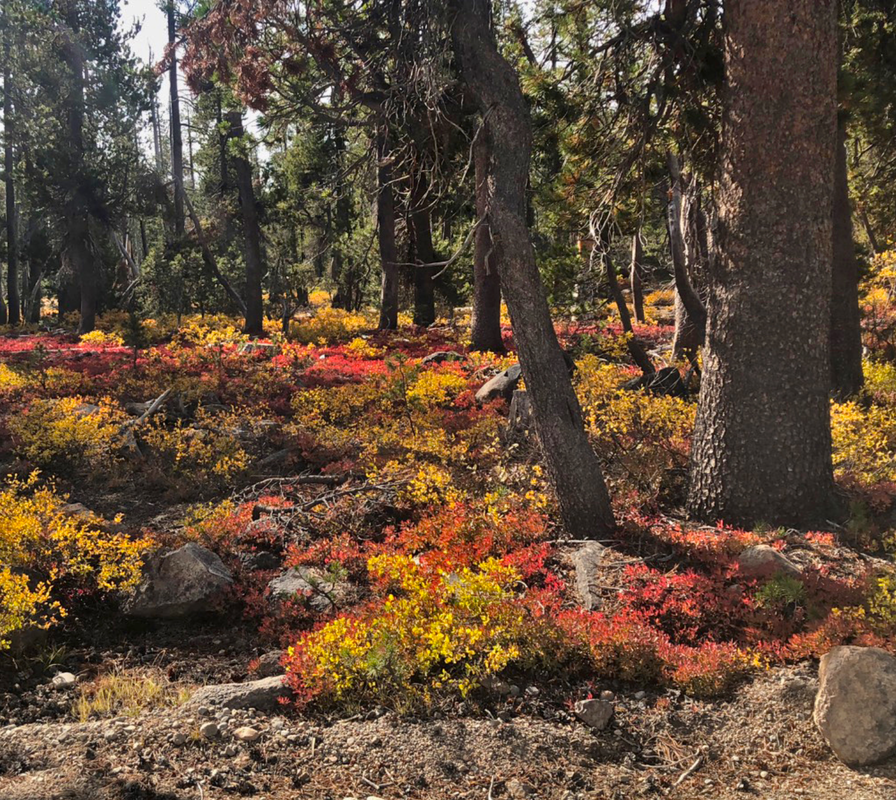
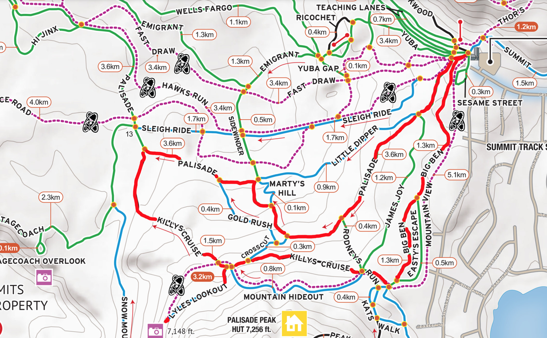
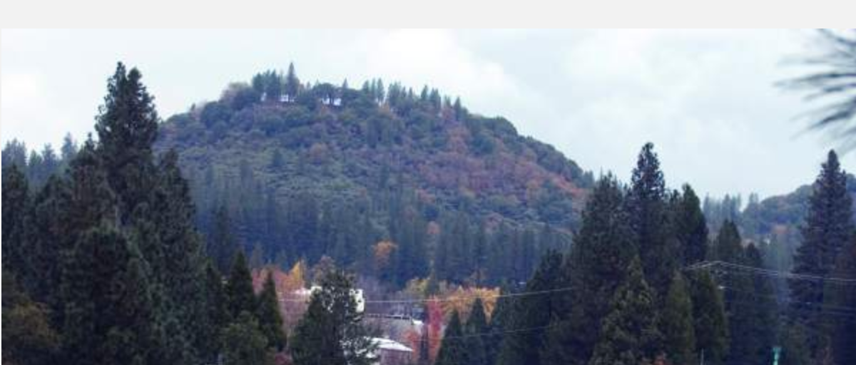
While evergreen conifers including some beautiful fir trees dominate the forests of Royal Gorge, the ground cover beneath is awash in gold and red this fall, with gooseberry and other species spread out across the forest floor.
Follow the winter ski trail signs from the Summit Station Trailhead off of Pahatsi Road. Take Big Ben Trail to Rodney’s Run (right), then turn left on Killy’s Cruise. Turn left out to Lyle’s Lookout for an incredible view of Palisade Lake and Devil’s Peak, then backtrack to Killey’s Cruise, turning left to continue on to Palasade, where you’ll turn right and head back to the trailhead.

Picture
Wendin Way in Johnson Canyon:
This south-facing canyon above Donner Lake gets a lot of sun on a cold, blustery fall day, making it a great option when the weather turns. Fall colors are dominated by the bitter cherry that lines the trail, small bunch willows, and a giant Scouler’s willow that towers over the Wendin Way Trail.
Start at the top of Donner Lake Road, just above intestate 80, where you’ll find the Land Trust’s trailhead parking area. The trail climbs steadily up the canyon, eventually reaching the Donner Lake Rim Trail, where you can choose to make a longer hike either heading up toward the Drifter Hut in Tahoe Donner or toward Summit Lake on the way to Castle Valley.
Picture
Elizabethtown Meadows Trail:
Our go-to fall hike thanks to its large aspen stands, Elizabethtown Trail starts at the intersection of Highway 267 and Northstar Drive, meandering 2.3 miles through Jefferey pine forests and popping out to the meadows edge where bright aspen stands are turning yellow and gold. Be sure to stop at the trail head kiosk to learn more about the property’s human history – the land has been used for thousands of years by Native Americans and Elizabethtown was a short-lived silver mining town located in the meadow.
With little elevation gain, it’s a great choice for a short walk for those not looking for a strenuous outing.

To see more information, CLICK HERE for the Tahoe Donner Newsletter "Hikes of the Month" series.

National Parks Trying To Get A Handle On E-Bikes

10/23/2019

 
Picture
Electric assisted bicycles, or e-bikes, are becoming more and more popular across the United States. Throughout the country's national parks, that could be a good and a bad thing.
It can be tough to distinguish an e-bike from a regular road or mountain bike by sight, but once you start pedaling, you sure feel the difference.
Battery-powered electric motors make pedaling much easier, uphill or down. Depending on the class of e-bike, the motors can give riders a boost of up to 28 miles per hour.
This year, the Interior Department directed all its bureaus, including the National Park Service, to adopt a policy for e-bikes.

Natalie Levine, with the National Parks Conservation Association, said that directive left parks about a month to scramble and adopt their own rules about where e-bikes are allowed.
"There are many parks where traditional bicycles are currently only allowed on park roads. So in those situations, adding electric bicycles there might not be as a big of a concern," Levine said.
But some parks, such as Golden Gate National Recreation Area and Acadia National Park, have more sensitive unpaved roads open to cyclists.
"We think there should be more analysis of the impacts of these bicycles," Levine said.
In Ohio's Cuyahoga Valley National Park, which sits between Cleveland and Akron, there are miles of dedicated mountain bike trails.
Stephen Metzler, head of the Cleveland Area Mountain Bike Association, said the park's carefully built trails weren't created with heavier and potentially faster e-bikes in mind.
"Speeds on the downhill, with a heavier bike, it could potentially cause injury to the rider and other trail users," Metzler said.
Cuyahoga Valley rolled out a draft policy allowing e-bikes on its roads and multi-use paths, but it banned them outright on the mountain bike trails.
"We, at this time, don't have enough data to be able to answer the question, 'Is an e-mountain bike different than a traditional mountain bike?' as far as impact on the trail or on resources," said Pamela Barnes, public information officer for Cuyahoga Valley National Park.
Ban or no ban, mountain biker Cody Rider said e-mountain bikes are already on the trails in Cuyahoga Valley anyway
"I think it's a lot like cars. Anybody can go buy a car, and anybody can go the speed limit. And then you can also drive considerably over the speed limit and make it an unpleasant experience for everyone around you and unsafe for that matter too," Rider said.
Proponents of e-bikes say the addition of pedal assist allows users of different abilities to ride mountain bike trails.
"It's just like riding a bike with less effort. I don't know how that's destroying any trails," e-mountain biker Matt Lewis said.
"This will get you back out there and get you doing the things you haven't done in a long time just because it's a lot easier," Lewis said.
Cleveland-area bike shop owner Chad Marn has no problem with people of any ability using e-bikes in national parks, but he's against allowing them on mountain bike trails that can be challenging for novice riders.
"If someone lacks the physical prowess or skill set to handle that, providing them an engine doesn't necessarily change those facts," Marn said.
Pete Smakula, who owns an e-bike store and sells e-bikes in Akron, disagrees.
With manufacturers racing to put out more and more e-bike models, Marn recognizes that he could be fighting a losing battle.
"I've actually asked the opinion of a lot of the different bicycle people that I trust, and the resounding theme is, 'It's inevitable — quit fighting it,' " Marn said.
And it's that popularity that's pressuring national parks to figure out whether to welcome or to restrict them.

CLICK HERE to see and hear the original article on National Public Radio (NPR)

Nevada City’s Sugarloaf Trail inches closer to reality

10/15/2019

 
Picture
The Nevada City Council last week moved forward on a trail project that will run from Highway 49 to the top of Sugarloaf Mountain, approving an initial environmental study and mitigated negative declaration for the project proposed by the Bear Yuba Land Trust.
Land trust officials said this week they now can move forward with permitting and seeking grant funding, noting they hope to complete a portion of the trail by next fall.
City Planner Amy Wolfson said once a trail alignment and initial study are approved, the Bear Yuba Land Trust would be able to make the final drawings for the trail construction.

“We’re very excited to be at this step,” said Erin Tarr of the land trust. “This will be a great amenity for the community.”
Reached Tuesday, Tarr said now that the California Environmental Quality Act study is complete, the land trust will start working on getting several permits — specifically, from Caltrans for roadway encroachment and from the state Department of Fish and Wildlife for a streambed alteration.
Meanwhile, Tarr said, the nonprofit will seek grant funding for trail construction.
“We need to get at least the lower portion of the trail done by September 2020, or our easements will expire,” she said.
THE TRAIL
Nevada City acquired the 35-acre Sugarloaf property in January 2011 from the Mull family for $450,000. It formally annexed the land in 2017. That same year the city approved the conceptual trail alignment and since then city and land trust staff have been working with consultants to prepare studies, including one for geotechnical engineering feasibility, as well as a cultural resource survey and a biological inventory.
In April the City Council received an update and approved the draft initial study, with a public comment period ending Aug. 2. One comment was received regarding an area of trail on potentially unstable soil. The city previously received a comment expressing concern about trail parking impacting downtown neighborhoods.
The goal of the trail project is to connect downtown Nevada City to the top of Sugarloaf Mountain, according to the staff report. The trail route will be approximately one mile in length, will start at the corner of Highway 49 and North Bloomfield Road, and end at a point along an existing gravel access road that goes to the top of Sugarloaf from an entrance on upper Coyote Street.
The new trail also will connect to an existing graveled excavated area that will be improved to accommodate trail parking for approximately eight vehicles. The parking area will connect via an existing informal, user-created trail, which will be minimally improved — including brush clearing and tread improvement for drainage and loose rock removal. The proposed trail also connects to Hirschman Trail and Tobiassen Park via a recently established county trail that runs west from North Bloomfield Road to the Eric Rood Administrative Center.
During the Aug. 28 council meeting Wolfson noted the land trust is working with the county to use some parking at the Eric Rood Administrative Center after work hours.

CLICK HERE to see the original article and photos in The Union newspaper

To contact Staff Writer Liz Kellar, email [email protected] or call 530-477-4236.


    Trail News

    Visit this page for all of the latest Trail News that affects our area.

    Archives

    June 2025
    February 2025
    August 2024
    September 2023
    June 2023
    March 2023
    February 2023
    January 2023
    November 2022
    October 2022
    September 2022
    August 2022
    July 2022
    June 2022
    April 2022
    March 2022
    January 2022
    November 2021
    October 2021
    August 2021
    July 2021
    June 2021
    May 2021
    April 2021
    March 2021
    February 2021
    January 2021
    December 2020
    November 2020
    October 2020
    September 2020
    August 2020
    July 2020
    June 2020
    May 2020
    April 2020
    March 2020
    February 2020
    January 2020
    December 2019
    November 2019
    October 2019
    September 2019
    August 2019
    July 2019
    June 2019
    May 2019
    April 2019
    March 2019
    February 2019
    January 2019
    December 2018
    November 2018
    October 2018
    September 2018
    August 2018
    July 2018
    June 2018
    May 2018
    April 2018
    March 2018
    February 2018
    January 2018
    December 2017
    November 2017
    October 2017
    September 2017
    August 2017
    July 2017
    June 2017
    May 2017
    April 2017
    March 2017
    February 2017
    January 2017
    December 2016
    November 2016
    October 2016
    September 2016
    August 2016
    July 2016
    June 2016
    May 2016
    April 2016
    March 2016
    February 2016
    January 2016
    December 2015
    November 2015
    October 2015
    September 2015
    August 2015

    Categories

    All

    RSS Feed

Home
Contact
 Mother Lode Trails is YOUR local volunteer-run trail information and resource website. Here you can find
up-to-the minute information on trail alerts, links and trail news for Placer,  Yuba, and Nevada counties.
Mother Lode Trails is trademarked.