Today, take your mom to see a pretty waterfall! There are plenty of spots in Northern California for waterfall-lovers to stumble upon. Waterfall photographer Leon Turnbull gave KCRA his suggestions for the most easily accessible waterfalls in Northern California.
AMERICAN CANYON CREEK FALLS
Nestled within a very narrow valley along the American Canyon Creek, a 15-foot waterfall offers visitors a very scenic and unique experience. "It is one of the coolest little waterfalls in the greater Sacramento area," Turnbull said. It's a nearly 2-mile hike to get a view of the American Canyon Creek Falls.
BLACK HOLE OF CALCUTTA FALLS
In Placer County, hikers can easily walk to the 40-foot Black Hole of Calcutta Falls. Turnbull suggests hikers follow the scenic path along the Western States Trail from the Auburn Confluence. "Start on the south side of the river, crossing over the historic No Hands Bridge, and continue on the north side up to the waterfall," Turnbull said. It is a 2-mile round-trip hike.
BRIDAL VEIL FALLS
Along Highway 50, waterfall-lovers can stumble upon Bridal Veil Falls, and you don't even need to hike to find it. Esmeralda Creek flows into the falls in El Dorado County.
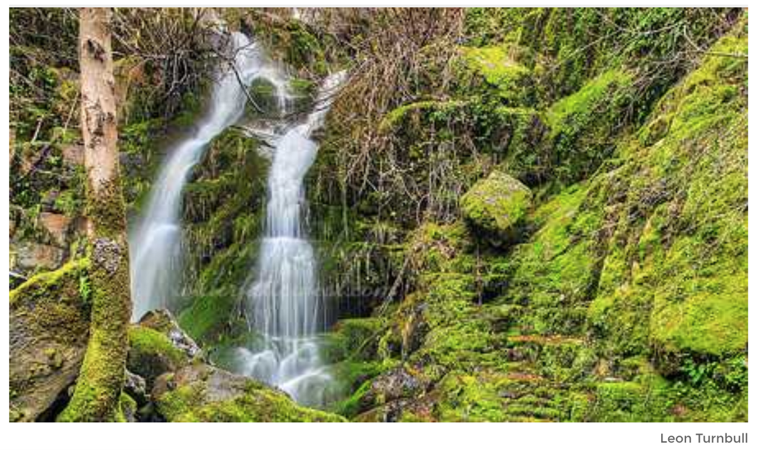
CODFISH FALLS
"The trail to Codfish Creek Falls is a beautiful and very easy hike along the North Fork of the American River," Turnbull said.Hikers can follow the trail for about 1.4 miles then reach Codfish Creek, where the trail turns upstream a short distance to the waterfall."The waterfall is a pretty cascade," Turnbull said about the 68-foot-high waterfall. "Codfish Creek drops almost vertically for 40 feet., then cascades for another 28 feet. In the spring, it is a beauty."There is a fee to park at the trailhead.
DEVIL FALLS
"It's certainly not the biggest or best, but if you want to see a pretty waterfall without getting out of your car, within a one-hour drive from the big city, then this is your ticket," Turnbull said. Devil Falls is 45 feet tall.
LAKE CLEMENTINE FALLS
"Lake Clementine Falls is not a natural waterfall, obviously. But it is such an interesting waterfall, and Lake Clementine is a neat place to visit," Turnbull said.
The Lake Clementine waterfall is formed from the North Fork Dam. Water flows off the dam for a 122-foot drop into the river below. "It is an amazing sight to see," Turnbull said. There is a fee.
LOVES FALLS
Located at the bridge over the North Yuba River along the Pacific Crest Trail, the Loves Falls offers hikers two easy ways to see the waterfall.
First, Turnbull said hikers can take a short, easy hike along the Pacific Crest Trail from Highway 49. However, if you have the time, Turnbull suggests hikers take the longer route from Wild Plum Campground.
"It is a fairly easy hike and has some nice views of the Sierra Buttes. The hike begins on the west side of Haypress Creek bridge," Turnbull said. Hikers then need to follow the Wild Plum Loop until it meets up with Pacific Crest Trail, then turn left for Loves Falls.
"The waterfall is quite a nice, little, cute one," Turnbull said. "Hopefully, you can find a good spot on the rocks below the falls to eat lunch."
NORTH FORK FALLS
The North Fork Falls, or the Emigrant Gap Falls, is a small waterfall along the North Fork American River. It's a short walk from the campground, near Emigrant Gap.
"It is a very popular swimming hole in the summer," Turnbull said.
PAULEY FALLS
"Although only 15 feet high, it is an incredibly pretty little waterfall," Turnbull said. "It cascades down Pauley Creek in many interesting little slices. In the spring, the flow can be very impressive." The land is owned by Downieville Water Co., but the public is allowed to access the waterfall.
CLICK HERE to see the original article and photos at KCRA News.
AMERICAN CANYON CREEK FALLS
Nestled within a very narrow valley along the American Canyon Creek, a 15-foot waterfall offers visitors a very scenic and unique experience. "It is one of the coolest little waterfalls in the greater Sacramento area," Turnbull said. It's a nearly 2-mile hike to get a view of the American Canyon Creek Falls.
BLACK HOLE OF CALCUTTA FALLS
In Placer County, hikers can easily walk to the 40-foot Black Hole of Calcutta Falls. Turnbull suggests hikers follow the scenic path along the Western States Trail from the Auburn Confluence. "Start on the south side of the river, crossing over the historic No Hands Bridge, and continue on the north side up to the waterfall," Turnbull said. It is a 2-mile round-trip hike.
BRIDAL VEIL FALLS
Along Highway 50, waterfall-lovers can stumble upon Bridal Veil Falls, and you don't even need to hike to find it. Esmeralda Creek flows into the falls in El Dorado County.
CODFISH FALLS
"The trail to Codfish Creek Falls is a beautiful and very easy hike along the North Fork of the American River," Turnbull said.Hikers can follow the trail for about 1.4 miles then reach Codfish Creek, where the trail turns upstream a short distance to the waterfall."The waterfall is a pretty cascade," Turnbull said about the 68-foot-high waterfall. "Codfish Creek drops almost vertically for 40 feet., then cascades for another 28 feet. In the spring, it is a beauty."There is a fee to park at the trailhead.
DEVIL FALLS
"It's certainly not the biggest or best, but if you want to see a pretty waterfall without getting out of your car, within a one-hour drive from the big city, then this is your ticket," Turnbull said. Devil Falls is 45 feet tall.
LAKE CLEMENTINE FALLS
"Lake Clementine Falls is not a natural waterfall, obviously. But it is such an interesting waterfall, and Lake Clementine is a neat place to visit," Turnbull said.
The Lake Clementine waterfall is formed from the North Fork Dam. Water flows off the dam for a 122-foot drop into the river below. "It is an amazing sight to see," Turnbull said. There is a fee.
LOVES FALLS
Located at the bridge over the North Yuba River along the Pacific Crest Trail, the Loves Falls offers hikers two easy ways to see the waterfall.
First, Turnbull said hikers can take a short, easy hike along the Pacific Crest Trail from Highway 49. However, if you have the time, Turnbull suggests hikers take the longer route from Wild Plum Campground.
"It is a fairly easy hike and has some nice views of the Sierra Buttes. The hike begins on the west side of Haypress Creek bridge," Turnbull said. Hikers then need to follow the Wild Plum Loop until it meets up with Pacific Crest Trail, then turn left for Loves Falls.
"The waterfall is quite a nice, little, cute one," Turnbull said. "Hopefully, you can find a good spot on the rocks below the falls to eat lunch."
NORTH FORK FALLS
The North Fork Falls, or the Emigrant Gap Falls, is a small waterfall along the North Fork American River. It's a short walk from the campground, near Emigrant Gap.
"It is a very popular swimming hole in the summer," Turnbull said.
PAULEY FALLS
"Although only 15 feet high, it is an incredibly pretty little waterfall," Turnbull said. "It cascades down Pauley Creek in many interesting little slices. In the spring, the flow can be very impressive." The land is owned by Downieville Water Co., but the public is allowed to access the waterfall.
CLICK HERE to see the original article and photos at KCRA News.
 RSS Feed