MOTHER LODE TRAILS
  • Home
  • About
  • Contact
  • Volunteer
  • Links
    • Law Enforcement Emergency
    • Federal, State, County Districts Parks & Trails
    • Running Clubs
    • Equestrian Clubs
    • Mt. Bike Clubs
    • Hiking Clubs
    • Trail Advocacy Organizations
    • Phone Numbers State & Federal Parks, Trails & Lands
    • Where to Eat on the Trails
  • News
  • Alerts

Triple Crown hiker dies in mt. biking accident, memorial donations requested to Pacific Crest Trail Assn.

4/24/2020

 
Stephen Whisenand, Jr. died unexpectedly April 13 while mountain biking in Utah. He was 58 years old.

After college Steve moved West, where he lived for many years in Hoback. He had a varied and active career working as the teen program coordinator at Teton County Library, guiding fly-fishing trips on the Snake River and serving on avalanche ski patrol in Jackson Hole.

A lifelong outdoor sports enthusiast, Steve actively pursued fly-fishing, skiing, mountain biking and long-distance hiking. In recent years he achieved the hiking Triple Crown completing through-hikes of the Pacific Crest Trail, the Appalachian Trail and the Continental Divide Trail, the three most prominent long hikes in the country, requiring hiking nearly 8,000 miles across 22 states.

Contributions in Steve's name can be made to the Pacific Crest Trail Association, 1331 Garden Highway, Sacramento, CA 95833,  PCTA.org/donate/#honorary-memorial

Click here to see Stephen's obituary.
Plans for relieving congestion at the Confluence

4/19/2020

 
Picture
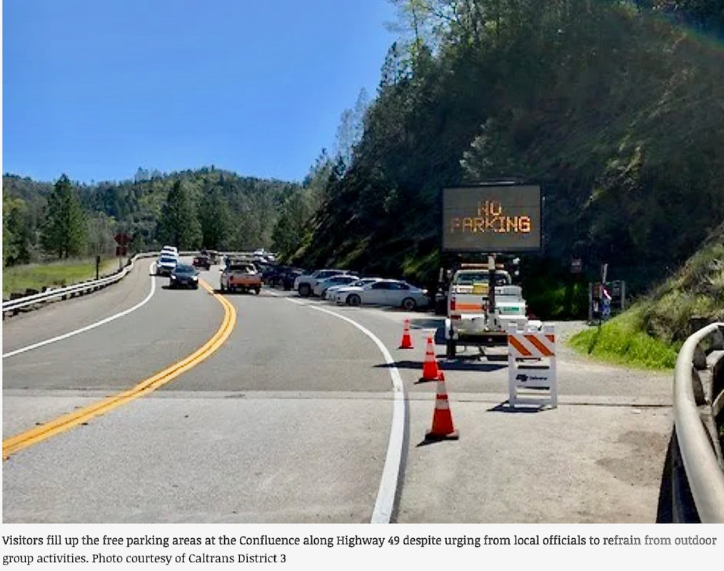
Amid the coronavirus outbreak, California State Parks officials moved to close paid parking areas March 30. That didn’t stop travelers from visiting the popular American River Confluence and its surrounding waterways and trails. 

Cars filled up the free parking along Highway 49 instead — a familiar sight during the warm months for the popular Western Slope destination — prompting officials to close those parking areas as well. 
Even during a potentially life-threatening pandemic, officials couldn’t keep hikers and bikers away.

Visitors and residents alike know what a pain parking and traffic in the area can be. Now, efforts may be underway to increase parking capacity near the Confluence in the months and years following the statewide state-at-home order.

District 2 Supervisor Lori Parlin said in a Facebook post last week that the El Dorado County Transportation Commission is expected to look into grants to “investigate issues and opportunities on (Highway) 49 from Cool to the Confluence,” including “parking, truck traffic and pedestrian safety.”

The commission is partnering with El Dorado County, Caltrans, Placer County Transportation Planning Agency, city of Auburn, Placer County and State Parks to find a solution to the parking issues plaguing the area. 

To see the original article in the Mountain Democrat, CLICK HERE.

As BLM seeks comments to add E-bikes to non-motorized trails, other agencies are balking

4/19/2020

 
Picture
Article posted by the Post Register newspaper in Idaho :
"It’s a tale of two federal agencies and two wheels.
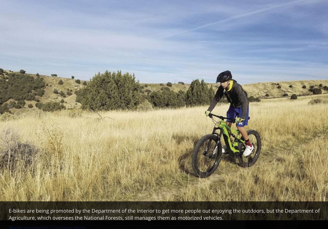
A recent call for public comment on using electric bikes (e-bikes) on federal land may have some trail bikers confused. (Martin Hackworth / Courtesy photo)
​

Last Fall, the Department of the Interior issued a call to expand the use of e-bikes on public lands. Last week, the Bureau of Land Management announced a 60-day public comment period on the proposed regulations for e-bikes on public land trails that now only allow non-motorized bikes. But National Forests, under the Department of Agriculture, did not adopt Secretary of Interior David Bernhardt’s call to expand access to e-bikes. The Forest Service considers e-bikes motorized and bans them from non-motorized trails.

“We want all Americans to have a chance to create life-long memories exploring and enjoying the great outdoors,” said BLM Deputy Director for Policy and Programs William Perry Pendley. “The BLM is working hard to implement Secretary Bernhardt’s directive wherever it can because our agency believes these public lands are managed in trust for all citizens.”


Shannon Bassista, a recreation planner at the BLM’s state office in Boise, said, if adopted, the new rule allowing e-bikes on BLM trails would only affect about 120 miles of trails in Idaho, “and the bulk of them are in the Owyhee field office” in the southwest corner of the state.
Most biking trails in eastern Idaho are on Forest Service land with hot spots at Kelly Canyon, the Big Hole Mountains and the Snake River Range areas. In these areas, e-bikes are only legally allowed on trails that currently allow motorized traffic.
“I think the Forest Service is closely watching this topic with how the (Department of Interior) is addressing it,” Bassista said.
Local mountain bike enthusiasts are generally in favor of e-bikes and see it as a way of getting more people out enjoying the activity. “I’ve noticed quite a few of them on the trails,” said Danny Kelly, president of the Snake River Mountain Bike Club. “As a matter of fact, I bought my wife one this year. … I think it’s getting more people off the couch and more people riding, for sure.”
Looking through the public comments already received by the BLM on the e-bike proposal shows that most seem to be in favor, with a few logging reservations on the impact of heavier bikes on trails and the possible impact of crowding on a limited number of trails. More than 900 comments had been posted on the BLM’s online site regulations.gov/docket?D=BLM-2020-0001 as of Friday.
Kelly said he went to the site and posted in favor of allowing e-bikes.
“They don’t do anything to the trail than what a regular mountain bike does,” Kelly said. “You can’t burn out the tires and dig up the dirt. All it does is pedal-assist.”
Dan Verbeten, president of Teton Valley Trails and Pathways, likes the idea of e-bikes getting more people active in the outdoors, but also advocates taking a case-by-case approach as to what is appropriate for specific areas and trails.
“We’re in favor of access for people to ride bicycles,” Verbeten said. “There also has to be consideration for each area for which it is appropriate. In this area, some of the BLM land is also critical migration habitat for some animals. That’s just a tough one to navigate.”
He said Teton Valley is blessed with a variety of outdoor activities.
“Honestly, throughout the entire (Big Hole) range the majority of trails would be accessible to e-bikes,” he said. “There’s about six that are non-motorized.”

To comment on the BLM’s e-bike proposal, go to regulations.gov/docket?D=BLM-2020-0001

To see the complete article in the Post Register CLICK HERE.


Exploring Steven’s Point Trail, wildflowers, American River views (due to COVID-19, BLM closed this trail 3-27-220)

4/10/2020

 
Picture
Stevens Trail Trailhead Closure Notice: (posted 3-27-2020) 
In accordance with guidance from the Centers for Disease Control and Prevention and with the Governor’s shelter in place order, the BLM will temporarily close this site until further notice to help limit the spread of COVID-19. To see the complete order CLICK HERE.


​---------
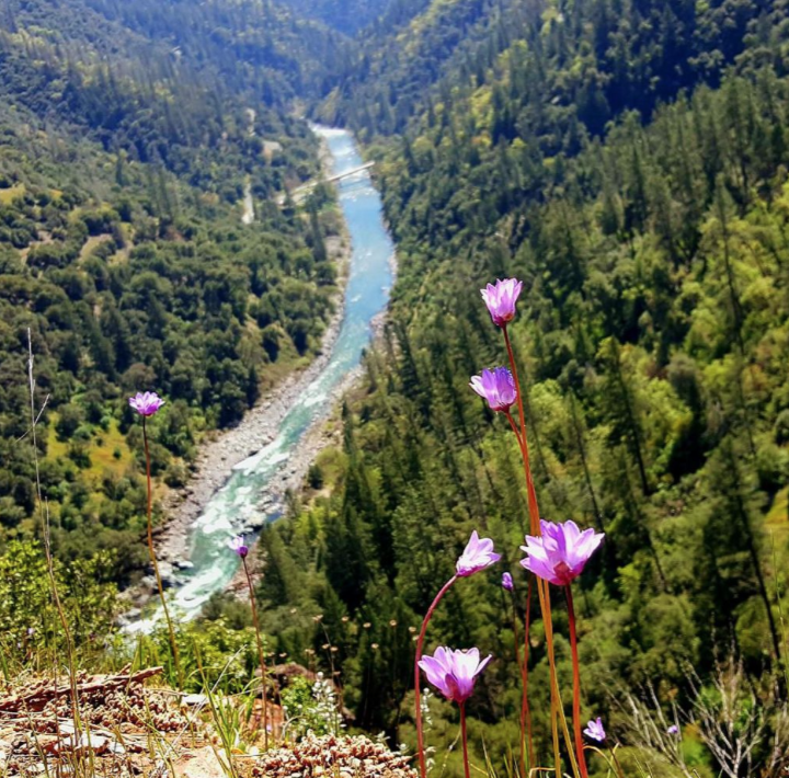
"Enjoy this trail before it gets too hot. Filled with wildflowers, waterfalls and North Fork American River views, Steven’s Trail in Colfax is a must do trail for day hikers.

Much of this trail is exposed so make sure you take plenty of water and sun protection for the nine-mile in and out hike that ends at the edge of the American River. Many of the trails in our area I would describe as a walk. Steven’s trail is a legitimate hike with significant elevation change, so be prepared.

The beginning of the trail runs parallel to I-80 but the sound of traffic gives way to running water and the cool air of the wooded trail. Along the way pine and manzanita line the path with oak and laurel. After crossing the balance beam across a small creek the trail opens to the sun and a trail sign sends you to the right. Not far along, the trail splits, go left along the canyon wall. Emerald green ferns seem to spring directly from rocks near the waterfalls in the shady inside curves that follow the mountain side.

This crossing is tricky. The rocks are not solid stepping stones. Watch your footing. After the crossing, be on the lookout for a shallow cave to peek into. Once on your way enjoy a breathtaking view of the American River and the Iowa Hill Bridge far below.

The sheer variety of wildflowers in spring, through summer and well into fall draws me back time and time again. The quantity and quality of the varied blossoms and blooms in pale peach, bright orange, blue, red, the brightest white and deepest purple are just a few of the eye catching shades of color to enjoy. The air was strong with Coyote Mint on my last visit. Look for the round blue blooms. The peach Monkey Face flowers grew in profusion this year.

Once at the water’s edge pick a spot for lunch with family and friends and relax. Rest up before the uphill return trip to the parking area.

Poison oak is also a factor along this trail, which narrows in spots. Mountain lions have been known to inhabit the area so taking friends is always a good idea. Pay attention as there are steep drop-offs that may make you think twice if you have a fear of heights.
With the many cautions I have offered, you should know I have been taking my sons on this trail since they were seven and 10 years old. The trail is well marked and well worn.

DIRECTIONS
Get to Steven’s Trail by taking interstate 80 east to Colfax, exit at Canyon Way. Turn left and follow the frontage road to the end. The trail head and paved parking lot with bathroom and signage are located here.
Every trail has its inherent risks, that being said, if you enjoy hiking in our foothills, enjoy Steven’s Trail for the flowers, river, canyon, waterfalls and the adventure."

 - Mary West is author of the book series “Day Hiker – Gold Country Trail Guides.”  You can follow West on Facebook and Instagram.

CLICK HERE to see the complete article and Mary's photos.


    Trail News

    Visit this page for all of the latest Trail News that affects our area.

    Archives

    February 2025
    August 2024
    September 2023
    June 2023
    March 2023
    February 2023
    January 2023
    November 2022
    October 2022
    September 2022
    August 2022
    July 2022
    June 2022
    April 2022
    March 2022
    January 2022
    November 2021
    October 2021
    August 2021
    July 2021
    June 2021
    May 2021
    April 2021
    March 2021
    February 2021
    January 2021
    December 2020
    November 2020
    October 2020
    September 2020
    August 2020
    July 2020
    June 2020
    May 2020
    April 2020
    March 2020
    February 2020
    January 2020
    December 2019
    November 2019
    October 2019
    September 2019
    August 2019
    July 2019
    June 2019
    May 2019
    April 2019
    March 2019
    February 2019
    January 2019
    December 2018
    November 2018
    October 2018
    September 2018
    August 2018
    July 2018
    June 2018
    May 2018
    April 2018
    March 2018
    February 2018
    January 2018
    December 2017
    November 2017
    October 2017
    September 2017
    August 2017
    July 2017
    June 2017
    May 2017
    April 2017
    March 2017
    February 2017
    January 2017
    December 2016
    November 2016
    October 2016
    September 2016
    August 2016
    July 2016
    June 2016
    May 2016
    April 2016
    March 2016
    February 2016
    January 2016
    December 2015
    November 2015
    October 2015
    September 2015
    August 2015

    Categories

    All

    RSS Feed

Home
Contact
 Mother Lode Trails is YOUR local volunteer-run trail information and resource website. Here you can find
up-to-the minute information on trail alerts, links and trail news for Placer,  Yuba, and Nevada counties.
Mother Lode Trails is trademarked.