For mountain bike riders, gate 128 leads to mile 6, 7 and 8 of the Foresthill Divide Loop Trail. The trail is 11-miles in length and crosses Foresthill Road at 8-Mile Curve gate 128. From gate 128 the trail leads to Upper Lake Clementine Road. A length of more than three miles. Across Upper Lake Clementine Road the trail continues. At the 2.5 mile point, on this length of the trail, and 5.5 miles from gate 128, is a great overlook of Lake Clementine. (Photo credit: Mary West)
Those first three miles are not much to see for hikers so it is left to mountain bikers who prefer to stay away from hikers and equestrians as much as we avoid them. But curiosity gets the best of most of us and we need to know, what is behind that gate.
If you need to know what is behind gate 128, park in the wide parking area off Foresthill Road at 8-Mile and head off on foot behind the gate. The trail begins with an open area including a picnic table and chemical toilets. Armed with sturdy shoes and a supply of water, start your walk along the rolling hillside trail about a mile and half above the North Fork of the American River.
I cannot tell you there are great views of the river here. I can tell you there are some ups and downs and even some level spots. It isn’t peaceful. You hear noise from the road nearby. This is a popular mountain bike trail so be prepared to step off the trail occasionally to allow them to pass. Due to the frequent road apples I encountered, I would say it is also a popular equestrian trail.
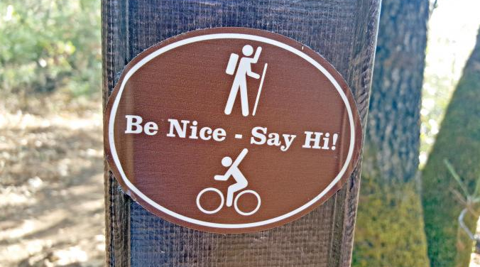
Here is where I get philosophical and equate a less than stellar bit of trail to life. A connector trail makes you look close for beauty because it is not abundantly evident. I found it in the fall colors. I found it in the peeling red bark of Manzanita outgrowing its skin. I found beauty in the form of kindness in the simple message on a sticker. it is beautiful. You just have to choose to see it.
To get there from Auburn take the Foresthill exit of Interstate 80. Drive over the Foresthill Bridge toward Foresthill. Just past Driver’s Flat Road you will see the wide curve that is 8-mile on the left. Watch for cross traffic, and park. This is a $10 fee parking area.
In life the connector trail is where the work gets done. The thinking, the deciding, the conviction to get to the next trailhead and onto the next adventure. The length of trail is not amazing but like life, this is a trail that gets you from where you are, to where you want to be. The trail “connects” you … to you.
Mary West is a retired radio personality and news reporter with a longtime love of the outdoors, sharing her favorite day hikes in Placer, Nevada, El Dorado and Yuba counties. Learn more about local trails by following her on Facebook, Twitter, Instagram, and YouTube.
CLICK HERE to see the original article and photos by Mary West, written for the Auburn Journal newspaper.
Those first three miles are not much to see for hikers so it is left to mountain bikers who prefer to stay away from hikers and equestrians as much as we avoid them. But curiosity gets the best of most of us and we need to know, what is behind that gate.
If you need to know what is behind gate 128, park in the wide parking area off Foresthill Road at 8-Mile and head off on foot behind the gate. The trail begins with an open area including a picnic table and chemical toilets. Armed with sturdy shoes and a supply of water, start your walk along the rolling hillside trail about a mile and half above the North Fork of the American River.
I cannot tell you there are great views of the river here. I can tell you there are some ups and downs and even some level spots. It isn’t peaceful. You hear noise from the road nearby. This is a popular mountain bike trail so be prepared to step off the trail occasionally to allow them to pass. Due to the frequent road apples I encountered, I would say it is also a popular equestrian trail.
Here is where I get philosophical and equate a less than stellar bit of trail to life. A connector trail makes you look close for beauty because it is not abundantly evident. I found it in the fall colors. I found it in the peeling red bark of Manzanita outgrowing its skin. I found beauty in the form of kindness in the simple message on a sticker. it is beautiful. You just have to choose to see it.
To get there from Auburn take the Foresthill exit of Interstate 80. Drive over the Foresthill Bridge toward Foresthill. Just past Driver’s Flat Road you will see the wide curve that is 8-mile on the left. Watch for cross traffic, and park. This is a $10 fee parking area.
In life the connector trail is where the work gets done. The thinking, the deciding, the conviction to get to the next trailhead and onto the next adventure. The length of trail is not amazing but like life, this is a trail that gets you from where you are, to where you want to be. The trail “connects” you … to you.
Mary West is a retired radio personality and news reporter with a longtime love of the outdoors, sharing her favorite day hikes in Placer, Nevada, El Dorado and Yuba counties. Learn more about local trails by following her on Facebook, Twitter, Instagram, and YouTube.
CLICK HERE to see the original article and photos by Mary West, written for the Auburn Journal newspaper.
 RSS Feed