For the best view of the confluence of the north and middle forks of the American River, let me suggest the Manzanita Trail to Stagecoach Trail. Sure you can get there from the confluence by going directly up Stagecoach trail, but the Manzanita Trail is worth the extra distance for many reasons. First, you can park for free at the Auburn State Recreation Area headquarters. Toilets, picnic tables and information about trails are located here make it a great start and end point. (Photo credits: Mary West)
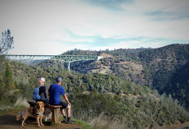
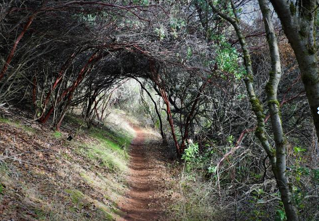
The Manzanita trail is aptly named. During or right after a rain, the bark of the manzanita is bright red. The hearty bush thrives along the trail and in a couple areas it is shaped into an arched trellis over the path. After connecting to Stagecoach Trail, the path opens providing views of the Foresthill Bridge the tallest bridge in California at 731 feet. The Confluence bridge, Old Foresthill Bridge and the Highway 49 bridge are all within view. If you look to the far right you can see the Mountain Quarries Railroad Bridge. A small bench provides a good mid-way point. The turkey vultures often perch here. I have enjoyed watching them spread their wings and sun themselves on the highest limbs of the tallest trees here.
You can continue on Stagecoach or head uphill to the top of the Foresthill Bridge or down hill to the confluence area. There are several trails to take advantage of from this point. On Stagecoach, I was surprised to see the Heart Rock Tree had been cut down. Speaking to the Auburn State Recreation Area it was necessary. A significant landslide took place near the tree making it unstable. I placed my share of heart shaped rocks in the nooks of the bark of the large pine. Now I only have pictures.
To get there from Auburn take Interstate 80 to the Elm Avenue exit. Turn left onto Highway 49. Follow Highway 49 into the canyon and into the Auburn State Recreation Area. The ranger’s station entrance will be on your left about halfway down the canyon. Park in front of the office. The trail will be up the hill to your right around the maintenance shop. Black bear, snakes and other wildlife are in the area, be cautious.
Take ample water and wear sturdy shoes. Exposed areas may require a hat, sunglasses and even sunscreen on sunny and hot days.
CLICK HERE to see the original article and more pictures by Mary West in the Auburn Journal newspaper.
Mary West is a retired radio personality and news reporter with a longtime love of the outdoors, sharing her favorite day hikes in Placer, Nevada, El Dorado and Yuba counties.
 RSS Feed