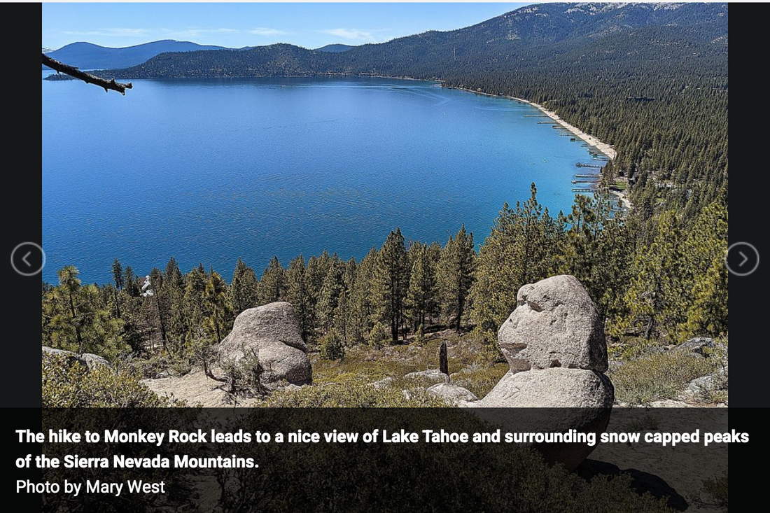
The famed Monkey Rock that overlooks Lake Tahoe from East Lake is off Tunnel Road in the Spooner Backcountry, part of Lake Tahoe Nevada State Parks. The hike to Monkey Rock (more like a gorilla, which is not a monkey but a great ape. We will let that go) leads to a nice view of Lake Tahoe and surrounding snow capped peaks of the Sierra Nevada Mountains.
I went hiking with my oldest son Canyon, his brilliant girlfriend Emily, and our faithful K9 Stella the wonder dog to Monkey Rock in late spring. We decided to take the longer — but we think — more scenic Highway 50 approach on the way up. At Sand Harbor look for the Bullwheel parking lot in front of the Tunnel Creek Cafe. There is no parking at the trailhead.
The steady climb is made easier by the ever-changing views of beautiful blue Lake Tahoe, the towering pines and bright granite boulders. Your hike begins from the parking lot and up behind the Tunnel Creek Cafe on Tunnel Creek Road. There is a $2 fee to hike the trails. An iron ranger with envelopes is up the trail a piece.
Once on Tunnel Creek Road it is all uphill. At the intersection you make the left with a steep uphill climb. You hike nearly 500 feet up on decomposed granite and sand. For this reason, I call this short hike moderate. The climb up is not so bad but coming down can be slippery. Wear sturdy shoes and if you are at all worried take your trekking poles. There is a longer route that spreads the hike over a greater distance and is less steep. You can find this alternative just a bit further up the main trail.
The steady climb is made easier by the ever-changing views of beautiful blue Lake Tahoe, the towering pines and bright granite boulders.
This is a popular trail. Once on top expect to wait your turn in the jumble of rocks that overlooks the lake and of course the co-star of the show, the gorilla shaped rock that sits taking in the view with you.
This in and out hike is maybe three miles total. You will not find signs declaring Monkey Rock. You must know what you are looking for. Other trails continue beyond Monkey Rock to Marlette Flume Trail, Tahoe Rim Trail and Twin Lakes.
The alternate route is up Interstate 80 to CA-267S in Truckee. Take NV-28E to Tahoe Blvd to Tunnel Creek Blvd in Incline Village.
Mary West is author of the book series Day Hiker – Gold Country Trail Guides (Available on Amazon). The books are a collection of the Day Hiker columns where West shares her longtime love of the outdoors, and favorite hikes in Northern California’s Gold Country and beyond. West was the recipient of the 2018 and 2019 CRAFT Award for Best Outdoor Column by the Outdoor Writers of California. You can follow West on Facebook and Instagram.
 RSS Feed