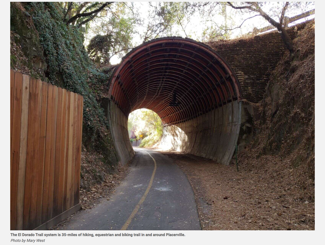
The El Dorado Trail system is 35-miles of hiking, equestrian and biking trail in and around Placerville, but much of it is paved and not your typical wild land hike.
The trail has grown over the years, with new additions now stretching from Camino to the El Dorado and Sacramento County line. Much of it is paved. Several access points or trailheads mean you can experience different parts of the trail depending on your schedule.
I have accessed the trail from three different trailheads. The first was my favorite.
I call this WUI hiking. WUI stands for Wildland Urban Interface. This isn’t exactly urban hiking but it isn’t the wild and rugged trails we know and love in the wilderness. This is a paved 3.1 mile walk just outside of town off Missouri Flat Road in Placerville. It took me some time to find the trailhead. Let me save you the trouble. Go to Sierra Door and Supply. Drive right to the business as if you were a customer. At the end of the parking lot look for another parking lot with what looks like a split rail fence. You will see the signs for the trailhead. Park in this lot. The pedestrian/bike path with two lanes takes you past some ranch land and past homes before you get to, what I think is the highpoint of this trail; a repurposed train trestle with a bridge over Weber Creek.
The wooden bridge is screened with metal fencing. The fence is adorned with a number of locks. The locks express the romantic gesture of couples showing their bond to one another. In many cases the key to the lock that symbolizes the happy couple’s commitment is thrown over the edge into the river below.
This is a family friendly and dog friendly trail. My sons enjoyed the exercise stations along the trail, including pull up bars and sit up benches. The trail ends at 3.1 miles at the back of the Sheriff’s station making for a 6.2 mile out and back walk, jog or ride.
If you head the other way, behind Walmart, you are exposed to the various homeless camps in and around the industrial area.
Several roads lead to Placerville. You can take Highway 49 to Highway 50. Turn right and head down the hill to Missouri Flat Road. Take a left back over the freeway and out Missouri Flat Road to Sierra Door and Supply. Do not park in the business parking lot. Park at the trailhead. If there is no parking available go across the street to Walmart.
Another access point is off Mosquito Road across the street from the bus station. It runs along the back of homes and features a tunnel.
The third portion I have hiked begins off Carson Road, off Jacquire on Amelia Lane. This portion leads to a bridge over highway 50. It’s loud along the highway.
Mary West is author of the book series Day Hiker – Gold Country Trail Guide I, II and III (Available on Amazon). The books are a collection of the Day Hiker columns where West shares her longtime love of the outdoors, favorite hikes in Northern California’s Gold Country and beyond. West was the recipient of the 2017 and 2019 CRAFT Award for Best Outdoor Column and the 2020 Craft Award for her second book in the series-Day Hiker Gold Country Trail Guide by the Outdoor Writers of California. You can follow West on Facebook and Instagram.
CLICK HERE to see the original article and more photos in The Union newspaper.
 RSS Feed