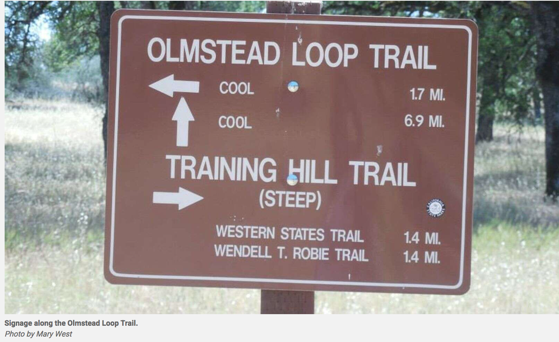
The Olmstead Loop Trail, in the Cool area of the Auburn State Recreation Area, is an 8.6-mile stroll through some wide-open spaces. Nearly nine miles may seem like a lot but have no fear. It seems like every time I venture out this way, a new trail cutoff has been worn into the fields. Some are more pronounced than others. If you do get lost — which is easy enough to do — ask an equestrian, cyclist or fellow hiker the way. I usually keep the radio towers to my south and Highway 49 to the east when hiking in this area.
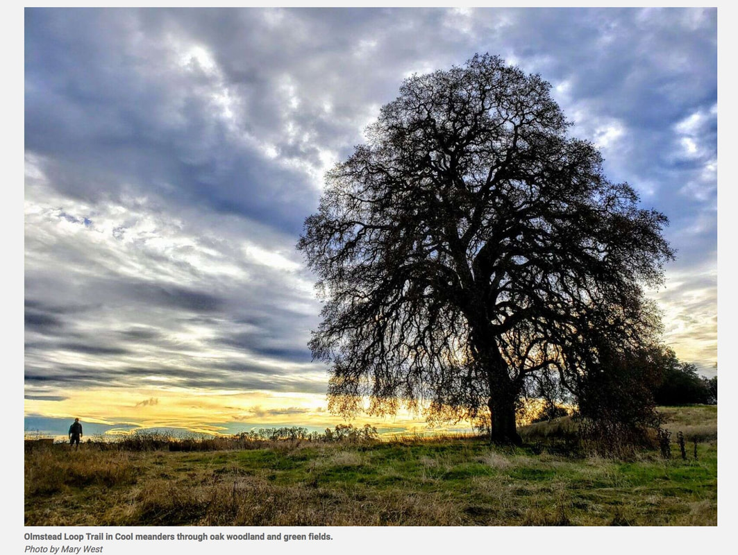
I love this hike in late fall. It can be muddy but it’s not hot. You need to pick your battles. Off Highway 49 park in the car lot not the trailer lot. Head out on the trail at the south end of the horse staging area. The Olmstead Loop Trail meanders parallel to Highway 49 south behind a few horse ranches before it cuts west and into the oak woodland that makes up much of the area. Ponds dot the area, some more seasonal than others. In winter, it’s best to hike here after things have dried out for a week or two. If you go after a rain, you will find puddles, some quite large, to get around. Follow the trail markers to Knickerbocker Creek. Cross the road and continue on Olmstead or follow the road or the trail that runs parallel to the road back to the horse staging area and parking lot near the Cool Fire Station.
Extend the hike by crossing the road and you will find yourself crossing the Auburn to Cool Trail or Coffer Dam Trail and off to Salt Creek to Pointed Rocks Trail. Past the signs for the Wendell T Robie Trail (Twice), you get to the headwaters of Salt Creek before returning to the Cool Fire Station and the parking lot. Some elevation change down and up from Knickerbocker Creek leads to some more steep hill climbs and down slopes. The hill tops out with some nice views.
Much shorter loops are in the area and provide meadows, ponds and wildflowers in spring. It is worth checking out any time of year. I am always reluctant to send people on the Olmstead Loop. The directions have never been very clear. Maps don’t seem to answer all the questions, especially if a mud puddle has given you cause to go off trail.
To get there from Auburn take Interstate 80 to Highway 49 south toward Placerville. Drive into the canyon and cross the Highway 49 bridge from Placer to El Dorado County. Follow Highway 49 to enter the town of Cool. Just before the stop sign look for the Cool Fire Station on your right. This is also the entrance into the Auburn State Recreation area parking area. There is a $10-day use fee.
CLICK HERE to see the original article in The Union newspaper.
Mary West is author of the book series Day Hiker – Gold Country Trail Guide I, II and III (2nd edition Available on Amazon). The books are a collection of the Day Hiker columns where West shares her longtime love of the outdoors, favorite hikes in Northern California’s Gold Country and beyond. West was the recipient of the 2017 and 2019 CRAFT Award for Best Outdoor Column and the 2020 Craft Award for her second book in the series-Day Hiker Gold Country Trail Guide by the Outdoor Writers of California. You can follow West on Facebook and Instagram
 RSS Feed