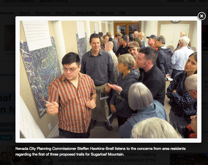
Trails have existed on the mountain for years by non-permitted, non-structured users, which prompted the city to choose an official trail after acquiring the property in 2011.
In January, the city approved a Sugarloaf Mountain Master Plan and began the process of connecting downtown Nevada City to the top of the mountain by means of a trail. The Bear Yuba Land Trust picked up the torch during the summer of 2013 and have been working ever since to see the reality of the connecting trail route succeed.
BYLT Trails Coordinator Bill Haire and Trails Volunteer Greg Archbald were on hand during the meeting to assist in answering questions and to help explain how the three separate trail proposals came about.
“The Bear Yuba Land Trust had been working with the city on numerous other trail projects in the past, so we took it upon ourselves to find what is feasible for a trail that would be available from the heart of Nevada City, to the top of the mountain, so that was the genesis of this,” Haire said, before explaining some of the differences between the three proposals.
All trail alternatives would begin in the southwestern corner of the Sugarloaf Mountain property and connect with the summit along different paths, some pre-existing, and some that would need further construction.
Options for access
Trail Alternative 1 is described as a standard trail with a 6 to 8 percent grade with all new construction of a switchback trail up the south face of the mountain, until that portion of the trail joins the existing service road a quarter mile from the top. The city’s display described several excellent viewpoints over Nevada City from the upper slopes of Sugarloaf. The alternative also showed a potential small parking lot along Coyote Street for those who don’t want to start the trail from town, and the existing non-permitted trail that currently exists along Coyote Street would be decommissioned.
Trail Alternative 2 leads from the southwest corner of the property and travels up around the east slopes of Sugarloaf via the existing trail along Coyote Street, is closer to the proposed parking lot along Coyote Street and still has several excellent viewpoints along the way.
Trail Alternative 3 was depicted as a hybrid of both the trails described in the other alternatives, yet showed a potential parking lot slightly further up Coyote Street than in the other two, and proved to be the most popular of the three trails amongst the crowd.
While most were satisfied with the trail process, a few were not happy that neighboring residents hadn’t been contacted earlier.
“I’m totally in support of the land trust, but they haven’t reached out,” said Justin Sternberg, a neighbor who said he had to contact the land trust once he saw that they were plotting a trail.
“We sat down with him for two hours several months ago,” Archbald later said of Sternberg’s concerns. “In respect to negotiating with the landowners, you have to be really discreet, that’s the way it’s done and there’s nothing wrong with that. But these landowners have been really, really great,” Archbald said.
Survey says?
Next, the crowd was broken into three separate groups where pros and cons were listed on each trail alternative. Once attendees were familiar with the pros and cons of each option, Wolfson used the opportunity to poll the crowd by a show of hands: zero chose Alternative 1, seven chose Alternative 2, and 22 people chose Alternative 3. Two said that they didn’t like any of the proposals.
The next steps involve compiling data before bringing the project back to the Planning Commission for a recommendation to be forwarded to the City Council.
Wolfson said a California Environmental Quality Act document will be required for the trail building portion, but not as part of the scoping process.
Some at the meeting were heard hoping the trail would be done before they die. Haire said, optimistically, trail construction could begin as early as the spring of 2017.
To read the original article in The Union newspaper, CLICK HERE.

 RSS Feed