From Mary West in the Auburn Journal: The Northernmost segment of the Tahoe Rim Trail (TRT) was my first hike of the fall season. The 165-mile trail meanders around beautiful Lake Tahoe. You can break the TRT down to 14 day hikes outlined on the TRT web site (tahoerimtrail.org). I jumped on the TRT at the Brockway Summit trailhead. This segment of the TRT leads 20.2 miles at the northernmost portion of the trail to the Mt. Rose Trailhead to the east and south.
If 20 miles is more than enough trail for you, consider a very pleasant 1.5 mile trek up to the peak of Brockway Mountain to Picnic Rock. The three-mile round trip hike starts at the parking area across Highway 267 near Kings Beach.
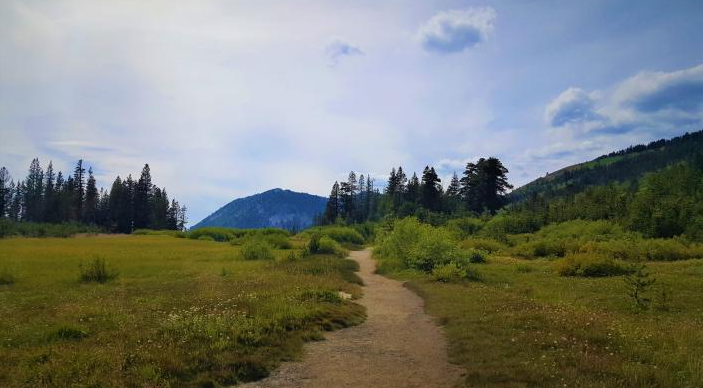
The trail is moderate up to the peak. The well-defined path leads you up a series of switchbacks to lava rock formations at the top. The flat topped rocks provide great seating to take in the view of Lake Tahoe, enjoy a picnic lunch, and your companions; people and pups. The trail is well marked so no worries about getting lost. With Tahoe being a popular world-class destination expect plenty of other hikers, bicycles and equestrians on the multi-use trail.
The hike down is easy with gravity on your side. I enjoyed the peek-a-boo views of Lake Tahoe between the towering pines the length of the trail. Some recent clearing of timber, lower down near the road, made for a cluttered and messy looking start to the trail but quickly clears to the alpine trail I look forward to when hiking at this elevation (7,009 feet).
Other hikes from this point include Brockway to Martis Peak at 4.3 miles and Brockway to Mt. Rose wilderness at 7.6 miles.
To get there from Auburn head east on Interstate 80 to Highway 267 toward Tahoe. The parking area is on the roadside just South of Brockway Summit between Truckee and Kings Beach.
The temps are generally cooler. Consider taking an extra layer to stay warm. Weather this time of year changes quickly. Be prepared.
I want to add a note about the care and devotion that was obvious to me on this trail. I usually pack out a trash bag of empty water and juice containers, granola bar wrappers, etc. No trash was to be found on this trail. The signage was above average. The blue arrows marking the TRT were numerous. It is good to know you are on the right path when following a new trail.
CLICK HERE to see the original article and Mary's photos in The Auburn Journal newspaper.
If 20 miles is more than enough trail for you, consider a very pleasant 1.5 mile trek up to the peak of Brockway Mountain to Picnic Rock. The three-mile round trip hike starts at the parking area across Highway 267 near Kings Beach.
The trail is moderate up to the peak. The well-defined path leads you up a series of switchbacks to lava rock formations at the top. The flat topped rocks provide great seating to take in the view of Lake Tahoe, enjoy a picnic lunch, and your companions; people and pups. The trail is well marked so no worries about getting lost. With Tahoe being a popular world-class destination expect plenty of other hikers, bicycles and equestrians on the multi-use trail.
The hike down is easy with gravity on your side. I enjoyed the peek-a-boo views of Lake Tahoe between the towering pines the length of the trail. Some recent clearing of timber, lower down near the road, made for a cluttered and messy looking start to the trail but quickly clears to the alpine trail I look forward to when hiking at this elevation (7,009 feet).
Other hikes from this point include Brockway to Martis Peak at 4.3 miles and Brockway to Mt. Rose wilderness at 7.6 miles.
To get there from Auburn head east on Interstate 80 to Highway 267 toward Tahoe. The parking area is on the roadside just South of Brockway Summit between Truckee and Kings Beach.
The temps are generally cooler. Consider taking an extra layer to stay warm. Weather this time of year changes quickly. Be prepared.
I want to add a note about the care and devotion that was obvious to me on this trail. I usually pack out a trash bag of empty water and juice containers, granola bar wrappers, etc. No trash was to be found on this trail. The signage was above average. The blue arrows marking the TRT were numerous. It is good to know you are on the right path when following a new trail.
CLICK HERE to see the original article and Mary's photos in The Auburn Journal newspaper.
 RSS Feed