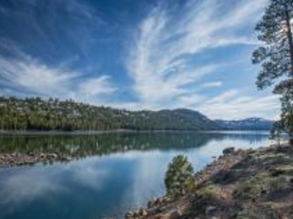
As the summer winds down and gives way to fall, now is the time to get out and visit Independence Lake. You can spend a day hiking its shores, kayaking its clear waters and picnicking among the pines. When you arrive, take advantage of the calm winds of the morning and take out one of the first-come, first-serve kayaks available at the lake. With fewer visitors than in the height of summer, it's the perfect time to head out on the water. Kayaks will be available through October 1 (visitors must use first-come, first serve kayaks as part of efforts to prevent invasive species from entering the lake, see rules below).
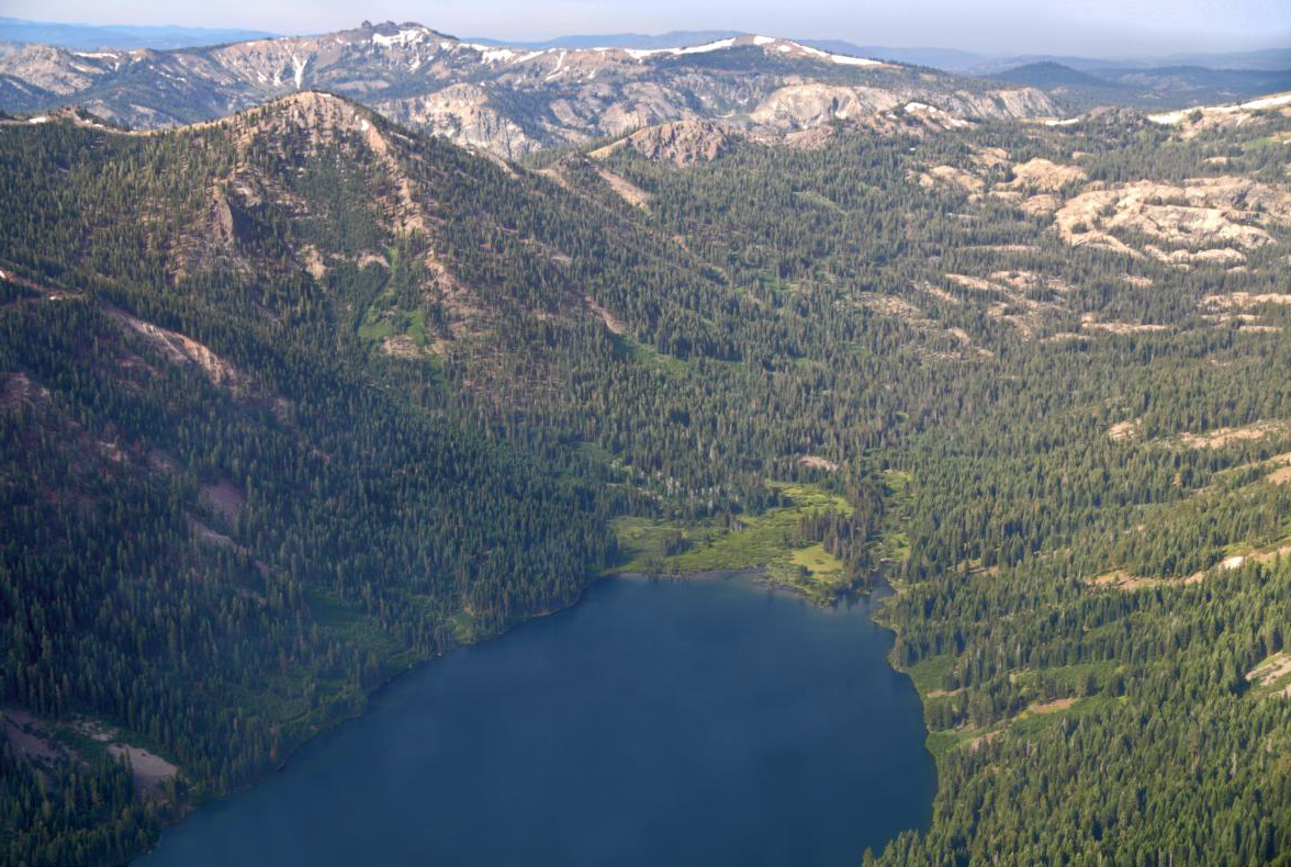
When you're ready to explore the 2,000-acre property on foot, there are trails along the north shore and south shore to choose from, as well as a short Meadow Loop Trail near the parking and picnic areas. The north shore trail will meander through the woods along the shore, looking up at Carpenter Ridge and up the lake toward Mt. Lola, the tallest peak in Nevada County. (Photo credit: Nature Conservancy)
The South Shore Trail also offers views of Mt. Lola, and has granite boulders along the water's edge, perfect for sitting and taking in the view.
Set at 6,949 feet elevation, the clear waters of Independence Lake are home to one of only two self-sustaining lacustrine populations of Lahontan cutthroat trout. An every-other week schedule for motor boats gives access for anglers.
When it's time for lunch, picnic tables are located along the north shore and at the east end near the parking area.
Independence Lake was acquired by The Nature Conservancy, the Truckee Donner Land Trust and the Northern Sierra Partnership in 2010. Learn more here.
How to Get There
From Hwy 89, about 17 miles North of Truckee, follow Jackson Meadows Road west 1.5 mi. Turn left/South at the sign for "Independence Lake – 5 miles". After about 2 miles, the road forks and a sign indicates ‘Independence Lake – 3 miles’ to the right. After an additional half mile, the road forks again, follow the left fork across a stream and continue to Independence Lake and the directional signs to the parking area.
Rules and Regulations
- No boats, float tubes or paddlecraft from outside the Preserve are permitted, as part of the aquatic invasive species prevention program
- All footgear you plan to use in the lake must be washed at our wash station before you enter the lake. No felt-soled wading boots are permitted
- Please check The Nature Conservancy website for wind and weather conditions and more!
- Click here to download the motorboat availability schedule!
 RSS Feed