MOTHER LODE TRAILS
  • Home
  • About
  • Contact
  • Volunteer
  • Links
    • Law Enforcement Emergency
    • Federal, State, County Districts Parks & Trails
    • Running Clubs
    • Equestrian Clubs
    • Mt. Bike Clubs
    • Hiking Clubs
    • Trail Advocacy Organizations
    • Phone Numbers State & Federal Parks, Trails & Lands
    • Where to Eat on the Trails
  • News
  • Alerts

Martis Valley Trail funded among others approved for $3.2 million Placer County tourist funds

1/28/2022

 
Picture
The Resort Triangle trail network, Martis Valley Trail and a scenic overlook were among 12 projects* approved by the Board of Supervisors on Tuesday for approximately $3.2 million in transient occupancy tax funding to support community priorities in eastern Placer County.
​
This year, the Capital Projects Advisory Committee reviewed and evaluated 13 grant applications totaling over $4.5 million in transient occupancy tax funding requests. 

“The funds raised through tourism are vital to both the local economy and the quality of life.”

“Residents and visitors are drawn to Eastern Placer County by its natural beauty and the region’s unique and historical attractions,” said Board Chair and District 5 Supervisor Cindy Gustafson. 

"The funds raised through tourism are vital to both the local economy and the quality of life. Our transient occupancy tax program is essential to fund projects and programs that both visitors and local residents can use. These projects improve the environment, provide capacity for the demands on our region, while supporting innovation and collaboration.”
-
Cindy Gustafson, District 5 Supervisor
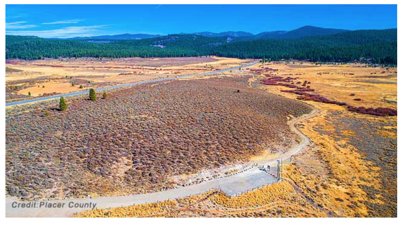
MARTIS VALLEY TRAIL
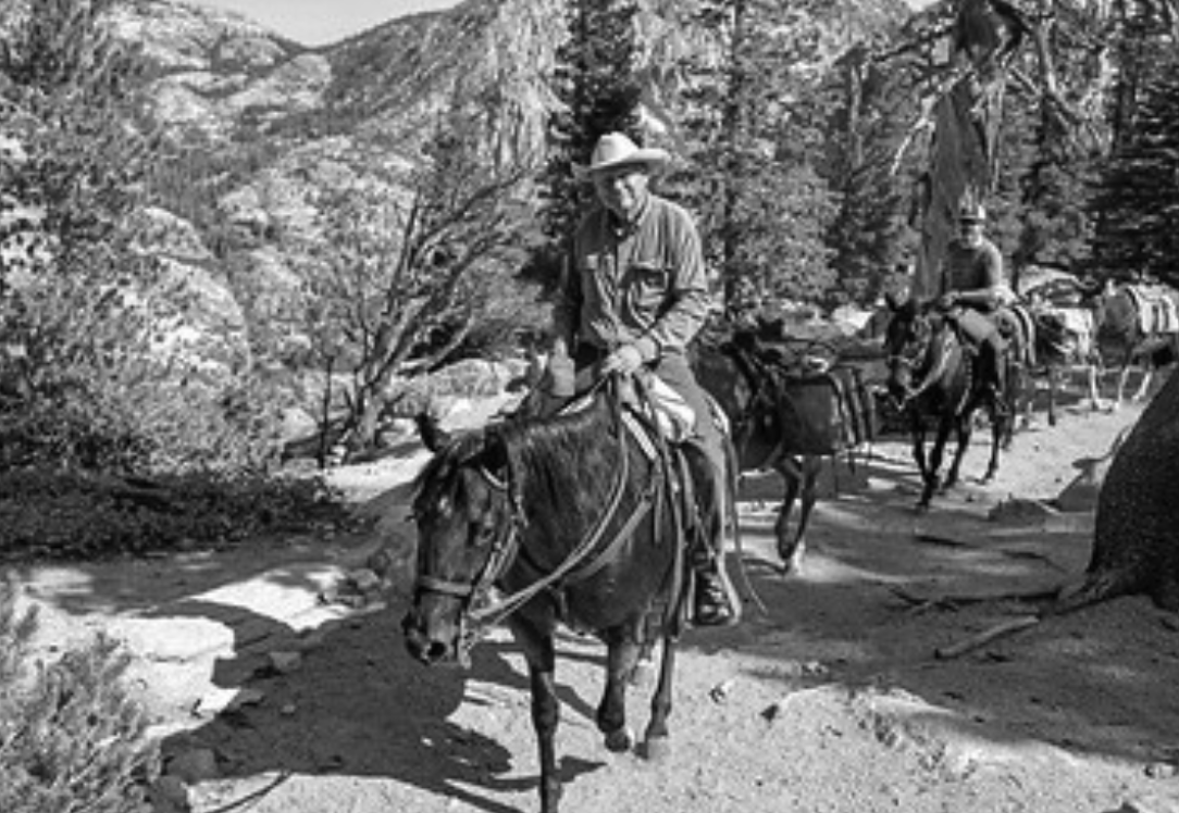
The Martis Valley Trail, a proposed 9-mile trail connecting Northstar Village with the Lake Tahoe Basin and the Town of Truckee, was awarded $1 million. Resort Triangle trail projects received an additional $900,000 to advance a regional initiative to connect Placer’s lakeside communities, mountain resorts and the Town of Truckee for alternative transportation and recreation options.
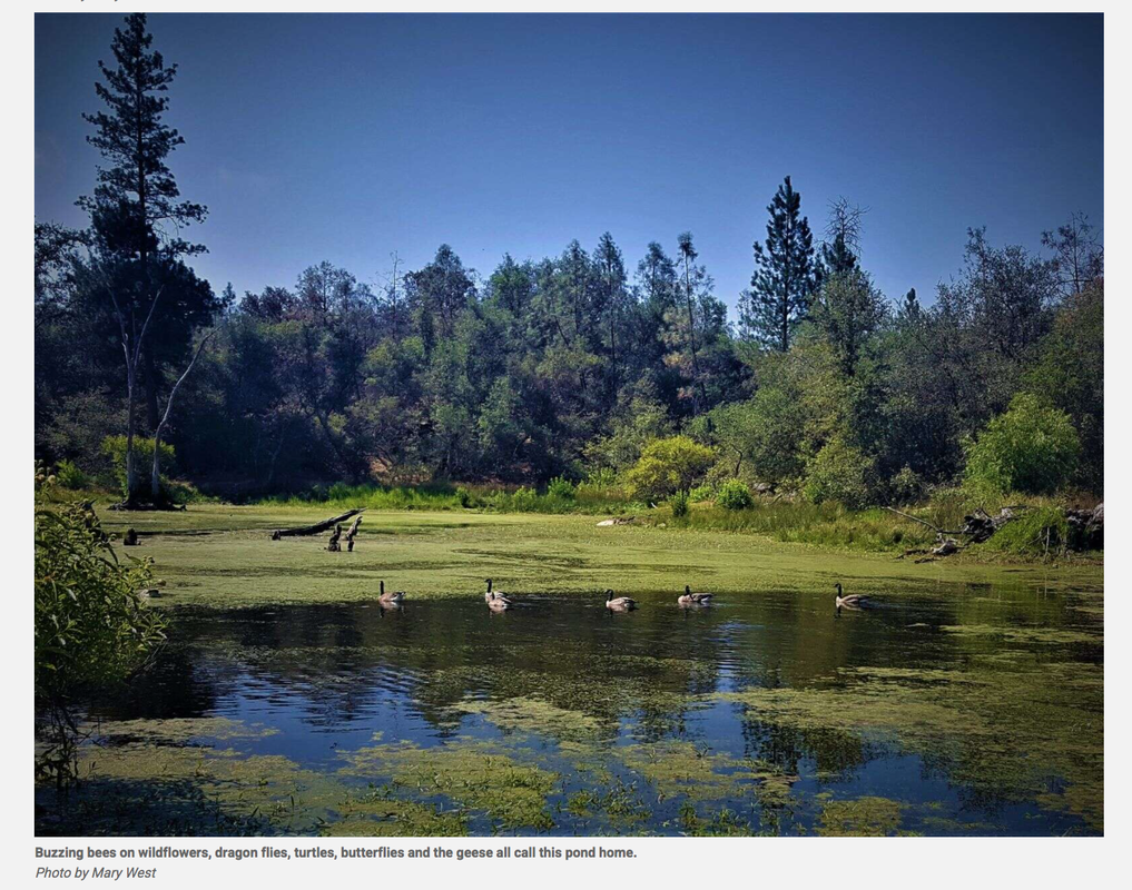
VAN NORDEN
The Van Norden Meadow Restoration and Recreation Project, which will provide enhanced recreation opportunities to the community as well as bring back the natural streams and floodplains to the Van Norden Meadow on Donner Summit, was awarded $500,000.

VAN NORDEN
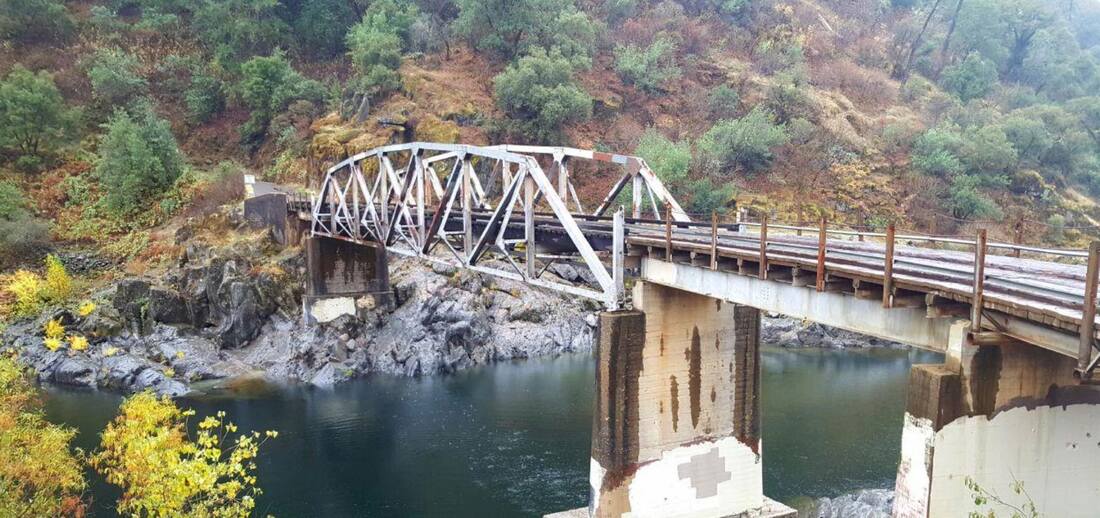
The Tahoe Vista Recreation Area Marina Trail and Scenic Overlook Improvement Project, which will construct a new lake access trail.

CAPITAL PROJECTS ADVISORY COMMITTEE
The Capital Projects Advisory Committee – a 13-member group representing the broad economic and geographic interests throughout eastern Placer County – evaluates project proposals based on how well they advance key priorities outlined in the Tourism Master Plan for the region. The committee is co-chaired by Placer County and the North Lake Tahoe Resort Association and includes members appointed by community organizations representing resorts, small business, residents and visitors.

The committee makes recommendations to the Board of Supervisors on which projects should receive funding allocated from the TOT tax collected from lodging guests in eastern Placer County.

CLICK HERE to see the complete article in Roseville Today.

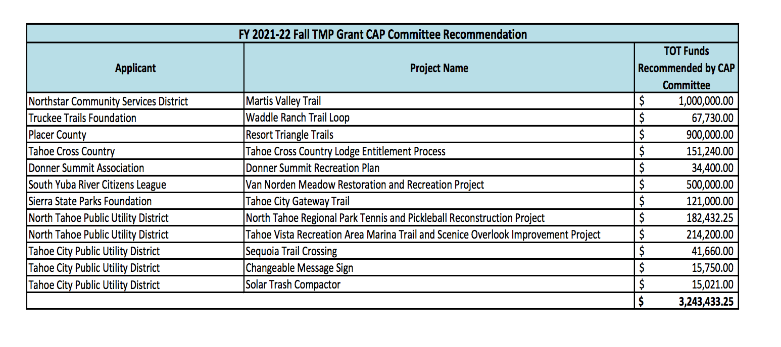
* COMPLETE LIST OF PROJECTS:
Picture

Exploring Black Swan Preserve

1/28/2022

 
Picture
by Mary West
Be patient, this trail is worth it. I was a bit skeptical when I saw the sign for the Black Swan Preserve right off Mooney Flat Road near the Nevada and Yuba county line. How great could it be, so close to Highway 20? I was pleasantly surprised.


The Bear Yuba Land Trust opened this 50-acre preserve to the public in 2014. Building trails isn’t easy and it’s an ongoing effort by the many volunteers and trail staff to maintain new trails until they “take hold” and stand on their own. I appreciate the Bear Yuba Land Trust for opening so many new trails to the public. You can learn more at bylt.org.

From the small parking area just off the road you hike a series of switchbacks that take you past some nice rock formations to the top of the hill. Much of the trail is exposed so remember your sunblock and hat. Just past the half-mile marker you will see a short trail to the right. This is an excellent spot to take in the view of the pond and surrounding foothills. I thought this view alone would be the payoff for this short two-mile hike but this trail had more to offer.

Beyond the hilltop view, the trail heads back downhill. Keep an eye out for the remains of foundations and signs of an old homestead. It looked like they may have even had a fruit orchard of some kind, many years ago. The blackberries were nice and ripe during my July hike. Blackberries right off the vine are a perfect trail snack.

Once at the pond I just stood for a while taking in the view. Being patient and taking a closer look, I found a wealth of wildlife. The buzzing bees on wildflowers, dragon flies, turtles, butterflies and the geese all call this pond home. I wouldn’t suggest taking a dip in the pond, although my advice didn’t convince Stella. Even though we were geographically so close to a highway, the pond provided a solitude and peacefulness to transport us to a sanctuary only found deep in the wilderness.

To get there take Highway 49 from Auburn north toward Grass Valley. Take the Highway 20 exit toward Penn Valley. Continue on Highway 20 to Mooney Flat Road. It is also the road to Englebright Dam. Just a quarter mile up the road you will see the green sign on your left for the preserve.

Park, be patient, and enjoy.

Mary West is author of the book series Day Hiker – Gold Country Trail Guide I, II and III (2nd edition Available on Amazon). The books are a collection of the Day Hiker columns where West shares her longtime love of the outdoors, favorite hikes in Northern California’s Gold Country and beyond. West was the recipient of the 2017 and 2019 CRAFT Award for Best Outdoor Column and the 2020 Craft Award for her second book in the series-Day Hiker Gold Country Trail Guide by the Outdoor Writers of California. You can follow West on Facebook and Instagram

CLICK HERE to see the complete article and photos in The Union newspaper.

ACE to change organization, mission

1/26/2022

 
Picture
Action Coalition for Equestrians (ACE) 501c3 organization's new Board of Directors has decided to change the name, make up and mission from a state-wide equestrian associations' advocacy group into a local group of non-motorized, non-mechanized, trail users. The Board's plan is to focus to an emphasis on local trails, trail use and trail safety. The membership and Board had difficulty achieving a focused plan during the past two years, so decided to concentrate on what was most important.

ACE has had a long and active history. It filed to be a nonprofit organization in 2002. In 2003-2006, it  assisted developing the California Horse Council which later became the CA Equestrian Trail and Land Coalition. ACE was instrumental in several California State Park trails plans, including Oroville State Recreation Area. Realizing there was a need to have a centralized database and reporting function for trail safety and usage, ACE funded the software development for Park Watch Report. It was implemented in three state parks with success and in 2014 was sold to be a for-profit entity. For over 10 years, Park Watch Report gathered data as well as providing trail safety and usage data to land  managers. ACE also funded many worth while organizations and projects, such as rebuilding the horse barns at Placer County Fair, Safe Trails Alliance, and partially funded Mother Lode Trails to be a local resource website for all trail users.

The change of ACE's mission corresponds with the increasing and active local membership of equestrian and trails organizations. All trail users, including equestrians, care about safe trails and equal access to public lands, and have established local trail advocacy organizations rather than funnel their energy and donations into national or state groups which may lack action in their own backyards.
You can see the links to all our local organizations, click here.

As for state-wide influence for equestrians and stock use on public lands, since 1981 Back Country Horsemen of California has been extremely effective and continues its valuable mission.

We can say goodbye to ACE as it was, and are looking forward to its success in what it plans to become.


Desolation Wilderness trails get help from Back Country Horsemen, Mother Lode Unit

1/25/2022

 
Picture
Every year, Mother Lode Unit (MLU) gets a request for pack support from the Tahoe Rim Trail Association (TRTA) to support trail crews working in Desolation Wilderness near Lake Tahoe on two major trails. Usually, MLU receives four or five trip requests annually, but the COVID restrictions in 2020 and the fires in 2021, reduced that to two each year.

The Tahoe Rim Trail (TRT) and the Pacific Crest Trail (PCT) share trail tread near the top of the Sierra Nevada Mountain Range as the trails pass through multiple forests near Lake Tahoe. The Tahoe Basin Management Unit integrates the management efforts of the various forest managers. The TRT and PCT Associations coordinate their volunteer maintenance crews and request special assistance from other trail support groups in the area, like BCHC Mother Lode Unit.

The 2021 request focused on a 1.5-mile section of trail between Echo Lake and Phipps Creek. This portion of the two trails is about 6,400 to 8,100 feet elevation and is popular, so it gets heavy usage. The trail crew reconstructed trail tread using native stone for a long-lasting and effective solution to the deleterious effects of high use and erosion on the trail. They improved or replaced water bars and drainages, plus built several more check steps.

The MLU packer contribution was to haul the crew’s heavy gear and sup- plies to their campsite, one trip in July and one in August. This allowed the trail crews more time and energy to work on the trail tread. When the planned work was done, the trail crews hiked out with their much lighter backpack loads of only personal gear.

Packer travel expenses were partially mitigated by a grant from the National Wilderness Stewardship Alliance. 

- by Lucy Badenhoop
Photos courtesy of Tahoe Rim Trail Association

To see the Back Country Horsemen of California news magazine for Winter 2022, CLICK HERE.


Picture

ASRA Codfish Falls day hike with Mary West

1/8/2022

 
With winter rain the waterfalls return. The drive down to the Ponderosa Bridge is the most harrowing part of this adventure.
The Ponderosa Bridge is at the bottom of Ponderosa Way at the American River. It’s here you will find the parking area and trailhead. You can get there with a high-profile vehicle from Foresthill Road at Ponderosa Way. The longer but slightly easier road my low-profile Subaru can traverse is off Interstate 80. Take the West Paoli exit and stay to the right to Ponderosa Way. Take a right on Ponderosa Way. Follow the winding dirt road three miles all the way down to the bridge. With winter rain, erosion of the road continues. Be cautious. This road can washout.

You will see signs as you enter the Auburn State Recreation Area. At the bridge, you find two chemical toilets. The trailhead is directly behind them. The trail follows the river most of the way. There is a rock outcropping you will need to navigate in the beginning, but it’s not too tough.

Areas of the trail are narrow and eroding. Wear sturdy shoes and pay attention. A nice new picnic table has been placed, probably by Eric Peach, in a wide spot about halfway. The table provides a nicely shaded respite from the trail in summer.
You hear the falls long before you see them. Once you arrive, your ears and eyes draw you up to the top of the falls. Taking in the cascading water, your eyes will slowly draw you the length of the first fall. Don’t stop here. Notice the series of falls below.
The pools of runoff are trimmed in lush vegetation. There is a boulder halfway down the falls, perfectly placed for a picnic. On my most recent visit, I sat quietly and listened to the running water, the falling rain, the birds calling and the sound of my own breathing; glorious.
​
Mary West is author of the book series Day Hiker – Gold Country Trail Guide I, II and III (2nd edition available on Amazon). The books are a collection of the Day Hiker columns where West shares her longtime love of the outdoors, favorite hikes in Northern California’s Gold Country and beyond. West was the recipient of the 2017 and 2019 CRAFT Award for Best Outdoor Column and the 2020 Craft Award for her second book in the series – Day Hiker Gold Country Trail Guide – by the Outdoor Writers of California. You can follow West on Facebook and Instagram.

CLICK HERE to see the complete article and photos in Gold Country Media.


The drive down to the Ponderosa Bridge at the American River is one of the more chilling parts of the Codfish Falls adventure. Credit: Photo courtesy Mary West
Picture

    Trail News

    Visit this page for all of the latest Trail News that affects our area.

    Archives

    February 2023
    January 2023
    November 2022
    October 2022
    September 2022
    August 2022
    July 2022
    June 2022
    April 2022
    March 2022
    January 2022
    November 2021
    October 2021
    August 2021
    July 2021
    June 2021
    May 2021
    April 2021
    March 2021
    February 2021
    January 2021
    December 2020
    November 2020
    October 2020
    September 2020
    August 2020
    July 2020
    June 2020
    May 2020
    April 2020
    March 2020
    February 2020
    January 2020
    December 2019
    November 2019
    October 2019
    September 2019
    August 2019
    July 2019
    June 2019
    May 2019
    April 2019
    March 2019
    February 2019
    January 2019
    December 2018
    November 2018
    October 2018
    September 2018
    August 2018
    July 2018
    June 2018
    May 2018
    April 2018
    March 2018
    February 2018
    January 2018
    December 2017
    November 2017
    October 2017
    September 2017
    August 2017
    July 2017
    June 2017
    May 2017
    April 2017
    March 2017
    February 2017
    January 2017
    December 2016
    November 2016
    October 2016
    September 2016
    August 2016
    July 2016
    June 2016
    May 2016
    April 2016
    March 2016
    February 2016
    January 2016
    December 2015
    November 2015
    October 2015
    September 2015
    August 2015

    Categories

    All

    RSS Feed

Home
Contact
 Mother Lode Trails is YOUR local volunteer-run trail information and resource website. Here you can find
up-to-the minute information on trail alerts, links and trail news for Placer,  Yuba, and Nevada counties.
Mother Lode Trails is trademarked.