MOTHER LODE TRAILS
  • Home
  • About
  • Contact
  • Volunteer
  • Links
    • Law Enforcement Emergency
    • Federal, State, County Districts Parks & Trails
    • Running Clubs
    • Equestrian Clubs
    • Mt. Bike Clubs
    • Hiking Clubs
    • Trail Advocacy Organizations
    • Phone Numbers State & Federal Parks, Trails & Lands
    • Lost & Found on the Trails
    • Where to Eat on the Trails
  • News
  • Alerts

EDHCSD makes ‘compromise’ decision on trail

8/24/2017

 
Picture
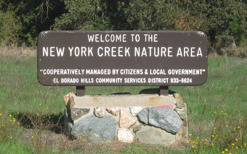
Neither the mountain bikers or the pedestrians are happy with the decision to change the pedestrian-only nature area to add bikes on part of it. The El Dorado Hills Community Services District Board of Directors voted 3-1 at its meeting Thursday night to keep the New York Creek Trail pedestrian only in its narrowest section by Jackson Elementary School but permitting bikes from the power lines to St. Andrews Drive. It was a decision EDHCSD General Manager Kevin Loewen calls “a compromise,” yet the most vocal proponents on both sides say slights their positions.

To read the rest of the article by Julie Samrick n the Mountain Democrat newspaper  CLICK HERE.

Earlier this year the CSD sent notices to 20 homeowners who live between Jackson Elementary and Falkirk Way that the district would be widening the trail to 8 feet to safely make it multi-use while retaining its wooded characteristics.
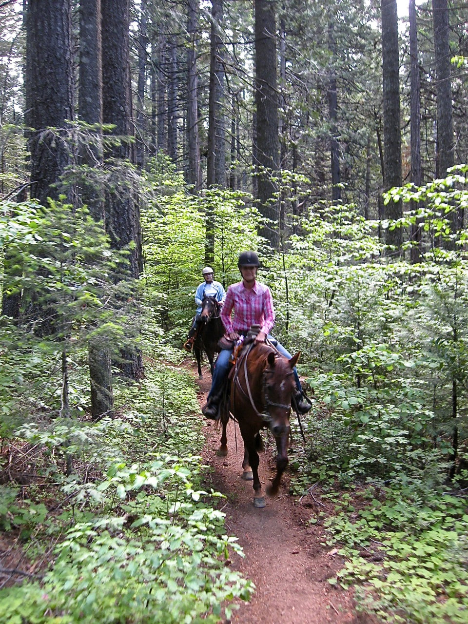
Although a “no bike” ordinance has been in effect since 1986, many cyclists use the trail, including recreational mountain bikers and children who use it as a safe route to travel off main roads. After the  CSD sent out the notice, neighbors argued both for and against a multi-use trail. Those in favor said bicyclists and pedestrians had been peacefully coexisting on the trail while others said they thought the clean-up would encourage more bicycle use and threatened lawsuits if the CSD performed the work (some of which was recently done by a contractor).
Since then the CSD held a stakeholder process to get the community’s input, which included two public meetings, an internet survey (Flashvote), emails and handwritten letters, as well as comments received during public meetings.
On Thursday Loewen told the board that his recommended action is: 1. Support continuation of the New York Creek Trail Interpretive Signage Capital Project, excluding trail widening to accommodate multi-use and 2. Uphold and support the pedestrian-only status of New York Creek Trail from St. Andrews Drive to Brackenwood Place.

“While the subject matter expert hired to assist the district with the stakeholder process has made a recommendation for permitting bike use in the form of walking bikes from the paved commuter connector (under the PG&E/SMUD power lines) southward, such an accommodation would further distort an already difficult pedestrian-only rule,” Loewen wrote in the report ahead of the vote. “Further, the benefits portrayed by multi-use proponents for permitting bike use (e.g., safe route alternative; healthy recreation activity in a unique setting) would not be realized by this compromise to the pedestrian-only status. In the event that a compromise be considered in which actual riding of bikes is allowed, then the Falkirk trailhead is the most viable option in which such a compromise could be made.”
Director Billy Vandegrift made a motion to approve Loewen’s recommendation to keep the trail pedestrian only, but it failed for lack of a second.
Director Noelle Mattock then made a motion to approve the first portion of Loewen’s recommendation — to add interpretive signage on the trail. The signage would be educational for the public and would include a list of concepts including, but not limited to, the New York Creek Watershed, oak woodland ecosystem, wildlife, human impacts to creek, trail etiquette at each trailhead and cultural resources and history of indigenous people to the area, including Miwok-Nisenan inhabitants.
Mattock also made a motion to make the New York Creek Trail pedestrian only from Brackenwood to Falkirk Way, the one-mile stretch described as the most “pristine,” “with the densest vegetation” and the subject of debate.
The two motions were seconded by Director Allan Priest. It was opened to discussion and Directors Mattock, Allan Priest and Ben Paulsen voted for the compromise. Vandegrift voted against. Director Wayne Lowery was not at the meeting but Loewen said he would have abstained from voting due to a conflict of interest because his home backs to the portion of the trail in question.
The following day neither pro-bike nor pedestrian-only advocates said they were happy with the decision." Click on the article to read comments.

Today, the community is starting to respond with op-eds and letters to the Board, so far only from the pedestrian-only advocates...here is one written to Village Life:
"Noelle Mattock, Ben Paulsen and Allan Priest:

On Aug. 10 you voted to proceed with the El Dorado Hills Community Services District’s plans to allow a mountain bike trail in the southern half of New York Creek. This area was deeded to CSD 30 years ago after CSD publicly promised to preserve this area as a pedestrian-only nature preserve.

This year the CSD held a six-month stakeholder process on this issue only after overwhelming objection to its ill-conceived plan to force through a previously undisclosed multi-use alteration of the nature path. The stakeholder process confirmed majority support to keep this are pedestrian only. The CSD received hundreds of emails and letters from residents with 85 percent in support of keeping this area pedestrian-only. In an internet survey, 73 percent of respondents did not support alterations to allow mountain bikes in this area.
The decision made by you to turn your backs on an overwhelming majority of affected residents in favor of a very small minority of mountain biking advocates — many of which don’t even live in EDH — is the worst form of local government. CSD General Manager Kevin Loewen went through extreme steps to find out what the majority of concerned EDH residents wanted and presented the results to you in his recommendation. You then proceeded to concentrate on a compromise, which was supported by a small minority of mountain biking advocates that did not come close to the overwhelming response in favor of a strictly pedestrian nature path, as it has been for 30 years."

And, to read another letter by Ed Dorado Hills resident, Eric Hildebrandt CLICK HERE.


State Parks, Placer CO, move forward with plans for 16 mile Memorial Overland Emigrant Trail at Donner

8/16/2017

 
Picture
Plans to build a 16-mile trail re-creating the original wagon route west over Donner Summit are closer to taking shape with the approval today of an agreement for construction and management of the Memorial Overland Emigrant Trail through Donner Memorial State Park. (Photo from SouthTahoeNow.com)

The earth trail will stretch from Kingvale through Donner State Memorial Park in Truckee, following the original Overland Emigrant Trail but away from its remnants to protect its historical artifacts.

“The Overland Emigrant Trail is such an important piece of our history, and the new trail will help us connect with that history and the incredible natural beauty of its surroundings,” said District 5 Supervisor and Board Chairwoman Jennifer Montgomery. “I couldn’t be happier to see it moving forward.”

The portion of the trail through the park will also help form the planned Donner Lake Rim Trail being developed by a number of agencies. West of the park, Sugar Bowl Ski Corporation has already provided a half mile of completed trail and Placer County is working with the U.S. Forest Service and Truckee Donner Land Trust to secure an additional 3 miles of trail across the Royal Gorge resort property.

Under the memorandum of understanding between Placer County and California Department of Parks and Recreation, approved today by the county Board of Supervisors, Placer County will take the lead on planning and design of the trail. California Department of Parks and Recreation will oversee permitting and construction of the trail, as funding and resources allow. The park will maintain and manage the trail within its boundaries. California Department of Parks and Recreation approved the agreement July 24.

Placer County has contracted with Stantec Inc. to complete environmental studies for the trail and design its alignment through the park, expected to be completed by summer of 2018. Public workshops are planned and will be announced as they’re scheduled.

CLICK HERE to see the original article at the Placer County website.


Pioneer Trail - Tahoe National Forest - civilized and wild

8/12/2017

 
Picture
The Pioneer trail is 25 miles long. It begins at Hwy 20 near 5 Mile House a few miles above Nevada City and ends at Spaulding Lake Trail. The Pioneer Trail is suitable for equestrians, hikers, joggers, and mountain bicyclists.

Difficulty Level: Easy, west end - Difficult, east end Use level: Moderate  Closed to all motorized vehicles
Closest Towns: Nevada City, CA

Directions: Trailhead Access: There are many places where you can access the trail, including Harmony Ridge Market, Lone Grave, White Cloud Picnic Area, Gold Country Trails Council Equestrian Staging Area, Washington Overlook trailhead, Upper Burlington Trailhead, Chalk Bluff trailhead, Omega Rest Stop, Ziebright Mine, all along Highway 20, and at Lang crossing on the Bowman Lake road.

Topo Maps:  Washington 7.5’ & Blue Canyon, 7.5'

Trail description: From Five Mile House to White Cloud, the trail parallels Highway 20. Just west of the campground, the trail crosses the highway and goes deeper into the forest. From White Cloud to Skillman Campground, the trail is often located on abandoned ditches and roadbeds in dense timber. From Skillman to Chalk Bluff, the trail enters tree plantations where wildfires killed most of the older trees. East of Omega Rest Stop, the trail crosses to the north side of the highway and follows an old pioneer road to Steephollow Creek. The trail climbs then, descends toward the highway on the old Tahoe-Ukiah highway route, the predecessor of Highway 20. Now on the south side of the highway, the trail descends into Bear Valley, where it meets the Bowman Lake Road on the east side of the valley. The trail then follows the Bowman Lake road to the South Yuba River, crossing the bridge at Lang crossing. From the crossing, the trail climbs through nearly solid rock, then into live oak woodlands and finally into a mixed conifer forest until the trail joins the Spaulding Lake trail at a penstock that provides water for hydroelectric power at Spaulding Lake.

Turning left and traveling ¼ mile, the trail returns to the Bowman Lake Road; turning right on the Spaulding Lake Trail, you can access the Grouse Ridge Trail and the many trails within the Grouse Lakes area.

The Pioneer Trail is suitable for equestrians, hikers, joggers, and mountain bicyclists. It is closed to all motorized vehicles. Volunteers constructed most of the trail, a twenty-year project undertaken by the Gold Country Trails Council with supervision by the Forest Service. The Trails Council maintains the trail, with participation by other trail users.

In 2003, the Pioneer trail was designated as a National Recreation trail.

For More Information:
Tahoe National Forest
631 Coyote Street
Nevada City, CA 95959
530-265-4531

For complete information go here:

https://www.fs.usda.gov/recarea/tahoe/recarea/?recid=56012


Your safety around yellow jackets/ground wasps/ground bees

8/4/2017

 
Picture
From Pt. Reyes National Park: Yellow jackets (Vespula species, Vespa species and Dolichovespula species) are considered beneficial around home gardens and commercially grown fruits and vegetables at certain times of the year because they feed abundantly on insect pests such as caterpillars and harmful flies.

However, in late summer and early fall when their populations peak, the yellow jackets' normal insect diet disappears and their feeding habits become a problem to park visitors. At that time of year, the yellow jacket has an appetite for the same food and drink as those consumed by humans. Also, yellow jacket stings can result in a life-threatening situation, if the person is allergic to yellow jacket venom. Persons highly sensitive to yellow jacket venom should always carry a sting treatment kit during outdoor activities.

Nests are often located in a soil cavity such as an abandoned gopher hole, mouse nest, or hollow tree. Other possible nest sites are in buildings, including attics, porches, eaves, or sheds. Disturbing ground nests or trees can cause yellow jackets to attack.

If you do disturb a yellow jacket nest, general guidelines are to slowly walk away with both hands covering the face to protect the more sensitive body areas. It is best to walk toward dense vegetation or enter a vehicle or building to avoid the stinging insects. Swift movements will only attract more yellow jackets.

Horse riders should always be alert for yellow jackets and their nests, particularly in the late summer and fall. As a horse passes near a yellow jacket nest, it can shake the nest. Yellow jackets will then swarm out to defend the nest. If you are on a horse that is being attacked by yellow jackets, you will definitely want to promptly move out of the area.
[From Mother Lode Trails, "RUN your horse as fast as possible away from the attacking wasps, yelling "BEES! This warns other trail users.] Some horses might panic upon being stung and may start bucking and bolting. Use your knowledge of your horse's temperament and your best judgment to resolve the situation.

Allergic reactions to yellow jacket or bees stings may cause shock and life threatening conditions. Those with known allergies should carry sting treatment kits and be prepared to seek prompt medical attention if stung. A yellow jacket does not leave a stinger in its victim, so it can therefore sting multiple times. Companions of multiple-sting victims should watch the victim and be prepared for emergency medical response and evacuation.

To see the original article, CLICK HERE.


Bear Yuba Land Trust Launches Major Effort to Save Independence Trail

8/4/2017

 
Picture
Hugging the steep slope above the Wild and Scenic South Yuba River, Independence Trail winds through a mature forest of Pacific madrone, mountain dogwood and incense cedar. For decades, busloads of eager school children, some in wheelchairs, have come here to explore Gold Rush era flumes and discover Sierra newts in Rush Creek every spring.
(Photo credit: Laura Peterson)
But today, the wooden ramp that took folks of all mobility levels to the creek is barricaded and several feet of decking removed to keep people out. It’s too dangerous to use.  Bear Yuba Land Trust (BYLT) is launching a community-supported effort to restore the iconic wooden Rush Creek Ramp and other features on the historic and universally-accessible Independence Trail located on the Land Trust’s 207-acre Sequoya Challenge Preserve.
Founded by the late Naturalist John Olmsted and built and maintained by a passionate crew of volunteers, the trail known for its dramatic wooden flumes became the nation’s first wheelchair accessible wilderness trail in the 1980s.
Located approximately six miles north of Nevada City, off Highway 49, the trail meanders through property owned and managed by BYLT and California State Parks. A popular hiking destination, the trail with the wooden switchback wheelchair ramp, which looks more like an art sculpture, attracts visitors from all over the world to experience one of Nevada County’s many wonders.
“This trail is forward-thinking and inclusive. With some fine-tuning and hard work we can attract even more users with limited mobility as well as the general population,” said local archaeologist and trails writer Hank Meals, who helped build the trail decades ago.
The trail memorializes the historic Gold Rush-era Excelsior Canal and includes ditch and berm sections, bridges, wooden flumes, overlook decks, and a long wooden ramp providing wheelchair access to Rush Creek. Every year, volunteer work parties, organized by BYLT and South Yuba River Parks Association (SYRPA) Volunteer Warren Wittich, help keep the ditches and wooden flumes free from forest litter but lack the funding for big infrastructure improvements.
Already, local rotary clubs, FREED Center for Independent Living, South Yuba River Citizen’s League (SYRCL) and others are coming forward to do whatever it takes to restore access to Rush Creek and keep the trail open.
“The Independence Trail isn’t worth saving because of one man’s dream conceiving it, or because of a few people’s hard work building it, it’s worth saving for every reason that parks and trails are important at all – public access to the wilds of nature,” said John Olmsted’s son, Alden, who remembers his dad’s patching the flumes with flattened coffee and bean cans hammered down with big flat head nails.
The South Yuba River corridor provides year-round habitat and migratory routes for many mammals, birds, amphibians and reptiles that make the river canyon their home. In general, riparian habitat accommodates a greater variety of wildlife than any other habitat type in California. Animals who are known to make their home in the area of this Land Trust preserve include deer, mountain lion, coyote, gray fox, bobcat and bear.

On a path to wildness
In 1969, John Olmsted discovered the overgrown ditch, the perfect solution to a problem his friend with disabilities asked him to solve:  help her get out into nature. He had found the ideal place for a rugged wheelchair trail into the wilderness. The 100-year old rock-lined ditches were the perfect width for maneuvering a wheelchair or as a safe passage for people with limited sight who used walking sticks. The historic integrity of the ditches could be preserved and recycled to serve a new purpose.
A decade later, Olmsted returned with enough money he and a group of other interested naturalists had scraped together to make the first down payment.
The tall, thin, bearded naturalist with a crumpled hat was regularly seen clipping dead branches away from the trail or replacing rotted flume planks. He always carried along his repair kit: a pack containing a bow saw, hammer and nails, scrap metal and long handled loppers to keep the trail in check.  Olmsted died in 2011, at the age of 73, after a long fight with cancer.
Like many locals who grew up here, Caleb Dardick, Executive Director of SYRCL, has a personal connection to the Independence Trail. As a kid growing up on the Yuba River, the trail fulfilled a dream of his, of taking his father, who used a wheelchair, to visit river swimming holes. The late Sam Dardick, was a disability rights activist and Nevada County supervisor who worked alongside John Olmsted and other volunteers to build the trail.
“I’ll never forget the first time we rolled down that smooth trail along the river canyon edge, over the new flume and down the remarkable switchback Ramp to the creek. Thanks to the Independence Trail, so many people with disabilities, like my Dad, enjoy the thrill of visiting the beautiful Yuba canyon,” said Caleb Dardick.
In recent years, the ramp has fallen into disrepair and was closed last fall because of safety concerns regarding the structure’s stability. A great diversity of outdoor lovers of all ages and mobility levels can no longer access Rush Creek.

Community support needed
In 2012, the non-profit group Sequoya Challenge (founded by Olmsted and his wife, Sally Cates) transferred ownership of 207 acres – including sections of the Independence Trail and the Rush Creek Ramp – to BYLT.
Restoring Independence Trail to its original glory, meeting today’s stringent standards to enhance accessibility, developing interpretive panels, and re-opening the ramp at Rush Creek will require phases of engineering and costly construction, supported by an enormous fundraising effort from the entire community.
BYLT is in the middle of a trail campaign to raise money and awareness about important projects like Independence Trail. A peer-to-peer on-line crowd funding campaign is available at http://donate-trails.causevox.com/ and will help BYLT reach its goal of raising $15,000 for the initial engineering report.  
“People can feel the magic and connect to a different time and place when hiking the Independence Trail. This ramp provides unique access for people of all mobility levels and we need to get it back,” said BYLT’s Land Access Manager Shaun Clarke.

A profound vision
Hank Meals was on the original Independence Trail work crew called the “Tin Woodsman” that in 1983 reclaimed the overgrown ditch and broken, rotten flumes.
“It was challenging work especially with John’s insistence on using 19th century tools and methods and his uncanny habit of appearing out of nowhere for an impromptu critique. But it was worthwhile,” said Meals.
Gold Rush ditches and canals originally used for water conveyance to the mines were not designed for recreational purposes yet today offer unique outdoor experiences, revealing environmental niches and views seldom seen by conventional trails. Easy grades make the trail accessible to a wide spectrum of users.
“John’s vision to convert a ditch to a trail suitable for wheelchair-users was and is profound and his determination and endless hustle made it a reality. We would be small-minded and foolish to drop the ball now,” said Meals.
---
To see the original article and photos in the Nevada City Chamber of Commerce website,  CLICK HERE


    Trail News

    Visit this page for all of the latest Trail News that affects our area.

    Archives

    June 2022
    April 2022
    March 2022
    January 2022
    November 2021
    October 2021
    August 2021
    July 2021
    June 2021
    May 2021
    April 2021
    March 2021
    February 2021
    January 2021
    December 2020
    November 2020
    October 2020
    September 2020
    August 2020
    July 2020
    June 2020
    May 2020
    April 2020
    March 2020
    February 2020
    January 2020
    December 2019
    November 2019
    October 2019
    September 2019
    August 2019
    July 2019
    June 2019
    May 2019
    April 2019
    March 2019
    February 2019
    January 2019
    December 2018
    November 2018
    October 2018
    September 2018
    August 2018
    July 2018
    June 2018
    May 2018
    April 2018
    March 2018
    February 2018
    January 2018
    December 2017
    November 2017
    October 2017
    September 2017
    August 2017
    July 2017
    June 2017
    May 2017
    April 2017
    March 2017
    February 2017
    January 2017
    December 2016
    November 2016
    October 2016
    September 2016
    August 2016
    July 2016
    June 2016
    May 2016
    April 2016
    March 2016
    February 2016
    January 2016
    December 2015
    November 2015
    October 2015
    September 2015
    August 2015

    Categories

    All

    RSS Feed

Home
Contact
 Mother Lode Trails is YOUR local volunteer-run trail information and resource website. Here you can find
up-to-the minute information on trail alerts, links and trail news for Placer, Nevada, El Dorado, Yuba and
Sacramento counties. Mother Lode Trails is trademarked.