MOTHER LODE TRAILS
  • Home
  • About
  • Contact
  • Volunteer
  • Links
    • Law Enforcement Emergency
    • Federal, State, County Districts Parks & Trails
    • Running Clubs
    • Equestrian Clubs
    • Mt. Bike Clubs
    • Hiking Clubs
    • Trail Advocacy Organizations
    • Phone Numbers State & Federal Parks, Trails & Lands
    • Where to Eat on the Trails
  • News
  • Alerts

Beat the heat: four spectacular high Sierra wild flower hikes

7/28/2019

 
Picture
It’s time! Last winter’s abundance of snow has finally retreated, and the high country is exploding with color. Now is the time to head off on your favorite wildflower hike. You will beat the heat and experience a visual feast that is unequalled at any other time of year. Now is the time to escape the heat and enjoy the beauty. However, don’t wait too long, or the peak wildflower-viewing season will pass. Happy hiking!​

1. Carson Pass to Lake Winnemucca
It’s a favorite of many hikers. Along the 2.5-mile hike, you will pass through an abundance of wildflowers, especially during the last ½ mile. At that point, there’s an area where the flowers are chest high, offering a seemingly unlimited variety.
This trail takes off at the Carson Pass Station and goes by beautiful Frog Lake on the way. The lake is only 200 feet or so off the trail and makes a scenic stop.
Directions:  Carson Pass
Directions:  Lake Winnemucca

2. Woods Lake to Lake Winnemucca
The 1.7-mile trail starts at the Woods Lake Trailhead about one mile off Highway 88. After you travel through a beautiful wooded area, the trail climbs and takes you past a hillside that is covered with an abundance and variety of flowers.
Directions: Woods Lake Trailhead

3. Meiss Meadows Trail
The trailhead is located on the north side of Highway 88 about ½ mile before Carson Pass. A roughly 2.5-mile hike takes you into Meiss Meadows, which is a large, lush meadow area teeming with wildflowers.
Directions: Meiss Meadows Trail

3. Schneider Camp to Meiss Meadows Trail
This hike is for folks with a little more adventurous nature and a four-wheel drive vehicle, since the road to the trailhead is unpaved. To get to the trailhead traveling east on Highway 88, you will turn left at the Cal Trans Maintenance Station about ½ mile past the second Caples Lake Dam. Follow the road through the station, and continue to the trailhead. The 1.0-mile trail to Meiss Ridge takes hikers through a basin filled with wildflowers.
Directions: Schneider Camp

Now is the time to escape the heat and enjoy the beauty. However, don’t wait too long, or the peak wildflower-viewing season will pass. Happy hiking!

To see the original article and more photos in Sacramento Valley magazine CLICK HERE.

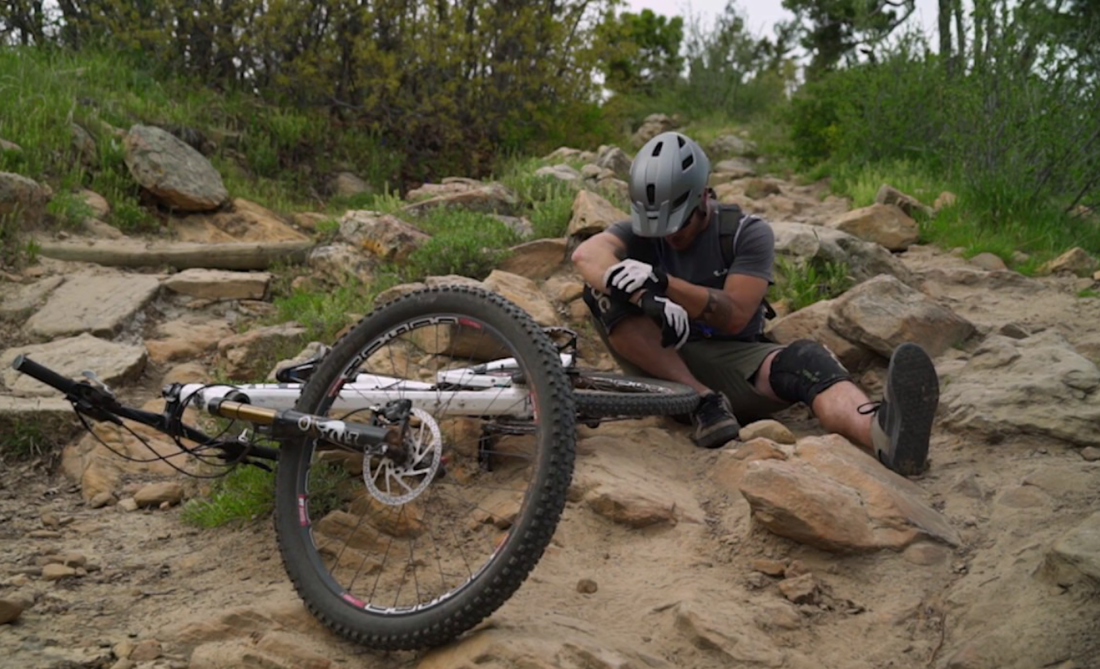
Preventing injury: one in 1,000 skiers are injured, one in 100 snowboarders, and one in 10 downhill cyclists.

7/7/2019

 
Picture
Dr. Annie Gareau, one of the co-authors of a 2012 study on the Epidemiology of Mountain Bike Park Injuries at the Whistler Bike Park, and an emergency room specialist at the Whistler Health Centre was quoted as saying, " A general rule of thumb is that one in 1,000 skiers are injured, one in 100 snowboarders, and one in 10 downhill cyclists."

Time for mountain bikers to take a page from snowsports.
--by 
Andru McCracken, The Rocky Mountain Goat newspaper

Last week we learned that a woman broke her spine during Valemount's
Annual Bikefest. She survived, but she and her family are still
waiting to see the extent of the injuries at a hospital in Edmonton.
The Rocky Mountain Goat wishes her a full and speedy recovery.

It was a traumatic, life changing event and naturally the woman and
her family didn't want to become headlines. This makes a ton of sense
to me. The woman's identity should be protected.

I am a proponent, however, of talking openly about the events that
lead crashes, even if it's anonymously.

It's time to create a place where riders can publish an anonymized
serious injury report.

Accidents happen. There's no need to downplay them. If you think that
accidents aren't a part of mountain biking, you're either from some
gravity-free planet or you are in denial. Dr. Annie Gareau, one of
the co-authors of a 2012 study on the Epidemiology of Mountain Bike
Park Injuries at the Whistler Bike Park, and an emergency room
specialist at the Whistler Health Centre was quoted as saying a
general rule of thumb is that one in 1,000 skiers are injured, one in
100 snowboarders, and one in 10 downhill cyclists.

That said, those of us who ride accept the risks. Hit by a tree in a
windstorm? Thrown off the bike after crashing into the same tree?
This isn't a ball pit at a theme park. It's a mountain. If you lost
your nerve on a steep section and hit the front brakes and ended up
in a patch of stinging nettle with a broken clavicle, it's on you.
The responsibility at Valemount Bike Park lies with the rider.

This isn't about laying blame. This is about building a culture of
smart safe riding.
It's about getting better and sharing what went
wrong, so the next person doesn't find themselves in the exact same
circumstance with the exact same consequences.

The potential value in this is echoed by the work of the local health
clinic. They have shared injury patterns with trail maintainers to
great effect, causing changes in trail layout and designations.

When there are really serious injuries a different kind of report
needs to be made: A report from the injured. What trail was it on?
What was the feature? Your skill level? The number of times you've
ridden the park and that trail in particular? What led up to the
crash? What would have helped?

Valemount is good at this already. Snowmobiling and backcountry
skiing are high risk sports, and the risk of avalanches is
notoriously easy to underestimate and hard to predict but proponents
of the sport have been making mad progress.  The latest move is for
recreationalists to submit mountain condition reports to the
Avalanche Canada website. People share how much new snow there is,
signs of instability or avalanche activity. It doesn't prevent
avalanche injuries or fatalities altogether, but it ups everybody's
game and raises awareness.

Valemount Bike Park could be a safer place, but the onus here isn't
on the trail maintainers, or the doctors at the clinic. The people
with power to help are an unlikely and unlucky crew: the injured.

It's a pretty inglorious task: How I flubbed it and why. But in the
future, I hope one of the first things we think of when we're flying
through the air all akimbo is, "What I am I going to include in my report?"

With any luck it will save some lucky soul no small amount of grief.

To read this original article in Rocky Mountain Goat CLICK HERE.

To read Dr. Garuau's report CLICK HERE.

Southern Cross Preserve on the North Fork American River permanently protected

7/3/2019

 
Picture
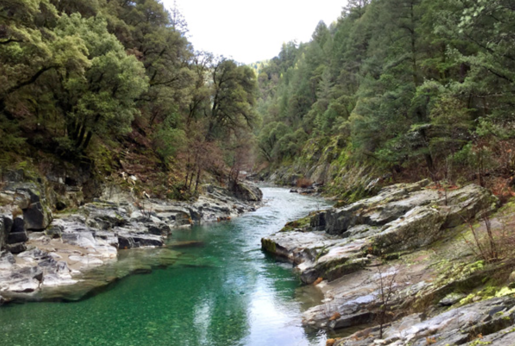
​Placer Land Trust has purchased and permanently protected the 46-acre Southern Cross Preserve on the North Fork American River north of Foresthill. The purchase was funded by Placer Land Trust members through the 2017 Placer Conservator Auction, the Emigrant Trails Greenway Trust, and a 50% bargain sale from the landowner.
 
The wooded canyon land Preserve includes several hundred feet of federally-designated Wild & Scenic river frontage, and a section of the public Euchre Bar Trail. The property is nestled within the Tahoe National Forest, connecting federal US Forest Service lands and other nearby Placer Land Trust Preserves to create a larger area of protected wilderness. 
   
"The acquisition of the property is a great addition to the Placer Land Trust portfolio," says Ron Gould, representative of the North Fork American River Alliance, member of Placer Land Trust, and North Fork American River aficionado. "The Southern Cross Preserve is located in one of the most scenic sections of the North Fork canyon, where the river drops from pool to pool, providing many recreational opportunities. The acquisition of the property not only provides protection for the North Fork American River Wild & Scenic River, but also helps to preserve the mining artifacts and rich history of the property and surrounding area for future generations to enjoy."

To read the complete story and see more photos CLICK HERE to see Placer Land Trust Newsletter.

    Trail News

    Visit this page for all of the latest Trail News that affects our area.

    Archives

    February 2023
    January 2023
    November 2022
    October 2022
    September 2022
    August 2022
    July 2022
    June 2022
    April 2022
    March 2022
    January 2022
    November 2021
    October 2021
    August 2021
    July 2021
    June 2021
    May 2021
    April 2021
    March 2021
    February 2021
    January 2021
    December 2020
    November 2020
    October 2020
    September 2020
    August 2020
    July 2020
    June 2020
    May 2020
    April 2020
    March 2020
    February 2020
    January 2020
    December 2019
    November 2019
    October 2019
    September 2019
    August 2019
    July 2019
    June 2019
    May 2019
    April 2019
    March 2019
    February 2019
    January 2019
    December 2018
    November 2018
    October 2018
    September 2018
    August 2018
    July 2018
    June 2018
    May 2018
    April 2018
    March 2018
    February 2018
    January 2018
    December 2017
    November 2017
    October 2017
    September 2017
    August 2017
    July 2017
    June 2017
    May 2017
    April 2017
    March 2017
    February 2017
    January 2017
    December 2016
    November 2016
    October 2016
    September 2016
    August 2016
    July 2016
    June 2016
    May 2016
    April 2016
    March 2016
    February 2016
    January 2016
    December 2015
    November 2015
    October 2015
    September 2015
    August 2015

    Categories

    All

    RSS Feed

Home
Contact
 Mother Lode Trails is YOUR local volunteer-run trail information and resource website. Here you can find
up-to-the minute information on trail alerts, links and trail news for Placer,  Yuba, and Nevada counties.
Mother Lode Trails is trademarked.