MOTHER LODE TRAILS
  • Home
  • About
  • Contact
  • Volunteer
  • Links
    • Law Enforcement Emergency
    • Federal, State, County Districts Parks & Trails
    • Running Clubs
    • Equestrian Clubs
    • Mt. Bike Clubs
    • Hiking Clubs
    • Trail Advocacy Organizations
    • Phone Numbers State & Federal Parks, Trails & Lands
    • Lost & Found on the Trails
    • Where to Eat on the Trails
  • News
  • Alerts

Bear Yuba Land Trust: Support for local trails bigger than ever

6/23/2017

 
 Outdoor recreationists turned up in a big way to show support for local trails last Saturday during Nevada County Celebration of Trails 2017 hosted by Bear Yuba Land Trust.

In the morning, Nevada City Mayor Evans Phelps joined trail lovers for a hike on the Deer Creek Tribute Trail with the Land Trust's Shaun Clarke. Local archeologist and trails author Hank Meals led a challenging hike at Black Swan Preserve and beyond while Executive Director of FREED Center for Independent Living joined Trails Coordinator Bill Haire for an outing to Hirschman Pond for folks of all mobility levels.

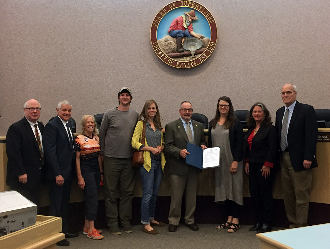
In the afternoon, Grass Valley Mayor Howard Levine presented the Land Trust with a trails day proclamation and announced a trail project getting started along Wolf Creek. "Trails are the veins of our existence. Trails are an important part of Grass Valley's connectivity. Grass Valley has had trails in its General Plan for decades and finally moving forward on Wolf Creek brings to our public one the most immediate beautiful sites our community can access. It is a resource too long hidden," said Grass Valley Mayor Howard Levine.

At the Trails Day festival, young and old picked up trail maps, planned their summer outdoor recreation adventures, shopped for camping and hiking gear, discovered state parks and public forest land or learned about land conservation efforts at the many vendor booths set up in the parking lot of the Tahoe National Forest headquarters off Coyote Street in Nevada City.

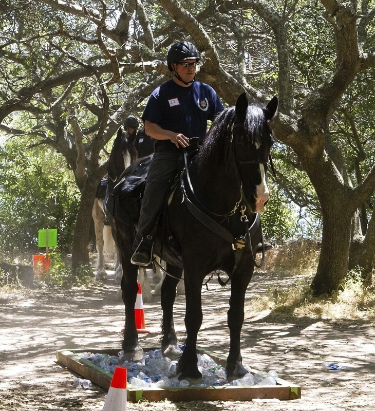
Kids played Twister in the Gold Crush Climbing Gym "Boulder Climber." Some rode Helen Crawford's friendly pack horse, Copper Belle, the day's mascot for Gold Country Trails Council. Others painted T-shirts using recycled bike parts at the Bicyclist of Nevada County (BONC) and Youth Bicyclists of Nevada County (YBONC) booth.

This year's participants included: Tarptent, Gold Crush Climbing Gym, Mountain Recreation, Inn Town Campground, Nevada City Scenics, Folk Trails Hiking Club, 49th Gold Country Scout Group, Sierra Trailblazers, Sierra Club, Nevada County Woods Riders, Gold Country Trails Council, South Yuba River State Parks Association, Empire Mine State Parks Association, Bicyclists of Nevada County, YBONC, Sierra Fund, Placer Nature Center, Three Forks Bakery and Brewing Co., No Pho King Way and hosts Tahoe National Forest.

Support for local trails continues all summer long at local brew pubs Three Forks Bakery and Brewing Company and Matteo's Public where a $1 from each pint of specialty beer, "Hirschman Hefeweizen" goes back to local trails while supplies last.
Want to learn more about local trails, summer treks and outings? Visit: http://www.bylt.org
Laura Petersen is community engagement manager for the Bear Yuba Land Trust.

CLICK HERE to see original article in The Union newspaper


UPDATES: Trail Runner, Bill Finkbeiner, Recovering After Hit and Run by Bicyclist Along American River Parkway

6/23/2017

 
Picture
UPDATE 6/23/2017 from the Sacramento Bee:
He ran every day for the past 37 years. A senseless act of violence just ended his streak
It was a hit-and-run accident with devastating effects. The victim, a Sacramento running legend, suffered five facial fractures, a fractured skull, a broken hand, two broken teeth and serious lacerations over much of his face and upper body.

Somewhere out there, the man responsible for the grievous injuries sustained by Bill Finkbeiner, 61, is escaping justice.
Sacramento authorities have the cellphone of the person who plowed into Finkbeiner on June 13. Described as a Caucasian male in his early 40s with sandy brown hair, the man dropped the device before he fled without saying a word or even looking at his victim, witnesses said.

But Sacramento County parks rangers can’t open the cell phone because they haven’t been able to get a search warrant. The Sacramento County District Attorney’s office says a search warrant hasn’t been obtained because the California vehicle code is not clear on whether this case actually qualifies as felony hit and run. If the DA can’t determine a felony occurred, a search warrant can’t be issued to access the phone.

Mind you, Finkbeiner has been incapacitated by his injuries, a serious financial blow to a self-employed commercial landscaper who earns his living through his hard work. Moreover, the Auburn resident has suffered a great personal loss as well. A member of the Sacramento Running Association Hall of Fame, Finkbeiner, who has competed in dozens of 100-mile “ultramarathon” races, had run every day of his life since Jan. 1, 1980 – a streak of 37 years.

That record ended with a sickening thud in an incident that Finkbeiner said he never saw coming. “I knew the streak would end one day, but not like this,” he said this week while convalescing in an easy chair, looking fruitlessly for an angle of repose that would ease his pain.

So why all the confusion over the California vehicle code?
Because Finkbeiner got creamed by a man riding a bicycle on the American River Parkway. And in the days since, the DA’s office has been unable to determine if the law allows for a felony prosecution of a hit and run in which the vehicle is a bike and the location of the incident is a bike trail.

“We’re unsure whether the statutes related to hit and run apply to a person riding a bike on something other than a typical highway (or street),” said Steve Grippi, chief deputy of the Sacramento County District Attorney’s Office.
The DA wouldn’t be able to file lesser charges against the suspect because they would never find him without unlocking his phone. And they can’t unlock his phone without being able to prosecute for a felony.

Grippi said his office has not made a final determination whether it can move forward with felony criminal charges. According to the California Vehicle Code, bicyclists riding upon a “highway” have all the rights and responsibilities of someone driving a car. In the state vehicle code, a highway can be a street, a parking lot or anyplace that is “publicly maintained and open to the use of the public for purposes of vehicular travel.”

Does a concrete trail on a levee on the American River Parkway qualify as a highway under the vehicle code? At least for now, Grippi said his office is not certain if it does. So until they figure this out, the cellphone containing the identity of the man who injured Finkbeiner sits in a drawer belonging to the county park rangers.

If the ultimate determination by the DA is that they can’t prosecute, then someone in the California legislature needs to tighten the language in the state vehicle code to make sure no other Californian is victimized as Finkbeiner has been.

Finkbeiner was walking near the Campus Commons Golf Course when he was struck from behind, slamming him face first onto the concrete and causing him to lose consciousness. “Bill was knocked two or three feet off the ground,” said his longtime friend Bill Hambrick who witnessed the collision.

The blow came so fast, and was so unexpected, that Finkbeiner didn’t have time to break his fall. “He was flying through the air with his hands behind his back,” Hambrick said.

Finkbeiner remembers bits and pieces of the incident. “I recalled immediately that there was blood,” he said. “I tried to sit up but I could feel the hands of my friends trying to keep me still. I heard, ‘Bill, it’s worse than you think.’”
Finkbeiner and his friends were traveling north on the parkway trail. Finkbeiner concedes he was walking on the right side of the trail and should have been on the left in the pedestrian lane. But what happened to him still shouldn’t have happened.
The man who hit Finkbeiner was in such a hurry to get away he dropped his cellphone, which Finkbeiner’s friends used to call paramedics.
Finkbeiner required surgery to repair a broken thumb. His recovery will take months. His face is so fragile that even the slightest cough or sneeze causes great discomfort. “The worst part have been the headaches,” he said. They keep him up at night. He requires constant help from family members.

Finkbeiner isn’t able to work and his friends have started a GoFundMe account for him: www.gofundme.com/bill-finkbeiners-recovery-fund
For what it’s worth, Finkbeiner said he doesn’t feel malice toward the man who injured him.
To see complete article and photos in the Sacramento Bee, CLICK HERE.

UPDATE 6-17-2017: The hit and run biker dropped a cell phone at the accident before he took off. Authorities now have that as evidence.
 
POSTED 6-17-2017
A man is recovering in the hospital after he was hit by a bicyclist along the American River Parkway on Tuesday night.
Bill Finkbeiner, who hasn't missed a day of running in 37 years, has skull and hand fractures and is missing teeth following the hit-and-run crash.

Friends who were walking with Finkbeiner say a man riding a bike came speeding up from behind and crashed into him, sending him flying into the air.

Finkbeiner is an avid runner who was preparing for a 100 mile run in August. He hasn't missed a day of running in 37 years.
Sacramento County park rangers are investigating the crash as a hit and run.

Friends in the running community are running in honor of Finkbeiner as he recovers at UC Davis Medical Center.

A GoFundMe account has been set up for Finkbeiner. You can donate here.

To see news story and video, CLICK HERE.
Picture

As summer nears, historic winter still grips state’s High Sierra Camps

6/18/2017

 
Picture
The High Sierra camps are five tent villages arranged in a loop, each about a day’s journey apart - they are closed for only the third time in a century. Summer officially begins Wednesday, but the historic storms that rolled through this winter deposited so much snow in the Sierra range that roads are still being plowed, tent sites are still being dug out and damage is still being assessed.

The lingering ice has been a particular problem in Yosemite National Park, where officials last week announced the shutdown of the famed High Sierra camps — only the third time in a century that the scenic back-country sites have been declared off-limits for the entire summer because of thick snow.

Gediman said reservations for this year at the remote shelters will be honored next summer when, presumably, there won’t be as much snow on the ground.

The High Sierra camps are five tent villages arranged in a loop, each about a day’s journey apart, similar to the hut-to-hut systems in the towering Alps of Austria, Switzerland, Germany and France. They range from the big Merced Lake camp at 7,150 feet to the Vogelsang camp perched on a mountainside 10,300 feet above sea level.

The other camps, which provide sleeping accommodations and showers, are May Lake, near Mount Hoffman; White Wolf, which was originally part of a mining camp; and Glen Aulin, on the Tuolumne River. They have been hugely popular with guests, including backpackers, horseback riders and celebrities, since the first one opened in 1916.

Photographer Ansel Adams was partial to them, as was former first lady Laura Bush, who visited three of the High Sierra camps in 2001 with friends and a Secret Service detail.

The camps can be reached only on foot or by horse and mule pack trains. Everything arrives this way, including filet mignon and, sometimes, birthday cakes. The five camps together can accommodate 203 people a night, and reservations are handled through a lottery held every November.

The problem, Gediman said, is that pack trains have not been able to get to the camps to set up tent cabins and other facilities. Now, there isn’t time to get everything up and running before September, when the camps normally close.

The Yosemite high country isn’t the only place still shrouded in white. Heaping piles of snow are also blocking access to some campsites in Tahoe National Forest, Desolation Wilderness, Lassen Volcanic National Park, Plumas National Forest and Shasta-Trinity National Forest.

In many places, camp operators are hustling to dig out and restore access. At the city of Berkeley’s Echo Lake Camp, in South Lake Tahoe, winter and spring storms damaged 37 of the 45 cabins while burying the site in 15 feet of snow. Workers could not get in to fix anything until early June, when the road leading to the camp was finally cleared.

“The damage to the tent cabins is significant and there is also damage to the pool fence, stage and observation deck,” said Scott Ferris, Berkeley’s parks and recreation director. “This is the worst snow year we’ve had in, I believe, 100 years. It has definitely been tough and it continues to be difficult because there is still a fair amount of snow on the ground.”

Those who forge ahead with their camping plans should expect wet, icy conditions, Ferris said.
“It’ll just be a High Sierra experience,” he said.

Despite the occasional ice coating, tents and sleeping bags are still likely to be abundant in the mountains this summer. Plenty of campsites are open, according to park rangers, and although the Yosemite high camps will be closed, the store, gas station and lodge at Tuolumne Meadows should open once Tioga Pass is cleared, hopefully in the next few weeks, Gediman said.

“People have been very understanding about it,” he said, “because they are aware of the kind of winter we’ve had.”

Photo credit: Lance Iversen, San Francisco Chronicle
To see this complete article by Peter Fimrite and photos in the San Francisco Chronicle, CLICK HERE

Bear Yuba Land Trust and National Trails Day recognized

6/14/2017

 
Picture
NEVADA CITY, Calif. June 14, 2017 – A little behind schedule, but the BOS proclaimed June 3 as National Trails Day and posed for a photo with members of the Bear Yuba Land Trust yesterday.The unanimously adopted resolution reads:
“WHEREAS, each year in conjunction with the American Hiking Society and Bear Yuba Land Trust, the Board of Supervisors of the County of Nevada joins communities across the nation in recognizing “National Trails Day” and the local event, “Celebration of Trails” as a time to reaffirm our commitment to the value of local recreation trails and the natural beauty of the landscape those trails traverse; and
WHEREAS, hundreds of thousands of trail enthusiasts are expected to participate in a wide variety of activities on public trails at more than one thousand nationally sanctioned Trails Day events across the nation; and
WHEREAS, access to trails supports the mission of the County of Nevada Planning and Health Departments to provide for the health, wellbeing and recreation opportunities for the citizens of Nevada County; and
WHEREAS, the Board of Supervisors of the County of Nevada recognizes the value of collaborative partnerships with public and private agencies to support the ongoing construction and maintenance of trail networks throughout the community; and
WHEREAS, trails and associated greenways can provide wildlife habitat and wildlife migration corridors, places of rich native plant diversity, tell the story of the region’s historic and cultural legacy as well as provide opportunities for outdoor education; and
WHEREAS, trail activities bring together friends, neighbors and family, enhance quality of life, boost tourism, build community and stimulate economic development in Nevada County.
NOW, THEREFORE, BE IT RESOLVED the Board of Supervisors of the County of Nevada does hereby proclaim June 3, 2017 as “Celebration of Trails” day in Nevada County in conjunction with American Hiking Society’s “National Trails Day.” In recognition of “Celebration of Trails” the Board urges all citizens to seek out their favorite trails and to discover, enjoy the beauty of, learn about and celebrate these trails while participating in educational exhibits and trail work projects.”

CLICK HERE to see the original article and photo in YubaNet.com

Placer Land Trust continues quest for open space, offering free hikes

6/12/2017

 
Picture
One local organization has been dedicated to preserving Placer County’s nature areas for the last 26 years, and that is something they plan to continue.
The Placer Land Trust was created in 1991 and since that time they have had the opportunity to protect more than 8,191 acres including recreation areas, riverfront and grasslands.The land trust works with willing land owners and conservation partners to permanently protect natural and agricultural lands in Placer County. That is what makes the Placer Land Trust important, the work they do in securing conservation easements protects the land forever.

A conservation easement is a legal agreement that prevents development on a land, and is attached to the deed with the land forever. “It is important because we make sure this land is always protected,” said Executive Director Jeff Darlington.
Darlington was the first employee the land trust officially hired back in 2002, and he has had his hand in securing thousands of acres of Placer County.

The land trust works with willing land owners to secure easements over properties that have
 public benefit, wildlife benefit, agricultural benefit or scenery. Some of the land they secure is public, while other portions remain private, with the legal agreement that the land will never be developed. Half of the land trust properties are owned and managed by the land trust while the other half they own as conservation easements. One of those conservation easement lands is the Auburn School Park Preserve near City Hall; the City of Auburn owns and manages the property.

The beautiful park includes benches, a historical stage and has been protected for public use and the Oak Woodlands habitat.
The Placer Land Trust gets their funding through donations, fundraising, investments, membership and public and private sources. “If we don’t have the financial ability to protect a land, we won’t do it,” said Darlington.

Land owners also have the opportunity to sell or donate an easement to the Placer Land Trust. “They get the chance to leave a legacy, their land will be protected long after they are gone,” said Darlington.

Placer County was listed as the second fastest growing county in California,which is good for the economy, but Darlington wants to ensure his children have open spaces to visit. “If we don’t take care of our own neighborhood, our own communities, nobody will,” he said. “This is my backyard, I grew up here.”

There are a lot of areas protected from development by the Placer Land Trust including the Big Bend North Fork Preserve, Canyon View Preserve and Doty Ravine Preserve.
“It’s a balance,” said Conservation Director Lynette Batt. “It’s nice to have parks and spaces to get outside.”
The land trust also works to restore land that is of public interest or create trails.
They were the top fundraiser in the Sacramento area for the “Big Day of Giving” raising $141,000 from 209 donors.
“The secret is out, we have become an important part of the community,” said Darlington.
They are normally able to conclude three to four projects a year while working on over a dozen at a time.
They also host docent- lead hikes on the second Saturday of the month, and various events throughout the year including a Great Sierra River Cleanup on Sept. 16.
“I would encourage people to look at our free hikes, get on the property and see what we do,” said Darlington.
With a handful of projects in the works and over 30 places in Placer County that will never see development, the work that the Placer Land Trust does leaves a gift for future generations to enjoy.
“We are set up to guarantee permanence,” said Darlington. “It is forever protected.”
--
By: Aurora Sain, Reporter

CLICK HERE to see complete article and photos in the Auburn Journal Newspaper.


Tevis starting at Soda Springs due to snow, first time since 1983

6/8/2017

 
Picture
Tevis Ride Director Update June 8, 2017
The 2017 Tevis is going to start at the sheep pens in Van Noreen meadows, Soda Springs. The snow conditions dictate that we relocate the start to Soda Springs. Snow levels through the Granite Chief Wilderness will not provide WSTF enough time to have the Squaw Valley trail ready for our August 5th start. Not since 1983 have the snow conditions required us to put an alternate high country trail into service.

This year's start will travel south out of the Van Noreen meadow about five miles before entering Soda Springs Road and continuing to Road 51 which takes riders up to Lyon Ridge. At that point we will travel the traditional Tevis trail all the way to Francisco's vet check.

There is still uncertainty as to whether or not the Poverty Bar river crossing will be shallow enough to provide safe passage, as the snow melt has the river running at high levels. At this date, we are not able to make a definitive decision on the lower trail.

We have two options after Francisco's. One is to make the crossing at Poverty Bar and using the old trail through the Upper Quarry to pointed rocks before crossing No Hands Bridge. The second choice, if we cannot cross the river, is to go up Drivers Flat Road, cross Foresthill Divide Road, and take the Clementine Trail. Riders would come down to the confluence, cross the Highway 49 Bridge, then pick up No Hands Bridge and travel on to the finish.

Should we have to use the Clementine Trail, it will be a first for the Tevis in our 63 years of history.
Riders are cautioned not to preride the Clementine Trail as parts of that trail are open to mountain bikers and hikers ONLY. Tevis riders will have the trail open to them and closed to bikes on the evening of August 5. Should we have to use the Clementine Trail, it will be a first for the Tevis in our 63 years of history.

We will keep everyone posted as we make the decision on the lower trail. We guarantee a trail that will include as much as the original trail as possible and the entire trail will offer an experience up to the standards expected of the Tevis.

Chuck Stalley
2017 Tevis Ride Director

A springtime stroll to a Folsom Lake gem: Avery’s Pond

6/6/2017

 
Picture
From Mary West's article in the Auburn Journal: The heavy rains made for a deep pool this spring at Avery’s Pond in Folsom. I enjoy the quiet of the pond. The bird calls, buzzing of bees and the plunging of turtles at the pond’s edges. When the winds are calm you can see perfect reflections of the clouds above. 
Picnic tables can be found on two sides of the pond. The tall grass, thick brush, and fallen trees have obscured the water line. The banks are steep on three sides. The trail takes you around the pond and back to the trail you came in on. 
From Auburn, take Highway 49 south to Lincoln Way. Turn Left onto Auburn Folsom Road. Turn left on Shirland Tract Rd. Follow it to Rattlesnake Road. Take Rattlesnake all the way into the Folsom State Recreation Area. There is a $12 day use fee. Go out to the Rattlesnake boat ramp and park on the left. The trail is unmarked other than a temporary sign stating the area is closed to motorized vehicles.
The trail was rutted and overgrown on my last visit. Watch out for poison oak, rattlesnakes and ticks. Take the trail straight up the hill to the T. Turn right and you will walk to Avery’s Pond. The stroll is maybe 1.2 miles. Much of the trail is shaded but the valley temperatures have an impact in summer. Bring plenty of water and take breaks as needed. 
If you want a greater challenge, you can start in Auburn and take the Pioneer Express Trail. Other trails lead you in and around Folsom Lake if you want to enjoy the wildflowers and lake views.
 -----------------------------
Photo by Mary West
"When the winds are calm you can see perfect reflections of the clouds above."


CLICK HERE to see the complete article and more photos in the Auburn Journal Newspaper

California Highway Patrol Mounted Unit members ride in the Folsom Lake Mounted Patrol Trail Trials

6/6/2017

 
Picture
Each spring, the Folsom Lake Mounted Patrol holds an event where 75 horses and their riders from all over Northern California compete negotiating judged obstacles on a five-mile trail ride.
This year's ride was for the big draft horses.
Also participating this year were California Highway Patrol officers that patrol the capitol in Sacramento. For this event, several different breeds included Belgians, Clydesdales and Shires.
The annual event raises money for the Folsom Lake State Recreation Area. Since entries are limited to 75, the average money raised each year is around $1,500.
Riders and horse combinations negotiated obstacles and situations one might encounter on a trial ride. A trail trials normally consists of six to 12 natural obstacles out on a five to six mile trail ride.
Riders are judged individually and how well they negotiate their horse through each obstacle, with an emphasis on calmness and safety. Because the competitors are only judged at the individual obstacles, riders of any division can ride together and families are welcome.
The CHP team wore matching shirts, caps and side arms. Only official law enforcement personnel are allowed to carry guns in state parks.
In the fall, the Folsom Lake Mounted Patrol holds a larger event, the annual Poker Ride on September 24, 2017, where 150 horse and riders are expected.
CLICK HERE to see the complete article in The Union newspaper.
Photo 1: the California Highway Patrol Mounted Unit resting on the trail between obstacles. Photo 2: CHP Mounted Unit member negotiating a trail obstacle. Photo credits Carl Brunberg Photography.


Picture

    Trail News

    Visit this page for all of the latest Trail News that affects our area.

    Archives

    January 2023
    November 2022
    October 2022
    September 2022
    August 2022
    July 2022
    June 2022
    April 2022
    March 2022
    January 2022
    November 2021
    October 2021
    August 2021
    July 2021
    June 2021
    May 2021
    April 2021
    March 2021
    February 2021
    January 2021
    December 2020
    November 2020
    October 2020
    September 2020
    August 2020
    July 2020
    June 2020
    May 2020
    April 2020
    March 2020
    February 2020
    January 2020
    December 2019
    November 2019
    October 2019
    September 2019
    August 2019
    July 2019
    June 2019
    May 2019
    April 2019
    March 2019
    February 2019
    January 2019
    December 2018
    November 2018
    October 2018
    September 2018
    August 2018
    July 2018
    June 2018
    May 2018
    April 2018
    March 2018
    February 2018
    January 2018
    December 2017
    November 2017
    October 2017
    September 2017
    August 2017
    July 2017
    June 2017
    May 2017
    April 2017
    March 2017
    February 2017
    January 2017
    December 2016
    November 2016
    October 2016
    September 2016
    August 2016
    July 2016
    June 2016
    May 2016
    April 2016
    March 2016
    February 2016
    January 2016
    December 2015
    November 2015
    October 2015
    September 2015
    August 2015

    Categories

    All

    RSS Feed

Home
Contact
 Mother Lode Trails is YOUR local volunteer-run trail information and resource website. Here you can find
up-to-the minute information on trail alerts, links and trail news for Placer,  Yuba, and Nevada counties.
Mother Lode Trails is trademarked.