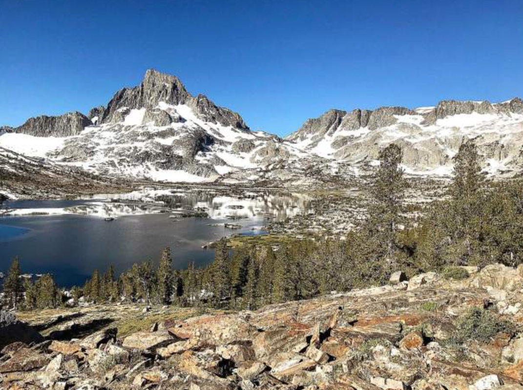
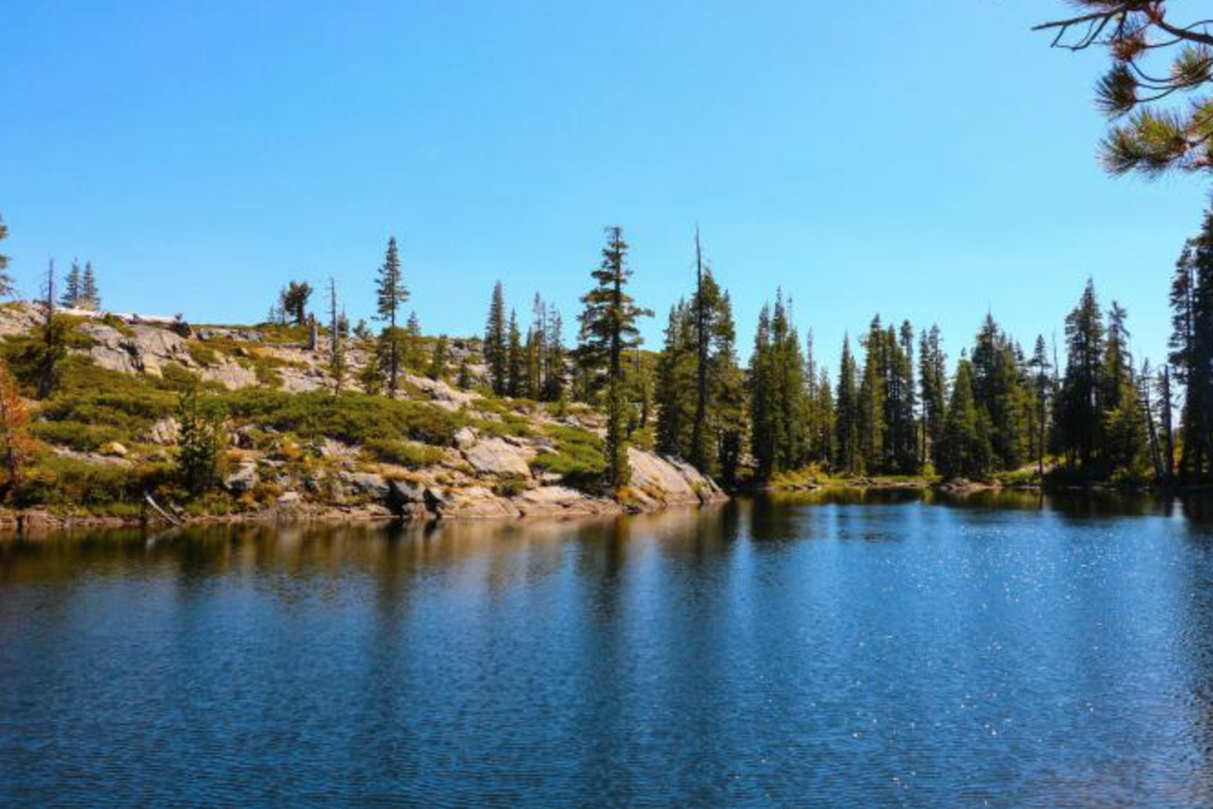
Spanning a vast 2,650 miles from the Mexican border to the Canadian border, the Pacific Crest Trail (or PCT) is well known for its incredible length and difficulty. The trail crosses multiple mountain ranges, traverses through hot deserts, and winds its way up snowy passes — difficulties that would challenge even the most experienced of hikers.
But to one man, this made the journey all the more enticing. Jack Emery, a 71-year-old local physical therapist and outdoors enthusiast, recently took on the challenge and completed hiking the famed Pacific Crest Trail.
"I've been a hiker for a long time, and I kept seeing this trail and said to myself, 'I want to do the whole thing,'" said Emery. "I love adventure and I think adventures makes us better people, and (this hike) was definitely an adventure."
A PASSION FOR THE OUTDOORS
Emery has always embraced adventurous activity. He has been hiking, cycling, swimming, backcountry skiing and competing in ultramarathons his entire life, and so the idea of conquering a 2,650 mile hike came almost naturally to him.
Despite his outdoorsy lifestyle, though, Emery was still incredibly focused in his preparation for the hike. He stressed the importance of training on similar terrain to the hike with a weighted backpack, spending time strength training, and properly preparing the tools and nutrition one will need for the long journey.
And by "long journey," Emery meant five and a half months of hiking across mountain ranges, in cold storm, and through scorching deserts.
The 71-year-old started his hike on March 28, 2018, and ended on Sept. 16 of the same year. He left the trail only to restock on food or supplies, or to escape the weather if it was too brutal. For the most part, however, Emery powered north, hiking for an average of 20 miles a day.
ON THE TRAIL
In order to complete this mileage, Emery would wake up before dawn, heading out as the sun rose. He would take a few breaks in the middle of the day to rest and eat, but would continue hiking on until just before dark, when he would stop the day's journey and make camp. Occasionally, though, Emery would hike into the night to find a better campsite or to make up for lost ground if he wasn't able to hike as much during the day.
"Sometimes I hiked in the dark if it was too hot," said Emery. "It happened often in the desert."
Through these five-and-a-half months, Emery saw many incredible sights (including spotting a wolverine) and made even more incredible friends. Hiking is often a solo activity — Emery journeyed many hours alone, listening to audiobooks or podcasts to pass the time.
He remarked that, "there's a great solitude and thrill in being in nature, and I love the quietness of nature." He gave a laugh and continued, "It was actually hard coming back to the noise, congestion and businesses."
Despite this appreciation of solitude, Emery preferred company on these long miles.
"I'm a people person," said Emery. "I hiked with someone when I could. And I ended up hiking with many people from all over the world, and made many friends."
Emery also called and messaged his wife regularly, checking in through his cell phone. Having this array of company made the journey much more fun, joining Emery to others through their common goal. It also, however, provided a crucial element into Jack Emery's journey: the comfort of safety.
Without friends and other hiking company, Emery may not have made it uninjured through one of the scariest moments of the trip.
AN UNEXPECTED EVENT
Up in Washington at the time, Emery was caught unprepared by a storm of fierce winds, rain and extreme cold.
"I was not dressed appropriately when the wind came," said Emery. "I was on a ridge, the trail running along its top without any shelter, and I got second stage hypothermia — uncontrollable shivering."
Frighteningly aware of how dangerous hypothermia is, Emery began running for a few miles to try to keep warm and eventually ran into some other hikers. The band made camp, where the other hikers made Emery hot water and lent him dry clothes, and he quickly recovered. This scare was just a reminder of how difficult and deadly these adventures can be, both physically and mentally.
But despite also experiencing a low point midway through the trip, when Emery almost gave up with such a long journey still ahead, the hiker remained incredibly positive through most of those five-and-a-half months, intensely appreciative of the beauty of nature.
He made a promise to himself to never get off the trail on a bad day — and there seemed to be hardly any bad days at all. This, Emery made sure to note, is the reason he loves outdoor sports so much.
It is also because of this that Emery encourages people to get out and explore the great outdoors as much as possible, be it by hiking, cycling, backpacking or simply going out for a walk.
THE IMPORTANCE OF GETTING OUT
"Even in (Nevada County), we have a plethora of hiking," said Emery, referencing the hundreds of miles of trails spread throughout Nevada County.
With such an array of options for adventure, it is hard not to find a trail at one's own level, and Emery stresses that the trail certainly doesn't have to be difficult. You could even hike in your own community and gain many of the things Emery did during his journey — including one important change in mindset during these experiences.
"One of the most prominent things is that you begin to make self evaluations about yourself and about what's important," Emery said. "When you are out in the beauty of nature and you see this beautiful world, you realize it all didn't happen by accident."
And at the end of the day, that is the most beautiful part of our wilderness — its ability to fill us with an intense love for the beautiful world around us.
To get more information on hiking, visit http://www.pcta.org or http://www.bylt.org/trails for a map of all Nevada County trails, or Mother Lode Trails www.motherlodetrails.org/federal-state-county-districts-parks--trails.html-state-county-districts-parks--trails.html for trail information in our extended area.
CLICK HERE to read the original article and photos by Mina Ricci who contributes to The Union.
 RSS Feed