Jun 24, 2019
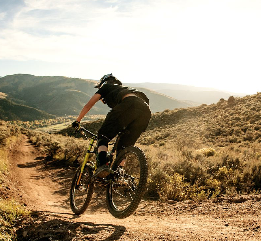
Nearly a third of elite enduro mountain bike racers finished their races after sustaining a concussion in competition, according to a newly released enduro mountain bike medical study funded by EWS and completed by Edinburgh Napier University of more than 2,000 EWS racers from 46 countries from 10 EWS events.
A quarter of amateur riders continue riding immediately after sustaining a concussion, according to the second part of the study, which surveyed more than 3,000 amateur level, enduro-oriented mountain bike riders. Delaying treatment can prolong recovery by 10 days. New concussion protocol help you get back on the bike sooner post injury and can shorten full recovery time.
It’s time for a pop quiz.
You’re out there in full enduro mode, ripping
down the gnarliest run of the day, feeling the
flow, when suddenly your front wheel washes out,
sending you over the bars and into the dirt like
a human javelin. You get up, a little woozy and
unsure of what just happened. What do you do next?
A: Make like Taylor Swift, Shake It Off, and jump
back on your bike and finish the run.
B: Take a moment to let the fog clear; check your
bike, and then saddle up and let it rip.
C: Give yourself a few minutes to assess yourself
and your bike. Then walk/cruise it out, getting
off for any steep, technical stuff so you can get
out safely and get checked out as soon as possible.
D: Count back from 20 and make sure you know what
day it is. If successful, hop back on and shred away.
You picked C, right? Seems like a no brainer (pun
fully intended), but way too many people are
actually picking those other choices instead.
According to the largest ever medical review on
the sport of mountain biking, which included more
than 2,000 Enduro World Series (EWS) racers,
nearly one third said they went ahead and
finished their race immediately after being
concussed, and 43 percent of the racers said they
took ZERO TIME OFF the bike after a concussion.
The survey, which also
polled more than 3,000 amateur level enduro
riders, found that lots of mountain bikers of
every level blow off their brain injuries even
when they’re just out there riding for fun.
Specifically, the report, which was funded by EWS
and conducted by Edinburgh Napier University,
found 25 percent of recreational mountain bikers
out of 3,000 surveyed (1,941 who completed the
entire survey) kept riding right after sustaining
a concussion. Sixty-three percent didn’t follow
any safety protocol before getting back on their
bike in the days and weeks that followed a brain injury.
As one would expect, the study revealed injuries
of all sorts, including many of the usual broken
collarbones and bashed shins. But the concussion
statistics, in particular, are what caught the attention of the researchers.
What to Do If You Think You Have a Concussion
Concussion
was still the third most common injury in the
amateur mountain bikers. Though women only accounted for 10
percent of the surveyed population, they
sustained three times as many concussions as
their male counterparts. (Women appear to be at
higher risk in all sports; researchers are
investigating the why.) Almost half of riders who
reported a concussion also said they have had
significant recurrences of concussion injury.
This prompted the researchers to call for
better concussion education and more rigorous
concussion safety protocols at events. Despite
news reports, magazine features, and even movies
being made about the dangers of traumatic brain
injuries, it’s clear too many people still don’t take concussion seriously.
“It’s a problem across all sports and
recreational activities,” said athletic trainer
Tamara C. Valovich McLeod, Ph.D., a writer on the
National Athletic Trainers’ Association (NATA)
Position Statement on the Management of
Sport-Related Concussion. “People don’t recognize
and understand all the symptoms of concussion,
and if they do, there are other factors-like
riders not wanting to lose fitness-that lead them
to avoid getting checked out.”
While every concussion is different, there are
some telltale signs to watch out for. These
include: headache; loss of consciousness;
amnesia; foggy headedness; nausea; rapid and/or
severe mood swings; unsteadiness; slowed reaction
times; irritability; and drowsiness.
But here’s the thing McLeod wants everyone to
know: Head injuries no longer mean riding the
La-Z-Boy for weeks on end while your brain mends.
The 2017 Concussion in Sport Group consensus
statement overturned the long-standing notion
that you needed complete rest to recover from a
concussion. Instead, the report, recommends 24 to
48 hours of rest and then gradually becoming more active as symptoms subside.
“That means under the direction of a health care
provider, you could be doing 20 minutes of riding
and then some other exercises on the first day,
and ultimately get back to safe, unrestricted
riding sooner than someone who doesn’t seek
medical help right away and just pushes through,” McLeod said.
One study published in JAMA Pediatrics found that
adolescents who followed this type of active
protocol postconcussion recovered in 13 days
compared to 17 days for teens who did no aerobic
exercise during their recovery.
“There’s recent evidence that if you delay
seeking treatment for concussion, you take up to
10 days longer to recover,” McLeod said. “It’s
like taking one little step forward and five steps back.”
- by SELENE YEAGER
Selene Yeager is a
top-selling professional health and fitness
writer who lives what she writes as a NASM
certified personal trainer, USA Cycling certified
coach, pro licensed mountain bike racer, and All-American Ironman triathlete.
CLICK HERE to see articles from Bicycling.com and HERE from Singletracks

 RSS Feed