After a six-month winter, Tioga Road will open Friday on a limited basis with access to the high country of Yosemite National Park. The Lassen Park Highway will open Saturday afternoon. Full operations at Echo Lake near Tahoe, Caples Lake near Carson Pass, and a dozen campgrounds in the Lakes Basin Recreation Area also will commence this weekend.
Two weeks from Fourth of July weekend, summer finally is arriving to the flank of the Sierra Nevada. Hot sun in the past 10 days has melted snow across millions of acres of national forest up to about 7,500-foot elevations in California’s mountain country. That is allowing rangers to open roads and trails for camping, hiking and boating at hundreds of small lakes and streams.
At the same time, many high-country wilderness areas remain inaccessible. Snow depths higher than 10 feet this week include at the Pacific Crest Trail above 9,500-foot Leavitt Lake near Sonora Pass, at 7,707-foot Grouse Ridge in the Bowman Lakes Recreation Area north of Tahoe, and at the 8,500-foot staging area for the trailhead for Lassen Peak.
Here are the latest tips for summer trips across the Sierra:
Tahoe Basin
Echo Lakes/Desolation: Echo Lakes finally became ice-free last weekend. The water level topped off this week and patchy snow continues circling the lake. The hiker’s boat taxi started this week and the Echo Chalet expects to open all operations by the weekend. The Pacific Crest Trail is snow-covered into Desolation Wilderness as far as Aloha Lake, but some ambitious hikers with crampons and ski poles are making the trek, anyway. Contact: Echo Chalet, 530-659-7207, www.echochalet.com.
D.L. Bliss/Emerald Bay: Eagle Point Campground opened for last weekend, joining the recent openers at D.L. Bliss State Park and the boat-in sites at Emerald Bay. In the vicinity of the shore of Lake Tahoe, all Forest Service campgrounds are open. In the surrounding higher terrain, you hit snow at 7,500 to 8,000 feet. Contact: D.L. Bliss State Park, 530-525-9529, www.parks.ca.gov; Lake Tahoe Basin Management Unit, 530-543-2600, www.fs.usda.gov/ltbmu.
North Sierra
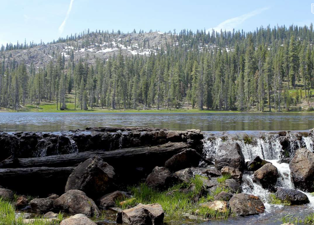
Lakes Basin Recreation Area: In the Lakes Basin (also called “The Gold Lakes”), campgrounds opening Friday include Packsaddle, Berger and Diablo. That means all the campgrounds at Gold, Sardine, Goose, Packer and Haven lakes will be open for the weekend. The road to the trailhead to the Sierra Buttes is clear, but the trail is buried by snow, with no projections when it will become passable. Contact: Yuba River Ranger District North, 530-288-3231, www.fs.usda.gov/tahoe; Beckwourth Ranger District, 530-836-2575, www.fs.usda.gov/plumas.
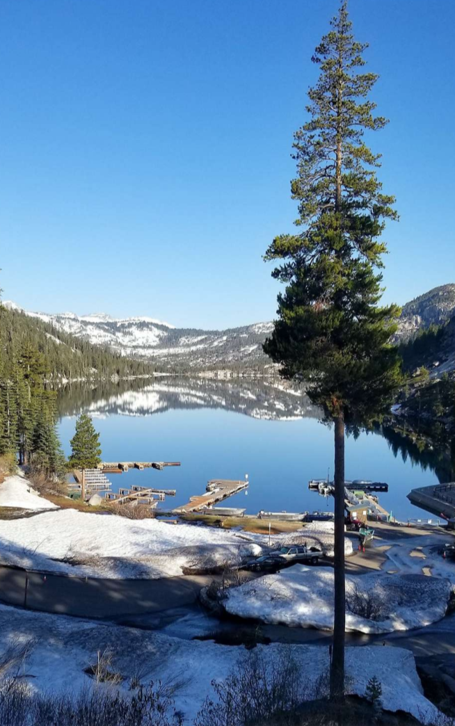
Carson Pass Lakes, Highway 88: Caples Lake (7,800 feet) became ice-free Monday, with immediate good fishing for big trout, and Caples Lake Resort will be open this weekend for lodging and boat rentals. Nearby on Highway 88, campgrounds are scheduled to open next Thursday at Silver, Kirkwood and Woods lakes (the last could be delayed by snow on the access road). Contact: Caples Lake Resort, 209-258-8888, www.capleslakeresort.com; Eldorado National Forest, Amador Ranger District, 209-295-4251, www.fs.usda.gov/eldorado.
Bowman Lakes Recreation Area: When you drive in on Bowman Road/Forest Road 20, the road is clear for 4 miles to Fuller Lake and beyond another 4 miles to the turnoff for Carr, Feeley and Lindsey Lakes. You turn right, and 2 miles in, become blocked by snow. It’s 50-50 if this route will clear by the Fourth of July. Nearby, the route to 7,707-foot Grouse Ridge, with 12 feet of snow measured at the lookout, is not even on the radar. Contact: Tahoe National Forest, Yuba River Ranger District South, 530-265-4531, www.fs.usda.gov/tahoe.
Independence Lake, Truckee: The snow depth was measured at 84 inches here this week. Contact: The Nature Conservancy, Nevada Field Office, 775-322-4990, www.nature.org.
Central Sierra
Yosemite National Park: Tioga Road will open Friday with limited hours, 10-11 a.m., and then in the afternoon, 3-4 p.m. Snow-clearing operations are continuing on shoulders, parking areas and visitor facilities, rangers said, and during the process, no parking on Tioga Road will be allowed. Tioga Road/Highway 120 spans from Crane Flat up to Tuolumne Meadows and beyond over 9,943-foot Tioga Pass. Many high-country areas above 8,000 feet still have several feet of snow, creeks are high and meadows are flooded. Rangers predict snow-covered trails well into July, and in some high-country areas with little sun exposure, into August. For camping along Tioga Road, there are no tentative opening dates for Tuolumne Meadows, Tamarack Flat, White Wolf, Yosemite Creek, Porcupine Flat, and the best guess by rangers is Aug. 2 for the first weekend of August. These late openers are compressing summer visitors to Yosemite Valley, where the waterfalls are still roaring and parking places are difficult to find after 9 a.m. (and to Glacier Point). Contact: Yosemite National Park, 209-372-0200, www.nps.gov/yose.
Crystal Basin Recreation Area: The road is clear (and paved) for 30 miles to Loon Lake (6,378 feet). In the process, you pass Ice House and Union Valley reservoirs, and snow-free spurs to other lakes. The campground at Loon is projected to open by the end of June and will be the last of 20 campgrounds in the region to open for the season. Contact: Eldorado National Forest, Placerville Ranger District, 530-644-2234, www.fs.usda.gov/eldorado.
Highway 4, Ebbetts Pass: Highway 4 is snow-free with hot weather at Calaveras Big Trees State Park and access out of Dorrington to the Stanislaus River, running high and cold. Near 8,730-foot Ebbetts Pass at the Pacific Crest Trail, the verified snow depth this week was 18 inches, patchy with drifts. Contact: Humboldt-Toiyabe National Forest, 775-331-6444, www.fs.usda.gov/htnf.
Highway 108, Sonora Pass: Highway 108 over 9,623-foot Sonora Pass is open and clear. Nearby, the gauge at Leavitt Lake reports a 115-inch snow depth and the PCT above Sonora Pass is impassable. Pinecrest and Beardsley lakes are open, full. Contact: Stanislaus National Forest, Summit Ranger District, 209-965-3434, www.fs.usda.gov/stanislaus.
North state
Lassen Park Highway: The Lassen Park Highway will open at 4:30 p.m. Saturday, and campgrounds at Manzanita and Butte lakes are open, along with camps at Southwest Walk-in and Warner Valley. Because of high snow above 7,500 feet, camps at Summit Lake, Juniper Lake, and the trailhead for Bumpass Hell geothermal area, will not open until well into July, and perhaps later. Contact: Lassen Volcanic National Park, 530-595-4480, www.nps.gov/lavo.
Mt. Shasta: The Everitt Memorial Highway is clear to Bunny Flat (6,950 feet), where you then run into the wall of snow. On giant Shasta, the snow has settled, hardened, and with low winds most recent days (on Thursday, forecast to blow to 40 on the summit), set up for excellent early-morning climbing conditions. Fifth Season Climbing Report, 530-926-5555 (recording, updated daily) or 530-926-3606 (in person).
Trinity-Divide: From Lake Siskiyou, South Fork Road is snow-free over Mumbo Summit to Grey Rocks and to Castle Crags, in time for the Castle Crags Century cycling event Saturday. Contact: Shasta-Trinity National Forest, Mount Shasta District, 530-926-4511, www.fs.usda.gov/stnf; Castle Crags Century, http://castlecragscentury.com.
Medicine Lake Highlands: The drive from Highway 89 at Bartle is blocked this week by 2 feet of snow some 28 miles in, just 2 miles from Medicine Lake. Contact: Modoc National Forest, Doublehead Ranger District, 530/667-2246, www.fs.usda.gov/modoc.
To see the original article and photos in the San Francisco Chronicle newspaper, CLICK HERE.
Two weeks from Fourth of July weekend, summer finally is arriving to the flank of the Sierra Nevada. Hot sun in the past 10 days has melted snow across millions of acres of national forest up to about 7,500-foot elevations in California’s mountain country. That is allowing rangers to open roads and trails for camping, hiking and boating at hundreds of small lakes and streams.
At the same time, many high-country wilderness areas remain inaccessible. Snow depths higher than 10 feet this week include at the Pacific Crest Trail above 9,500-foot Leavitt Lake near Sonora Pass, at 7,707-foot Grouse Ridge in the Bowman Lakes Recreation Area north of Tahoe, and at the 8,500-foot staging area for the trailhead for Lassen Peak.
Here are the latest tips for summer trips across the Sierra:
Tahoe Basin
Echo Lakes/Desolation: Echo Lakes finally became ice-free last weekend. The water level topped off this week and patchy snow continues circling the lake. The hiker’s boat taxi started this week and the Echo Chalet expects to open all operations by the weekend. The Pacific Crest Trail is snow-covered into Desolation Wilderness as far as Aloha Lake, but some ambitious hikers with crampons and ski poles are making the trek, anyway. Contact: Echo Chalet, 530-659-7207, www.echochalet.com.
D.L. Bliss/Emerald Bay: Eagle Point Campground opened for last weekend, joining the recent openers at D.L. Bliss State Park and the boat-in sites at Emerald Bay. In the vicinity of the shore of Lake Tahoe, all Forest Service campgrounds are open. In the surrounding higher terrain, you hit snow at 7,500 to 8,000 feet. Contact: D.L. Bliss State Park, 530-525-9529, www.parks.ca.gov; Lake Tahoe Basin Management Unit, 530-543-2600, www.fs.usda.gov/ltbmu.
North Sierra
Lakes Basin Recreation Area: In the Lakes Basin (also called “The Gold Lakes”), campgrounds opening Friday include Packsaddle, Berger and Diablo. That means all the campgrounds at Gold, Sardine, Goose, Packer and Haven lakes will be open for the weekend. The road to the trailhead to the Sierra Buttes is clear, but the trail is buried by snow, with no projections when it will become passable. Contact: Yuba River Ranger District North, 530-288-3231, www.fs.usda.gov/tahoe; Beckwourth Ranger District, 530-836-2575, www.fs.usda.gov/plumas.
Carson Pass Lakes, Highway 88: Caples Lake (7,800 feet) became ice-free Monday, with immediate good fishing for big trout, and Caples Lake Resort will be open this weekend for lodging and boat rentals. Nearby on Highway 88, campgrounds are scheduled to open next Thursday at Silver, Kirkwood and Woods lakes (the last could be delayed by snow on the access road). Contact: Caples Lake Resort, 209-258-8888, www.capleslakeresort.com; Eldorado National Forest, Amador Ranger District, 209-295-4251, www.fs.usda.gov/eldorado.
Bowman Lakes Recreation Area: When you drive in on Bowman Road/Forest Road 20, the road is clear for 4 miles to Fuller Lake and beyond another 4 miles to the turnoff for Carr, Feeley and Lindsey Lakes. You turn right, and 2 miles in, become blocked by snow. It’s 50-50 if this route will clear by the Fourth of July. Nearby, the route to 7,707-foot Grouse Ridge, with 12 feet of snow measured at the lookout, is not even on the radar. Contact: Tahoe National Forest, Yuba River Ranger District South, 530-265-4531, www.fs.usda.gov/tahoe.
Independence Lake, Truckee: The snow depth was measured at 84 inches here this week. Contact: The Nature Conservancy, Nevada Field Office, 775-322-4990, www.nature.org.
Central Sierra
Yosemite National Park: Tioga Road will open Friday with limited hours, 10-11 a.m., and then in the afternoon, 3-4 p.m. Snow-clearing operations are continuing on shoulders, parking areas and visitor facilities, rangers said, and during the process, no parking on Tioga Road will be allowed. Tioga Road/Highway 120 spans from Crane Flat up to Tuolumne Meadows and beyond over 9,943-foot Tioga Pass. Many high-country areas above 8,000 feet still have several feet of snow, creeks are high and meadows are flooded. Rangers predict snow-covered trails well into July, and in some high-country areas with little sun exposure, into August. For camping along Tioga Road, there are no tentative opening dates for Tuolumne Meadows, Tamarack Flat, White Wolf, Yosemite Creek, Porcupine Flat, and the best guess by rangers is Aug. 2 for the first weekend of August. These late openers are compressing summer visitors to Yosemite Valley, where the waterfalls are still roaring and parking places are difficult to find after 9 a.m. (and to Glacier Point). Contact: Yosemite National Park, 209-372-0200, www.nps.gov/yose.
Crystal Basin Recreation Area: The road is clear (and paved) for 30 miles to Loon Lake (6,378 feet). In the process, you pass Ice House and Union Valley reservoirs, and snow-free spurs to other lakes. The campground at Loon is projected to open by the end of June and will be the last of 20 campgrounds in the region to open for the season. Contact: Eldorado National Forest, Placerville Ranger District, 530-644-2234, www.fs.usda.gov/eldorado.
Highway 4, Ebbetts Pass: Highway 4 is snow-free with hot weather at Calaveras Big Trees State Park and access out of Dorrington to the Stanislaus River, running high and cold. Near 8,730-foot Ebbetts Pass at the Pacific Crest Trail, the verified snow depth this week was 18 inches, patchy with drifts. Contact: Humboldt-Toiyabe National Forest, 775-331-6444, www.fs.usda.gov/htnf.
Highway 108, Sonora Pass: Highway 108 over 9,623-foot Sonora Pass is open and clear. Nearby, the gauge at Leavitt Lake reports a 115-inch snow depth and the PCT above Sonora Pass is impassable. Pinecrest and Beardsley lakes are open, full. Contact: Stanislaus National Forest, Summit Ranger District, 209-965-3434, www.fs.usda.gov/stanislaus.
North state
Lassen Park Highway: The Lassen Park Highway will open at 4:30 p.m. Saturday, and campgrounds at Manzanita and Butte lakes are open, along with camps at Southwest Walk-in and Warner Valley. Because of high snow above 7,500 feet, camps at Summit Lake, Juniper Lake, and the trailhead for Bumpass Hell geothermal area, will not open until well into July, and perhaps later. Contact: Lassen Volcanic National Park, 530-595-4480, www.nps.gov/lavo.
Mt. Shasta: The Everitt Memorial Highway is clear to Bunny Flat (6,950 feet), where you then run into the wall of snow. On giant Shasta, the snow has settled, hardened, and with low winds most recent days (on Thursday, forecast to blow to 40 on the summit), set up for excellent early-morning climbing conditions. Fifth Season Climbing Report, 530-926-5555 (recording, updated daily) or 530-926-3606 (in person).
Trinity-Divide: From Lake Siskiyou, South Fork Road is snow-free over Mumbo Summit to Grey Rocks and to Castle Crags, in time for the Castle Crags Century cycling event Saturday. Contact: Shasta-Trinity National Forest, Mount Shasta District, 530-926-4511, www.fs.usda.gov/stnf; Castle Crags Century, http://castlecragscentury.com.
Medicine Lake Highlands: The drive from Highway 89 at Bartle is blocked this week by 2 feet of snow some 28 miles in, just 2 miles from Medicine Lake. Contact: Modoc National Forest, Doublehead Ranger District, 530/667-2246, www.fs.usda.gov/modoc.
To see the original article and photos in the San Francisco Chronicle newspaper, CLICK HERE.
 RSS Feed