MOTHER LODE TRAILS
  • Home
  • About
  • Contact
  • Volunteer
  • Links
    • Law Enforcement Emergency
    • Federal, State, County Districts Parks & Trails
    • Running Clubs
    • Equestrian Clubs
    • Mt. Bike Clubs
    • Hiking Clubs
    • Trail Advocacy Organizations
    • Phone Numbers State & Federal Parks, Trails & Lands
    • Where to Eat on the Trails
  • News
  • Alerts

Ranger veteran Scott Liske retiring from Auburn State Recreation Area

4/23/2018

 
Picture
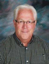
Retirement for Auburn State Recreation Area supervising ranger Scott Liske means an opportunity for something new to him but not necessarily to too many other people.
“I’ve earned a summer vacation — finally,” Liske said.
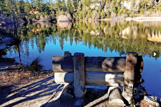
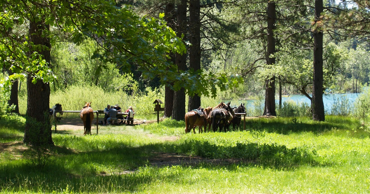
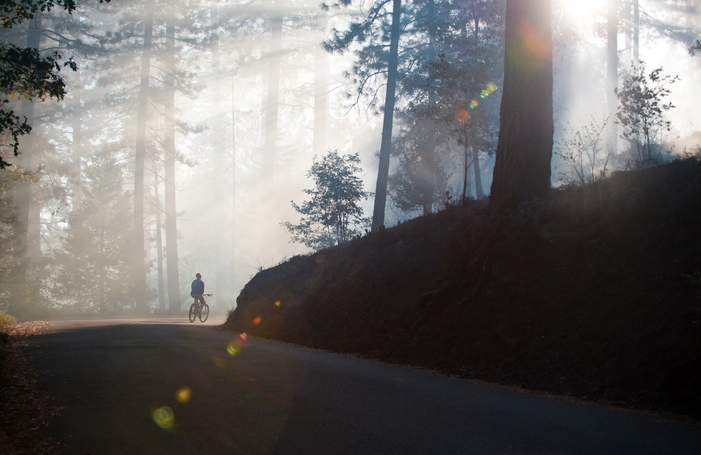
For 15 years as a State Parks ranger in the 35,000-acre recreation area, Liske has patrolled canyon areas above the north and middle forks of the American River that are both scenic and dangerous. Timing of shifts is dictated when the most people will be in the park.
“The last 4th of July I had off was in 1985,” Liske said. “Part of being a ranger is working holidays and weekends. When most of society is off, I’m working.”
So this coming summer and retirement will mean Liske will have time for experiencing what others were experiencing while he was working as a ranger. That means the freedom to travel inside the U.S. and overseas, he said. April 30 will be his last patrol day.
Now 56, Liske started his career with the state in 1985 as a Cal Fire seasonal firefighter. During the summer fire season, Liske was stationed near Angel’s Camp off Highway 49, working there for seven fire seasons. Coincidentally, the last two digits of his badge number are “49” and he’s been working out of the State Parks office on Highway 49 at Auburn since 2003.
Liske was on the groundbreaking Morris Fire near Monterey that burned several homes along 17-Mile Drive. That fire changed Cal Fire actions during fires toward protecting structures as well as lives.
Moving over to serve a four-year stint as a state correctional officer at maximum security Folsom Penitentiary, Liske was planning to continue with Cal Fire, after hiring resumed.
But with an opportunity for State Parks ranger training opening up, Liske again moved over to a different state job in 1997. His first assignment was at Folsom Lake Recreation Area and a transfer to Auburn came in 2003.
The recreation area’s tragedies, quirky stories and political donneybrooks over building an Auburn dam would be chronicled in 2005 by former recreation area ranger Jordan Fisher Smith in the book “Nature Noir.”
Liske said he is asked on occasion about when he’ll write his book about park experiences.
“I could,” Liske said. “There a lot here that could be put into one.”
Some of the oddest tales in Fisher Smith’s book dealt with the 730-foot-high Foresthill Bridge — the highest bridge in California and fourth highest in the nation. Liske estimates that he’s been called to 19 fatal leaps off the bridge, including one afternoon when a man jumped and then — about an hour later — a woman who had no knowledge of the first jump made a second fatal plunge off the span.
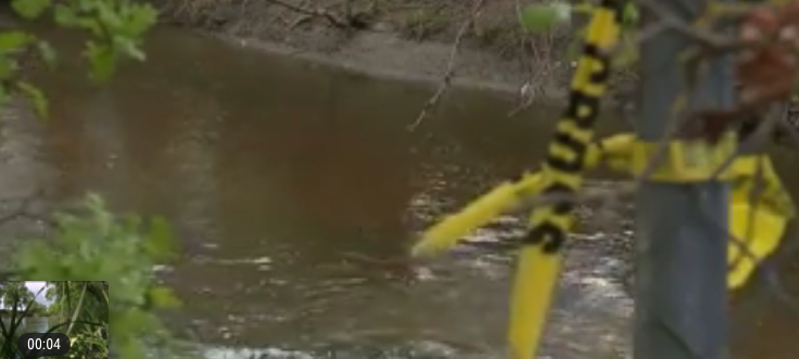
“And there have been countless drownings and fatalities,” Liske said. “It’s an unfortunate part of the Auburn State Recreation Area.”
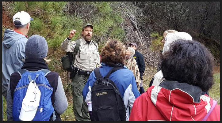
Liske said he has gained particular enjoyment during the times when he has led walks like last new year’s day’s First Day tour of the confluence area that brought out 100 people.
Above and beyond his normal duties, Liske said he’s proud of accomplishments like adding enclosed kiosk buildings at four locations in the park — Mammoth Bar, Upper Lake Clementine, Lower Lake Clementine and the confluence — that increase employee comfort and provide better security for visitors.
Liske also led an effort to identify all gated entrances to the park along Foresthill Road with numbers. That not only has made it easier for emergency personnel to be dispatched by provides a simple meeting location for trail hikes and other activities.
The future of the park is in good hands with Superintendent Mike Howard, a former river guide, understanding its function as a river-oriented facility, Liske said.
But State Parks and government officials should be cognizant of the rapid growth in park user numbers that Liske said can be attributed to social media spreading the word. That means keeping hiring up and equipment upgraded, he said.
“Up until 10 years ago, the recreation area was off the radar for most people,” Liske said. “People took selfies next to an incredible river scene or sunset and that changed things.”                  Photo credit: Auburn State Recreation Area

CLICK HERE to see the original article and photos in the Auburn Journal.


SMUD to upgrade campgrounds, trails, and day use areas in Crystal Basin Recreation Area

4/21/2018

 
Picture
Two popular Eldorado National Forest campgrounds in the Crystal Basin Recreation Area are slated for improvements as part of $150 million in projects tied to the Sacramento Municipal Utility District’s hydroelectric operations on the Upper American River.
Upgrades to existing facilities as well as some new improvements are planned this spring and summer at the Sunset and Azalea Cove campgrounds near Union Valley Reservoir as well as to the Gerle Creek Reservoir area, according to a SMUD news release.
Sunset campground improvements will include a new showering facility, a new group campsite, RV service station upgrades, a new entry kiosk, an upgraded drinking water system, and improved signage and information boards.
At Azalea Cove, upgrades will include a new drinking water system, the addition of bear-proof food receptacles and a new vehicle parking area.
New and improved trails to the shoreline of Union Valley Reservoir also are planned.
The Sunset and Azalea Cove work will require partial or complete closure of some areas. Azalea Cove will be closed in May and June. Sunset is closed for the year and is scheduled to reopen in spring 2020, according to the news release.
Limited closures will occur at the Gerle Creek day-use area, where work is to begin in July on improvements to day-use areas and trails.
Information about closures and limited access is available on SMUD’s website, www.smud.org.
The projects were agreed to in SMUD’s 50-year hydroelectric operating license issued by the Federal Energy Regulatory Commission in 2014 for the Upper American River Project. Under the new license, the news release said, SMUD also provides $1 million annually to the U.S. Forest Service to operate and maintain the recreation facilities related to the Upper American River Project.
By Cathy Locke  clocke@sacbee.com
To see the complete article and photos in the Sacramento Bee newspaper, CLICK HERE.


NID talks trails at Scotts Flat reservoir

4/19/2018

 
Picture
An unpopular decision last summer by Nevada Irrigation District to fence off the spillway at Scotts Flat reservoir is leading to the creation of a new recreational opportunity.
NID eventually reopened the spillway gate, but warned that public access from one side of the lake to the other will only be temporary due to safety concerns.
The district now is in the process of creating a new trail across Deer Creek below Scotts Flat, and has developed several alternatives that were presented to the public Tuesday. Many of those in attendance were members of local trail and bicycle groups, who expressed a desire to collaborate with NID on building the trail.
"There are certainly a lot of concerns and a lot of ideas floating around out there," NID Assistant General Manager Greg Jones said. "I wanted to continue the conversation."
Jones said NID staff had been whittling down suggestions made last fall, as to how hikers and bikers could get from the north side of the reservoir to the south side without going over the spillway and the dam structure itself. Since January, he said, staff members have been surveying the area, walking the potential trails and looking at which options were feasible.
"The idea was to go out there and truth-test it," he said.

Three options are currently on the table, all of which start at the bottom of the dam road from Pasquale Road, at the start of the spillway. All of the options being considered encroach on one piece of private property, but the owner has been open to the idea of granting an easement, Jones said.
Each option is a little over a mile long and each has bridge options to span Deer Creek, he added.
"There's a whole lot of concern (from neighbors) about opening up this section that traditionally no one knows much about," Jones said. "It's a pretty interesting spot."
A new trail in the area could potentially bring hundreds of people a day, he said, adding, "That's what happens when you put a trail somewhere."
Jones cautioned that NID staff were not trail-building experts, and wanted input on which trail might cost the least, cause the least environmental harm and provide the best ease of access for potential users.

The audience in attendance made several suggestions, including extending the trail to Pasquale Road. A "field trip" is being planned for stakeholders in the near future to walk the proposed trail system.
The proposed timeline calls for making a decision on a trail option by the end of August, with design starting in September and the permit process getting under way in October.
"Back in December, the thought was the work would be done in the fall," Jones said. "If all the stars align, with acceptance by the board and design specs, with costing, CEQA and permitting, with all the groups working together, maybe in October of next year, we have a nice system out there … Let's put a milestone out there and push for it."
Contact reporter Liz Kellar at 530-477-4236 or by email at lizk@theunion.com.

To see the original article and photos in The Union newspaper, CLICK HERE.


Photo: 30 members of Gold Country Trails Council working on Tahoe National Forest trails this past weekend.

4/19/2018

 
Picture
Photo from The Union newspaper. Thirty members of the Gold Country Trails Council performing maintenance work on the local trails in the Tahoe National Forest. They maintain the non-motorized, multi-use trails that are open to all hikers, horses and bicyclists.  Go HERE to see more.


Man found dead on Sacramento Northern Bike Trail

4/16/2018

 
Picture
RIO LINDA -- Sacramento Sheriff's detectives are investigating who may have killed a 76-year-old man on a Rio Linda bike trail Sunday night.The victim's body was discovered near Elkhorn Boulevard and 10th Street.
The bike path across Dry Creek from Roy Hayer Park is a peaceful place. It's where Les Whitaker often takes his lunch breaks.
"I come down here all the time to let my dog run and a lot of kids come down here and play," Whitaker said.
But between 2 and 5 p.m. Sunday detectives said it is where the 76-year-old Hispanic man was brutally attacked.
"At this point, we believe this was a deliberate act, it was a violent act and it was not an accident," said Sgt. Shaun Hampton.
The victim did not survive.
Whitaker said he would often see the man hanging around the park. "Nice guy, walked with a cane. I couldn't see why anybody would hurt him, to tell you the truth," he said.
Detectives are not yet releasing the victim's name but FOX40 was told he did live in the neighborhood for years.
Whitaker said there are homeless who camp throughout the area but that most of them are harmless.
"They normally sit right here on these benches and don't bother nobody," Whitaker said.
Detectives are not yet releasing a motive. However, with a BMX course, go-kart track and baseball field nearby they believe witnesses may be the key to missing clues.
"Really we're looking for anyone that may have seen anything and that could be something as simple as this old man walking around with someone else," Hampton said.
Whitaker hopes whoever is responsible is brought to justice. "Can't believe they done it to an old man like that."
CLICK HERE to see the original article and video at Fox 40 News.


Bid process starts today for South Yuba State Park "Bridgeport Covered Bridge project"

4/12/2018

 
Picture
Any misstep, or just random chance, in the process to rehabilitate the Bridgeport Covered Bridge could have scuttled the project. Instead, after years of fighting for the historic structure's repair and clearing all possible hurdles, the project will be put out to bid today.
"This was a massive undertaking," Nevada County Supervisor Hank Weston said at Tuesday's regular meeting of his board. "But it finally came through."

Weston said the rehabilitation would begin this fall. Officials estimate the bridge will reopen around May 2019.

Closed in 2011 to foot traffic, the 155-year-old bridge in the South Yuba State Park needs new interior support structures. Current structures are failing. It also must be raised 18 inches because of higher river levels.

The reconstruction of the bridge — which officials have called the longest single-span, wood-covered bridge in the world — will keep the structure's historic appearance. Weston said he wants the bridge to be an economic draw for the county.

"It's just fabulous for this community," he said. Over $4 million in state funding will pay for the repairs. Contractors will have three weeks from today to bid on the project, said Barbara Bashall, executive director of the Nevada County Contractors' Association.

Bashall doubts the main contractor will be local. The project, because of its historic status and scope, requires a company with specific experience. However, Bashall said locals could secure bids as subcontractors.
"We work really hard to find contractors that are qualified," she said.

Companies interested in bidding on the project will attend an April 20 pre-bid walkthrough. Additionally, they'll submit their qualifications for working on historic structures and bridges.

To contact Staff Writer Alan Riquelmy, email ariquelmy@theunion.com or call 530-477-4239.

CLICK HERE to see the original article in The Union newspaper.


Mt. bicyclist death at Forest Hill Divide Loop in Auburn SRA

4/12/2018

 
Picture
One minute, a 66-year-old mountain bicyclist was enjoying a spring day and kibitzing with an Auburn State Recreation Area ranger at the start of a popular but challenging trail. A couple of hours later, Granite Bay resident Kenneth Mutch was in severe distress after cresting a hill on his bike with his wife, Meg.
Mutch was reported this week by State Parks to have died on the trail in what is considered a rare occurrence in a park that attracts hundreds of mountain bikers on many of its busiest days.

Supervising Ranger Scott Liske said he was in contact with Mutch the day of the incident, when the two were at the Foresthill Divide Loop trailhead off Foresthill Road between Auburn and Foresthill.
“I talked to him at the trailhead and we discussed the great weather,” Liske said. “A couple of hours later we received the report of a medical emergency.”
The 12-mile loop trail is considered challenging for cyclists but Liske said he can’t remember a cyclist collapsing in a similar condition in his 15 years patrolling the recreation area.

Mutch was pronounced dead at the scene of his collapse March 27. Meg Mutch started CPR and other cyclists who came on the scene also assisted but they were unsuccessful in reviving him.
In a blogpost, Justin Wages quoted one of the mountain bikers at the incident saying that firefighters using a defibrillator but couldn’t get Mutch’s heart started.
“It was an incredibly emotional experience for everyone there and absolutely heartbreaking for the woman that had started this 12-mile loop with her husband and would be going home without him,” Wages quoted the cyclist as saying.

CLICK HERE to see the original article in the Auburn Journal newspaper.


Obituary for Kenneth Freeman Mutch.
Kenneth Freeman Mutch passed away suddenly at Foresthill, California on March 27th at the age of sixty-six.

Kenneth is predeceased by his parents Nancy and Freeman Eugene as well as his brother John. He is survived by his loving wife of thirty three-years, Meg, and their three children Peter, Jeannette and Christopher.

Kenneth and Meg were married in Tiburon, California on October 12th, 1984. Kenneth is lovingly remembered by his step-mother Anna, uncle John, sister-in-law Jane, sister Karen, nephews John and Robbie, nieces Natalie, Heidi and Sarah, cousins George, John and Barb Rentschler and many grand-neices and nephews.

Kenneth was born in Chardon Ohio on December 18th 1951. He graduated from Brecksville High School in 1970 and was still in touch with many classmates. He went on to study psychology at Ohio Wesleyan University, graduating with a BA in 1974. He received his Masters Degree at Alfred University in 1978 and worked as a school psychologist for forty years.

Ken loved outdoor sports, his friends and family.

In lieu of flowers, contributions can be made to the Brain and Behavior Research Foundation, at www.bbrfoundation.org Condolences and memories may be offered online at chapelofthevalley.com under “Current Services”. A Celebration of Life will be planned for a future date which will be placed on the above web site."


Hiking the Hirschman Trail in Nevada County

4/7/2018

 
Picture
Just outside Nevada City, off Highway 49 on Cement Hill Road, is another exquisite trail brought to you by the Bear Yuba Land Trust. Hirschman Trail is highlighted by a large pond with easy access (Hirschman Pond). Beyond the pond is a meandering two-mile trek through the woods. I was impressed by the size of some of the trees including one of the largest oaks I have ever seen. A few mining artifacts are nearby. If you like giant moss covered boulders, you will love this hike.
You find ample parking at 115 Cement Hill Road. Don’t mind the trail work underway just beyond the first bridge. Without this trail maintenance work, the underbrush crowds out the native trees and the competition for water and nutrients creates undue stress on the trees making them vulnerable to beetle attack and fungus. (Photo credit: Mary West)

The four-mile round trip in and out follows Highway 49. You can hear the traffic on the highway on several parts of the hike. If you take your canine companion, make sure they are leashed. The trail runs very close to the highway in a couple spots. The two-mile marker is near the Indian Flat Road intersection with Highway 49. This is your turnaround.

Woods Ravine was a very nice area. It was here that I spotted the massive oak tree. Large pines also dot this trail. The sunlight pierced through the canopy, lighting the trail here, making for some great pictures. The trail skirts several private homes. Please respect the property lines and stay on the trail.

To get to Hirschman Trail from Auburn, take Highway 49 north to Nevada City. Just above Nevada City turn left to stay on Hwy 49 toward Downieville. The second road to the right, just past the Rood Center is Cement Hill Road. Drive up Cement Hill Road to the parking lot on the left.

The boulders, pond, trees, bridges and trail are just a few good reasons to check out Hirschman Trail in Nevada County.

--Mary West
Learn more about local trails by following Mary West on Facebook and Instagram.

To see more photos by Mary, CLICK HERE to read the original article in the Auburn Journal newspaper.


Day use payment options added at Sly Park

4/6/2018

 
Picture
Sly Park Recreation Area, 17 miles east of Placerville in Pollock Pines, has long been a favorite destination for visitors. With Jenkinson Lake at its heart, the park offers a variety of recreational activities, including RV and tent camping, extensive bicycle and hiking trails, equestrian trails and rich opportunities for fishing and enjoying nature. El Dorado Irrigation District owns and operates the park and funds its operations through visitor fees.
Now, recreation staff is expanding options for visitors to access the park by installing two self-pay stations near the first and second dams along Mormon Emigrant Trail. The stations will be installed within the next two weeks.

Picture
The stations — like similar stations located at the Bumpy Meadows day use area and the equestrian staging area — will provide envelopes that visitors can use to pay the five-dollar fee for entering the park.

“Park use fees support our efforts to keep Sly Park Recreation Area’s beautiful facilities in top shape,” said EID Parks and Recreation Manager Greg Hawkins. “Everyone who enters the park impacts it in some manner: grounds workers maintain, clean, and restock restrooms and maintenance workers perform work to keep the trail system passable and the day use facilities safe and usable.”

Sly Park Recreation Area has become increasingly popular over the years. For 10 straight years the park has been chosen by readers of the Mountain Democrat newspaper as the Best Recreation Facility in the area.
The popularity of the recreation area is confirmed by increasing visitor numbers. In each of the last six years, Sly Park Recreation Area has experienced a 12 percent average annual increase in day use visitation and a seven percent average annual increase in overnight camping.
With the continued popularity, the park often fills to capacity during the high season between Labor Day and Memorial Day.

“Some weekends when capacity is reached, we have to turn away visitors at the main entrance,” said Hawkins. “Until now, visitors who enter the park along Mormon Emigrant Trail did not have a convenient way to pay the use fee. With the installation of the pay stations, we hope our walk-in visitors will find this to be an easy way to pay the modest day use fee and enjoy this natural gem—and support its ongoing operations and keep the park beautiful and clean.”

Annual passes remain EID recreation’s best deal: $156 per year ($120 for seniors) gives you access to Sly Park, Silver Lake and Caples Lake. Since Sly Park is open 365 days a year that works out to 43 cents per day (33 cents for seniors).
Visitors can go to eid.org/recreation to get more information.

CLICK HERE to see the original article in the Mountain Democrat newspaper.

    Trail News

    Visit this page for all of the latest Trail News that affects our area.

    Archives

    February 2023
    January 2023
    November 2022
    October 2022
    September 2022
    August 2022
    July 2022
    June 2022
    April 2022
    March 2022
    January 2022
    November 2021
    October 2021
    August 2021
    July 2021
    June 2021
    May 2021
    April 2021
    March 2021
    February 2021
    January 2021
    December 2020
    November 2020
    October 2020
    September 2020
    August 2020
    July 2020
    June 2020
    May 2020
    April 2020
    March 2020
    February 2020
    January 2020
    December 2019
    November 2019
    October 2019
    September 2019
    August 2019
    July 2019
    June 2019
    May 2019
    April 2019
    March 2019
    February 2019
    January 2019
    December 2018
    November 2018
    October 2018
    September 2018
    August 2018
    July 2018
    June 2018
    May 2018
    April 2018
    March 2018
    February 2018
    January 2018
    December 2017
    November 2017
    October 2017
    September 2017
    August 2017
    July 2017
    June 2017
    May 2017
    April 2017
    March 2017
    February 2017
    January 2017
    December 2016
    November 2016
    October 2016
    September 2016
    August 2016
    July 2016
    June 2016
    May 2016
    April 2016
    March 2016
    February 2016
    January 2016
    December 2015
    November 2015
    October 2015
    September 2015
    August 2015

    Categories

    All

    RSS Feed

Home
Contact
 Mother Lode Trails is YOUR local volunteer-run trail information and resource website. Here you can find
up-to-the minute information on trail alerts, links and trail news for Placer,  Yuba, and Nevada counties.
Mother Lode Trails is trademarked.