MOTHER LODE TRAILS
  • Home
  • About
  • Contact
  • Volunteer
  • Links
    • Law Enforcement Emergency
    • Federal, State, County Districts Parks & Trails
    • Running Clubs
    • Equestrian Clubs
    • Mt. Bike Clubs
    • Hiking Clubs
    • Trail Advocacy Organizations
    • Phone Numbers State & Federal Parks, Trails & Lands
    • Where to Eat on the Trails
  • News
  • Alerts

BLM Mother Lode Field Office planning construction projects that will affect trails, staging areas Cronan, Magnolia, Old Flume Trail.

2/27/2018

 
Picture
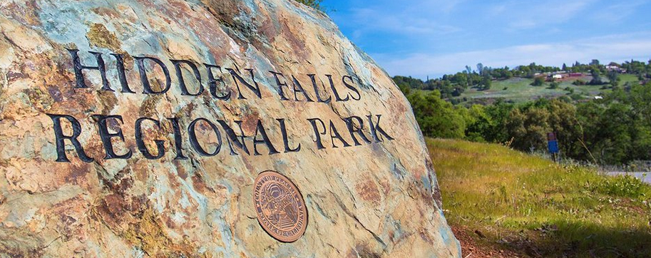
EL DORADO HILLS, Calif. – The Bureau of Land Management Mother Lode Field Office is planning several construction improvement projects to heighten outdoor recreational options on public lands in El Dorado County this year.
“For a short-term inconvenience, we will gain even more great outdoor recreational opportunities in the heart of the historic gold rush area, right along the beautiful South Fork of the American River,” says Mother Lode Field Manager William Haigh. “The BLM strives to be a good neighbor in the communities we serve. These projects will really enhance the public’s enjoyment of BLM’s recreational sites, which are so close to the Sacramento metropolitan area.”

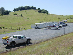
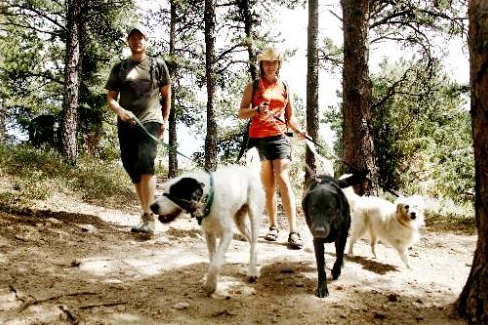
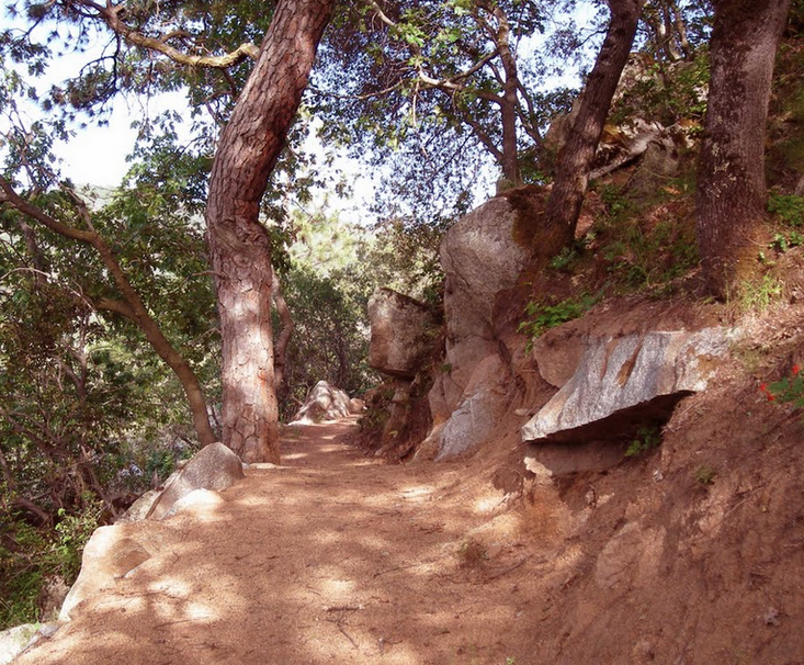
Construction is expected to start in mid-April to put in culverts, clean out ditches and grade the main access road at the Cronan Ranch Regional Trails Park near Pilot Hill. The work is designed to protect the road from water runoff to help make a smoother path for hikers, mountain bikers and horseback riders. The main access road will be closed for roughly 30 days, or until mid-May, but outdoor enthusiasts can still access Cronan Ranch via the Long Valley or West Ridge trails.

From approximately mid-May to mid-July, the Old Flume Trail Head parking lot will be relocated to a larger clearing on public land. Crews will also be improving the trail access to the new parking lot near Red Shack, north of Placerville. There will be no public parking during the 60-day construction phase.

From roughly mid-July to mid-August crews will be extending the parking lot and creating a raft staging area at the Greenwood Creek River Access, which is adjacent to the Magnolia Ranch Trail Head along Coloma Road/California State Route 49. Public parking will be limited, but the project should make loading and unloading much easier and more efficient for South Fork of the American River users.

Finally, from June to mid-October, crews will be building a new 85-foot walking, biking and equestrian bridge across Hastings Creek on the Connector Trail, between the Cronan and Magnolia ranches north of Coloma. For safety reasons the original creek crossing will not be accessible and users are encouraged to recreate elsewhere during the 120-day construction timeframe. A portion of the Magnolia Ranch Trailhead parking area will also be used as a staging area for construction crews.

The BLM manages public lands for the benefit of current and future generations. Please beware of heavy equipment, respect temporarily closed areas, and call the Mother Lode Field Office at 916-941-3101.

CLICK HERE to see the complete Press Release from BLM.


Due to wet fragile trails, GCTC Spenceville March 3 ride rescheduled to March 24

2/27/2018

 
Picture
Gold Country Trails Council's first equestrian ride of the year always takes place at the Spenceville Wildlife Area close to Beale Air Force Base. They determined that a large storm is coming in, predicted to drop over 5 inches of rain/snow just before this ride that was originally scheduled on March 3.

Because of GCTC's mission, they build and maintain trails and are careful not to use trails that are in fragile condition.

To those who are interested in the Gold Country Trails Council and their work in Nevada and Placer Counties, visit their web site by CLICKING HERE.

UPDATE: Repeated incidents of person frightening trail users on Snowberry Trail

2/14/2018

 
Picture
Elusive transient scares horseback riders in Folsom Lake SRA
FOLSOM -- The Shadow Glen Riding Stables in the Folsom Lake Recreation Area is surrounded by winding trails and thousands of acres with nothing but nature. People go there for horseback riding, fresh air and peace and quiet. But lately, riders say that quiet was interrupted by a man scaring several joggers and horseback riders.
"He'll jump up in front of the horses and, of course, that's dangerous," said Everett Blix. "It's actually an army camouflage tarp, from what I understand. That's what he's been hiding under. Then all the sudden 'woo!'" Blix said, putting his hands in the air.
Folsom lake park rangers say the man in his 30s is a transient who's been sleeping under a rug near the Snowberry Bridge.
Blix and Dennis Dew have been on alert looking for him. They haven't spotted the "elusive" man under the rug. They realize it sounds pretty strange.
"It's kind of funny, but nothing funny about somebody falling off a horse, getting hurt," Blix said. It could be dangerous, especially for the horses. I've seen people get thrown off horses, bucked off horses on a spook," Dew said.

Park rangers say they came out to look for the man after reading complaints on social media. They found him, cited him for illegal camping and other violations and evicted him from the area.

Homeless encampments are a growing problem in the region, park rangers say. Blix has noticed it too.

"As long as they keep to themselves, nobody really cares. But when they start doing things like that, trying to scare the people, scare the horses, that's when the danger aspect comes in," Blix said.
Park rangers say people reported the issue on social media and no one called them or 911. They urge people to report things like this so rangers can respond.
The transient was asked not to come back to the area and he wasn't charged with any crimes and nothing can really stop him from coming back.

CLICK HERE TO SEE ORIGINAL NEWS ON FOX 40 TELEVISION

---------------------------
POSTED 2/11/2018
As reported to Folsom Lake SRA Park Rangers, for the past three days there have been repeated incidents of a man, lying in the bushes covered by a rug, who leaps up, flapping the rug, and deliberately frightening anyone who is coming along the trail. He will stare intently, is non-verbal, and is not easily intimidated when asked to move along. The Rangers have been to this area, but have been unable to spot him.

This person will be found on the right side of the trail as you leave the boarding stable, after the Snowberry Bridge and before the culvert. He will be behind shrubs and not easily seen until he leaps up. There are ways around this area, and it is suggested trail users travel in alternate areas until the Rangers apprehend this person.


Enforcement stepped up on off-leash dogs in Auburn SRA

2/11/2018

 
Picture
According to trail users' reports, Park Rangers at Auburn State Recreation Area (ASRA) were issuing $150.00 citations for off leash dogs this weekend on the Olmsted Loop.

There are no new leash laws in ASRA, the rule has always been:
"Pets must be under control and on a leash no longer than six feet. They must be enclosed in a tent or vehicle at night. "
But, leashed dog rule enforcement has been not a priority. This may be about to change.

During the summer last year, Folsom Lake SRA was reporting about one ER visit a week due to off-leash dog aggression and bites. Folsom Lake SRA is in the same district (Gold Fields) as Auburn SRA.

AUBURN SRA DOG RULES
CLICK HERE to see the rules on the State Parks website.
No dogs are permitted on the lake, in the boat-in camps or day use areas
In the boat- in camps: NO DOGS are permitted in the campground or on the lake.
In primitive camps: Dogs must be on a leash or secured inside a vehicle or tent at all times.
Park wide: Pets must be under control and on a leash no longer than six feet. They must be enclosed in a tent or vehicle at night.


What you need to know about the Hidden Falls Reservation System

2/10/2018

 
Picture
The Hidden Falls reservation system has gone through its testing phase and is now an established process for everyone.

RESERVATION RULES
You must have a reservation BEFORE you arrive at the park, no passes are at the park.
Reservations are required on:
- Weekends
- Holidays
- A few other additional days listed below* and on their website
You DON'T need a reservation on weekdays.

HOW TO GET ONE?
You must have a reservation BEFORE you arrive at the park on a weekend or holiday, no passes are at the park.
For parking reservations: https://secure.rec1.com/CA/placer-ca/catalog
    Reservation REQUIRED on high volume days (weekends, holidays, etc.)
    $8.00 per vehicle – full day (sunrise to sunset).
    $4.00 per vehicle – partial day (morning or afternoon).
     No reservation is required during the week.
The horse trailer area will be reserved in the same way as the automobile area (same prices during the same peak days), but it will have its own separate quota of reservations to make sure the full gravel horse trailer area is kept just for trailered vehicles.
At the end of the reservation process, a parking reservation pass will be issued.  Pass to be placed on the dashboard/rear view mirror of your vehicle during your stay at the park.

*ADDITIONAL DAYS IN 2018
Reservations are required on all weekends.  In addition, the following days during 2018 will require a parking reservation:  1/1, 1/15, 2/19, 3/26-3/30, 5/25, 5/28, 7/4, 9/3, 10/8, 11/22-11/23, and 12/21-12/31.

HOW TO MAKE SURE YOU HAVE A SPACE DURING THE WEEK
WEBCAM - Current view of parking lot (updated every 6 minutes from dawn to dusk)
<https://www.placer.ca.gov/departments/facility/parks/parks-content/parks/hidden-falls>

NO RESERVATIONS ARE REQUIRED DURING REGULAR WEEKDAYS.

CLOSURE DURING RAIN OR INCLEMENT WEATHER
Trails are closed to cyclists and equestrians during and after rain events in order to maintain trail stability, permit drying, and minimize soil displacement.  Reopening shall occur as soon as practical, given soil conditions. Notices of trail closure status are posted on our Facebook page <https://www.facebook.com/hiddenfallspark/>
and Twitter <https://twitter.com/hiddenfallspark> daily.

WHY?
The reservation system is to make sure everyone has a parking place on the busy weekends and can visit the Park. Hidden Falls had become so popular, the Park was turning away hundreds of visitors on the weekends because of lack of parking.

PLANS FOR THE FUTURE
Soon there will be a Placer County ballot measure that will expand Hidden Falls access and parking. The County is preparing a Subsequent Environmental Impact Report (SEIR) for the proposed Hidden Falls Regional Parks Trails Networks Expansion project, which would expand the trail system into areas northeast, west, and east of the existing park, where the County holds existing trail easements or owns property.  In total, approximately 30 additional miles of trails would be added, along with the construction of two additional bridges over Coon Creek between the existing regional park trail network and Taylor Ranch (as well as one additional bridge over Coon Creek within Hidden Falls Regional Park that was analyzed under the prior EIR), additional parking, access areas, and other improvements, and possible improvement of off-site access roads.  A Notice of Preparation (NOP) was released on January 31, 2017, and the public comment period ran until March 1, 2017.  A Public Scoping Meeting was held on February 21, 2017, from 6:00 p.m. to 8:00 p.m. in the Placer County Planning Commission Hearing room.  For more information on the project, please click HERE
<https://www.placer.ca.gov/departments/communitydevelopment/envcoordsvcs/eir/hiddenfallsregionalparktrailsexpansion>


Water undermining Pioneer Express trail at Mile 44.75

2/9/2018

 
Picture
Be aware of a large hole at the vicinity of Mile 44.75 (between the power lines and the Horseshoe Bar sign) on the Pioneer Express Trail in Folsom Lake SRA. The trail is being undermined by water flowing below.


Independence Trail vehicle break-ins and 5 ways to prevent them

2/7/2018

 
Picture
 Recently there has been a rash of vehicle break-ins at the Independence Trail trailhead off Highway 49. Unfortunately, these thieves are cunning, mainly smashing and grabbing quickly what they can steal, and leaving the area. If this happens to you, be sure to call 911 and report it. You may not get your gear back, but it will alert the authorities to increase patrols and prevent others from thefts.

Here are five ways to prevent a trailhead break-in
One of everyone's biggest fears is showing up at the trailhead after several miles and hours on the trail to discover that your  car has been broken into, your tires have been slashed, and the spare water that you keep in your car has been consumed by the same thief.  Stuck, alone at an isolated trailhead, without cell phone reception.

Nothing would ruin a good day on the trails more than a trailhead break-in like this.  And it’s easy to get complacent, especially for those of us who think we live and play in safe places.  A little bit of common sense and street smarts are a vital part of break-in prevention.

1. Chose your trailhead wisely.  Stay informed, check the news or a good social media news monitoring site to see if there have been any trailhead break-ins in areas you want to explore.  If we hear of trailhead break-ins, Mother Lode Trails will  keep you posted.  A report of recent break-in is no reason to stay home or avoid a trailhead since local authorities will likely be checking trailheads, and that one in particular, more often.

2. Keep the inside of your car clear. a clean car.  Reduce the amount of clutter inside the car.  If a thief looks into a car and can see a bunch of clutter, loose change, and gear, it’s an invitation to smash open the window with a rock and see what else they can find.

3. Park your car in a smart place.  Check the ground for broken glass or evidence of vandalism.  An article on the REI website recommends parking “your vehicle with the trunk or rear-access door facing the most exposed section of the parking lot,” to expose any thieves tampering with your vehicle.

4. Stash items in the car before you pull into the trailhead.  It’s inevitable that we aren’t going to carry everything we bring in our car to a trailhead. Sheriffs will advise you to stash your items in a locked truck BEFORE YOU ARRIVE AT THE TRAILHEAD. Chances are if someone wants to break into a parked car they are watching every move at the trailhead and they’ll pay close attention to where you are hiding our gear before we lock our doors and head out for adventure.

5. REPORT your trail and trailhead issues to www.ParkWatchReport.com  And, you can dlownload the free app from the App Store (parkwatchreport). This vital data is sent to the land managers to have a paper trail and keep tabs on all trail issues (maintenance, conflicts, law breaking) so they can respond appropriately.

HOW TO ACCESS THE INDEPENDENCE TRAIL AT HIGHWAY 49, 5 MILES NORTH OF NEVADA CITY.
PARK HOURS AT 49 CROSSING ARE SUNRISE TO SUNSET. NO PARKING 10PM-6AM.
Pass through Grass Valley / Nevada City and turn left to remain on Hwy 49 for another 7 miles. There are 2 parking areas for the Independence Trail about 1/2 mile before the river crossing on the right. The parking lot for 49 Crossing is immediately before the bridge on the right.
Picture

    Archives

    May 2025
    April 2025
    March 2025
    February 2025
    January 2025
    December 2024
    November 2024
    October 2024
    September 2024
    August 2024
    July 2024
    June 2024
    May 2024
    April 2024
    March 2024
    February 2024
    January 2024
    December 2023
    November 2023
    October 2023
    September 2023
    August 2023
    July 2023
    June 2023
    May 2023
    April 2023
    March 2023
    February 2023
    January 2023
    December 2022
    November 2022
    October 2022
    September 2022
    August 2022
    July 2022
    June 2022
    May 2022
    April 2022
    March 2022
    February 2022
    January 2022
    December 2021
    November 2021
    October 2021
    September 2021
    August 2021
    July 2021
    June 2021
    May 2021
    April 2021
    March 2021
    February 2021
    January 2021
    December 2020
    November 2020
    October 2020
    September 2020
    August 2020
    July 2020
    June 2020
    May 2020
    April 2020
    March 2020
    February 2020
    January 2020
    December 2019
    November 2019
    October 2019
    September 2019
    August 2019
    July 2019
    June 2019
    May 2019
    April 2019
    March 2019
    February 2019
    January 2019
    December 2018
    November 2018
    October 2018
    September 2018
    August 2018
    July 2018
    June 2018
    May 2018
    April 2018
    March 2018
    February 2018
    January 2018
    December 2017
    November 2017
    October 2017
    September 2017
    August 2017
    July 2017
    June 2017
    May 2017
    April 2017
    March 2017
    February 2017
    January 2017
    December 2016
    November 2016
    October 2016
    September 2016
    August 2016
    July 2016
    June 2016
    May 2016
    April 2016
    March 2016
    February 2016
    January 2016
    December 2015
    November 2015
    October 2015
    September 2015
    August 2015
    July 2015

    Categories

    All

    RSS Feed

Home
Contact
 Mother Lode Trails is YOUR local volunteer-run trail information and resource website. Here you can find
up-to-the minute information on trail alerts, links and trail news for Placer,  Yuba, and Nevada counties.
Mother Lode Trails is trademarked.