If you would like to know the history of the beach trail, called the 1854 North Fork Ditch trail, CLICK HERE.
|
Almost every year, the temporary "beach trail" goes underwater as Folsom Lake is fills up with snow runoff held behind the dam. Several riders have posted up this weekend that the trail is under water between Sterling Pointe and Beeks Bight. It probably will be under water through the snow melt season. In the summer, the Department of Water Resources draws down the water as they provide irrigation for central and southern California agriculture, and the trail reappears. The alternate trail is the Pioneer Express Trail, or, the "upper" trail. It is open, but is rough going in a few places where the generous rain this year has rutted the trail. Photo credit Robert Sydnor. If you would like to know the history of the beach trail, called the 1854 North Fork Ditch trail, CLICK HERE. The Pioneer Express Trail, above the beach trail. Photo credit from AllTrails.com
Attorneys on both sides of the Cascade Canal Trail lawsuit stood before the Nevada County judge, prepared for trial over public use of the Nevada City path. Then, on Wednesday, they said a little more time was needed in hopes they could reach an agreement. A day later the attorneys returned before Superior Court Judge Robert Tice-Raskin with an agreement that ended an 18-month legal action and will reopen the trail to the public. (map credit: Bear Yuba Land Trust)
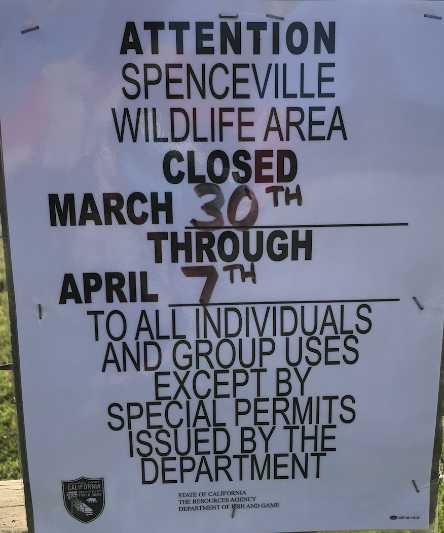
"We're delighted with the outcome," said Susan Sanders, a board member of Friends of Banner Mountain, which filed the suit against Jonathan and Jacy Davis. "This is what we'd hoped for — public access to a trail that has been used by the public for over 50 years, for generations." Users of the trail discovered around May 2017 that a gate was blocking access to the Cascade Canal Trail at Gracie Road, near Banner Lava Cap Road. A letter informed hikers that "disrespectful trail users" led the Davis' to block the trail. Friends of Banner Mountain filed suit in September 2017. The agreement calls for the installation by Tuesday of a 13-by-19 inch sign on a modified version of the Gracie Road gate, which will remain unlocked. The sign will state: "Cascade Canal Trail. Open to the public. Please stay on the trail and respect landowners' privacy. The landowner requests that the first 800 feet of the trail be used only during daylight hours." The trail is on a public easement that runs through private property. The first 800 feet runs through the Davis' land. The agreement calls for the removal of a second gate in the northeast part of the property. "I think it was a good resolution," said attorney Craig Diamond, who represents the Davises. "The interests of both parties were addressed and I think reasonably compromised." According to Diamond, a conversation was needed about the trail's use and the privacy concerns of his clients. That conversation is reflected in the agreement reached Thursday. Diamond emphasized that the easement allowing access to the trail existed before his clients were born. John Bilheimer, an attorney for Friends of Banner Mountain, said a state law enacted in 1972 stopped the use of public easements across private land for recreational purposes. However, the Cascade Canal Trail has been used since before that law's creation, and that recreational easement remains intact. "We're really pleased with the result," Bilheimer said. "We think it's important public trails are kept accessible to Nevada County." ------------ CLICK HERE to see the original article in The Union newspaper. IMPORTANT: This is from the FRIENDS OF BANNER MOUNTAIN (FBM): CASCADE CANAL GATE RESOLUTION Friends of Banner Mountain (FBM) has succeeded in securing a public easement on the Cascade Canal Trail over the Davis property. On March 21, 2019, Judge Tice-Raskin signed a stipulated judgment declaring the public has the right to walk, jog, ride bikes, and fish on the gated portion of the trail starting at the Gracie Road trailhead.The judgment requires that on or before April 2, 2019 the northeasterly gate must be removed, and the Gracie Roadtrailhead gate remain unlocked. To view the stipulated judgment click here: http://bannermountain.org/wp-content/uploads/2019/03/19-03-21-stipulated-judgment.pdf Even though FBM's superb attorneys provided their services at a reduced rate, FBM still has a big legal bill to pay. FBM appreciates all the donations it has received to date but additional financial support is desperately needed. If you haven't already made a donation, please consider doing so by going to: http://www.gofundme.com/save-the-cascade-canal Friends of Banner Mountain P.O. Box 833 Nevada City, CA 95959 The annual special permit turkey hunt is happening at Spenceville. Please be aware the whole area is closed to all trail users from March 30 to April 7, 2019.
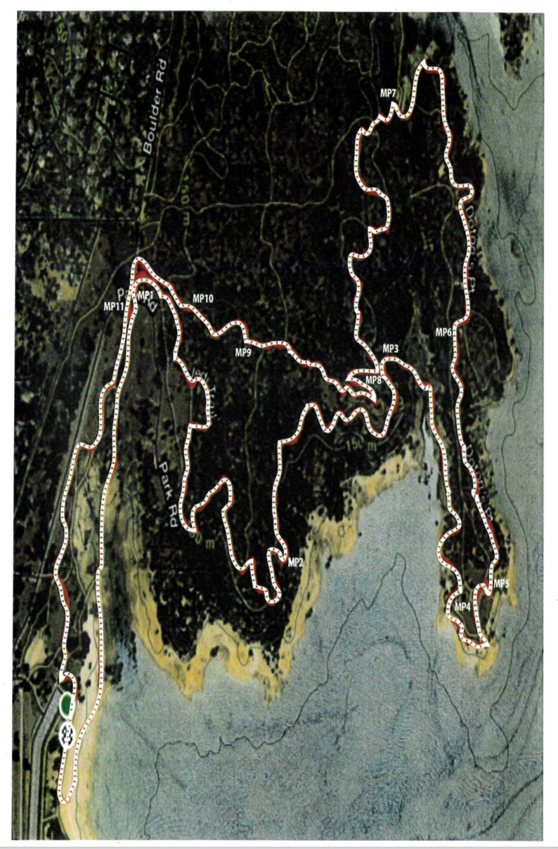
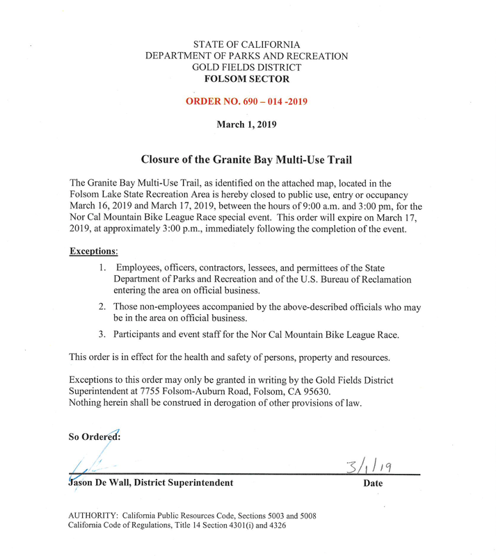
To find out more about the Spenceville Wildlife Area CLICK HERE on the Mother Lode Trails website. Under Specific Parks and Trails, scroll down to The Granite Bay Multi-Use Trail will be closed to the public on March 16 and 17, until 3:00 PM for the NorCal Grinder Mt. Bike Race.
CLICK HERE for original Order from Folsom Lake SRA administration. EL DORADO HILLS, Calif. – The Bureau of Land Management’s Mother Lode Field Office will temporarily close Magnolia Ranch from March 13-14, while the Wildland Fire Training Center conducts its wildland fire training with personnel.
Magnolia Ranch is located approximately five miles north of the town of Coloma along State Route 49 and the South Fork of the American River. It is on BLM-managed public lands, situated between Cronan Ranch and Greenwood Creek River Access, which will remain open during the training. For more information, please contact the Mother Lode Field Office at 916-941-3101 during business hours. For information on the Wildland Fire Training Center in McClellan, visit https://nationalfiretraining.nwcg.gov/. OPPORTUNITY TO SHARE INPUT ON PARKS AND TRAILS
AUBURN, Calif. – The first-ever countywide Placer County Parks and Trails Master Plan draft is now available for public input through April. Community members are invited to provide feedback on the plan at upcoming municipal advisory council meetings or online CLICK HERE AT placerparksplan.com. A schedule of plan presentations at MAC and public meetings will be available at the Parks and Trails Master Plan website. Those interested in attending are encouraged to sign up on the plan website for meeting notifications. 10 YEAR VISION When complete the plan will provide a 10-year vision for the development and operation of parks, recreation opportunities, open space and trail networks in the county. The plan is intended to reflect the recreational needs of individual communities, such as league play demands in Granite Bay and Loomis, and the need for connected trails for summer and indoor recreation during the winter in eastern Placer County. “This is a vigorous plan for major development of parks and trails across the county,” said Placer County Parks Administrator Andy Fisher. “OUR OUTDOOR RECREATION OPPORTUNITIES ARE A MAJOR REASON FOR OUR HIGH QUALITY OF LIFE AND WE WANT TO CONTINUE TO ENSURE THE HIGHEST QUALITY OF RECREATION EXPERIENCES FOR OUR RESIDENTS.” Andy Fisher, Placer County Parks Administrator The draft plan reflects community input provided over a two-year planning process through a series of public workshops, online surveys, focus groups and municipal advisory council meetings, to name a few. PUBLIC FEEDBACK CRUCIAL Feedback received indicated high support for paved and dirt trails, natural areas and new and improved facilities particular to each community. The results also affirmed that the park and trail projects already in development in the county are consistent with communities’ desired improvements. A summary of the Parks and Trails Master Plan public survey responses is available as a 10 MB PDF download. “This is a golden opportunity to get involved and help guide the future of recreation in Placer County for the next decade and beyond,” said Fisher. “The draft plan contains a great deal of data and analysis. We hope our community members can look it over and tell us how to make it even better before it’s finished.” Once the community’s input has been collected, the Parks and Trails Master Plan draft will be finalized and brought before the county Board of Supervisors for review, scheduled for June. CLICK HERE to see the original article in Roseville Today online newspaper. This is from the Western States Foundation: Press Release - Ride Date Change to 8-17-19
Wednesday, March 6, 2019 The Western States Trail Foundation Executive Committee, the Tevis Ride Director, along with other key Ride personnel have had discussions over the past week to evaluate the current snow and weather impacts to the 2019 Tevis Cup Ride. Based on the snowfall water content, and comparing current conditions and forecasts to past historical records, the decision was made to postpone the 2019 ride date from July 20th to August 17, 2019. We expect changing to this later date will allow us to use our traditional trail and make all the necessary improvements and annual seasonal clean up efforts before the ride. We appreciate the support and understanding of our riders, volunteers, sponsors, and the Tevis community as we move forward with this new date. Gold Country Trails Council trail team members Suzanne Vaccaro and Mary Beyer rode their horses at Spenceville Wildlife Area on Friday in preparation for the upcoming day ride. They reported very wet, soggy soil conditions and the water crossings as raging. The footing is saturated, leaving the trails in fragile state. They quickly got off the trails as not to damage them.
With another inch of rain predicted for next week, GCTC has rescheduled this ride to the rain date of March 16. For more information email GCTC Trails Coordinator, Jamie Canon What: GCTC Spenceville Wildlife Area Day Ride Trail Boss: Jamie Canon RSVP required 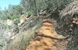 Placer County Parks has alerted all trail users that the ONE WAY section of Creekside Trail is CLOSED to ALL USERS until further notice due to unstable trail conditions and possibility of mud slide. To find out more about this trail CLICK HERE for a review and pictures. Way Too Cool 50K Endurance Run is its 30th annual, will be running on Saturday, March 2, 2019 at 8 A.M.
The course will Start at the Cool Fire Station on St. Florian Ct. and Hwy 49, and will be run on the Olmsted Loop, Western States, and Wendell T. Robie trail, ending back at the Cool Fire Station. Go Here for more information. This is a BIG race. If you aren't a participant, please consider other trails that day. Or don't. They are too wet and fragile to use anyway. |
Archives
July 2024
Categories |




 RSS Feed