NEVADA COUNTY, Calif. December 28, 2023 – As the year comes to a close, local community stakeholders are celebrating a safer and cleaner river canyon, improved trails and more modern amenities thanks to a shared commitment from Nevada County and community partners to strengthen sustainable tourism while addressing the pressures from climate impacts and growing visitation.
After the COVID-19 pandemic, the Nevada County Board of Supervisors saw a need to put more resources toward recreation and for the past two years have set an objective to promote health and safety at high-risk and high-use recreation areas.
Both short and long-term goals were established, including the development of the county’s first-ever Recreation and Resiliency Master Plan which will identify recreation needs and provide guidance for managing open space and recreation over a 10- to 15-year horizon. Funded by Sierra Nevada Conservancy and American Rescue Fund dollars, the next round of outreach will begin at the first of the year followed by the plan’s much anticipated completion in March.
“We live in such a beautiful area, and we know how important the Yuba River and recreation is to our residents,” said Supervisor Sue Hoek, who has taken a leading role in making recreation a priority for the county. “We hope our new Recreation and Resiliency Master Plan will help us manage our open space areas better than ever before.”
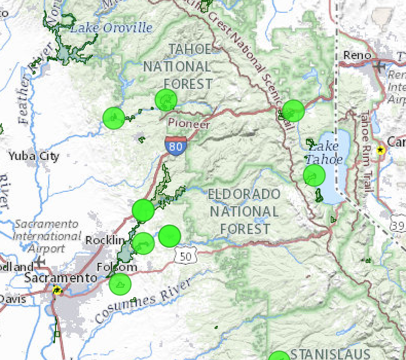
In addition, the county established the Outdoor Visitor Safety Fund grant program to expand capacity and infrastructure. So far, two rounds of Outdoor Visitor Safety Funds with up to $850,000 have been awarded to 19 local, state and federal projects and programs.
“We’re really excited to embark on this journey and see the difference it is making,” said Erika Seward, senior administrative analyst for the Nevada County Community Development Agency, who coordinates recreation for the county.
It’s not work the county is doing alone
For six years, Nevada County has been part of the South Yuba River Public Safety Cohort, a multi-agency working group made up of federal, state, local and community stakeholders who identify needs and find solutions to some of Nevada County’s toughest challenges related to increased visitation.
“Ultimately, we are a county that looks to tourism as part of our income. There is this balance of volume and quality and impact on the environment. Responsibility works hand in hand with that,” said cohort member Patrick Sullivan, division chief of operations for Nevada County Consolidated Fire District.
Last month, the California State Association of Counties recognized Nevada County with a 2023 Challenge Award for its collaborative solution-based approach to visitor safety and outdoor recreation, efforts that could serve as a model for other communities.
A safer river corridor
Each year, 800,000 people visit the South Yuba River. Nevada County Consolidated Fire District provides technical rescues within the river corridor responding annually to upward of 30 medical emergencies between the town of Washington and Lake Englebright.
Last spring, deadly cold and fast water in the Yuba River prompted the cohort to scale up outreach on river safety. The county coordinated a media day on May 17 with a message to “Stay Out, Stay Alive.” A weekly outreach campaign was launched with community partners, including a public safety video, travel alerts, social media posts and roadside message boards in English and Spanish that alerted visitors of hazardous conditions.
First responders had a decline in emergency calls even though the river was at historically high levels.
“The effort was well done. I think it has made a difference in safety and heightened the level of awareness in the river,” said Sullivan.
The cohort has also worked with the County to identify placement and installation of new call boxes at river crossings, procure portable toilets to keep the river cleaner and develop trail mile markers along 39 miles of trails to help first responders find injured hikers sooner. Trash and traffic congestion remain ongoing issues countywide.
“We know people are going to come. How do we give them resources to do it appropriately and not put a strain on our resources?” said Sullivan.
Improved access to trails
Users of the Scotts Flat Trail, Hoot Trail and Pioneer Trail off Highway 20 will now have safer parking and trail access. The popularity of these trails has increased in recent years, putting cyclists and pedestrians in harm’s way of speeding motorists.
A $75,000 grant from the Outdoor Visitor Safety Fund will pay for new asphalt parking, signage and trailhead information with safe access on Scotts Flat Road at the unstaffed Station 82 fire station at the busy intersection by the Wheelhouse Event Center. As a bonus, the new parking area will also provide a school bus turnaround and drop-off location with an enclosed structure for inclement weather.
Nevada Irrigation District recently completed construction of a new parking area near Scotts Flat Reservoir on Scotts Flat Road conveniently located by the Gate 2 campground entrance and the end of the popular Scotts Drop Trail. The project was supported with $18,000 from the same county grant program.
Helping public lands
Tahoe National Forest represents 27 percent of the County and attracts 2.1 million visitors annually. Since the pandemic, these public lands have seen higher volumes of people.
Money from the Outdoor Visitor Safety Fund Grant brought a new $50,000 vault toilet to the Golden Quartz free-use campground, a remote site on the South Yuba River managed by the Tahoe National Forest off Maybert Road five miles upstream from the Town of Washington. The new toilet replaces a 40-year-old dilapidated outhouse.
“We often don’t get enough appropriated money to install new structures, so we have to get creative and work with partners like South Yuba River Citizens League (SYRCL), who received the award from the County,” said Mary Sullivan, Recreation Program Manager for the Tahoe National Forest, who is a member of the cohort.
Collaborating with downtowns
Nevada City is a city that has always been surrounded by open space. Today, popular destinations include Pioneer Park, a public pool, and miles of trails, including Hirschman Trail, Deer Creek Tribute Trail, and soon, a reimagined Sugarloaf Trail.
The city serves the broader community, and most users of parks, trails, and programs do not follow jurisdictional boundaries. Up to 80 percent of the people who use the city pool are not city residents. With the County’s Master Plan and related survey data, the city will now have information that will better inform strategic recreation planning and make it more relevant to the population who uses it.
“It becomes an opportunity to be collaborative instead of working in a silo,” said City Manager Sean Grayson.
Sustainable tourism at Donner SummitFrom Cisco Grove to Donner Lake, members of the Donner Summit Association are working with Nevada County to bring sustainable tourism and economic stimulus to the community.
“We’ve had an increase in visitors and there’s really no infrastructure for that. Nevada County has been very supportive by providing portable toilets and garbage bins,” said Patricia Malberg, President of the Donner Summit Association.
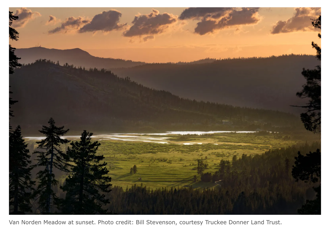
The group has a new website and a newly completed Donner Summit Public Use, Trails and Recreation Facilities Plan with a long-range vision for a visitor center and multiple destinations of cultural and historic significance. A big project in the works is to build trails and provide infrastructure like a trailhead, parking and restrooms at the west end of Van Norden Meadow to protect sensitive habitat and provide amenities for the growing number of visitors to the region.
“It’s a breathtaking spot. It looks up to all of the mountains in the Sugar Bowl complex and Castle Peak. You sit there, and you’re just in awe,” said Malberg.
Learn more about recreation in Nevada County and receive notifications on how to get involved at www.nevadacountyca.gov/recreation
- article by Laura Petersen and County of Nevada CA
For complete article and photos, go here:
https://yubanet.com/regional/balancing-local-recreation-needs-and-visitor-safety-with-focus-on-sustainable-tourism/
After the COVID-19 pandemic, the Nevada County Board of Supervisors saw a need to put more resources toward recreation and for the past two years have set an objective to promote health and safety at high-risk and high-use recreation areas.
Both short and long-term goals were established, including the development of the county’s first-ever Recreation and Resiliency Master Plan which will identify recreation needs and provide guidance for managing open space and recreation over a 10- to 15-year horizon. Funded by Sierra Nevada Conservancy and American Rescue Fund dollars, the next round of outreach will begin at the first of the year followed by the plan’s much anticipated completion in March.
“We live in such a beautiful area, and we know how important the Yuba River and recreation is to our residents,” said Supervisor Sue Hoek, who has taken a leading role in making recreation a priority for the county. “We hope our new Recreation and Resiliency Master Plan will help us manage our open space areas better than ever before.”
In addition, the county established the Outdoor Visitor Safety Fund grant program to expand capacity and infrastructure. So far, two rounds of Outdoor Visitor Safety Funds with up to $850,000 have been awarded to 19 local, state and federal projects and programs.
“We’re really excited to embark on this journey and see the difference it is making,” said Erika Seward, senior administrative analyst for the Nevada County Community Development Agency, who coordinates recreation for the county.
It’s not work the county is doing alone
For six years, Nevada County has been part of the South Yuba River Public Safety Cohort, a multi-agency working group made up of federal, state, local and community stakeholders who identify needs and find solutions to some of Nevada County’s toughest challenges related to increased visitation.
“Ultimately, we are a county that looks to tourism as part of our income. There is this balance of volume and quality and impact on the environment. Responsibility works hand in hand with that,” said cohort member Patrick Sullivan, division chief of operations for Nevada County Consolidated Fire District.
Last month, the California State Association of Counties recognized Nevada County with a 2023 Challenge Award for its collaborative solution-based approach to visitor safety and outdoor recreation, efforts that could serve as a model for other communities.
A safer river corridor
Each year, 800,000 people visit the South Yuba River. Nevada County Consolidated Fire District provides technical rescues within the river corridor responding annually to upward of 30 medical emergencies between the town of Washington and Lake Englebright.
Last spring, deadly cold and fast water in the Yuba River prompted the cohort to scale up outreach on river safety. The county coordinated a media day on May 17 with a message to “Stay Out, Stay Alive.” A weekly outreach campaign was launched with community partners, including a public safety video, travel alerts, social media posts and roadside message boards in English and Spanish that alerted visitors of hazardous conditions.
First responders had a decline in emergency calls even though the river was at historically high levels.
“The effort was well done. I think it has made a difference in safety and heightened the level of awareness in the river,” said Sullivan.
The cohort has also worked with the County to identify placement and installation of new call boxes at river crossings, procure portable toilets to keep the river cleaner and develop trail mile markers along 39 miles of trails to help first responders find injured hikers sooner. Trash and traffic congestion remain ongoing issues countywide.
“We know people are going to come. How do we give them resources to do it appropriately and not put a strain on our resources?” said Sullivan.
Improved access to trails
Users of the Scotts Flat Trail, Hoot Trail and Pioneer Trail off Highway 20 will now have safer parking and trail access. The popularity of these trails has increased in recent years, putting cyclists and pedestrians in harm’s way of speeding motorists.
A $75,000 grant from the Outdoor Visitor Safety Fund will pay for new asphalt parking, signage and trailhead information with safe access on Scotts Flat Road at the unstaffed Station 82 fire station at the busy intersection by the Wheelhouse Event Center. As a bonus, the new parking area will also provide a school bus turnaround and drop-off location with an enclosed structure for inclement weather.
Nevada Irrigation District recently completed construction of a new parking area near Scotts Flat Reservoir on Scotts Flat Road conveniently located by the Gate 2 campground entrance and the end of the popular Scotts Drop Trail. The project was supported with $18,000 from the same county grant program.
Helping public lands
Tahoe National Forest represents 27 percent of the County and attracts 2.1 million visitors annually. Since the pandemic, these public lands have seen higher volumes of people.
Money from the Outdoor Visitor Safety Fund Grant brought a new $50,000 vault toilet to the Golden Quartz free-use campground, a remote site on the South Yuba River managed by the Tahoe National Forest off Maybert Road five miles upstream from the Town of Washington. The new toilet replaces a 40-year-old dilapidated outhouse.
“We often don’t get enough appropriated money to install new structures, so we have to get creative and work with partners like South Yuba River Citizens League (SYRCL), who received the award from the County,” said Mary Sullivan, Recreation Program Manager for the Tahoe National Forest, who is a member of the cohort.
Collaborating with downtowns
Nevada City is a city that has always been surrounded by open space. Today, popular destinations include Pioneer Park, a public pool, and miles of trails, including Hirschman Trail, Deer Creek Tribute Trail, and soon, a reimagined Sugarloaf Trail.
The city serves the broader community, and most users of parks, trails, and programs do not follow jurisdictional boundaries. Up to 80 percent of the people who use the city pool are not city residents. With the County’s Master Plan and related survey data, the city will now have information that will better inform strategic recreation planning and make it more relevant to the population who uses it.
“It becomes an opportunity to be collaborative instead of working in a silo,” said City Manager Sean Grayson.
Sustainable tourism at Donner SummitFrom Cisco Grove to Donner Lake, members of the Donner Summit Association are working with Nevada County to bring sustainable tourism and economic stimulus to the community.
“We’ve had an increase in visitors and there’s really no infrastructure for that. Nevada County has been very supportive by providing portable toilets and garbage bins,” said Patricia Malberg, President of the Donner Summit Association.
The group has a new website and a newly completed Donner Summit Public Use, Trails and Recreation Facilities Plan with a long-range vision for a visitor center and multiple destinations of cultural and historic significance. A big project in the works is to build trails and provide infrastructure like a trailhead, parking and restrooms at the west end of Van Norden Meadow to protect sensitive habitat and provide amenities for the growing number of visitors to the region.
“It’s a breathtaking spot. It looks up to all of the mountains in the Sugar Bowl complex and Castle Peak. You sit there, and you’re just in awe,” said Malberg.
Learn more about recreation in Nevada County and receive notifications on how to get involved at www.nevadacountyca.gov/recreation
- article by Laura Petersen and County of Nevada CA
For complete article and photos, go here:
https://yubanet.com/regional/balancing-local-recreation-needs-and-visitor-safety-with-focus-on-sustainable-tourism/

 RSS Feed