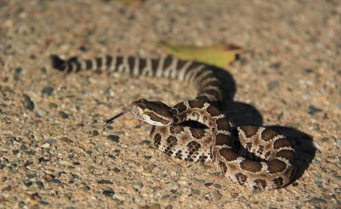
It just hasn't been that cold this year and the rattlesnakes are taking advantage of it. Saturday, one was seen at Hidden Falls Saturday, and today one was in the middle of the lower trail at Folsom Lake SRA. Rattlesnakes are coming out of of their dens, basking in the sun, and then becoming more active - this is a full month early.
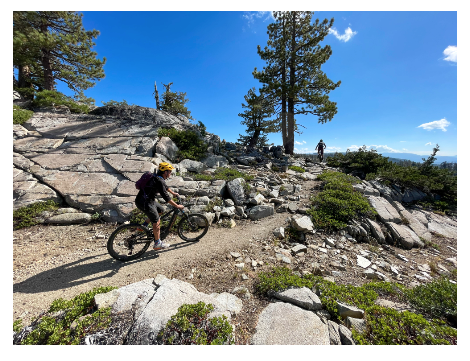
Keep an eye out on the trails below 1500 feet, especially at Cronan Ranch, Folsom Lake SRA, Auburn SRA. In our area, rattlesnakes bite hikers, bikers, runners, dogs, and horses every year, usually starting in mid-April. This year, starting now, in March.
SNAKE FACTS
Most people bitten by rattlesnakes have inadvertently stepped or ridden over them. Snakes detect movement by sensing vibrations in the ground. Their eyes see well even in low light. Rattlesnake bites can be dangerous but are rarely fatal to humans. With proper medical treatment, including antivenin, bites are usually not serious. Rattlesnakes can strike 2/3rds their length, and they are wonderfully camouflaged in the same color grass.
NOT ALL RATTLE!
Young rattlesnakes do not yet have their rattles, though they are as dangerous as adults, according to the National Park Service at Yosemite. Furthermore, some adults may lose their rattles, so it is a good idea look out for the triangular head. (In Folsom Lake, for example, rattlesnakes that rattle get killed, those that don't...don't. Meaning that after several generations, we have many families of silent snakes.)
After the rattle, rattlesnakes’ most distinctive physical feature is their triangular head. Also, they have vertical pupils, like cat’s eyes.
RATTLESNAKES ARE LOCAL
Generation after generation of rattlesnake will use the same dens, sometimes the same den for more than 100 years. Upon leaving their dens, they like to sun themselves on rocks, trails, and other open places. Though they are not nocturnal, in the hot summer months they may be more active at night.
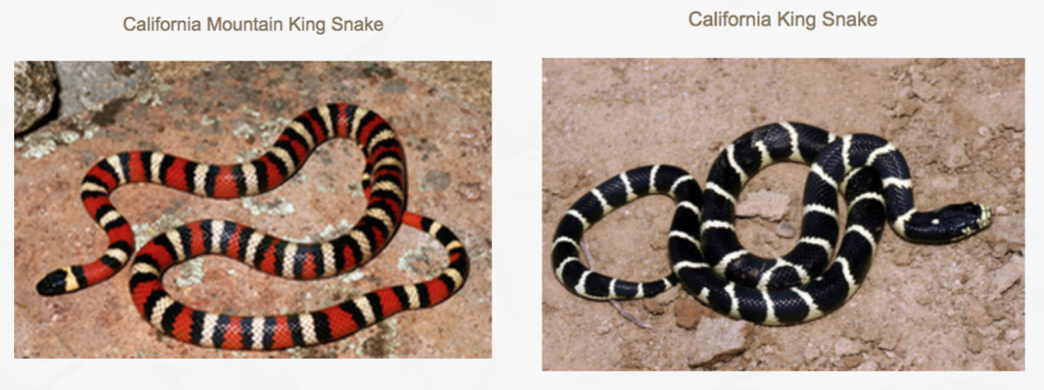
CALIFORNIA KING SNAKES ARE GOOD SNAKES!
Despite their venom, rattlesnakes are no match for California King snakes, which are fond of putting them on their dinner menus. DON'T KILL CALIFORNIA KING SNAKES! (pictures below)
Keep an eye out on the trails below 1500 feet, especially at Cronan Ranch, Folsom Lake SRA, Auburn SRA. In our area, rattlesnakes bite hikers, bikers, runners, dogs, and horses every year, usually starting in mid-April. This year, starting now, in March.
- - Keep your dogs ON LEASH so they don't get bitten. Rattlesnake avoidance training is available all year round. See trainers online, such as "Get Rattled."
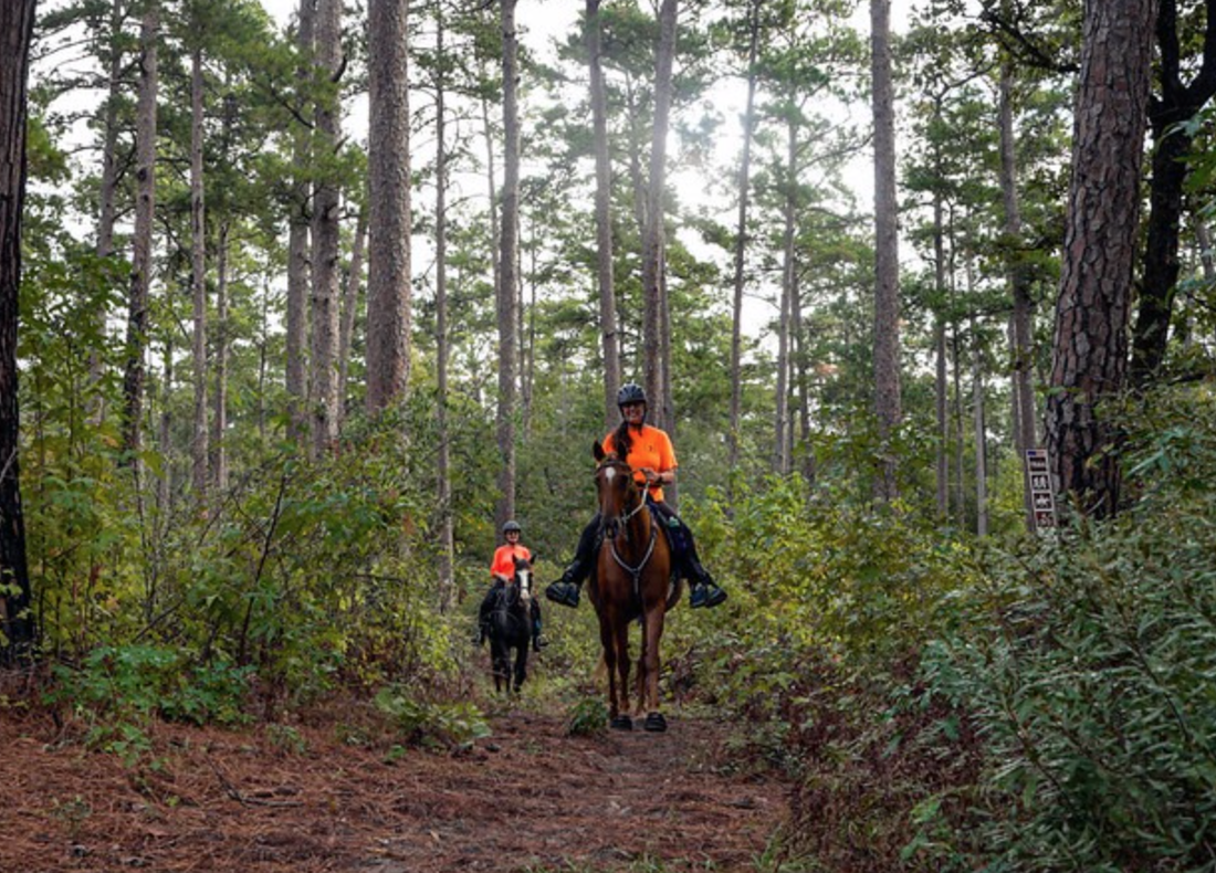
- - Many horses will alert you to snakes - equestrians should really listen to their horses who can hear and smell them way before their riders can.
- - When hiking wear long loose pants and high boots.
- - STAY on the trails. It's almost impossible to see the snakes in high grass.
- - Mt. bikers, slow down, so you don't run over them (and get bit in the process).
SNAKE FACTS
Most people bitten by rattlesnakes have inadvertently stepped or ridden over them. Snakes detect movement by sensing vibrations in the ground. Their eyes see well even in low light. Rattlesnake bites can be dangerous but are rarely fatal to humans. With proper medical treatment, including antivenin, bites are usually not serious. Rattlesnakes can strike 2/3rds their length, and they are wonderfully camouflaged in the same color grass.
NOT ALL RATTLE!
Young rattlesnakes do not yet have their rattles, though they are as dangerous as adults, according to the National Park Service at Yosemite. Furthermore, some adults may lose their rattles, so it is a good idea look out for the triangular head. (In Folsom Lake, for example, rattlesnakes that rattle get killed, those that don't...don't. Meaning that after several generations, we have many families of silent snakes.)
After the rattle, rattlesnakes’ most distinctive physical feature is their triangular head. Also, they have vertical pupils, like cat’s eyes.
RATTLESNAKES ARE LOCAL
Generation after generation of rattlesnake will use the same dens, sometimes the same den for more than 100 years. Upon leaving their dens, they like to sun themselves on rocks, trails, and other open places. Though they are not nocturnal, in the hot summer months they may be more active at night.
CALIFORNIA KING SNAKES ARE GOOD SNAKES!
Despite their venom, rattlesnakes are no match for California King snakes, which are fond of putting them on their dinner menus. DON'T KILL CALIFORNIA KING SNAKES! (pictures below)


 RSS Feed