MOTHER LODE TRAILS
  • Home
  • About
  • Contact
  • Volunteer
  • Links
    • Law Enforcement Emergency
    • Federal, State, County Districts Parks & Trails
    • Running Clubs
    • Equestrian Clubs
    • Mt. Bike Clubs
    • Hiking Clubs
    • Trail Advocacy Organizations
    • Phone Numbers State & Federal Parks, Trails & Lands
    • Where to Eat on the Trails
  • News
  • Alerts

June 3, BYLT Celebration of Trails, the biggest showcase of local community trails and events for all trail users

5/31/2017

 
Picture
  Join Bear Yuba Land Trust (BYLT), outdoor recreationists and trail supporters next week for the biggest showcase of local community trails of the year!“Trails are one of our greatest community assets. They build strong neighborhoods and boost the local economy. Trails get us outside and close to nature for healthy exercise and spiritual renewal. I am really inspired by the diversity of people who come together for such a wonderful cause,” said BYLT’s Community Engagement Manager Laura Petersen.

Celebration of Trails
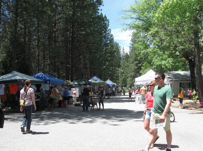
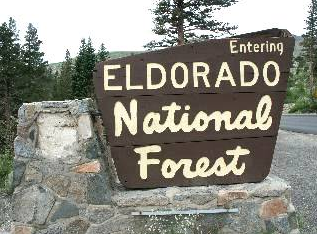
On Saturday, June 3, the community is invited to Celebration of Trails – the perfect day to enjoy local trails and plan your summer outdoor recreation adventures. Numerous local outdoor recreation groups will be in one place to bring the community everything they want to know about trail related topics – a one stop resource for gear, maps, summer guided hiking and trail ride schedules, flora and fauna, and more.
The day starts with a lineup of guided morning outings on local trails such as Black Swan Trail with Author and Historian Hank Meals, Deer Creek Tribute Trail with BYLT’s Shaun Clarke and Hirschman Trail with Ana Acton of FREED and Bill Haire of BYLT. The outings will be followed by a fun family-friendly trails day festival held from noon to 3 p.m. at Tahoe National Forest headquarters, 631 Coyote Street in Nevada City.
“People should come to this event if they care about the local beauty of our natural trails,” said Volunteer and Past Board Member Bob Jennings of Empire Mine Park Association who will hand out Empire Mine trail maps. The park has three trails – Hardrock Trail, Osborne Hill Trail, Union Hill Trail – a total over 7 miles.
Celebration of Trails coincides with American Hiking Society’s National Trails Day first begun in 1993. In 2015, 176,000 people got outdoors on community trails and participated in 2,329 activities across the U.S.
This year’s participants include: Tarp Tent, Gold Crush Climbing Gym, 49th Gold Country Scout Group, Bicyclists of Nevada County, Youth Bicyclists of Nevada County, City of Grass Valley, City of Nevada City, Empire Mine Park Association, FREED, Gold Country Trails Council, Mountain Recreation, Inn Town Campground, Folk Trails Hiking Club, Nevada City Scenics, Nevada City Chamber of Commerce, Sierra Club, South Yuba River Citizens League, South Yuba River State Park Association, Sierra Fund, Tahoe National Forest, California Gold Kettle Corn, Placer Nature Center, Nevada County Woods Riders and more. “Local trails are important – You can get in shape, join your family for a ride on a shady trail in August, connect to our great forests and rivers, and challenge yourself on a new steep route. We are so lucky to have an abundance of opportunities in Nevada County,” said BONC Secretary Ellen Lampham.

Family Activities and Local Food
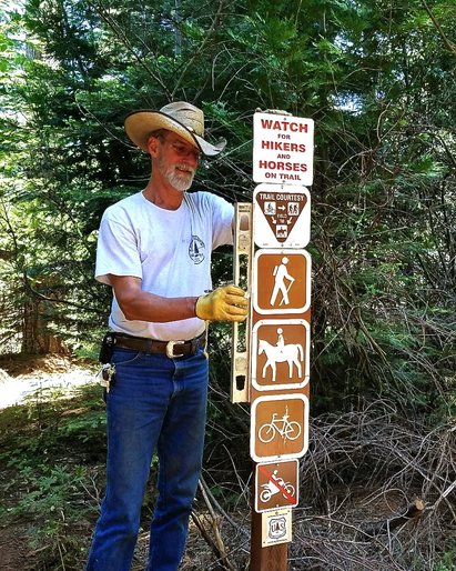
Besides giving out maps and info on the new Hoot Trail, BONC and YBONC will offer t-shirt printing with recycled bike parts during the afternoon festival. Other activities include a “boulder twister” climbing trailer with Gold Crush Climbing Gym, face-painting and trail shots game with BYLT, a photo booth with Tahoe National Forest, scouting activities with 49th Gold Country Scout Group, backpacking basics with Mountain Recreation and a live horse appearance from Gold Country Trails Council.
Local food and drink are also on tap. Colombia-born Rene Medina from new mobile organic and local farm to fork business, “Chomp” will serve up sausages made from local meats and fermented kimchee and sauerkraut. It’s the perfect pairing with “Hirschman Hefeweizen” from Three Forks Brewing Company. Folks who shop Nevada City’s Farmers Market in the morning can pick up a $1 off drink ticket at the market’s information booth before heading up Coyote Street to the Trails Day festival headquarters.

Morning Hikes:
WHAT: Hike from Black Swan to Deer Creek led by Hank Meals
WHEN: 8:30 a.m.
DIFFICULTY: Moderate 3 to 5 miles, carpooling required
MEET AT: Tahoe National Forest Headquarters, 631 Coyote Street, Nevada City
Join the area’s best-loved archeologist, author and hiking guru Hank Meals on this walk from Bear Yuba Land Trust’s Black Swan Preserve to Deer Creek.
“The Nisenan loved this place. Right over the ridge from Deer Creek Diggins (Black Swan), at Rose’s Bar, is where gold was ‘discovered’ on the Yuba River,” said Meals.
Dress appropriately for the weather, sturdy footwear, sun protection and bring snacks and plenty of water.
Space is limited to 15. Pre-register required! www.bylt.org or Contact: Laura Petersen [email protected], 272-5994 x 211

WHAT: Family Hike on the Hirschman Trail with FREED and BYLT
WHEN: 9:30 a.m.
DIFFICULTY: Easy to moderate (depending on distance and mobility level), .8 miles (wheelchair accessible) – 5 miles possible (moderate ascending and descending)
MEET AT: Hirschman Trail Trailhead on Cement Hill Road
Bring the whole family for this kid-friendly, all ability level exploration of Nevada City’s Hirschman Trail. Join Ana Acton of FREED and Bear Yuba Land Trust to learn about the history of this former hydraulic mine site and investigate the flora and fauna of this popular trail. Cameras, binoculars and sketch books are encouraged. This is a wheelchair, limited mobility accessible trail to the pond (.8 mile round trip). Those who want to go further, will have that option, too.
Call FREED 477-3333 for transportation information.

WHAT: Deer Creek Tribute Trail with BYLT and Nevada City
WHEN: 9:30 a.m.
DIFFICULTY: Easy to moderate
MEET AT: Meet in front of Miner’s Foundry, Spring Street, Nevada City

Join Bear Yuba Land Trust’s Trails Coordinator Shaun Clarke and special guest Nevada City Mayor Evans Phelps for this guided walk from downtown Nevada City to the beautiful Deer Creek Tribute Trail. Don’t forget to pick up your $1 off beer coupon from the Nevada City Farmers Market info booth before heading back up the hill to the trails day festival.

WHAT: 2017 Gold Country Trails Council Poker Ride
WHEN: Sign up at 8:30 a.m., ride out at 10 a.m.
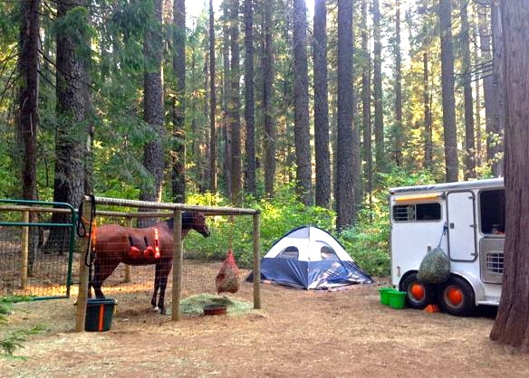
WHERE: Skillman Horse Camp on Tahoe National Forest
Calling all equestrian riders, this is the 26th annual Poker Ride led by Gold Country Trails Council. This ride on eight miles of easy to moderate marked trails benefits the building and maintenance of local trails, staging and parking areas around horse camps such as Skillman and Little Lasier Meadow. The event includes a raffle, prizes, food and live music.
Register at: www.GoldCountryTrailsCouncil.org

Learn more about Celebration of Trails at: www.bylt.org

CLICK HERE to see the original article in YubaNet.

Gold Country Trails Council Poker Ride this weekend brings over 100 riders and campers to support Tahoe National Forest trails.

5/31/2017

 
Picture
Photo Credit: http://trails-and-trials-with-major.blogspot.com/
Jeff Foltz, the GCTC Poker Ride Manager, said that the 26th Annual Gold Country Trails Council Benefit Poker Ride for equestrians, based at Skillman Horse Camp on June 2 and 3, has over 100 riders and fills the campgound. The ride will take place on the Hallelujah and other trails around Skillman. This is the largest fund raiser for the trails group each year, and the proceeds go back to maintain Skillman and Little Lasier Horse Camps and over 100 miles of multi-use trails in Tahoe National Forest.
This equestrian event is also part of the Celebration of Trails event hosted by the Bear Yuba Land Trust.
For any more information about the ride, visit the Gold Country Trails Council 
website at www.GoldCountryTrailsCouncil.org
For information about the Celebration of Trails, visit www.BYLT.org

Grazing goats back at Traylor Ranch this week

5/30/2017

 
Picture
To all the regular trail users at Traylor Ranch Nature Preserve in Loomis, you know that the fire-prevention goats come every year to graze the high grass. They will be back within the next couple of days and there there will be rolling areas blocked off. In the past years, there were some staging areas blocked. Dave Faoro, TRNR Chair, asks, "Please respect the temporary electric fences and signs."
The photo and trail alert is from the Loomis Basin Horsemen, the equestrian group that maintains the park.


Issues? Put these CA State Parks phone numbers in your cell phone

5/28/2017

 
Picture
Our local state parks have regular office numbers where trail users can ask for a Ranger, report maintenance issues, or to just say thanks for taking care of our park. If you ride or hike in these parks, put these numbers in your phone. They are there to help you. All these offices have regular hours, usually 9am - 5pm, Monday-Friday.
Folsom Lake SRA - (916) 988-0205
Auburn SRA - (530) 885-4527
Oroville SRA - (530) 538-2219

Empire Mine SHA - (916) 653-6995

What if you need to report something outside of business hours?
California State Parks in our area use one central dispatch number for 24/7 contact. This number is posted in our State Parks, but it is hard to find when you really need it...when you are in an situation out on the trail. This number is not to be used for when you are annoyed at the noisy kids on the beach, or that maintenance hasn't picked up the trash that day. When should you use the Central Dispatch number? For issues where a State Parks Ranger is needed to be dispatched for a public safety issue. Some of those issues might be to report a dangerous off-leash dog, or an illegal motorcycle on a non-motorized trail, or someone destroying cultural or natural artifacts, or reckless speed endangering others on a trail, or a a washed out trail or unsafe bridge. 
California State Parks Central Dispatch (916) 358-1300 - available 24/7

Who do you call for serious injury, or for fire, or observe dangerous or threatening behavior?  CALL 9-1-1


Eldorado Forest - be prepared for high elevation snow, increased run-off and storm damage Memorial Day holiday

5/27/2017

 
Picture
Visitors are reminded to check on the status of their favorite campgrounds as not all facilities are typically open at the beginning of the season and this year's large snow pack is hanging around. Permits are still required for wilderness areas even though they have snow.

  • Recreation facilities that are open now are Dru Barner, Stumpy Meadows, Black Oak Group, Ponderosa Cove, Hell Hole, Strawberry Point, Northwind, Jones Fork, Big Silver Group, China Flat, Sand Flat, Silver Fork, Capps Crossing, Lovers Leap, Westpoint, Pyramid Trailhead, Middle Fork Cosumnes, Pardoes Point, and Pipi.
  • Facilities expected to be open the Friday of Memorial Weekend are Ice House, Sunset (sites 62 to 131), Fashoda, Azalea Cove, Wench Creek, Yellowjacket, Gerle Creek, and Airport Flat.
  • Early June openings are expected for Northshore, South Shore, and Camino Cove.
  • Facilities above 6,000 feet in elevation that are expected to open in mid to late June are Loon Lake, Bear River Group, Caples Lake, and Silver Lake East.
  • At over 7,000 feet in elevation, Kirkwood Lake, Caples Lake, Woods Lake and Wrights Lake will be the last to open most likely in late June to early July.
For recreation facility updates visit our Current Conditions web page at www.fs.usda.gov/goto/enf/currentconditions . Reservations for many of our campgrounds, rental cabins, and overnight wilderness camping can be made at recreation.gov.
As the higher elevation routes are still blocked by snow drifts, Mormon Emigrant Trail will NOT be open for Memorial Weekend. The Highway 88 end of the road is at almost 8,000 feet in elevation with a 5 foot deep snow pack for the last 5 miles. Access from the Sly Park end is still 1 mile short of the Silver Fork road intersection. Motor Vehicle Use Maps are available free of charge from any of our Ranger Stations or downloaded from our Forest website.  For road updates visit our Current Conditions web page at www.fs.usda.gov/goto/enf/currentconditions.
Visitors need to exercise caution as they enjoy the outdoors. All rivers and streams are running high, swift, and cold due to melting snow resulting in suddenly hazardous conditions. Many of the reservoirs are close to spilling and have increased their releases to make room for the incoming water from a greater than normal snow pack. River and stream levels fluctuate rapidly so do not cross them as you may not be able to return. Swimming is not advised as the cold water can result in hypothermia very quickly. Visitors are urged to be careful as there are also hazardous conditions around the forest due to tree mortality from 5 years of drought and insect damage.
Outside of hosted campgrounds, visitors must have a California Campfire Permit to have a campfire, or use a charcoal barbecue, gas stove or gas lantern.  The permit is your agreement to follow the campfire restrictions and regulations in effect.  Remember that regulations governing campfires can change with weather conditions and the seasons. To protect yourself and the forest, before each visit, check with the Forest Service for current campfire restrictions. Smoking outside of an enclosed vehicle may be completely prohibited during times of high fire danger.  Your campfire permit is valid from the date issued until the end of the calendar year; it may be used in any National Forest in California.  California Campfire permits are available free of charge at our Ranger Stations and online at www.preventwildfireca.org.
As a result of the severe winter, multiple roads, trails, and facilities have been damaged. The southern end of the forest is not accessible due to extensive road damage to Ellis Creek, Panther Creek, Salt Springs, and Tiger Creek roads. The northern end of the forest cannot be accessed from the Eldorado side as Eleven Pines road and Blacksmith Flat/Ralston road have multiple damage areas and unstable slopes. Access from the Tahoe National Forest side via Mosquito road is only one lane in areas due to road damage so visitors are encouraged to drive cautiously. This is a 2 ½ hour trip from Georgetown to Hell Hole area.
  • Recreation facilities temporarily closed or inaccessible due to storm damage are Bridal Veil Picnic Area, Mokelumne, White Azalea, Moore Creek, Middle Fork Cosumnes Annex, Sugar Pine Point, and Wolf Creek campgrounds. A bridge on the Pony Express Trail has washed out preventing through access on the trail. For updates visit our Storm Damage web page at www.fs.usda.gov/goto/enf/stormdamage.
Forest offices are open 8:00 AM to 4:30 PM. The Forest Supervisor's office and the Placerville and Amador Ranger District offices are open Monday to Friday. The Pacific Ranger District office is open 7 days a week although Sunday is only from 8:00 am to 12:00 pm. Georgetown Ranger Station on Wentworth Springs road is open 6 days a week Monday through Saturday. Carson Pass and Crystal Information Stations will be open on weekend days. Please visit our website at www.fs.usda.gov/eldorado  for maps and visitor information.


Nesting bald eagles cause temporary Sunset campground closure in Eldorado National Forest

5/27/2017

 
Picture
Nesting bald eagles have returned to Sunset Campground in the Eldorado National Forest. A temporary closure of the Shady and Meadow Loops (units 1 - 61) has been implemented to protect the eagles which are sensitive to disturbance. The other sites in Sunset Campground (units 62-131) will open on Friday May 26 in time for Memorial Day Weekend and will be available through the reservation system on www.recreation.gov. In addition to Sunset, there are many other campgrounds around the Union Valley Reservoir, including Wench Creek Campground which doesn't require reservations. There are also abundant dispersed camping options throughout the Crystal Basin on the Pacific Ranger District."Sunset Campground was a new nest site for these eagles last year," said District Ranger, Richard Thornburgh. "We encouraged the eagles to nest away from the campground by building a nesting platform nearby on Granlee Point last fall. Although the eagles still choose to return to Sunset this year, we've been able to narrow the scope and timing of the closure to accommodate more camping."
The Forest Service plans to begin a phased reopening of units 1-61 in mid-June. During the nesting season, the Forest Service will also provide opportunities for visitors to view the bald eagle nest with a spotting scope and learn more about the biology of these magnificent birds.
Bald eagles have nested around Union Valley Reservoir since 1986. Bald eagles build large stick nests in the upper branches of the tallest trees, which offer great views for fishing and protecting their nest. Pairs generally return to the same nest year after year, building upon and improving it. For more than 10 years, the Union Valley bald eagles nested on Granlee Point on the southeast side of the reservoir.
Late in 2015, the Granlee Point nest fell out of the tree, and the bald eagles built a new nest in Sunset Campground. The bald eagles in Union Valley have successfully fledged two juveniles in 2015 and 2016, helping to boost populations of bald eagles in California.    
The US Forest Service is working with California Department of Fish and Wildlife and US Fish and Wildlife Service to protect the nesting eagles while minimizing restrictions on recreational use of the area.  Disturbance of eagles is prohibited under the Bald and Golden Eagle Protection Act.    
The complete Sunset Campground Bald Eagle Closure Order No. 03-16-03 is posted on the forest website at www.fs.usda.gov/eldorado . You can also visit this website for more information on the status of roads and recreation sites forest-wide.
Eldorado National Forest Press Release May 24, 2017
Photo credit from the Audubon Field Guide


New safety and trail designation signs on Hoot (Cable) Trail

5/25/2017

 
Picture
The Forest Service has approved and installed new trail signs to remind everyone that the newly re-routed Hoot Trail, which starts at the Harmony Market on Highway 20, is shared by all trail users.The Hoot Trail is the old Cable Trail that was closed by the Tahoe National Forest for safety reasons. For over a decade, the equestrians of the Gold Country Trails Council worked with the Forest Service to get this multi-use, non-motorized trail re-opened by funding the CEQA, NEPA declarations done and protected species clearance.
During the past 18 months, trails organizations assisted the Forest Service in finally building the new trail, including Gold Country Trails Council and Bicyclists of Nevada County (BONC) by providing CCC funds, trail tools and machines, design and the physical work on the ground finishing the trail. The trail was officially opened this past month.
As designated, this trail is multi-use, open to bikes, hikers and horses. Because the trail has been marketed for this past month as a bicycle trail, many out-of-area mt. bikers have come to try it out. To curtail speed and post trail yield rules, the Forest Service approved and installed these new signs on May 24 to remind everyone that the trail is shared by all trail users.

Photo: Gold Country Trails Council volunteer, Barry Vacarro, sets the new trail signs.


UPDATE: Mountain lion sightings on El Dorado Trail, another at the Quarry

5/25/2017

 
Picture
THE QUARRY 5/25/2017: A Park Watch Reporter said a lion ran into the side of her trailer at Hwy 49 and the Quarry as they were driving out of the Confluence. The lion spun around and went back into the woods.  She saw that it was uninjured.

EL DORADO TRAIL 5/25/2017: There has been a mountain lion sighting on the El Dorado Trail in the Weber Creek Bridge (portion of the trail between Forni Rd and Missouri Flat Rd).  This sighting was of a mother and her young.  Parks and Trails posted signs on the trail. Please be cautious and aware of your surroundings. This information came from the County of El Dorado Parks and Trails division.

For those of you who are running or riding in these areas, a good idea is to wear bells. Most lions want to stay hidden from noise or humans.

 The Ag Department recommends:
  • Do not feed feral cats. The cats, raccoons, opossums, and skunks that come for the food also attract mountain lions and are easy “tidbits” for them. Do not leave pet foods out overnight as they attract these visitors that in turn attract the mountain lions.
  • Do not feed deer. Presence of deer on your property attracts mountain lions as they are the natural prey of the lions.
Always:
  • Be aware of your surroundings.
  • Do not enter brushy areas.
  • Stay close to the building at night and do not enter dark areas alone.  
The Agriculture Department and the State Department of Fish and Game also make the following recommendations:
  • DO NOT HIKE ALONE: Go in groups, with adults supervising children.
  • KEEP CHILDREN CLOSE TO YOU: Observations of captured wild mountain lions reveal that the animals seem especially drawn to children. Keep children within your sight at all times.
  • DO NOT APPROACH A MOUNTAIN LION: Most mountain lions will try to avoid a confrontation. Give them a way to escape.
  • DO NOT RUN FROM A MOUNTAIN LION: Running may stimulate a mountain lion’s instinct to chase. Instead, stand and face the animal. Make eye contact. If you have small children with you, pick them up if possible so they don’t panic and run. Although it may be awkward, pick them up without bending over or turning away from the mountain lion.
  • DO NOT CROUCH DOWN OR BEND OVER: In Nepal, a researcher studying tigers and leopards watched the big cats kill cattle and domestic water buffalo while ignoring humans standing nearby. He surmised that a human standing up is just not the right shape for a cat’s prey. On the other hand, a person squatting or bending over looks a lot like a four-legged prey animal. If you’re in mountain lion country, avoid squatting, crouching or bending over, even when picking up children.
  • DO ALL YOU CAN TO APPEAR LARGER: Raise your arms. Open your jacket if you are wearing one. Again, pick up small children. Throw stones, branches, or whatever you can reach without crouching or turning your back. Wave your arms slowly and speak firmly in a loud voice. The idea is to convince the mountain lion that you are not prey and that you are not a danger to it.
  • FIGHT BACK IF ATTACKED: A hiker in Southern California used a rock to fend off a mountain lion that was attacking his son. Others have fought back successfully with sticks, caps, jackets, garden tools and their bare hands. Since a mountain lion usually tries to bite the head or neck, try to remain standing and face the attacking animal. If you see a mountain lion near a County facility, or to IMMEDIATELY REPORT A DANGEROUS
  • ENCOUNTER OR ATTACK: CALL 911 The threat to public safety will be assessed and any appropriate action will be taken. Also report any sighting of dead or injured mountain lions. 
All trail users need to be aware of their surroundings. Currently there have never been a report of a mountain lion attacking a horse and rider combination, but lions have attacked and killed mt. bikers, hikers, horses alone, and dogs on our trails.

Caution urged during bike trail closure at Lake Natoma

5/25/2017

 
Picture
The Bureau of Reclamation, in partnership with the California Department of Parks and Recreation, has temporarily closed a portion of the American River Bike Trail along Lake Natoma due to landslide activity that began January 22, south of Negro Bar. California State Parks has installed fencing, barricades and warning signs on both sides of the trail closure and is urging the public to stay away from the area until further notice, as additional slides may occur. Construction activities to stabilize the cliff and remove debris have not yet been scheduled due to ongoing hazards.

Cyclists and other recreationists should use the paved trails on the south side of Lake Natoma as an alternate route between Hazel Avenue and Folsom Boulevard.

More information is available at California State Park’s Folsom Lake State Recreation Area, 916-988-0205 or parks.ca.gov/?page_id=500.

Photo credit: Sacramento Bee newspaper
CLICK HERE to see original article in the Folsom Telegraph Newspaper

Tahoe National Forest Modifies Bowman Road Closure

5/24/2017

 
Picture
NEVADA CITY, Calif. – In a continuing effort to provide vehicular access to the Tahoe National Forest, while also providing for public safety, the Forest has moved the Bowman Road closure from the intersection with Highway 20 to the intersection with Forest Service Road 14 (Grouse Ridge Lookout Road). The Road had been closed due to storm damage, including a large sinkhole. Initial repairs have made the road passable; however, uneven surfaces still warrant caution while driving the newly opened section of road.

Snow, ice and debris are inhibiting access to some Tahoe National Forest roads and additional road damage is still being revealed. The Forest has seen extensive damage to roads and other infrastructure from this year’s winter storms. Unsafe conditions, damaged roads, as well as snow and debris have resulted in the need to close some roads to public use. Closed roads will reopen once they are repaired and deemed safe for travel.

Those with a valid permit from the U.S. Forest Service are authorized to use these roads, as are any Federal, State or local officers or members of an organized rescue or firefighting force in the performance of official duty.
For more Tahoe National Forest information, go to www.fs.usda.gov/tahoe. Follow us on Twitter at twitter.com/Tahoe_NF and “Like” us on Facebook at www.facebook.com/TahoeNF.

Release Date: May 22, 2017  
Contact(s): Michael Woodbridge
CLICK HERE to see original press release


<<Previous

    Archives

    May 2025
    April 2025
    March 2025
    February 2025
    January 2025
    December 2024
    November 2024
    October 2024
    September 2024
    August 2024
    July 2024
    June 2024
    May 2024
    April 2024
    March 2024
    February 2024
    January 2024
    December 2023
    November 2023
    October 2023
    September 2023
    August 2023
    July 2023
    June 2023
    May 2023
    April 2023
    March 2023
    February 2023
    January 2023
    December 2022
    November 2022
    October 2022
    September 2022
    August 2022
    July 2022
    June 2022
    May 2022
    April 2022
    March 2022
    February 2022
    January 2022
    December 2021
    November 2021
    October 2021
    September 2021
    August 2021
    July 2021
    June 2021
    May 2021
    April 2021
    March 2021
    February 2021
    January 2021
    December 2020
    November 2020
    October 2020
    September 2020
    August 2020
    July 2020
    June 2020
    May 2020
    April 2020
    March 2020
    February 2020
    January 2020
    December 2019
    November 2019
    October 2019
    September 2019
    August 2019
    July 2019
    June 2019
    May 2019
    April 2019
    March 2019
    February 2019
    January 2019
    December 2018
    November 2018
    October 2018
    September 2018
    August 2018
    July 2018
    June 2018
    May 2018
    April 2018
    March 2018
    February 2018
    January 2018
    December 2017
    November 2017
    October 2017
    September 2017
    August 2017
    July 2017
    June 2017
    May 2017
    April 2017
    March 2017
    February 2017
    January 2017
    December 2016
    November 2016
    October 2016
    September 2016
    August 2016
    July 2016
    June 2016
    May 2016
    April 2016
    March 2016
    February 2016
    January 2016
    December 2015
    November 2015
    October 2015
    September 2015
    August 2015
    July 2015

    Categories

    All

    RSS Feed

Home
Contact
 Mother Lode Trails is YOUR local volunteer-run trail information and resource website. Here you can find
up-to-the minute information on trail alerts, links and trail news for Placer,  Yuba, and Nevada counties.
Mother Lode Trails is trademarked.