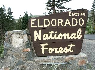
Visitors are reminded to check on the status of their favorite campgrounds as not all facilities are typically open at the beginning of the season and this year's large snow pack is hanging around. Permits are still required for wilderness areas even though they have snow.
As the higher elevation routes are still blocked by snow drifts, Mormon Emigrant Trail will NOT be open for Memorial Weekend. The Highway 88 end of the road is at almost 8,000 feet in elevation with a 5 foot deep snow pack for the last 5 miles. Access from the Sly Park end is still 1 mile short of the Silver Fork road intersection. Motor Vehicle Use Maps are available free of charge from any of our Ranger Stations or downloaded from our Forest website. For road updates visit our Current Conditions web page at www.fs.usda.gov/goto/enf/currentconditions.
Visitors need to exercise caution as they enjoy the outdoors. All rivers and streams are running high, swift, and cold due to melting snow resulting in suddenly hazardous conditions. Many of the reservoirs are close to spilling and have increased their releases to make room for the incoming water from a greater than normal snow pack. River and stream levels fluctuate rapidly so do not cross them as you may not be able to return. Swimming is not advised as the cold water can result in hypothermia very quickly. Visitors are urged to be careful as there are also hazardous conditions around the forest due to tree mortality from 5 years of drought and insect damage.
Outside of hosted campgrounds, visitors must have a California Campfire Permit to have a campfire, or use a charcoal barbecue, gas stove or gas lantern. The permit is your agreement to follow the campfire restrictions and regulations in effect. Remember that regulations governing campfires can change with weather conditions and the seasons. To protect yourself and the forest, before each visit, check with the Forest Service for current campfire restrictions. Smoking outside of an enclosed vehicle may be completely prohibited during times of high fire danger. Your campfire permit is valid from the date issued until the end of the calendar year; it may be used in any National Forest in California. California Campfire permits are available free of charge at our Ranger Stations and online at www.preventwildfireca.org.
As a result of the severe winter, multiple roads, trails, and facilities have been damaged. The southern end of the forest is not accessible due to extensive road damage to Ellis Creek, Panther Creek, Salt Springs, and Tiger Creek roads. The northern end of the forest cannot be accessed from the Eldorado side as Eleven Pines road and Blacksmith Flat/Ralston road have multiple damage areas and unstable slopes. Access from the Tahoe National Forest side via Mosquito road is only one lane in areas due to road damage so visitors are encouraged to drive cautiously. This is a 2 ½ hour trip from Georgetown to Hell Hole area.
- Recreation facilities that are open now are Dru Barner, Stumpy Meadows, Black Oak Group, Ponderosa Cove, Hell Hole, Strawberry Point, Northwind, Jones Fork, Big Silver Group, China Flat, Sand Flat, Silver Fork, Capps Crossing, Lovers Leap, Westpoint, Pyramid Trailhead, Middle Fork Cosumnes, Pardoes Point, and Pipi.
- Facilities expected to be open the Friday of Memorial Weekend are Ice House, Sunset (sites 62 to 131), Fashoda, Azalea Cove, Wench Creek, Yellowjacket, Gerle Creek, and Airport Flat.
- Early June openings are expected for Northshore, South Shore, and Camino Cove.
- Facilities above 6,000 feet in elevation that are expected to open in mid to late June are Loon Lake, Bear River Group, Caples Lake, and Silver Lake East.
- At over 7,000 feet in elevation, Kirkwood Lake, Caples Lake, Woods Lake and Wrights Lake will be the last to open most likely in late June to early July.
As the higher elevation routes are still blocked by snow drifts, Mormon Emigrant Trail will NOT be open for Memorial Weekend. The Highway 88 end of the road is at almost 8,000 feet in elevation with a 5 foot deep snow pack for the last 5 miles. Access from the Sly Park end is still 1 mile short of the Silver Fork road intersection. Motor Vehicle Use Maps are available free of charge from any of our Ranger Stations or downloaded from our Forest website. For road updates visit our Current Conditions web page at www.fs.usda.gov/goto/enf/currentconditions.
Visitors need to exercise caution as they enjoy the outdoors. All rivers and streams are running high, swift, and cold due to melting snow resulting in suddenly hazardous conditions. Many of the reservoirs are close to spilling and have increased their releases to make room for the incoming water from a greater than normal snow pack. River and stream levels fluctuate rapidly so do not cross them as you may not be able to return. Swimming is not advised as the cold water can result in hypothermia very quickly. Visitors are urged to be careful as there are also hazardous conditions around the forest due to tree mortality from 5 years of drought and insect damage.
Outside of hosted campgrounds, visitors must have a California Campfire Permit to have a campfire, or use a charcoal barbecue, gas stove or gas lantern. The permit is your agreement to follow the campfire restrictions and regulations in effect. Remember that regulations governing campfires can change with weather conditions and the seasons. To protect yourself and the forest, before each visit, check with the Forest Service for current campfire restrictions. Smoking outside of an enclosed vehicle may be completely prohibited during times of high fire danger. Your campfire permit is valid from the date issued until the end of the calendar year; it may be used in any National Forest in California. California Campfire permits are available free of charge at our Ranger Stations and online at www.preventwildfireca.org.
As a result of the severe winter, multiple roads, trails, and facilities have been damaged. The southern end of the forest is not accessible due to extensive road damage to Ellis Creek, Panther Creek, Salt Springs, and Tiger Creek roads. The northern end of the forest cannot be accessed from the Eldorado side as Eleven Pines road and Blacksmith Flat/Ralston road have multiple damage areas and unstable slopes. Access from the Tahoe National Forest side via Mosquito road is only one lane in areas due to road damage so visitors are encouraged to drive cautiously. This is a 2 ½ hour trip from Georgetown to Hell Hole area.
- Recreation facilities temporarily closed or inaccessible due to storm damage are Bridal Veil Picnic Area, Mokelumne, White Azalea, Moore Creek, Middle Fork Cosumnes Annex, Sugar Pine Point, and Wolf Creek campgrounds. A bridge on the Pony Express Trail has washed out preventing through access on the trail. For updates visit our Storm Damage web page at www.fs.usda.gov/goto/enf/stormdamage.
 RSS Feed