It’s time to start coming out of the mountains to some of our favorite foothill trails. Fall and winter are my favorite hiking seasons. I do love the flowers in spring but the solitude of winter hikes is charming to me.
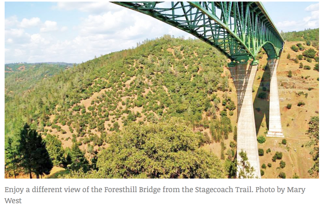
The Stagecoach Trail in the Auburn State Recreation Area is three trails in one. Park in the confluence area near the kiosk. Keep in mind there is a $10 day-use fee. Behind the state park kiosk there is a trail that leads under the Foresthill Bridge (The tallest bridge in California at 730 feet). You will be headed up river left — not to be confused with the popular Clementine trail on the other side of the North Fork of the American.
Behind the kiosk you hike the moderate uphill climb toward the bridge with the river on your right. If you know the area you may be familiar with the two left turns off the main trail. These lead to first the lower and then upper Stagecoach Trail.
If you take the first sharp left onto Lower Stagecoach at the sign you enjoy the view of the Mountain Quarries Railroad Bridge and the American River that flows beneath. You can continue to the bench for a view of the confluence area and onto Russell Road. The out-and-back hike is approximately 2 miles.
Upper Stagecoach offers nice canyon views and isn’t as heavily trafficked at Lower Stagecoach. Keep your eye out for the heart tree. It is a tree that has been covered with heart shaped rocks placed in the nooks and crannies of the tree bark. Both trails are home to a variety of wildflowers in the spring.
Have you ever continued along the trail by the river and under the bridge? If not, I suggest you give it a try.
Park rangers have warned me not to linger under the bridge as objects have been dropped and could be a danger to hikers or mountain bikers traveling under the bridge. Walking under the 730-foot foundation offers a different view of the bridge those of us who hike here regularly know so well.
The trail drops down to the base of the foundation before continuing along the canyon wall. It isn’t a very long trail, maybe 2 miles round trip, but at the end of the trail there is a great picnic spot. An open area that overlooks the river and has a seasonal waterfall that runs along the edge of the grassy area.
A combination of trails can make for a good workout and great views of the river and canyon.
Mary West is the author of the book series “Day Hiker — Gold Country Trail Guide.”
To see the original article and photos by Mary West in the Mountain Democrat newspaper, CLICK HERE.
 RSS Feed