MOTHER LODE TRAILS
  • Home
  • About
  • Contact
  • Volunteer
  • Links
    • Law Enforcement Emergency
    • Federal, State, County Districts Parks & Trails
    • Running Clubs
    • Equestrian Clubs
    • Mt. Bike Clubs
    • Hiking Clubs
    • Trail Advocacy Organizations
    • Phone Numbers State & Federal Parks, Trails & Lands
    • Where to Eat on the Trails
  • News
  • Alerts

Auburn SRA Plan proposals include American River Canyon bridges, campsites - comment until July 23

7/5/2018

 
Picture


Trail bridges over the American River canyon at Greenwood and Auburn are part of a draft proposal opened up for discussion this summer by State Parks.
So are plans for camping facilities on the El Dorado County side of the American River canyon across from Auburn.

And people have through July 23 to share their opinions on the new general plan being prepared for the Auburn State Recreation Area by answering an online questionnaire.

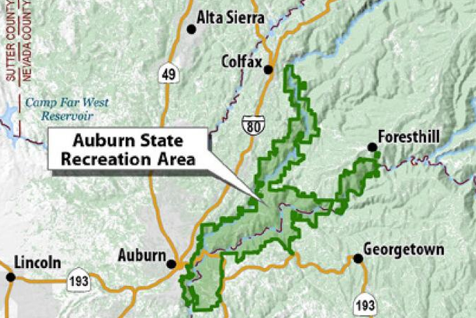
Park Superintendent Mike Howard said that the trail bridge and camping proposal has sparked concerns about increased fire danger, particularly from residents of areas in Auburn perched on the canyon rim.
Some of that concern has dissipated after residents learned that an alternative proposal for camping facilities at China Bar on the Auburn side of the American River had already been removed because of public input, Howard said.

That left some people to still express concerns about a bridge being built over the river and bringing more traffic onto the Auburn side. Howard said that environmental studies will be taking place through 2019 and one of the impacts to be looked at will be fire mitigation.

The Auburn-to-Cool bridge would mark a return of sorts to foot traffic below Auburn. A diversion tunnel for the American River was built as part of Auburn dam construction, allowing hikers, runners and horses to cross over the river from El Dorado County to Placer County. The river was daylighted a decade ago and the tunnel closed off but the Placer County Water Agency pledged $600,000 to help fund a bridge.

The second bridge being considered would be on the middle fork American River at the former Greenwood Bridge site. The Greenwood Bridge — then a vehicle crossing — was washed out when an upstream dam collapsed in 1964.

Plans for the Knickerbocker Flat area across the river from Auburn include up to 50 individual campsites.
“The river is clearly a natural fire break (to Auburn-area fire concerns),” Howard said.

A statewide goal of the Parks Department is to increase camping opportunities, he said. In all, the draft proposal is considering 245 more individual campsites and five group sites.

The online questionnaire can be accessed at opentownhall.com/6431

To see the original article and pictures in the Auburn Journal newspaper, CLICK HERE.


Comments are closed.

    Archives

    November 2025
    October 2025
    September 2025
    August 2025
    July 2025
    June 2025
    May 2025
    April 2025
    March 2025
    February 2025
    January 2025
    December 2024
    November 2024
    October 2024
    September 2024
    August 2024
    July 2024
    June 2024
    May 2024
    April 2024
    March 2024
    February 2024
    January 2024
    December 2023
    November 2023
    October 2023
    September 2023
    August 2023
    July 2023
    June 2023
    May 2023
    April 2023
    March 2023
    February 2023
    January 2023
    December 2022
    November 2022
    October 2022
    September 2022
    August 2022
    July 2022
    June 2022
    May 2022
    April 2022
    March 2022
    February 2022
    January 2022
    December 2021
    November 2021
    October 2021
    September 2021
    August 2021
    July 2021
    June 2021
    May 2021
    April 2021
    March 2021
    February 2021
    January 2021
    December 2020
    November 2020
    October 2020
    September 2020
    August 2020
    July 2020
    June 2020
    May 2020
    April 2020
    March 2020
    February 2020
    January 2020
    December 2019
    November 2019
    October 2019
    September 2019
    August 2019
    July 2019
    June 2019
    May 2019
    April 2019
    March 2019
    February 2019
    January 2019
    December 2018
    November 2018
    October 2018
    September 2018
    August 2018
    July 2018
    June 2018
    May 2018
    April 2018
    March 2018
    February 2018
    January 2018
    December 2017
    November 2017
    October 2017
    September 2017
    August 2017
    July 2017
    June 2017
    May 2017
    April 2017
    March 2017
    February 2017
    January 2017
    December 2016
    November 2016
    October 2016
    September 2016
    August 2016
    July 2016
    June 2016
    May 2016
    April 2016
    March 2016
    February 2016
    January 2016
    December 2015
    November 2015
    October 2015
    September 2015
    August 2015
    July 2015

    Categories

    All

    RSS Feed

Home
Contact
 Mother Lode Trails is YOUR local volunteer-run trail information and resource website. Here you can find
up-to-the minute information on trail alerts, links and trail news for Placer,  Yuba, and Nevada counties.
Mother Lode Trails is trademarked.