BEAR YUBA LAND TRUST is excited to see the Pines to Mines project move forward after years of careful planning and collaboration with many partners. When complete, the trail will be 72 miles in length, and will include 50 miles of existing forest service trails and 22 miles of new trail construction, connecting Truckee to Nevada City.
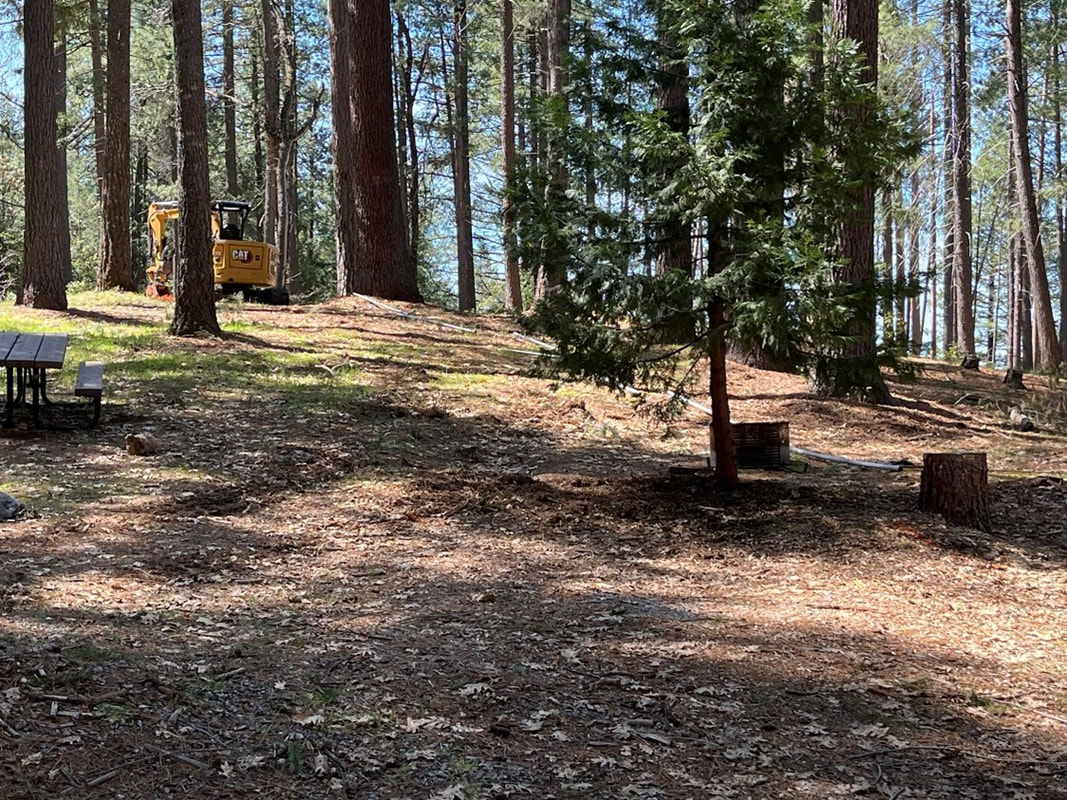
Crew is set to break ground on the ‘missing link’ section from Hole in the Ground to Spaulding Lake Trail this 2024 trail season. In addition to the 'missing link' section, BYLT is also working to secure a trail alignment between Harmony Ridge and Sugarloaf Trail that will complete the trail connection to Nevada City, as well as leading a bridge project on the Spaulding Lake Trail that would allow hikers, bikers, and equestrians safe, year-round access to the trail.
For more on Pines to Mines, check out Sierra Rec magazine's feature here.
https://sierrarecmagazine.com/article/truckee-pines-to-mines-trail/
Unveiling the Pines to Mines Trail – The Missing Link Connecting Truckee to Nevada CityIn the heart of the Sierra Nevada, where rugged peaks meet sprawling forests and crystalline lakes, a new adventure is about to unfold. The Truckee Trails Foundation, in collaboration with the United States Forest Service, Nevada County, Bear Yuba Land Trust, and Bicyclists of Nevada County, (not mentioned is the Gold Country Trails Council - from Mother Lode Trails) is on the brink of realizing a long-awaited dream—a trail that will bridge the gap between Truckee and Nevada City, aptly named the Pines to Mines Trail.
Shovel Ready for Adventure
Spanning 72 miles of breathtaking terrain, the Pines to Mines Trail is set to become a haven for outdoor enthusiasts seeking the ultimate backcountry experience. With 50 miles of existing Forest Service trails already in place, the final 22 miles of new construction will seamlessly connect these trails into a cohesive network, promising an unforgettable journey to the heart of the Sierra.
For years, the vision of a long-distance trail linking both ends of Nevada County has fueled the dedication of trail advocates and outdoor enthusiasts alike. Now, with funding secured and environmental studies complete, the stage is set for groundbreaking in 2024. The anticipation is palpable as the community eagerly awaits the realization of this ambitious project.
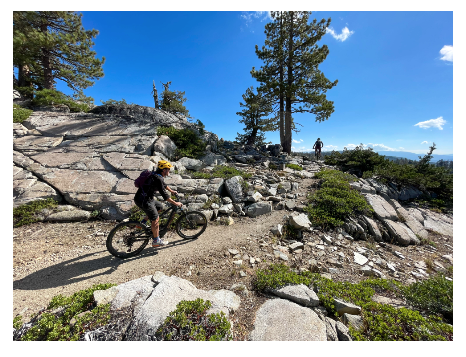
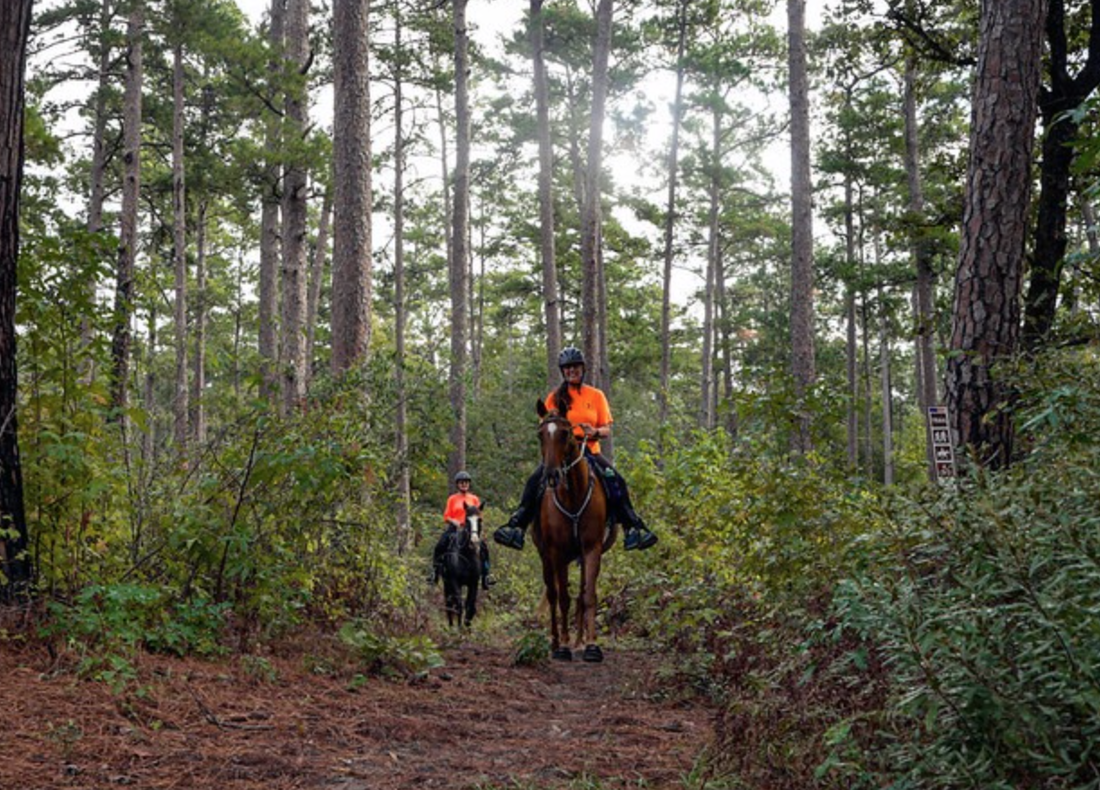
A Trail for All SeasonsThe Pines to Mines Trail promises something for everyone, catering to hikers, runners, mountain bikers, and horseback riders alike. From leisurely day hikes to challenging multi-day backpacking expeditions, the trail offers a diverse range of experiences against the backdrop of stunning vistas and varied terrain.
As adventurers traverse the trail, they’ll encounter a tapestry of landscapes, from the tranquil shores of Donner Lake to the rugged peaks of the Sierra Crest. Along the way, historic towns and pristine wilderness converge, offering a glimpse into the rich history of Nevada County’s heritage.
Beyond the Trail
But the Pines to Mines Trail is more than just a pathway through the wilderness—it’s a catalyst for community engagement and active lifestyles. With local restaurants and breweries awaiting weary travelers at either end of the trail, the journey is as much about camaraderie and celebration as it is about exploration.
Moreover, the trail holds the promise of economic revitalization, drawing visitors from far and wide to experience the unparalleled beauty of the Sierra Nevada. By fostering a deeper connection to nature and promoting outdoor recreation, the trail embodies the spirit of stewardship and conservation that defines the Sierra communities.
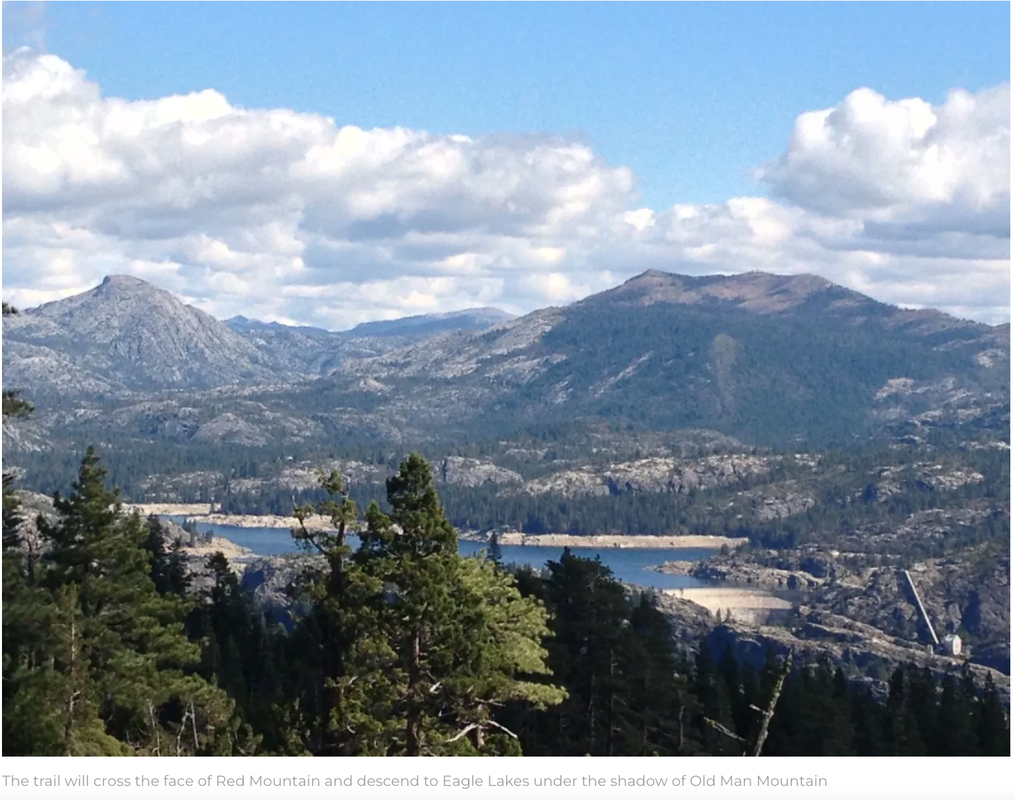
The trail will cross the face of Red Mountain and descend to Eagle Lakes under the shadow of Old Man Mountain
A Trail to Remember
As we stand on the cusp of a new chapter in Sierra exploration, the Pines to Mines Trail beckons us to embark on a journey of discovery and adventure. From Truckee to Nevada City, through towering forests and across alpine meadows, the trail invites us to forge connections, create memories, and experience the magic of the Sierra in all its splendor.
Join us as we countdown to groundbreaking in 2024 and witness the birth of a trail that will leave an indelible mark on the landscape and in the hearts of all who traverse its path. The Pines to Mines Trail—where adventure awaits around every bend, and the spirit of the Sierra comes alive. With this new trail, bikepackers and long-distance hikers will not only have the opportunity to connect to iconic routes like the Pacific Crest Trail and the Tahoe Rim Trail but also to the Tahoe to Pyramid Lake Trail. This connection opens up the possibility for a complete Sierra crossover adventure, stretching from Nevada City to Pyramid Lake in Nevada, offering an unparalleled journey through the diverse landscapes of the Sierra Nevada range.
Truckee Trails Project Engineer Larry Lehman scouting the missing link section with Devil’s Peak in the background.
Crew is set to break ground on the ‘missing link’ section from Hole in the Ground to Spaulding Lake Trail this 2024 trail season. In addition to the 'missing link' section, BYLT is also working to secure a trail alignment between Harmony Ridge and Sugarloaf Trail that will complete the trail connection to Nevada City, as well as leading a bridge project on the Spaulding Lake Trail that would allow hikers, bikers, and equestrians safe, year-round access to the trail.
For more on Pines to Mines, check out Sierra Rec magazine's feature here.
https://sierrarecmagazine.com/article/truckee-pines-to-mines-trail/
Unveiling the Pines to Mines Trail – The Missing Link Connecting Truckee to Nevada CityIn the heart of the Sierra Nevada, where rugged peaks meet sprawling forests and crystalline lakes, a new adventure is about to unfold. The Truckee Trails Foundation, in collaboration with the United States Forest Service, Nevada County, Bear Yuba Land Trust, and Bicyclists of Nevada County, (not mentioned is the Gold Country Trails Council - from Mother Lode Trails) is on the brink of realizing a long-awaited dream—a trail that will bridge the gap between Truckee and Nevada City, aptly named the Pines to Mines Trail.
Shovel Ready for Adventure
Spanning 72 miles of breathtaking terrain, the Pines to Mines Trail is set to become a haven for outdoor enthusiasts seeking the ultimate backcountry experience. With 50 miles of existing Forest Service trails already in place, the final 22 miles of new construction will seamlessly connect these trails into a cohesive network, promising an unforgettable journey to the heart of the Sierra.
For years, the vision of a long-distance trail linking both ends of Nevada County has fueled the dedication of trail advocates and outdoor enthusiasts alike. Now, with funding secured and environmental studies complete, the stage is set for groundbreaking in 2024. The anticipation is palpable as the community eagerly awaits the realization of this ambitious project.
A Trail for All SeasonsThe Pines to Mines Trail promises something for everyone, catering to hikers, runners, mountain bikers, and horseback riders alike. From leisurely day hikes to challenging multi-day backpacking expeditions, the trail offers a diverse range of experiences against the backdrop of stunning vistas and varied terrain.
As adventurers traverse the trail, they’ll encounter a tapestry of landscapes, from the tranquil shores of Donner Lake to the rugged peaks of the Sierra Crest. Along the way, historic towns and pristine wilderness converge, offering a glimpse into the rich history of Nevada County’s heritage.
Beyond the Trail
But the Pines to Mines Trail is more than just a pathway through the wilderness—it’s a catalyst for community engagement and active lifestyles. With local restaurants and breweries awaiting weary travelers at either end of the trail, the journey is as much about camaraderie and celebration as it is about exploration.
Moreover, the trail holds the promise of economic revitalization, drawing visitors from far and wide to experience the unparalleled beauty of the Sierra Nevada. By fostering a deeper connection to nature and promoting outdoor recreation, the trail embodies the spirit of stewardship and conservation that defines the Sierra communities.
The trail will cross the face of Red Mountain and descend to Eagle Lakes under the shadow of Old Man Mountain
A Trail to Remember
As we stand on the cusp of a new chapter in Sierra exploration, the Pines to Mines Trail beckons us to embark on a journey of discovery and adventure. From Truckee to Nevada City, through towering forests and across alpine meadows, the trail invites us to forge connections, create memories, and experience the magic of the Sierra in all its splendor.
Join us as we countdown to groundbreaking in 2024 and witness the birth of a trail that will leave an indelible mark on the landscape and in the hearts of all who traverse its path. The Pines to Mines Trail—where adventure awaits around every bend, and the spirit of the Sierra comes alive. With this new trail, bikepackers and long-distance hikers will not only have the opportunity to connect to iconic routes like the Pacific Crest Trail and the Tahoe Rim Trail but also to the Tahoe to Pyramid Lake Trail. This connection opens up the possibility for a complete Sierra crossover adventure, stretching from Nevada City to Pyramid Lake in Nevada, offering an unparalleled journey through the diverse landscapes of the Sierra Nevada range.
Truckee Trails Project Engineer Larry Lehman scouting the missing link section with Devil’s Peak in the background.
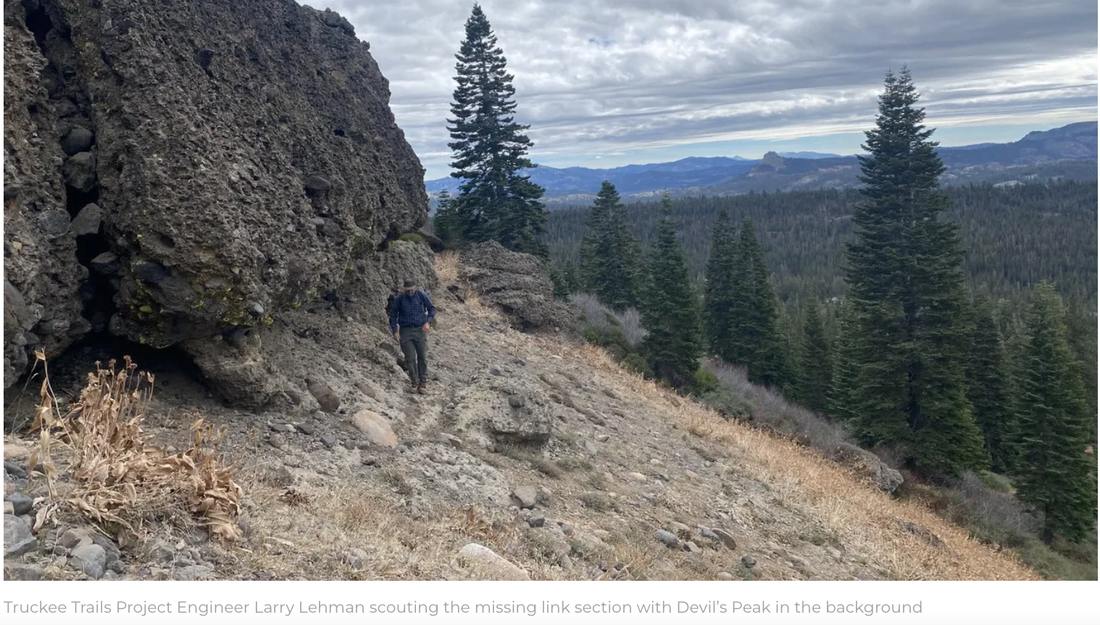
PHOTO CREDITS: SIERRA REC MAGAZINE. To see the full article and all the photos, go here:
sierrarecmagazine.com/article/truckee-pines-to-mines-trail/
sierrarecmagazine.com/article/truckee-pines-to-mines-trail/


 RSS Feed