June is historically high time for Folsom Lake recreation, as the Sierra Nevada snowpack "water bank" empties the vault under the spring sun. Folsom boat launches are regular bee hives in June, while teen sunbathers crowd Granite Beach.
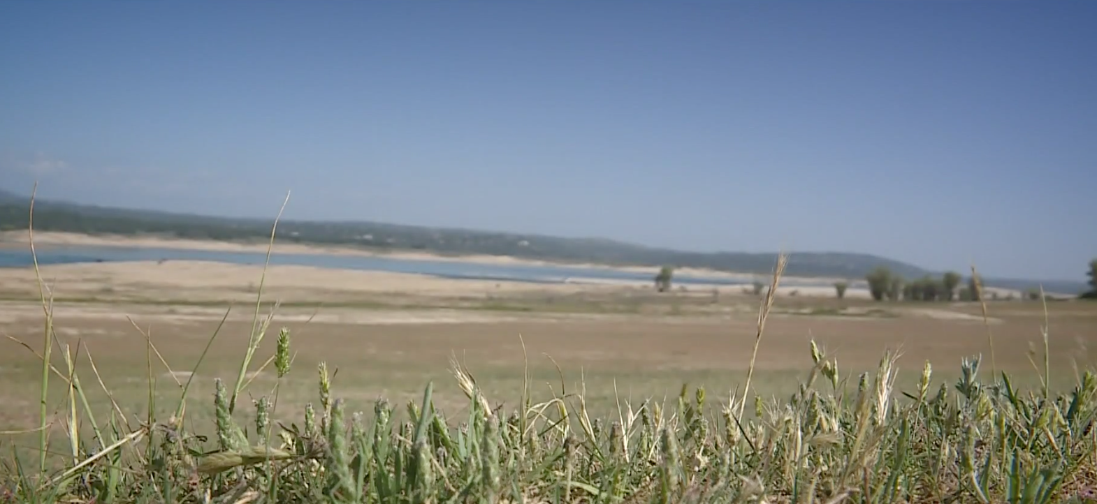
But a second weak snowpack in a row puts the 63-year-old reservoir in dire straits, the lowest point this time of year since the 1977 drought. Granite Beach is high and dry, with the water's edge a good hike or car ride down the hillside.
As of this week, Folsom fell to 393 feet above sea level, or roughly 42 percent of normal, 35-percent capacity. During a normally wet precipitation year, the lake level peaks this month in the 460-foot range.
"They should never let it drain that far down," said Adelus Galus of Roseville in an online lake forum. "Very frustrating."
Just two years ago in 2019, the lake reached 464 feet in early June, after a record-breaking snowfall season. Even with the weak snowpack and runoff last year, the lake still managed to reach a somewhat healthy 449 feet last June.
This year, the reservoir already peaked a month ago May 18 at a disappointing 398 feet. Any lower isn't unknown territory, however. The Folsom water level plunged to 381 feet in late January.
Only two of Folsom's state park boat launches were still in operation as of last weekend - Granite Bay on the Placer County, American River North Fork shore and Brown's Ravine on the El Dorado County South Fork branch.
The low levels also forced a 5-mph speed limit since January on the remaining lake for those hearty boaters who decide to rough it and haul their craft down dusty, makeshift dirt roads to the distant, last launches.
Folsom Lake capacity is 977,000 acre-feet, with June normally reaching 80 to 90 percent. When full, the reservoir features 75 miles of shoreline with enough water to cover the state of Rhode Island with one and a half feet of water.
Throughout last spring, the snowpack above in the upper American River watershed showed signs pointing toward a "near normal" year. Snow was measured at 83 percent as late as April at Phillips Station or a reasonable flux of average.
Phillips Station is up near Echo Summit at the American River South Fork source, which feeds the reservoir. The American River North and Middle forks feed the Placer northwestern branch.
The State Department of Water Resources measurement at Phillips Station is widely used in the media as an annual harbinger of the entire Sierra runoff. But the South Tahoe area location turned out to be a strange anomaly this year compared to the rest of the mountain range. Surrounding snow totals in the North Tahoe region dipped to 70 percent.
Even that lower amount would still normally top off Folsom Lake much higher than where it peaked already. But as some experts loosely predicted, nearly three quarters of a million acre-feet of Sierra runoff literally disappeared on the way down the hill.
The melt never showed up because it failed to rain much last fall in order to soak the Sierra soil before snow fell, state officials said. So a good portion of the runoff went straight down into the ground. Another substantial portion simply evaporated along the way down under late spring warm temperatures, authorities said.
As of this week though, Folsom Lake State Recreation Area park entrances remained open to vehicle traffic at Rattlesnake Bar near Loomis, plus Granite Bay and Beals Point on the Placer County side. Beals includes a 69-site overnight campground.
The Folsom Point, Brown's Ravine (Folsom Lake Marina), Darrington Trailhead, Skunk Hollow, Salmon Falls, Old Salmon Falls, Peninsula and Mormon Island entrances on the El Dorado side also remain open.
Down below Folsom Dam on Lake Natoma, the Willow Creek, Negro Bar, Nimbus Flat, CSUS Aquatic Center, Park Shore, Nimbus Overlook and Shadow Glen parks in Sacramento County remain open.
The day-use facilities and restrooms are open at all the above locations. The three campgrounds at Beals Point, Peninsula and Negro Bar are also still open, officials said.
CLICK HERE to see the original article in Gold Country Media.
 RSS Feed