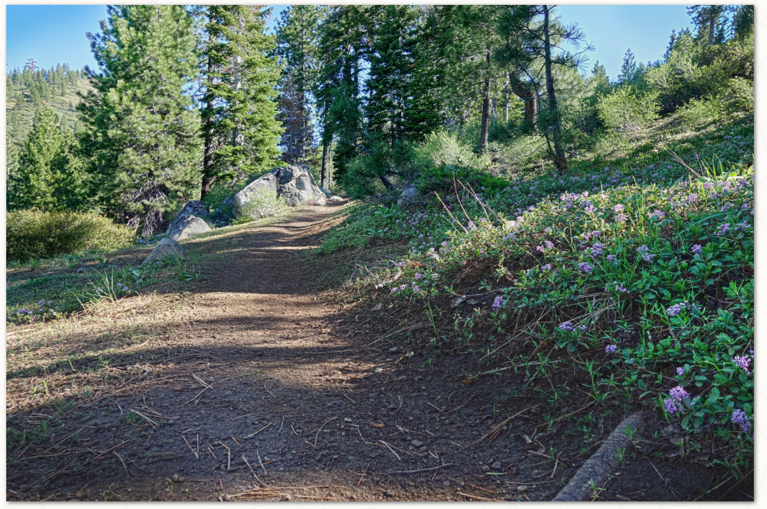
As the massive snows of the winter of 2018-19 finally melt out of the Sierra, Wendin Way is a great trail to start exploring higher elevations to see how spring (even after the first day of summer) is progressing. Right now tobacco brush, mahala mat and manzanita are blooming, with mule's ear, lupin and paintbrush starting as well.
The trail starts above Donner Lake, winding through pine, mountain alder, willows and cottonwood. As you start out, you'll see a Truckee River Watershed Council project to help restore the watershed which serves as the headwaters of Gregory Creek draining down to Donner Lake, and up high, all the melting snow from the big winter is feeding springs that will spawn thick colonies of tall bracken fern along the trail later in the summer.
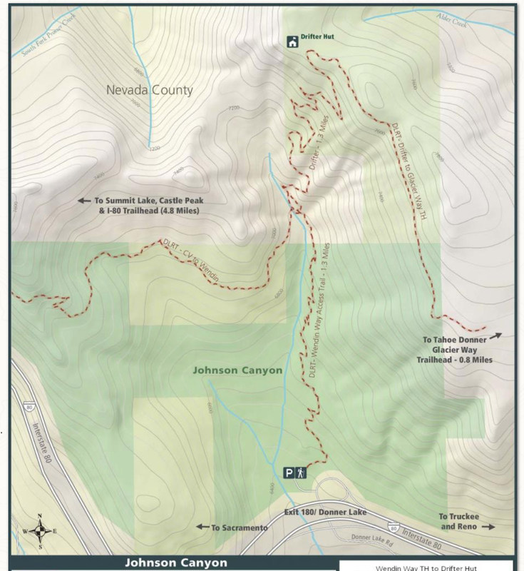
Around each corner you'll enjoy different views of Donner Ridge, Donner Lake and the Sierra Crest beyond, still covered in snow. Continuing uphill, the 1.3-mile trail eventually connects with the Donner Lake Rim Trail, though snow drifts still exist if you choose to go higher.
The trail is open to hikers, bikers and equestrians and the climb is a steady 500 feet of elevation gain before joining with the Donner Lake Rim Trail.
How to get there:
Take the Donner Lake Exit on Interstate 80. At the bottom of the ramp, head uphill about 300 yards to the trailhead where there is a parking area with informational kiosks and a map.
CLICK HERE to see the original article and photos from the Tahoe Donner Land Trust newsletter.
Click here for a map and more information.
The trail starts above Donner Lake, winding through pine, mountain alder, willows and cottonwood. As you start out, you'll see a Truckee River Watershed Council project to help restore the watershed which serves as the headwaters of Gregory Creek draining down to Donner Lake, and up high, all the melting snow from the big winter is feeding springs that will spawn thick colonies of tall bracken fern along the trail later in the summer.
Around each corner you'll enjoy different views of Donner Ridge, Donner Lake and the Sierra Crest beyond, still covered in snow. Continuing uphill, the 1.3-mile trail eventually connects with the Donner Lake Rim Trail, though snow drifts still exist if you choose to go higher.
The trail is open to hikers, bikers and equestrians and the climb is a steady 500 feet of elevation gain before joining with the Donner Lake Rim Trail.
How to get there:
Take the Donner Lake Exit on Interstate 80. At the bottom of the ramp, head uphill about 300 yards to the trailhead where there is a parking area with informational kiosks and a map.
CLICK HERE to see the original article and photos from the Tahoe Donner Land Trust newsletter.
Click here for a map and more information.
 RSS Feed