Nevada City, Calif. – The US Forest Service will conduct several prescribed hand, grapple, and machine pile burns across the Tahoe National Forest this Tuesday through Thursday, 12/3/19-12/5/19, and possibly continuing into the weekend.
The locations of these prescribed pile burns on the Tahoe National Forest include:
West Side (Highway 20 and 49 corridor; Foresthill, French Meadows; Downieville; Camptonville)
Sugar Pine Reservoir
Forks House Nature Trail
Mitchell Mine Road
Foresthill administrative sites
Big Trees day use area
North Bloomfield/Graniteville rd. east of Malakoff diggings
Marysville Road/Pendola (possible)
East Side (Highway 89 corridor; Donner Summit; Truckee; Sierraville)
Lake of the Woods
North-east of Independence Lake North-east Alder Creek Road
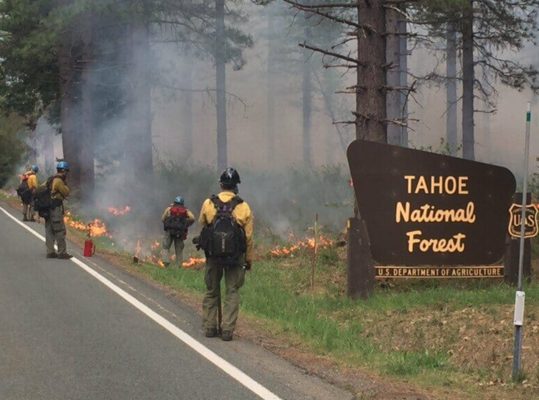
The overall goal of all prescribed fires within the Tahoe National Forest is to decrease the amount of fuels available to burn during a future wildfire. Other benefits include enhancing wildlife habitat and natural systems by reintroducing fire into a fire-dependent ecosystem. Reducing hazardous fuels through prescribed fire activities is the most effective and cost-efficient treatment that influences future fire behavior and suppression success while also increasing forest health.
Fall, winter, and spring bring cooler temperatures and precipitation, which favor prescribed burning. Each prescribed fire operation follows a prescribed fire burn plan that considers temperature, humidity, wind, moisture of the vegetation, available personal, and conditions for the dispersal of smoke. This information is used to decide when and where to burn. The Tahoe national Forest strives to provide as much advance notice as possible before prescribed fire activities, but some operations may be conducted on short notice. Fire personnel closely patrol prescribed fire areas during ignition and for several days after.
Smoke from prescribed fire operations is normal and may continue for several days after an ignition depending on the project size and environmental conditions. Smoke may settle into the valleys in the evening and lift in the morning. The Tahoe National Forest coordinates with state and local county air pollution control districts and monitors weather conditions closely before prescribed fire ignition. Crews also conduct test burns before igniting a larger area to verify how effectively fuels are consumed and how smoke will travel.
To see complete article in YUBANET.NET, click here.
The locations of these prescribed pile burns on the Tahoe National Forest include:
West Side (Highway 20 and 49 corridor; Foresthill, French Meadows; Downieville; Camptonville)
Sugar Pine Reservoir
Forks House Nature Trail
Mitchell Mine Road
Foresthill administrative sites
Big Trees day use area
North Bloomfield/Graniteville rd. east of Malakoff diggings
Marysville Road/Pendola (possible)
East Side (Highway 89 corridor; Donner Summit; Truckee; Sierraville)
Lake of the Woods
North-east of Independence Lake North-east Alder Creek Road
The overall goal of all prescribed fires within the Tahoe National Forest is to decrease the amount of fuels available to burn during a future wildfire. Other benefits include enhancing wildlife habitat and natural systems by reintroducing fire into a fire-dependent ecosystem. Reducing hazardous fuels through prescribed fire activities is the most effective and cost-efficient treatment that influences future fire behavior and suppression success while also increasing forest health.
Fall, winter, and spring bring cooler temperatures and precipitation, which favor prescribed burning. Each prescribed fire operation follows a prescribed fire burn plan that considers temperature, humidity, wind, moisture of the vegetation, available personal, and conditions for the dispersal of smoke. This information is used to decide when and where to burn. The Tahoe national Forest strives to provide as much advance notice as possible before prescribed fire activities, but some operations may be conducted on short notice. Fire personnel closely patrol prescribed fire areas during ignition and for several days after.
Smoke from prescribed fire operations is normal and may continue for several days after an ignition depending on the project size and environmental conditions. Smoke may settle into the valleys in the evening and lift in the morning. The Tahoe National Forest coordinates with state and local county air pollution control districts and monitors weather conditions closely before prescribed fire ignition. Crews also conduct test burns before igniting a larger area to verify how effectively fuels are consumed and how smoke will travel.
To see complete article in YUBANET.NET, click here.
 RSS Feed