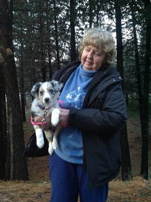
Photo Credit: Donna Furlow. Donna Williams with her favorite dog, Pepper.
Donna Williams (Nov. 13, 1942 - April 8, 2024)
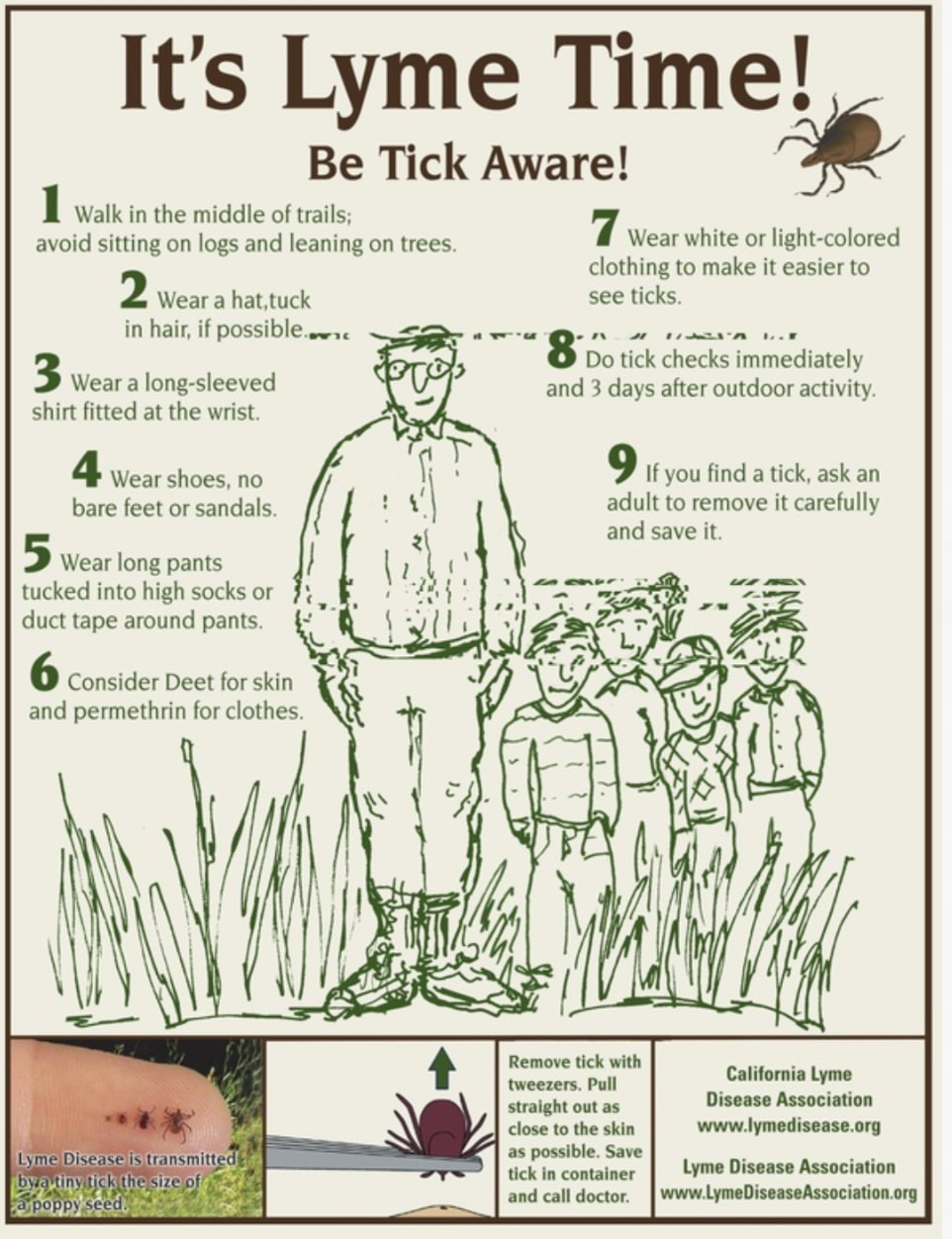
Many of you knew Donna Williams and her smile, saying, "Hey, kid!" when she saw you on the trail, and then would ask if you could help that weekend clearing trail or weed whacking or attend a trail comment meeting.
For over 40 years, Donna shared her passion for equestrian trails and public lands with others. She had a quiet strength and never gave up on fighting for something she felt was right. She was instrumental in keeping the horse trails in Oroville SRA, she established the Sterling Pointe Equestrian Staging area and maintained it religiously, she rode for the Folsom Lake SRA Mounted Patrol and never missed a public comments meeting for those trails. And, what comments she wrote! Here is one requesting FERC restore the bridges and trails on the American River.
This letter entails everything who Donna was - please read it and be inspired!
https://relicensing.pcwa.net/var/www/html/public_html/documents/DLA//__Draft%20License%20Application%20-%20Comments%20Received/01_Donna%20Williams/Donna%20Williams%2020101013-0054.pdf
In addition to all that, she was a founder of ACE and particularly the Park Watch Report, which evolved into this current Mother Lode Trails resource website. She volunteered with the Sweep Riders of the Sierras, she has THREE Tevis buckles, established and helped maintain many miles of trails, all the while encourage others to do the same. She belonged to and volunteered her time to GCTC, LBHA, AERC and many other organizations.
She was a tireless advocate for public trails because she believed being in nature with our animals encourage the very best in us.
Personally, she mentored me for decades. She helped me establish the Emigrant Trail Conservancy, the Park Watch Report, and Mother Lode Trails. She encouraged me to use my technical talents to help organizations who advocate for the trails.
A friend said, "Donna was a perfect example of how one person can make a huge difference..." Donna will be missed by all who knew and were inspired by her.
Rest in peace and keep riding on the other side of the Rainbow Bridge, my dear friend and mentor.
Donna Williams (Nov. 13, 1942 - April 8, 2024)
Many of you knew Donna Williams and her smile, saying, "Hey, kid!" when she saw you on the trail, and then would ask if you could help that weekend clearing trail or weed whacking or attend a trail comment meeting.
For over 40 years, Donna shared her passion for equestrian trails and public lands with others. She had a quiet strength and never gave up on fighting for something she felt was right. She was instrumental in keeping the horse trails in Oroville SRA, she established the Sterling Pointe Equestrian Staging area and maintained it religiously, she rode for the Folsom Lake SRA Mounted Patrol and never missed a public comments meeting for those trails. And, what comments she wrote! Here is one requesting FERC restore the bridges and trails on the American River.
This letter entails everything who Donna was - please read it and be inspired!
https://relicensing.pcwa.net/var/www/html/public_html/documents/DLA//__Draft%20License%20Application%20-%20Comments%20Received/01_Donna%20Williams/Donna%20Williams%2020101013-0054.pdf
In addition to all that, she was a founder of ACE and particularly the Park Watch Report, which evolved into this current Mother Lode Trails resource website. She volunteered with the Sweep Riders of the Sierras, she has THREE Tevis buckles, established and helped maintain many miles of trails, all the while encourage others to do the same. She belonged to and volunteered her time to GCTC, LBHA, AERC and many other organizations.
She was a tireless advocate for public trails because she believed being in nature with our animals encourage the very best in us.
Personally, she mentored me for decades. She helped me establish the Emigrant Trail Conservancy, the Park Watch Report, and Mother Lode Trails. She encouraged me to use my technical talents to help organizations who advocate for the trails.
A friend said, "Donna was a perfect example of how one person can make a huge difference..." Donna will be missed by all who knew and were inspired by her.
Rest in peace and keep riding on the other side of the Rainbow Bridge, my dear friend and mentor.

 RSS Feed