MOTHER LODE TRAILS
  • Home
  • About
  • Contact
  • Donations
  • Volunteer
  • Links
    • Law Enforcement Emergency
    • Federal, State, County Districts Parks & Trails
    • Running Clubs
    • Equestrian Clubs
    • Mt. Bike Clubs
    • Hiking Clubs
    • Trail Advocacy Organizations
    • Phone Numbers State & Federal Parks, Trails & Lands
    • Lost & Found on the Trails
    • Where to Eat on the Trails
  • News
  • Alerts

Suspect in Yuba River trailhead burglaries sentenced

1/29/2020

 
Picture
A woman arrested in connection with vehicle break-ins at the South Yuba River last spring has taken a plea agreement and was sentenced to 262 days in county jail with credit for time served.
Arraya Elizabeth Figueroa, 31, of North San Juan, pleaded no contest to four counts of second-degree burglary and will be on formal probation for three years with search and seizure terms that include possession of drugs.
Figueroa and Christian Aaron Davis, 28, of Auburn, were arrested March 17, 2019, after a California Highway Patrol officer pulled them over on Highway 49 at the Independence Trail. Reports stated their vehicle had expired license tags, and a search uncovered stolen items, burglary tools, drug paraphernalia, a replica firearm, and an official law enforcement uniform.
The couple and the vehicle matched the description of suspects on a number of break-ins at the Independence Trail trailhead parking area, the Hoyt Crossing trail head parking area and other locations within the South Yuba River State Park. Davis gave a false identity to officers and had multiple outstanding arrest warrants, according to reports.
Davis subsequently pleaded no contest in May 2019 to all four charges and was sentenced to one year in the Nevada County Jail, followed by four years’ mandatory supervision. He must stay away from Bridgeport, Purdon and Edwards crossing, Independence Trail and the South Yuba River at Highway 49. According to court records, those terms can be removed after he successfully serves one year of mandatory supervision.
To contact Staff Writer Liz Kellar, email lizk@theunion.com or call 530-477-4236.

CLICK HERE to see the original article in The Union newspaper.


Empire Mine Conlon Mine Trail "widow maker"

1/27/2020

 
Picture
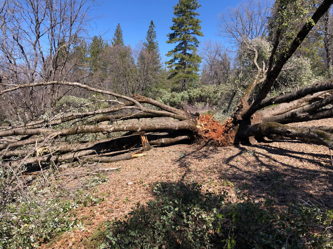
Today riding Empire Mine SHP Conlon Mine Trail loop, equestrians noticed a dangling limb over the trail. These limbs are called "widow makers" for good reason as even a light wind can knock them down out of the tree onto the trail users below.

In traveling the counter clockwise direction, this tree is just after the manzanita grove that has been severely cut back.

Olmstead - Salt Creek trail blocked by downed tree

1/26/2020

 
Picture
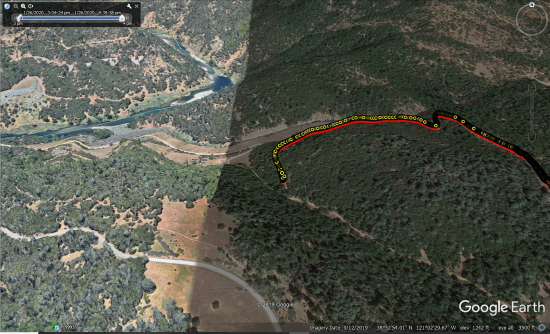
Tracey Bakewell posts that there is a tree down heading towards Salt Creek trail on Olmstead. If you are heading towards Salt Creek on Olmstead going counter-clockwise, almost reaching Salt Creek, trail is blocked. If you want to go down Salt Creek Trail, come at it clockwise. Park Watch Report filed. Screen shot is where riders turned back. 

Meandering the Beale Falls Trail

1/24/2020

 
Picture
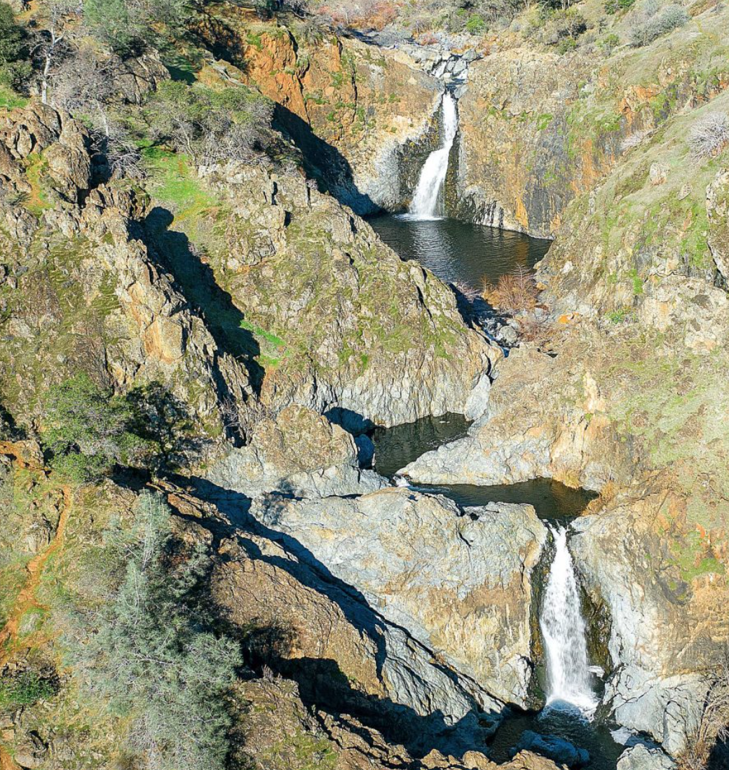
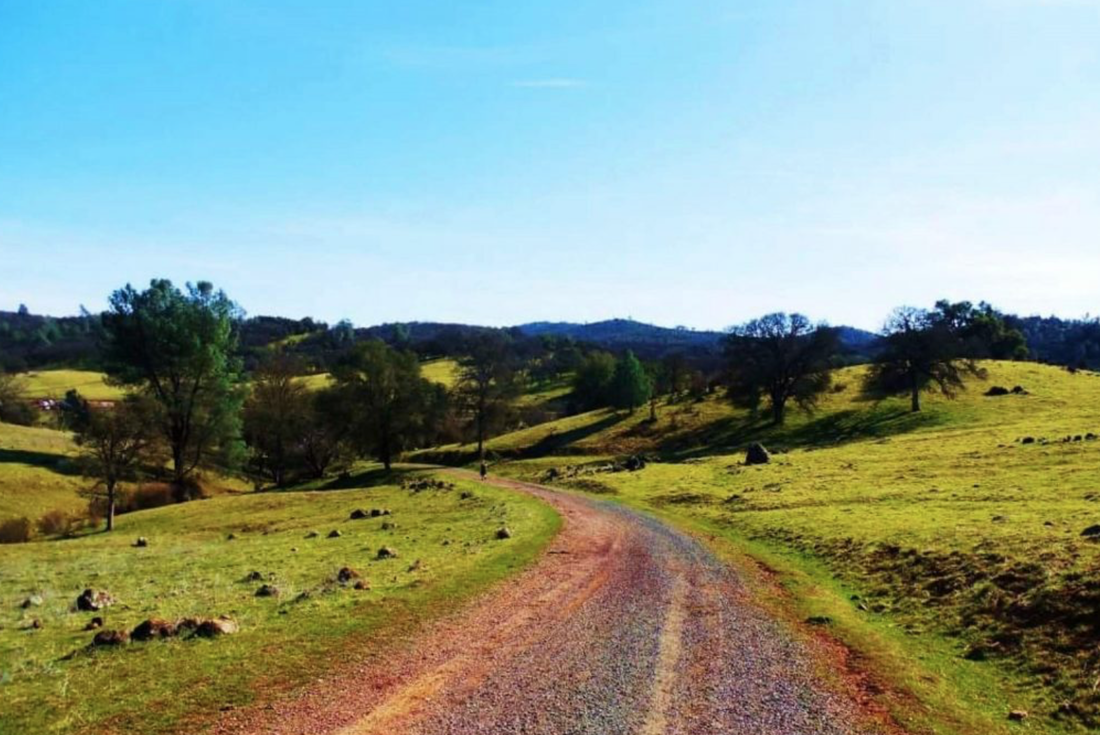
The drive out to Yuba County is worth it to enjoy the open spaces and waterfalls at Beale Falls. The falls get their name due to the proximity to Beale Air Force Base. Some call is Fairy Falls but whatever you call it, it is a lovely hike when the fields are green. (Photos credit: Mary West)

(From MLT: These Spenceville trails are also a favorite of horseback riders in the spring, when the wildflowers are in bloom.)

Just over five miles, this loop trail takes you over old pastureland. The property is well maintained making for good views through the oaks that dot the fields. This easy hike leads to three-tiers of waterfalls. The upper is fenced off at the steep drop off. The middle section is accessible if you don’t mind a little rock hopping and bouldering. The bottom section is easier to get to and the payoff is a nice swimming hole if you reach this destination in summer. I prefer to go while the fields are still green in winter and early spring.

From Interstate 80 east take the Highway 49 north exit toward Grass Valley. In Grass Valley take the Highway 20 exit toward Marysville. Just over the Yuba County line take the left onto Hammonton Smartsville Road. Left on Chuck Yeager. Turn left off the pavement onto Waldo Road and into the Wildlife area. There is a shooting range on your left, keep going. About two miles down the road you cross the creek. Left onto Spenceville Road. The parking area is on your left just short of the yellow gate at the end of the road.

Cross over the footbridge and head to the right through rolling hills along the creek. The trail opens into pastureland. You will turn right and go through a gate. Continue hiking across the cattle gate and take the upper or lower trail to begin the loop to the falls.

The 100-foot falls pool at the bottom before continuing into the creek that follows much of the trail. This is an easy to moderate trail with heavy use at its peak in spring.

-Mary West

Mary West is the author of the book series Day Hiker – Gold Country Trail Guide. The books are a collection of Day Hiker columns where West shares her longtime love of the outdoors, and favorite hikes in Northern California’s Gold Country and beyond (Available on Amazon). West was the recipient of the CRAFT Award in 2017 and 2019 for Best Outdoor Newspaper Column by the Outdoor Writers Association of California. You can follow West on Facebook and Instagram.

To see the complete article and all the photos, CLICK HERE.
Picture

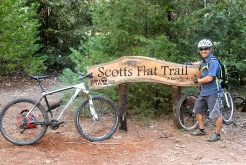
Trail workers requested at Scotts Flat trails by Bicyclists of Nevada County on Feb. 9, 2020

1/20/2020

 
Picture
Join Bicyclists of Nevada County (BONC) for a day of trail work on the Scotts Flat and Lakeside Trails at 9 a.m. Sunday, Feb. 9. All volunteers are to meet at parking lot for Scotts Flat Lake boat launch/campground. Please bring gloves, water, closed-toe shoes, your favorite trail tool (rakes, loppers, McLeods, etc.) and a lunch for yourself.

To volunteer or for more information,  CLICK HERE.

Auburn Cycling mt. bike rides every two weeks Hidden Falls

1/13/2020

 
Picture
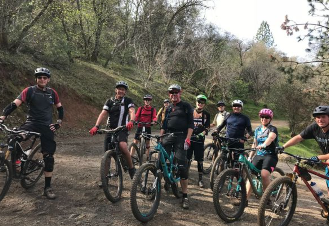
Starting Friday, January 17, 2020, noon to 2:00 PM and every 2 weeks thereafter on Fridays.The ride will be about 2-3 hours and vary from week to week, the pace will be strong beginner/intermediate depending on the group. Ride will be 10-15 miles depending on the group.  Mountain Bike, Single Speed or Cross Bike. Photo credit Auburn Cycling MeetUp.
Meet in the parking lot at Hidden Falls. Any questions/problems/running behind call or text Steve Smollen 916-539-0386
CLICK HERE for the MeetUp group information.


Public Meetings – Managing Natural Fire for Multiple Resource Benefits on the Tahoe National Forest

1/9/2020

 
Picture
Nevada City, Calif. January 8, 2020 – The Tahoe National Forest will be hosting several public information meetings this month to discuss a proposed amendment to the Tahoe National Forest Land and Resource Management Plan. Presentations and discussions at the public meeting will cover:
  •  - The historic and present role of natural fire within the Tahoe National Forest
  •  - Details of the proposed amendment that would expand opportunities to use naturally ignited, lightning-caused wildfires (natural fire) to achieve multiple resource benefits
  •  - The process for amending the Tahoe National Forest Land and Resources Management Plan
  • ​
The Tahoe National Forest is initiating scoping for a proposed amendment to the Tahoe National Forest Land and Resource Management Plan that would expand opportunities for using natural fire to achieve multiple resource benefits, including enhancing forest resilience; reducing the risk for large, damaging wildfires; stabilizing carbon storage; improving watershed health and function; and protecting public health and safety.


Public Information Meeting Schedule
Truckee Ranger District 10811 Stockrest Springs Rd, Truckee, CA 96161 January 21, 2020 5:00 p.m. – 7:30 p.m.
Supervisor’s Office—Nevada City 631 Coyote St, Nevada City, CA 95959 January 23, 2020 5:00 p.m. – 7:30 p.m.
American River Ranger District 22830 Foresthill Rd, Foresthill, CA 95631 January 28, 2020 5:00 p.m. – 7:30 p.m.
Yuba River Ranger District 15924 Highway 49, Camptonville, CA 95922 January 29, 2020 1:00 p.m. – 4:30 p.m.
Sierraville Ranger District 317 South Lincoln St, Sierraville, CA 96126 January 30, 2020 5:00 p.m. – 7:30 p.m.  

For questions and comments, please contact
Joe Flannery, Tahoe National Forest Public Affairs Officer at (530) 478-6205 or joseph.flannery@usda.gov.

CLICK HERE to see the original article in YubaNet.com


California Loop on Western States Trail closed for repairs

1/6/2020

 
Picture
January 2 at 3:57 PM
Trail notice - please do not ride on California loop until further notice. There is an impassable slide about half way down trail near Peachstone creek and the trail is also not safe from Ford's bar to Sandy Bottoms due to trees down and erosion from winter storms. The trails team has trained trail stewards in place who are organizing to fix these locations and we will notify you when these repairs have been made.

As a reminder, El Dorado Canyon from Deadwood to El Dorado Creek is also not currently safe for horses until trail repairs have been made. Thank you for respecting the trails and staying safe.

If you would like to assist, we annually spend about $30,000 on trail maintenance and repairs. Winter and Spring are our busiest seasons clearing downed trees and repairing the trail bed as needed. We appreciate your support.

Please contact the Western States Trail Foundation for any further information or to support their organization.

    Archives

    April 2021
    March 2021
    February 2021
    January 2021
    December 2020
    November 2020
    October 2020
    September 2020
    August 2020
    July 2020
    June 2020
    May 2020
    April 2020
    March 2020
    February 2020
    January 2020
    December 2019
    November 2019
    October 2019
    September 2019
    August 2019
    July 2019
    June 2019
    May 2019
    April 2019
    March 2019
    February 2019
    January 2019
    December 2018
    November 2018
    October 2018
    September 2018
    August 2018
    July 2018
    June 2018
    May 2018
    April 2018
    March 2018
    February 2018
    January 2018
    December 2017
    November 2017
    October 2017
    September 2017
    August 2017
    July 2017
    June 2017
    May 2017
    April 2017
    March 2017
    February 2017
    January 2017
    December 2016
    November 2016
    October 2016
    September 2016
    August 2016
    July 2016
    June 2016
    May 2016
    April 2016
    March 2016
    February 2016
    January 2016
    December 2015
    November 2015
    October 2015
    September 2015
    August 2015
    July 2015

    Categories

    All

    RSS Feed

Home
Contact
 Mother Lode Trails is YOUR local non-profit trail information and resource website. Here you can find
up-to-the minute information on trail alerts, links and trail news for Placer, Nevada, El Dorado, Yuba and
Sacramento counties. Mother Lode Trails is trademarked.