MOTHER LODE TRAILS
  • Home
  • About
  • Contact
  • Volunteer
  • Links
    • Law Enforcement Emergency
    • Federal, State, County Districts Parks & Trails
    • Running Clubs
    • Equestrian Clubs
    • Mt. Bike Clubs
    • Hiking Clubs
    • Trail Advocacy Organizations
    • Phone Numbers State & Federal Parks, Trails & Lands
    • Lost & Found on the Trails
    • Where to Eat on the Trails
  • News
  • Alerts

"Where to Eat on the trails" section adds new restaurant

2/28/2020

 
Picture
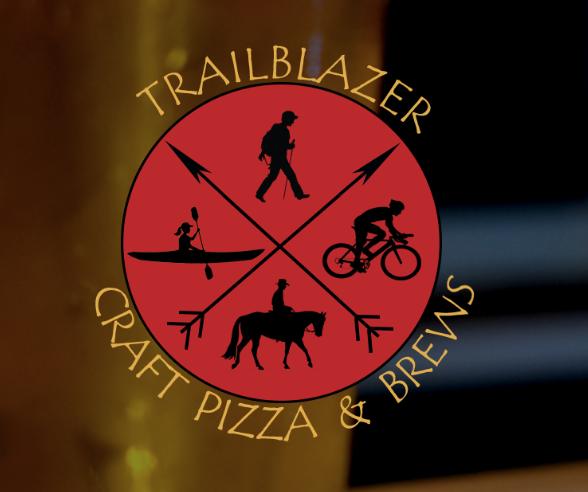
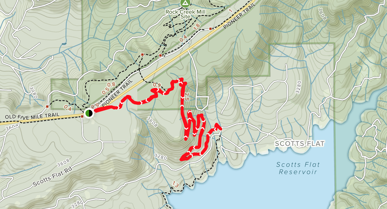
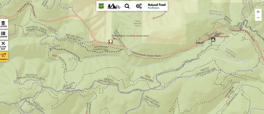
When you get off the trail, do you want to go home and cook? Or, do you want lots of reasonably priced, healthy food from an easy to find and highly recommended restaurant? Mother Lode Trails has several reference pages off the LINKS tab, and one of the most popular pages is "Where to Eat on the Trails." Our criteria is simple - has this restaurant been recommended by trail users. We added a new restaurant today, recommended by four trail users. And as you can see from the TrailBlazer logo and name, they LOVE us trail folks!

On the Mother Lode Trails webpage, click on the LINKS tab, then hover down to "Where to Eat on the Trails." The restaurants are listed by trail head locations. This new restaurant is listed under 
HIDDEN FALLS, EMPIRE MINE, HIGHWAY 49 AUBURN, GRASS VALLEY.

Here is the new entry:

TrailBlazer Craft Pizza and Brews - top notch made-from-scratch pizza with creative toppings, excellent burgers, gluten free selections. HUGE parking lot for rigs. Good wi-fi. Just a few feet off Highway 49 and Alta Sierra Drive intersection, take the first left on Johnson Place, 250 feet down on the left. 
4.5 stars. CLICK HERE FOR MENU

Spenceville WA closed for annual turkey hunt March 28 - April 5, 2020

2/27/2020

 
Picture
Spenceville's annual turkey hunt will close the park to all visitor entry during the first nine days of the spring turkey season (which starts on the last Saturday in March) except for special turkey permit holders. Photo courtesy of the National Wild Turkey Federation

​Opening Weekend this year is Saturday, March 28, 2020. Spenceville will remain closed to all others but special hunt permit holders from March 28 through Sunday, April 5, 2020.

For any questions call (530) 538-2236.

For more information, go to the website HERE.


Public comments OPEN today for Hidden Falls expansion project -  make YOUR voice heard

2/20/2020

 
Picture
Placer County has released a Draft Subsequent Environmental Impact Report (SEIR) for the project listed below:
PROPOSED PROJECT: Hidden Falls Regional Park Trails Expansion Project (PLN19-00187) (State Clearinghouse No. 2007062084)
PUBLIC REVIEW AND COMMENT PERIOD: February 20, 2020 through April 20, 2020
PROJECT LOCATION: The proposed trail expansion areas are located northeast, east and west of the existing Hidden Falls Regional Park (HFRP), and south of the Bear River in Placer County, approximately 40 miles northeast of Sacramento.
PROJECT DESCRIPTION: The County is proposing to expand the HFRP natural-surface, multi-use trail network onto approximately 2,765 additional acres of land owned by the Placer Land Trust (where the County holds trail easement rights), or owned by the County or where the County owns easements. Approximately 30 miles of trails (including existing and proposed trails) within the expansion areas would be added to the 30+/-miles of existing trails within the existing park boundary. Three new parking areas and an additional overflow area within the existing HFRP parking area are also proposed, as well as other amenities such as bridges, overlooks, picnic benches and tables, restrooms, drinking fountains and equestrian amenities.
SIGNIFICANT ENVIRONMENTAL EFFECTS: The Draft SEIR identified potentially significant project impacts with respect to Visual Impacts to Garden Bar Road and increases in Vehicle Miles Traveled (VMT) in the Existing Plus Project and Cumulative Plus Project scenarios. These impacts were found to be significant and unavoidable.
PUBLIC MEETINGS: The following public meeting will be held during the public review period to receive comments on the Draft EIR:
  March26,2020–  10:00 AM
Placer County Planning Commission
3091 County Center Drive, Auburn, California.
Meeting begins at 10:00 a.m.

The Placer County Planning Commission meeting will begin at 10:00 a.m.; however, the proposed project is not time certain. Please refer to the meeting agendas at the following link up to 1 week prior to the meetings for updated information: https://www.placer.ca.gov/AgendaCenter/Planning-Commission-53

WHERE DRAFT SEIR MAY BE REVIEWED: The Draft SEIR is available for review during normal business hours at the Auburn Library (350 Nevada Street), Lincoln Library (485 Twelve Bridges Drive), the Placer County Community Development Resource Agency offices in Auburn (3091 County Center Drive) and the County Clerk-Recorder’s Office (2954 Richardson Drive, Auburn). The Draft SEIR is also available online at:
https://www.placer.ca.gov/2537/Hidden-Falls-Regional-Park-Trail-Network

SEND WRITTEN COMMENTS TO: Placer County Community Development Resource Agency, Environmental Coordination Services, 3091 County Center Drive, Suite 190, Auburn, CA 95603; or fax (530) 745-3080; or email cdraecs@placer.ca.gov no later than 5:00 p.m. on April 20, 2020.

Comments received during the public review period (February 20, 2020 through April 20, 2020) will be responded to in the Final SEIR.
For more information on the project, please contact Parks Administrator Andy Fisher at (530) 889-6819.

To see this notice, go here:
https://www.placer.ca.gov/DocumentCenter/View/42752/Notice-of-Availability-of-Draft-SEIR-PDF

Major renovations to Negro Bar from February to October 2020

2/16/2020

 
Picture
California State Parks announces the start of a major renovation project that will improve recreation facilities at the Negro Bar unit of the Folsom Lake State Recreation Area (SRA) beginning on February 2020. 

The renovation project will include:
  • New interpretive panels that highlight the area’s historic, natural and cultural resources.
  • ADA accessible walkways to the swim beach.
  • New stairway access to the beach.
  • A new restroom facility.
  • A new paddle sport concession facility and Junior Lifeguard facility.
  • Improved picnic facilities with picnic tables, shade ramadas, barbecues, trashcans, and additional group picnic sites.
  • Converting an existing gravel area into additional paved parking. 

The renovation project is expected to last through October 2020 and will impact access to the swim beach area and day-use parking facilities in the western portion of the park.
​

Those areas not impacted will be the launch ramp, main parking area, horse assembly area, group campground facilities and trail access to the American River Bike Trail.
​

For questions about this project, please contact California State Parks’ Gold Fields District Office at (916) 988-0205

CLICK HERE to see announcement from Folsom Lake State Recreation area webpage.

Buttermilk Bend (Independence) Trail still closed

2/15/2020

 
Picture
The east side of the Independence Trail, east of Highway 49, above the 49 crossing at South Yuba River State Park is still closed. It is due to open next month. 
A historic flume that acts as a bridge, has a failed support beam and is undercut by continuous instability in the hillside. This particular location was closed a few times in the past two years due to landslides associated with the winter 2017-18 storms.

Closure signs are posted at the trail. Please stay off this trail for your safety.

​
Thank you for your patience and understanding.
South Yuba River Park Association

Scotts Flat Trail will be closed on NID property from Feb. 17-21

2/15/2020

 
Picture
The Scotts Flat Trail will be closed from Monday (Feb. 17) through Friday, (Feb. 21) on Nevada Irrigation District property while mastication work is done to remove fire fuels, according to a press release.

NID is using mastication as an effective fuel reduction treatment to reduce wildfire risk and return its forested property to natural conditions, the release states. The work includes the removal of hazardous trees and dense vegetation on NID’s property around Scotts Flat Reservoir. The work will improve forest health and reduce catastrophic fire risk on forested lands adjacent to the reservoir and to nearby residential communities, the release states.

“While the work is being done, the multi-use trail will be closed to bicyclists and hikers for their safety,” the release states. “NID thanks the public for patience and understanding.”

For questions about the closure, contact NID Environmental Resources Administrator Neysa King at 530-271-6733.

CLICK HERE to see original article in The Union newspaper.

After a three year closure officials to reopen American River Bike Trail Saturday

2/14/2020

 
Picture
After a three-year closure, officials have announced the reopening of the Jedediah Smith Memorial Trail along Lake Natoma.
Known best as the American River Bike Trail the long awaited opening will take place this Saturday, Feb. 15, according to a press release issued by California State Parks on Friday morning. Reopening this section of the trail will once again allow the recreating and commuting public to enjoy the north shore of Lake Natoma and the ability to trek completely around Lake Natoma.

The American River Bike Trail is part of Folsom Lake State Recreation Area’s (SRA) 19,500 acres. The park has 95 miles of trails for hikers, bicyclists, runners and horseback riders. A paved, mostly accessible bicycle trail loops around Lake Natoma, linking Beals Point and the American River Bike Trail.

A large landslide covered portions of the American River Bike Trail, located between Nimbus Dam and the Negro Bar area of Folsom Lake SRA, during the winter storms of January and February 2017. In late August of 2019, the U.S. Bureau of Reclamation in partnership with State Parks initiated repairs by removing the debris that covered the trail as a result of those storms.
​
The second phase of the project utilized a geotechnical contractor to scale a portion of the bluff to remove loose rock from the face of the bluff directly above the trail. Following the scaling, crews removed the additional debris and repaved the damaged sections of the trail.

State Parks thanks the public for their patience and understanding as it worked with its partners to reopen this popular trail for everyone’s enjoyment.

As with any outdoor activity, State Parks encourages its visitors to practice safe and environmentally-sound practices such as staying on designated trails, leaving no trace, controlling your speed and always wearing a helmet.

Detailed information on Folsom Lake State Recreation Area can be found online at www.parks.ca.gov/FolsomLakeSRA.

Go HERE to see the original article and photos in the Folsom Telegraph newspaper.

Spenceville WA...the road has been graded!

2/14/2020

 
Picture
Update on Spenceville Wildlife Area: loads of cattle, green grass is peeking through, the creeks are low, the trails are dry. And...THE ROAD HAS BEEN GRADED!

Thank you to the equestrians who rode there today for this update, and the beautiful picture.


E-Bike policy on federal lands database now available

2/13/2020

 
Picture
The controversial E-bike (electric motorized bike) policy is currently being developed for public lands managed by federal agencies. This newly accessible database covers all lands managed by:
  • National Park Service (by state and park)
  • Bureau of Land Management (by field offices)
  • ​Bureaus of Reclamation (by District)
  • Fish and Wildlife Service (by individual Refuge)
Select these TABS at the bottom of the spreadsheet to see each agencies list of parks and lands.

​You can access the database HERE.

Policies are literally all over the map, depending on the department and individual land manager. Access ranges from e-bikes not being allowed on any trails, to being allowed on motorized trails and roads but not on non-motorized trails,  to full  access where ever regular bikes are allowed. Also, e-bike access will depend on class of e-bike and some individual land managers.

There are loud objections to adding a new motorized user to non-motorized public trails, and the Dept. of Interior has been revealed to be secretly meeting with e-bike lobbyists for over a year. See article HERE entitled "E-bike industry "advisory group" violated federal law in secretly lobbying the National Park Service.

Because most of the plans were never publicly available and policies were put into place with no CEQA or environmental impact on the trails, or public comment allowed, litigation is being filed all over the country. Ultimately, these policies will be finalized, some now and some after current and future litigation is settled. 

Yes, it is confusing. If you have concerns about your local county, state or federal park and land, contact the managing agency. The local contact lists are HERE and HERE.


Federal Interactive trails map 2.0 drills down to single trails

2/8/2020

 
Picture
This National Forest map, entitled "Interactive Visitor Map 2.0" shows all the federal trails in our area. It also has layers and legends that will help you.

CLICK HERE TO ACCESS INTERACTIVE VISITOR MAP 2.0

Trail information is currently available on the Visitor Map 2.0 for several National Forests, although it is not yet for all their units. As updated trail map information becomes available, it will be displayed on the map, forest-by-forest. To see a list of which Forests and Grasslands have published trails data for the Visitor Map, please visit the Data Status Page.
Picture
Picture
<<Previous

    Archives

    January 2023
    December 2022
    November 2022
    October 2022
    September 2022
    August 2022
    July 2022
    June 2022
    May 2022
    April 2022
    March 2022
    February 2022
    January 2022
    December 2021
    November 2021
    October 2021
    September 2021
    August 2021
    July 2021
    June 2021
    May 2021
    April 2021
    March 2021
    February 2021
    January 2021
    December 2020
    November 2020
    October 2020
    September 2020
    August 2020
    July 2020
    June 2020
    May 2020
    April 2020
    March 2020
    February 2020
    January 2020
    December 2019
    November 2019
    October 2019
    September 2019
    August 2019
    July 2019
    June 2019
    May 2019
    April 2019
    March 2019
    February 2019
    January 2019
    December 2018
    November 2018
    October 2018
    September 2018
    August 2018
    July 2018
    June 2018
    May 2018
    April 2018
    March 2018
    February 2018
    January 2018
    December 2017
    November 2017
    October 2017
    September 2017
    August 2017
    July 2017
    June 2017
    May 2017
    April 2017
    March 2017
    February 2017
    January 2017
    December 2016
    November 2016
    October 2016
    September 2016
    August 2016
    July 2016
    June 2016
    May 2016
    April 2016
    March 2016
    February 2016
    January 2016
    December 2015
    November 2015
    October 2015
    September 2015
    August 2015
    July 2015

    Categories

    All

    RSS Feed

Home
Contact
 Mother Lode Trails is YOUR local volunteer-run trail information and resource website. Here you can find
up-to-the minute information on trail alerts, links and trail news for Placer,  Yuba, and Nevada counties.
Mother Lode Trails is trademarked.