MOTHER LODE TRAILS
  • Home
  • About
  • Contact
  • Donations
  • Volunteer
  • Links
    • Law Enforcement Emergency
    • Federal, State, County Districts Parks & Trails
    • Running Clubs
    • Equestrian Clubs
    • Mt. Bike Clubs
    • Hiking Clubs
    • Trail Advocacy Organizations
    • Phone Numbers State & Federal Parks, Trails & Lands
    • Lost & Found on the Trails
    • Where to Eat on the Trails
  • News
  • Alerts

This weekend...63rd TEVIS CUP on the Western States Trail

7/25/2018

 
Picture
There will be over 200 riders and over 1,000 volunteers on the Western States Trail this week. For safety, if you are not a participant, please stay off this trail.

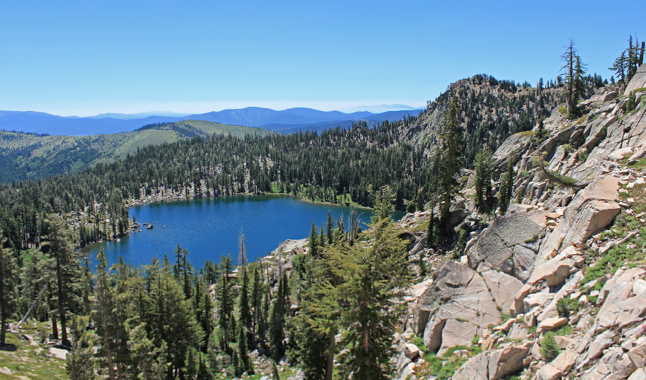
This weekend of the full moon, the 63rd Tevis Cup (Western States 100 mile - 1 day endurance ride) will take place. This endurance event is considered the oldest, and the most difficult of all the U.S. endurance rides. Riders and their crews come from all over the world to compete and share in the experience of the amazing, unique Western States Trail.

To learn more about this historic ride, CLICK HERE

Tahoe Donner Hike of the Month: Frog Lake Cliff/Euer Valley

7/24/2018

 
Picture
To The Truckee Donner Land Trust is excited to announce its latest conservation project, the Campaign to Conserve Frog Lake, Red Mountain and the Carpenter Ridge.
While the property won't be open to the public for two years as the Land Trust and its partners raise the funds required to complete the transaction, you can enjoy the aerial view of this gem from above using the Warren Lake Trail. (But please don't go down to the Lake until we open it to the public in 2020).
The Warren Lake Trail starts at the Intersection of the Summit Lake Trail and the Donner Lake Rim Trail on Donner Summit, accessible by the Pacific Crest Trail or from the Castle Valley Trailhead. Parking is available at the Castle Peak exit off Highway 80. (This popular trailhead was protected from development in 2016 by The Trust for Public Land and the Truckee Donner Land Trust, allowing continued public access to the Pacific Crest Trail, Castle Peak, and the popular Hole in the Ground mountain biking trail.) A trail kiosk at the end of the paved road directs you to the Donner Lake Rim Trail. Follow the trail east behind the Donner Summit Rest Area toward Summit Lake. You'll encounter a well-signed intersection with the Warren Lake trail east of the Rest Area before Summit Lake.
From parking to Frog Lake Cliff via the Donner Lake Rim Trail and Warren Lake Trail is about three miles, gaining roughly 1,400 feet in elevation through mature mixed conifer forest replete with regular views east. A short unsigned spur trail to the top of Frog lake Cliff will be very evident at a high, open point. Follow that spur and your climb will be rewarded not only with sweeping views of Frog Lake more than 1,000 feet below, but also Euer Valley and the surrounding peaks.
For those looking for more mileage, continue another mile or two on the Warren Lake Trail north and into Castle Valley where the lupine, paintbrush, and other wildflowers are at their peak this time of year and the views of Castle and Basin Peaks from the East are impressive. Warren Lake itself is another 4 miles from the Frog Lake Cliffs viewpoint and includes a steep one mile descent to the lake itself.
To see the original article in the Tahoe Donner Land Trust newsletter CLICK HERE.

July 24 - Trail Planning in the Loomis Basin by Placer CO Parks

7/20/2018

 
Picture
There will be a presentation and discussion of public trails planning by Placer County on July 24 at the Horseshoe Bar/Penryn MAC meeting. From the AGENDA:
Trail Planning in the Loomis Basin (25 minutes):
County staff will provide an update of public trail planning and projects in the Loomis Basin. Topics will include the status of the Griffith Quarry Improvement Project, trail connectivity along Horseshoe Bar Road, and phasing of trails within Bickford Ranch. Presenter: Andy Fisher, Parks Administrator for Parks & Grounds

MEETING
7:00 PM, Tuesday, July 24, 2018
Loomis Veteran’s’ Memorial Hall
5945 Horseshoe Bar Road
Loomis, CA 95650


This is a public meeting and all are invited to attend.

CLICK HERE to see the complete Agenda.


8 Things You Didn't Know About BLM

7/19/2018

 
Picture
One of nine bureaus under the Interior Department, the Bureau of Land Management’s roots go back to America’s founding. BLM was established on July 16, 1946, when the General Land Office and the U.S. Grazing Service were merged. More than 70 years later, it remains a small agency with a big job -- managing public lands for multiple-uses like recreation and natural resource development for the benefit of present and future generations.

1. BLM’s predecessor helped homesteaders settle the American west.
2. BLM oversees 245 million surface acres of public lands for the American people.
3. BLM’s oil and gas program is a boon for the U.S. economy.
4. BLM firefighters protect public lands, wildlife neighboring communities from the threat of wildfires.
5. Many BLM-managed public lands serve as outdoor laboratories, allowing students to discover the ancient world through real artifacts.
6. Awesome recreational activities abound on BLM-managed public lands.
7. Public lands power American homes and businesses.
8. BLM’s grazing program helps support healthy range lands.

Region leads state in West Nile virus

7/13/2018

 
Picture
West Nile virus activity is surging in Sacramento County, with the region now leading the state, officials say.
There is also greater and more localized activity this year compared to last year, said Luz Robles, public information officer for the Sacramento-Yolo Mosquito and Vector Control District.
“Residents need to be vigilant, especially as we enter the hottest of the hottest weeks of the year,” Robles said, explaining that heat advances the life cycles of mosquitoes.
West Nile Virus activity is defined by the number of dead birds and mosquito samples testing positive for the virus, Robles said. Sentinel chickens and horses testing positive would also be taken into consideration, but there have not been cases of either in California so far this year.
In the majority of cases, the disease is contracted from the bite of an infected mosquito.
Mosquitoes become carriers of the disease after feeding on infected birds, such as crows, ravens and finches, which act as hosts for the disease.
More mosquitoes flying around means a greater chance of getting bitten and a greater chance of contracting the virus.
Nine human cases in California have tested positive for the virus. Fresno and San Bernardino counties have reported one positive human case each, and Kern, Los Angeles and Riverside Counties have each reported two positive human cases.
The California West Nile virus website does show one human case in Sacramento County testing positive for the virus, but an official from Sacramento County clarified that the county believes this individual was infected with the virus in 2017 and only just tested this year.
Last week, 15 dead birds tested positive for West Nile virus – 14 of those birds were from Sacramento County. Most local activity is widespread, Robles said, but activity has been specifically identified in Land Park and Elk Grove.
A total number of 50 dead birds from 12 California counties have tested positive for the virus this year, with just over half of those birds collected from Sacramento County.
“Dead bird reports are very important because they are usually the first indication that the virus is active in an area,” the westnile.ca.gov website states.
Locally, on July 11, 31 mosquito samples tested positive for the virus, reports the Mosquito and Vector Control District. These samples, which test from one to 50 mosquitoes at a time, were collected from Elk Grove and Sacramento parks and neighborhoods.
Recently, activity of the virus was identified in Yolo County, with a mosquito sample from Davis testing positive.
After receiving lab results from the Elk Grove mosquito samples showing positive results, the Mosquito and Vector Control District responded quickly, spraying parts of Elk Grove with a treatment aimed to reduce mosquito populations.
Residents can sign up to receive notifications about spraying activity within their ZIP code on the Mosquito and Vector Control District’s website.
The district asks people who see a bird dead for less than 24 hours to report it online on the westnile.ca.gov website or by calling 877-968-2473.
Although most people infected with the disease don’t show symptoms, about one in five people infected will develop a condition referred to as West Nile fever, with symptoms including headache, body aches, joint pains and fatigue, according to the Centers for Disease Control and Prevention.
The most severe cases – about 1 in every 150 cases – can be life-threatening.
Robles said people should avoid mosquito bites by using repellant, staying inside from dusk to dawn as much aspossible or wearing long sleeves and pants when outdoors during these times and draining all standing water, which acts as a breeding ground for mosquitoes.

CLICK HERE to see original article and photos in the Sacramento Bee.

Auburn SRA Plan proposals include American River Canyon bridges, campsites - comment until July 23

7/5/2018

 
Picture


Trail bridges over the American River canyon at Greenwood and Auburn are part of a draft proposal opened up for discussion this summer by State Parks.
So are plans for camping facilities on the El Dorado County side of the American River canyon across from Auburn.

And people have through July 23 to share their opinions on the new general plan being prepared for the Auburn State Recreation Area by answering an online questionnaire.

Park Superintendent Mike Howard said that the trail bridge and camping proposal has sparked concerns about increased fire danger, particularly from residents of areas in Auburn perched on the canyon rim.
Some of that concern has dissipated after residents learned that an alternative proposal for camping facilities at China Bar on the Auburn side of the American River had already been removed because of public input, Howard said.

That left some people to still express concerns about a bridge being built over the river and bringing more traffic onto the Auburn side. Howard said that environmental studies will be taking place through 2019 and one of the impacts to be looked at will be fire mitigation.

The Auburn-to-Cool bridge would mark a return of sorts to foot traffic below Auburn. A diversion tunnel for the American River was built as part of Auburn dam construction, allowing hikers, runners and horses to cross over the river from El Dorado County to Placer County. The river was daylighted a decade ago and the tunnel closed off but the Placer County Water Agency pledged $600,000 to help fund a bridge.

The second bridge being considered would be on the middle fork American River at the former Greenwood Bridge site. The Greenwood Bridge — then a vehicle crossing — was washed out when an upstream dam collapsed in 1964.

Plans for the Knickerbocker Flat area across the river from Auburn include up to 50 individual campsites.
“The river is clearly a natural fire break (to Auburn-area fire concerns),” Howard said.

A statewide goal of the Parks Department is to increase camping opportunities, he said. In all, the draft proposal is considering 245 more individual campsites and five group sites.

The online questionnaire can be accessed at opentownhall.com/6431

To see the original article and pictures in the Auburn Journal newspaper, CLICK HERE.


Discover Malakoff Diggins - a very special hike with Hank Meals

7/1/2018

 
Picture
The Friends of North Bloomfield and Malakoff Diggins, in cooperation with the Sierra Gold Sector of California State Parks, will present a very special hike with Hank Meals on July 14, 2018. The hike is the latest in the Discover Malakoff! monthly events and activities initiated by the Friends of North Bloomfield & Malakoff. The intent of the Discover Malakoff! series is to bring new visitors to the remote state park throughout the entire year, and to ignite interest and support for the wide spectrum of resources and activities at the historic park, home to the still-standing “ghost town” of North Bloomfield, and site of the largest hydraulic mine in the country.When: Saturday July 14, 2018, 9 am-1 pm

Hike Description: From downtown North Bloomfield to the Diggins Trail and back is about a 3.5 to 4 mile loop trail in a unique environment. The Diggins Trail offers a good close look at the industrial landscape created by the Malakoff mine and to what degree nature is reclaiming the place. In addition to the fascinating history of the hydraulic mine, there is an artistic dimension in the fantastic pallet of colors in the exposed gravel banks. Our hike should last about three and a half hours.
Cost: Free for the tour; $10 state park day use fee

Transportation: Carpooling is encouraged. We will meet at the museum/park headquarters. Accessing the park from Highway 49 and Tyler Foote Road is recommended, as the shortest route via North Bloomfield Road is very rough, and unpaved from Edwards Crossing.
This free event is limited to 25 participants and requires pre-registration RSVP.
What to bring: Water (2 liters), sack lunch, hat, sunscreen, camera, shoes suitable for uneven ground and wet (muddy) crossings. Bring a small backpack for your food and water. Please leave your dogs at home for this event, since dogs are not permitted on this trail.

Event registration link: https://www.eventbrite.com/e/discover-malakoff-diggins-hike-with-hank-meals-tickets-47469725226
Please do RSVP, and update, if you need to change your plans. We will maintain a wait list.
For more information call (530) 265-2740 or email friends.nbmd.publicity@gmail.com

*Trip Leader: Hank Meals, 2013 Bear Yuba Land Trust John Skinner Sierra Outdoors Recreation Award Recipient
Hank Meals, archeologist, writer and photographer worked as an archeologist for the Tahoe National Forest over the course of 25 years. His is a talented photojournalist, with hands-on experience in all manner of outdoor activities from tree planting, fire fighting, trail constructing, and cone-gathering to wildlife habitat improvement, trail guiding and interpretation. He is the author of several books about trails and is co-authoring a book about the Nisenan people. Meals has been leading hikes for local nonprofits for more than 20 years and his knowledge of local history and trails is legendary.
Learn more about Malakoff:
http://malakoffdigginsstatepark.org/ and https://www.parks.ca.gov/?page_id=494

Malakoff Diggins State Historic Park
23579 North Bloomfield Road
Nevada City, CA 95959
Presented by the Friends of North Bloomfield and Malakoff Diggins and California State Parks Sierra Gold Sector
Friends of North Bloomfield & Malakoff Diggins Mission:
We enhance the interpretive experience for visitors, promote park-based education for learners of all ages, and support and preserve the natural and cultural resources of Malakoff Diggins SHP. We also assist other cooperative associations and the State Park System mission for the benefit of the public.

CLICK HERE to see the original article in Yubanet.net

    Archives

    March 2021
    February 2021
    January 2021
    December 2020
    November 2020
    October 2020
    September 2020
    August 2020
    July 2020
    June 2020
    May 2020
    April 2020
    March 2020
    February 2020
    January 2020
    December 2019
    November 2019
    October 2019
    September 2019
    August 2019
    July 2019
    June 2019
    May 2019
    April 2019
    March 2019
    February 2019
    January 2019
    December 2018
    November 2018
    October 2018
    September 2018
    August 2018
    July 2018
    June 2018
    May 2018
    April 2018
    March 2018
    February 2018
    January 2018
    December 2017
    November 2017
    October 2017
    September 2017
    August 2017
    July 2017
    June 2017
    May 2017
    April 2017
    March 2017
    February 2017
    January 2017
    December 2016
    November 2016
    October 2016
    September 2016
    August 2016
    July 2016
    June 2016
    May 2016
    April 2016
    March 2016
    February 2016
    January 2016
    December 2015
    November 2015
    October 2015
    September 2015
    August 2015
    July 2015

    Categories

    All

    RSS Feed

Home
Contact
 Mother Lode Trails is YOUR local non-profit trail information and resource website. Here you can find
up-to-the minute information on trail alerts, links and trail news for Placer, Nevada, El Dorado, Yuba and
Sacramento counties. Mother Lode Trails is trademarked.