Just go here:
https://www.pcta.org/discover-the-trail/closures/northern-california/
|
The Pacific Crest Trail Association has created an up-to-the-minute trail closure alert webpage for the PCT. Before you head out to hike or ride the PCT, be sure to check and make sure it's open.
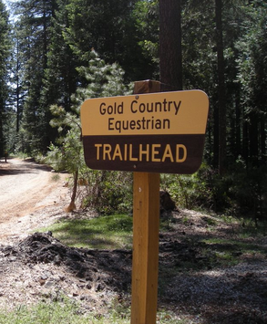
Just go here: https://www.pcta.org/discover-the-trail/closures/northern-california/  A Park Watch Reporter told MLT of logging activity in the Lone Grave trails area, especially close to the Gold Country Equestrian Trailhead (off Conservation Road on Highway 20 above Nevada City) where she could hear and see the loggers from the trail head. Signs are posted giving more information on areas and dates the loggers will be working. If you would like to avoid any logging activity, Sunday would be the best day to use those trails. The Western States 100-Mile Endurance Run is the world’s oldest 100-mile trail race. Starting in Squaw Valley, California near the site of the 1960 Winter Olympics and ending 100.2 miles later in Auburn, California, the Western States, in the decades since its inception in 1974, has come to represent one of the ultimate endurance tests in the world.
Following the historic Western States Trail, runners climb more than 18,000 feet and descend nearly 23,000 feet before they reach the finish line at Placer High School in Auburn. In the miles between Squaw Valley and Auburn, runners experience the majestic high country beauty of Emigrant Pass and the Granite Chief Wilderness, the crucible of the canyons of the California gold country, a memorable crossing of the ice-cold waters of the main stem of the Middle Fork of the American River, and, during the latter stages, the historic reddish-brown-colored trails that led gold-seeking prospectors and homesteading pilgrims alike to the welcoming arms of Auburn. For more than four decades, Western States has been home to some of the sport’s most stirring and legendary competitions, and has spurred the capacity of spirit of all runners, of all abilities and from all walks of life, from all over the globe. With more than 1,500 dedicated volunteers, offering the sport’s oldest and most prized possession – a sub-30-hour finisher’s bronze belt buckle or a sub-24-hour finisher’s silver belt buckle – and owning 100-mile racing’s richest and most compelling history, Western States remains one of the undisputed crown jewels of human endurance. For all information, go to the WSER website https://www.wser.org/ All other trail users, use other trails this weekend. PLACER COUNTY, CA (MPG) - California State Parks invites the public to attend its upcoming open house and help shape the future of Auburn State Recreation Area (Auburn SRA). The open house will be held Tuesday, June 26, 2018 at the Gold Country Fairgrounds Sierra Building, 209 Fairgate Road in Auburn (95603). There will not be a scheduled presentation. Children are welcome.
Auburn SRA is located in the Sierra Nevada foothills, northeast of Sacramento. It includes about 30,000 acres of public land that is situated along nearly 40 linear miles of the north and middle forks of the American River. California State Parks manages the state recreation area through a managing partner agreement with the U.S. Bureau of Reclamation (Reclamation). The department is collaborating with the Reclamation to prepare a joint Auburn SRA General Plan/Auburn Public Lands Resource Management Plan (Plan). The Plan alternatives include resource preservation and land use strategies that will serve the communities and recreating public in the long term. Highlights of the proposed action would allow or facilitate:
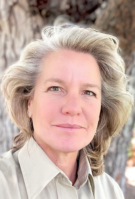
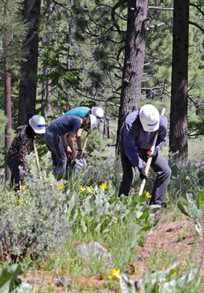
The department is appreciative of the feedback it has received thus far. More than 150 people attended the December public workshop and provided feedback. Online, more than 800 people participated in a questionnaire, and more than a dozen public agencies have provided comments. Information from this feedback was used to prepare the California State Parks proposed action to allow development of additional facilities and management actions. Once California State Parks finalizes the proposed action, an analysis of the potential environmental impacts of all the alternatives will be conducted. Finally, the Plan will be presented to the California State Park and Recreation Commission and the Bureau of Reclamation for review and adoption. The entire process is expected to be completed by October 2019. More information about the Plan, the public outreach and the schedule is available at www.parks.ca.gov/PLANASRA. Materials for the June 26, 2018 open house and the online questionnaire are also available on the webpage through July 24, 2018. If you would like to be added to the contact list to receive email notifications of public outreach opportunities, please contact Project Lead Cheryl Essex at plan.general@parks.ca.gov. Click HERE to see the original article in the Placer Sentinel newspaper.  A Truckee native takes over as Bridgeport District ranger next week, according to the Humboldt-Toiyabe National Forest Monday is Jan Cutts' first day on the job, where she will oversee management of more than 1 million acres of National Forest lands in California and Nevada. "Jan comes to the forest with 25 years of diverse land management experience," said Forest Supervisor Bill Dunkelberger. "She is no stranger to the Sierra Nevada region, having also worked on the Inyo and Tahoe National Forests in various capacities. We are excited to have Jan join our team. She brings a wealth of skills in working with employees, communities, and other stakeholders to achieve shared stewardship of the National Forest." Cutts began her Forest Service career in 1989 as a seasonal archaeologist on the Inyo National Forest in Bishop, and subsequently served as assistant forest archaeologist, forest public affairs officer, forest civil rights officer, and Mt. Whitney and White Mountain deputy district ranger. In 2005, Cutts accepted the American River district ranger position in the Tahoe National Forest in Foresthill, Calif. Cutts then moved to Silverthorne, Colo., in 2008 to serve as the Dillon district range in the White River National Forest. During this time, she also had two four-month details as acting regional director of external affairs for the U.S. Forest Service Rocky Mountain Region in Denver. In 2015, Cutts left the Forest Service for a three-year break to join her retired husband at their home in the New Mexico mountains. "I am excited to return to the Forest Service as part of the Humboldt-Toiyabe National Forest team and to provide leadership on the Bridgeport Ranger District," said Cutts. "I am especially looking forward to developing and fostering relationships with District employees and partners in our communities. Bridgeport is a busy Ranger District and I'm eager to work together and continue to accomplish great work there. My family and I are thrilled to make the eastern Sierra our home again." Cutts grew up in Truckee, and earned a bachelor of science in anthropology from the University of California at Davis. She replaces Jeremy Marshall who left the Bridgeport Ranger District for a District Ranger Position with the Tres Piedras Ranger District on the Carson National Forest in northern New Mexico. CLICK HERE to see the original article in the Mountain Democrat newspaper.  Nothing beats getting a little dirt under your fingernails, swinging a Mccleod and that feeling at the end of the day that you contributed to one of our region's fantastic trails. The Land Trust has several trail days this summer to get out and lend a hand. Become a Volunteer! The 2018 Truckee Donner Land Trust Trail Work Day schedule: June 23 (click here for more information) July 28 August 18 September 8 October 6 General Land Trust volunteering information: We appreciate the support of our wonderful volunteers. Volunteers typically help with events, administrative work, and with trail maintenance. Please CLICK HERE to complete our volunteer form and let us know how you'd like to support our mission to protect and preserve land in the Truckee Donner area. CLICK HERE for original article in the Truckee Donner Land Trust News and more information. Placer County is taking the next step in a proposed expansion of the popular Hidden Falls Regional Park trails system near Auburn. The county has issued a revised notice of preparation for a subsequent environmental impact report for the expansion proposal. The public comment for this notice of preparation extends through July 6. A public scoping meeting to solicit input on the expansion plan will be held June 14 from 6-8 p.m. in the Placer County Planning Commission Hearing Room, located at 3091 County Center Drive in Auburn.
A notice of preparation for the proposed project was originally released in January 2017, followed by a public scoping meeting that February; a revised notice of preparation is being released because the project description is being modified to reflect the county’s potential purchase of the 50-acre Twilight Ride property north of the park, along Bell Road. The property could be used to provide additional parking and access to Hidden Falls Park. More information about the land purchase agreement is available here. Thanks to a partnership with the Placer Land Trust, approximately 2,500 acres of open space near the 1,200-acre Hidden Falls Park have been preserved and could accommodate the expansion of the trail system from Hidden Falls to the Bear River. This would result in a trail system approximately 60 miles in length, providing hikers, cyclists and equestrians alike with access to more than double the length of existing multi-use trails. To improve access to the park, the county proposes to build a parking lot and trail connection from a county-owned parcel off of Garden Bar Road to the existing parking lot at Mears Place. Additional parking and trail access are proposed from the Twilight Ride property on Bell Road, as well as from the Harvego Bear River property located north of the park. Other features of the proposed expansion include those uses already allowed under the current use permit for the park: Americans with Disabilities Act-compliant accessibility features, drinking water fountains, restrooms, on-site groundwater wells, fire suppression facilities, equestrian features (horse watering and hitching posts, horse boarding facilities), other potential concessions compatible with the characteristics of the park (e.g., bicycle rentals, nature education classes), picnic areas, benches, bear-proof trash receptacles and interpretive displays. The purpose of a NOP is to provide sufficient information about the proposed project to allow agencies and interested parties the opportunity to provide a response related to the scope and content of the project’s subsequent environmental impact report, including mitigation measures that should be considered and alternatives that should be addressed. There will be additional discussions on the project at upcoming meetings of all seven municipal advisory councils located in western Placer County. Questions can be addressed to the project manager, Lisa Carnahan, at lcarnaha@placer.ca.gov, or at 530-889-6837. To make formal comments on the project, which will become a part of the administrative record, please direct them to Shirlee Herrington at sherring@placer.ca.gov. From Park Watch Reporter, Martha Mirriam, "Yesterday this tree was across the Pioneer Express Trail south of Sterling Point and just south of Mile Marker 42. You can get around it on the lake side of the trail, but it’s rough."
Park Watch Report sends all maintenance reports directly to the land managers, so has been reported to Folsom Lake SRA Maintenance Supervisor for clearance. Placer County is taking the next step in a proposed expansion of the popular Hidden Falls Regional Park trails system near Auburn. The county has issued a revised notice of preparation for a subsequent environmental impact report for the expansion proposal. The public comment for this notice of preparation extends through July 6. A public scoping meeting to solicit input on the expansion plan will be held June 14 from 6-8 p.m. in the Placer County Planning Commission Hearing Room, located at 3091 County Center Drive in Auburn.
A notice of preparation for the proposed project was originally released in January 2017, followed by a public scoping meeting that February; a revised notice of preparation is being released because the project description is being modified to reflect the county’s potential purchase of the 50-acre Twilight Ride property north of the park, along Bell Road. The property could be used to provide additional parking and access to Hidden Falls Park. More information about the land purchase agreement is available here. Thanks to a partnership with the Placer Land Trust, approximately 2,500 acres of open space near the 1,200-acre Hidden Falls Park have been preserved and could accommodate the expansion of the trail system from Hidden Falls to the Bear River. This would result in a trail system approximately 60 miles in length, providing hikers, cyclists and equestrians alike with access to more than double the length of existing multi-use trails. To improve access to the park, the county proposes to build a parking lot and trail connection from a county-owned parcel off of Garden Bar Road to the existing parking lot at Mears Place. Additional parking and trail access are proposed from the Twilight Ride property on Bell Road, as well as from the Harvego Bear River property located north of the park. Other features of the proposed expansion include those uses already allowed under the current use permit for the park: Americans with Disabilities Act-compliant accessibility features, drinking water fountains, restrooms, on-site groundwater wells, fire suppression facilities, equestrian features (horse watering and hitching posts, horse boarding facilities), other potential concessions compatible with the characteristics of the park (e.g., bicycle rentals, nature education classes), picnic areas, benches, bear-proof trash receptacles and interpretive displays. The purpose of a NOP is to provide sufficient information about the proposed project to allow agencies and interested parties the opportunity to provide a response related to the scope and content of the project’s subsequent environmental impact report, including mitigation measures that should be considered and alternatives that should be addressed. There will be additional discussions on the project at upcoming meetings of all seven municipal advisory councils located in western Placer County. Questions can be addressed to the project manager, Lisa Carnahan, at lcarnaha@placer.ca.gov, or at 530-889-6837. CLICK HERE to see this original notice in the Placer County Newsletter. COMMENTS To make formal comments on the project, which will become a part of the administrative record, please direct them to Shirlee Herrington at sherring@placer.ca.gov A Park Watch Reporter spoke to a forester yesterday about logging property below Madrone Springs/Cooper Rd. In the next couple of days they are scheduled to start falling trees and logging this area and plan to finish by the end of August. They were moving big equipment into the area yesterday. They said they typically work Monday-Saturday with the exception of June 16, for the Wild Wild West endurance ride.
They will start at the campfire area on Barn Hollow Rd. and work down from there. The last area to log will be the single track trail connecting the top of Barn Hollow with the intersection of (paved) Cooper and Madrone Springs Rd. |
Archives
April 2024
Categories |