MOTHER LODE TRAILS
  • Home
  • About
  • Contact
  • Volunteer
  • Links
    • Law Enforcement Emergency
    • Federal, State, County Districts Parks & Trails
    • Running Clubs
    • Equestrian Clubs
    • Mt. Bike Clubs
    • Hiking Clubs
    • Trail Advocacy Organizations
    • Phone Numbers State & Federal Parks, Trails & Lands
    • Where to Eat on the Trails
  • News
  • Alerts

CalFire-recommended fire break funding not in ASRA general plan, vote goes ahead anyway

9/28/2021

 
Picture
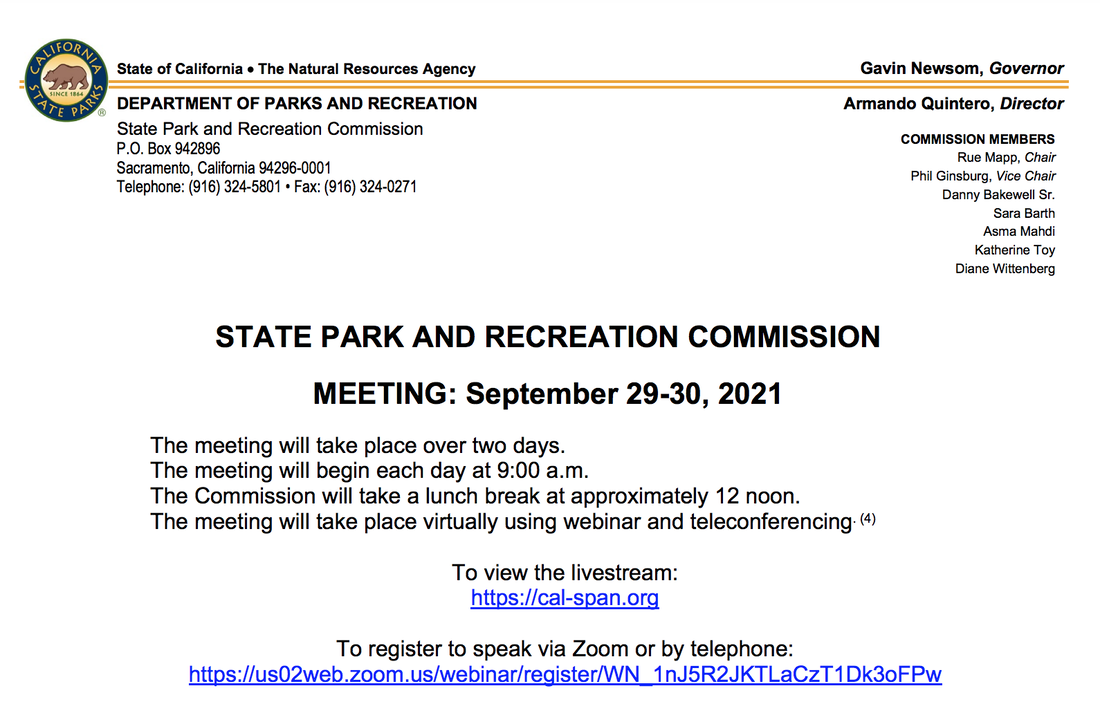
Those wanting a final say on elements of the Auburn State Recreation Area General Plan will have their chance Thursday as the California State Park and Recreation Commission is scheduled to vote on the document.

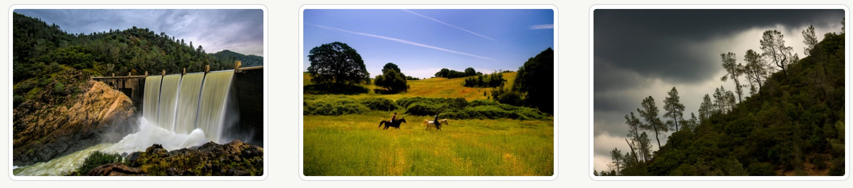
The plan defines long-term vision and outlines broad goals and guidelines for management of the Auburn State Recreation Area and provides the basis for developing future focused management plans, specific project plans and other goals.

The park is in need of a general plan, according to Jim Micheaels, senior park and recreation specialist for California State Parks, because the area’s last guiding document was an interim plan from 1992. “Because construction of Auburn Dam is on hold indefinitely, there’s a need for a long-range planning document for the Auburn State Recreation Area in its current condition, which is two river canyons,” Micheaels said.

Growth is also a factor. The state park has increased annual visitors from 300,000 in 1995 to more than 1 million visitors a year today.

Projects in the general plan include up to 142 additional campsites, new and expanded parking areas, day-use facilities and other recreational facilities. The projects in the documents are not an immediate reality for the state park; they still require their own planning and funding.

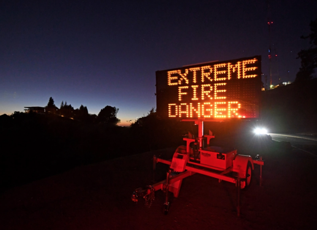
Despite the General Plan being up for final approval, many in the community, including fire officials, city of Auburn council members and local residents, still take issue with elements of the plan.

Local leaders from Foresthill Fire District, Georgetown Fire Protection District, El Dorado County Fire District, Auburn City Fire District and the Auburn Lake Trails Fire and Safety Improvement Council signed a letter stating they have “serious concerns regarding the additional threat of wildfire that will result from the proposed expansion of facilities.”

The letter went on to ask State Parks to implement all fire-related recommendations made by CAL FIRE in a 2019 letter in response to the general plan. The letter also asked that the fire fuel breaks in the Auburn State Recreation Area be updated at least every five years.

“Failure to maintain any of these fuel breaks at their recommended frequency would require the facilities in the vicinity of those areas to be closed to the public,” the letter stated.

Last week, Auburn Councilwoman Alice Dowdin Calvillo and Councilman Daniel Berlant wrote a letter to the commission addressing their concerns with the general plan.
“The department points to the Bureau of Reclamation’s recently approved Fire Management Plan as a means by which to address much of the associated fire risk,” the letter stated. “Unfortunately, the plan is not only woefully insufficient due to the low numbers of acres scheduled to be managed each year, it is not funded.”

Their letter asks for Auburn State Recreation Area to prohibit overnight camping in the Auburn Interface Management Zone (the area of the park closest to the city of Auburn) during fire season. They also asked for the campgrounds to be closed for all use on Red Flag Warning Days, when fire risk is the highest.

Also similar to the fire leadership’s requests, Dowdin Calvillo and Berlant asked for a requirement to work with local fire agencies. The letter stated State Parks should “not only coordinate with local fire agencies … when conducting planning efforts for new or expanded facilities within the Auburn State Recreation Area, but they be required to obtain fire agency approval on fire prevention efforts associated with such facilities.”

Dowdin Calvillo said she hopes the commission will revise the general plan to make adjustments.
“I really hope that they consider what we are saying and consider the risk we are facing,” Dowdin Calvillo said. “I tried to give them some realistic modifications. These are absolutely things they could do.”

Some community members feel a lack of trust in State Parks claims in the general plan.

“The bureaucrats at State Parks shouldn’t be the ones making the fire risk decisions, it should be CAL FIRE and the fire agencies,” said Curt Kruger, director of American River Community Coalition and an Auburn Lake Trails resident. “If they wanted to assuage the fire concerns, they would have put in the specific issues to address.”

Kruger and others from the American River Community Coalition met virtually with State Parks Director Armando Quintero on Monday, requesting the general plan be removed from the commission’s agenda Thursday. They did not get what they were looking for.

“I’m uncomfortable,” said Lorna Dobrovolny, who was a part of the virtual meeting. “Past practices tell us not to trust (State Parks).” Dobrovolny, a resident of Cool on the El Dorado County side of the canyon, said she doesn’t feel she and her neighbors are being listened to.
​

“We live here with the trash and the traffic this park has brought us,” she said. “They can’t control what they have. How can we expect more people to visit and feel safe?”

CLICK HERE to see the original article in Gold Country Media/Auburn Journal newspaper.


Eldorado National Forest: GDETF Poker Ride and ALL public events CANCELLED through the month of October.

9/26/2021

 
Picture
(Photo Caldor Fire) 
​According to GDETF, the El Dorado National Forest administration has decided to cancel all Event Permits for the month of October. Given the current fire conditions and the stretched personnel still fighting the existing fires, the best decision was to cancel all October events. 

​
Forest personnel are concerned for everyone's safety and won't issue permits unless they feel confident the public will not be at risk. 

Please call the Eldorado National Forest Supervisor's Office to get the most current information: 
FOREST SUPERVISOR'S OFFICE
Jeff Marsolais, Forest Supervisor
100 Forni Road, Placerville, CA 95667
Office #: 530 303-2412

Auburn SRA General Plan meeting and EIR Approval Hearing Sept. 30

9/25/2021

 
Picture
California State Parks is completing the planning process to prepare a General Plan for the Auburn State Recreation Area. Auburn State Park Recreation Area General Plan and EIR approval hearing is scheduled for September 30, 2021

Following public release of the Auburn State Recreation Area (ASRA) Preliminary General Plan and Draft Environmental Impact Report (EIR) in July 2019, California State Parks staff made changes to the General Plan. The proposed changes, along with responses to comments received on the Draft EIR, were published in June 2020 in a Final EIR in compliance with the California Environmental Quality Act (CEQA). The Preliminary General Plan, Draft EIR, and Final EIR 
<https://www.parks.ca.gov/?page_id=24325>  
are available for review.

The proposed General Plan revisions include a reduction in the total number of new campsites allowed in ASRA from 224 sites (220 individual sites and four group sites) to 142 sites (135 individual site and seven group sites). Other changes describe the comprehensive planning process that would occur prior to the development of any new or expanded facilities; require a site-specific assessment to determine if campfires would be allowed at individual new campsites; and identify best practices for the protection of Tribal Cultural Resources that would be implemented in coordination with California Native American Tribal groups
Virtual Meeting:
California State Park and Recreation Commission Hearing
Thursday, September 30, 2021
The meeting agenda and meeting materials are available here 
<https://www.parks.ca.gov/?page_id=30545>

** Auburn State Recreation Area Virtual Tour
Learn about the Auburn State Recreation Area and the proposed General Plan with a virtual tour 
<https://www.youtube.com/watch?v=XoWlEDIJCow>

** Upcoming Meetings
------------------------------------------------------------
The Auburn State Recreation Area General Plan will be considered for approval by the California State Park and Recreation Commission 
during its virtual meeting scheduled September 30, 2021. For the full agenda and instructions how to view and/or make public comment, see the meeting website

​<https://www.parks.ca.gov/?page_id=30545>

Agenda items will include consideration and possible action on the following department recommendations related to the Auburn State Recreation Area: Certification of the EIR for the Auburn State Recreation Area General Plan, and adoption of the General Plan.

The meeting will be live streamed at <www.cal-span.org> where a recording of the meeting will also be archived for later viewing. In addition, the meeting will be hosted on the video conferencing service, Zoom. Public comments can be made on specific agenda items through Zoom or by phone. A full meeting agenda and a link to register to speak at the virtual hearing are available online in compliance with California Government Code Sections 11125(a)&(b). 

Sent from:
Ascent Environmental, Inc. 
455 Capitol Mall, Suite 205 
Sacramento, CA 95814 . USA


Cyanotoxin algae warning for ponds, still water, lethal for pets

9/15/2021

 
Picture
U.C.. Davis just issued a warning to keep dogs away from one of their waterways as it was contaminated by Cyanotoxins, a type of algae. It is the time of year when water gets low that you have to be aware that some ponds and still water can be lethal to your pets.
​

LEARN MORE HERE
  • Cyanobacteria FAQ
  • Is the cyanobacteria harmful to pets and wildlife?
  • What are signs of possible cyanobacterial toxin poisoning in dogs?
  • Can you tell if cyanotoxins are present by looking at the water?
  • Is the cyanobacteria harmful to humans?
  • What should we do?
  • How long will the bloom last?
  • What can be done to prevent blooms like this?
  • Are blooms like this happening in other places?
  • Where can I find more information?

Here is U.C. Davis' warning about their waterway:
UC Davis issued a caution today (Sept. 8) to people visiting the Arboretum Waterway with their dogs: Keep your animals away from the water — do not let them go in it, do not let them drink it — due to the presence of cyanotoxins.

These toxins from microscopic cyanobacteria can be rapidly lethal to dogs that ingest the contaminated water. The concentration at this time is low, said Nina Suzuki, waterway steward for the Arboretum and Public Garden. Still, dog owners should be cautious.

Blooms of algae and cyanobacteria are common in creeks, rivers, ponds and lakes, especially in nutrient-rich waters in summer. (The Arboretum Waterway, despite its name, is a pond — it has no natural flow.)

Cyanobacteria live throughout the water column, not just as “scum” on the surface. So it is difficult to tell if water is contaminated just by looking at it. The solution? Just don’t go in the water.
“This timing is typical for the cyanotoxins in the Arboretum Waterway,” Suzuki said. “The pattern in the last three years has been that the toxins aren’t present in detectable amounts until August.”
And, so, upon observing an algal bloom last month, she collected a water sample and sent it in for analysis. The results came back Sept. 5.

“For context, the state water board has three tiers, or trigger levels (caution, warning and danger), for advisories based on the concentration of toxins found in the water,” Suzuki said. “The lab results from our sample are at the low end of the caution level.”


ASRA and Folsom Lake SRA quietly adds electric motorized bikes (e-bikes) to over 40 dirt trails and roads

9/14/2021

 
Picture
With no fanfare, announcement or CEQA-required public comment, electric motorized bikes are now allowed on many dirt non-motorized trails in Auburn and Folsom Lake SRAs because of a new order by the Superintendent (see below for their contact information).

Because of public concern over trail safety and environmental issues, the controversial decision of adding electric motorized bikes on non-motorized trails on public lands have prompted successful lawsuits by PEER, BCHA, Wilderness Society and other groups. CLICK HERE to see information about the e-bike lawsuit against Tahoe National Forest. CLICK HERE to see the five lawsuits against e-bikes in National Parks.

CLICK HERE to see the new trails added and the policy change.

The trails where you will now find e-bikes in Auburn SRA:

Bridgeview Trail, Clementine Trail, Confluence Trail, Culvert Trail, Flood Road Trail, Foresthill Divide Loop Trail, Fuel Break Trail, Lake Clementine Access Trail, Long Point Fuel Break Trail, Manzanita Trail, McKeon-Ponderosa Trail, Mossy Rock Trail, Stagecoach Trail  Olmstead Loop Trail, PG&E Road, Quarry Trail, Robie Point Fuel Break Trail, PCWA Road, Pleasant Avenue Road, Salt Creek Road, Knickerbocker Haul Road, Ponderosa Road, Upper Lake Clementine Road  

The trails where you will now find e-bikes in Folsom Lake SRA:
South Lake Natoma Multi-use Trail (dirt), South Lake Natoma Bike Path (paved), Parkshore Bike Path Connector Trail (paved), American River Bike Path-Jedediah Smith Memorial Trail (paved), Main Avenue Bike Path Connector Trail (paved), Mississippi Bar Service Road (dirt), Service Road-Beals Point to Granite Bay Across Dikes 4-6 (dirt), Dike 4-6 Multiuse Trail (dirt), Granite Bay Multi-use Trail-South (dirt), Granite Bay Multi-use Trail-North (dirt), Center Trail (dirt), Doton's Point Multi-use Trail (dirt), Darrington Trail (dirt), South Fork America River Trail (dirt), Sweetwater Trail (dirt), Mormon Island Cove to Brown's Ravine (dirt) Dike 8 to Mormon Island Cove-Across MIAD (dirt), Leidsdorff Trail (paved) 

The new State Parks policy went into effect on August 27, 2021, and is as follows:

E-bike use on trails and nonpublic, controlled-access [ii] roads shall be allowed only where designated by Superintendent’s Order in the following park unit classifications:
  • State recreation area
  • State vehicular recreation area
  • E-bike use in park units:
    • State recreation areas:
      • Except for public roadways, only class 1 e-bikes shall be allowed by Superintendent’s Order on controlled-access roads and trails.
      • Except for public roadways, class 2 or 3 e-bikes are not allowed.
      • Class 1 e-bikes may be designated for use only on trails and controlled-access roads that already allow traditional (non-electric) bicycles.
    • State vehicular recreation areas:
      • Class 1, 2 and 3 e-bikes may be allowed by Superintendent’s Order for use on trails and controlled-access roads.
    • All other park unit classifications:
      • Class 1 e-bikes may be temporarily allowed by Superintendent’s Order for use on trails and nonpublic, controlled-access roads for research and demonstration purposes.
      • Except for public roadways, class 2 or 3 e-bikes are not allowed.                                                   
You may wish to contact the responsible Superintendent of either of these parks for further information:

Auburn State Recreation Area
Superintendent Mike Howard 
Email: <Mike.Howard@parks.ca.gov>
(530) 885-4527

Folsom Lake State Recreational Area
Superintendent Rich Preston
Email: <Rich.Preston@parks.ca.gov>
(916) 988-0205


Both of these State Recreation Area belong to:
Gold Fields District
7755 Folsom Auburn Road
Folsom, CA 95630-6634
(916) 988-0205


If you have further questions regarding e-bike use in the California State Park System, please email trails@parks.ca.gov.


Forest Service Ending Regional Closure Order Two Days Early; Five Forests to Remain Closed Under Local Orders

9/14/2021

 
Picture
VALLEJO, Calif., — Sept. 14, 2021. The USDA Forest Service Pacific Southwest Region will end the regional closure order affecting National Forests in California at 11:59 pm on Wednesday, Sept. 15, two days prior to the original end date of Sept. 17. However, forest-wide closures will remain in place and be extended until midnight on September 22nd on the Los Padres, Angeles, San Bernardino, and Cleveland National Forests in Southern California due to local weather and fire factors, as well as a temporary strain on firefighting resources supporting large fires in other areas of the state.

In addition to the four National Forests that will remain closed in Southern California, some National Forest System lands throughout the state will be closed under local closure orders in areas of ongoing wildfires to ensure public safety. This includes the Eldorado National Forest in Northern California, which has a forest closure order until Sept. 30. Fire restrictions also remain in place across all National Forests in California to prevent new fire starts. Please refer to the local National Forest that you plan to visit to obtain specific information on closures and restrictions.
We are constantly evaluating weather and fire conditions in California, as well as regional and national firefighting resources available to us so that we can ensure the safety of the public and our firefighters,” said Regional Forester Jennifer Eberlien. “Some factors are more favorable now, which is why I decided to end the regional closure order. I want to thank the public and our partners for their patience and understanding during these challenging times.”
Factors leading to this decision include:
  1. Anticipated increase of firefighting resource availability to California due to fire danger lessening in other areas of the country.
  2. Regional weather systems and related climate zones becoming more variable as the seasons change, leading to less uniform conditions across California. Where weather and fire danger remain high, tailored fire restrictions and closures remain in place locally and may be added where necessary.
  3. Peak summer visitation has tapered off significantly since the Labor Day holidayweekend. The public is a critical partner in mitigating risk and recreating responsiblyonour National Forests.
  4. We recognize the important role of National Forests to peoples’ livelihood and quality of life.

Favorable fire conditions remain throughout many parts of the state, and the public’s role in recreating responsibly has never been more important. We remind visitors to practice self-sufficiency during visits to National Forests, be aware of fire conditions in the area you are visiting and follow guidelines to prevent human-caused fire starts. Best practices include:
  • Heed local information regarding trails and campgrounds, especially fire restrictions and closures. Generally, camp stoves with a shutoff valve will be allowed.
  • Be proactive in your thinking about preventing fire starts. Smoking, parking in grass, flammable material, and other activities could cause fire ignition under dry conditions.
  • COVID-19 remains a concern. Maintain at least six feet distance from others.
  • Do not gather in groups and please follow the latest guidance from officials.
  • Communicate with others as you pass. Alert trail users of your presence and step aside to let others pass. • Pack out your trash and leave with everything you bring in and use.
  • All services may not be available, so please plan accordingly.

More than 7,404 wildfires have burned over 2.25 million acres across all jurisdictions in California. The nation remains at Preparedness Level 5 (PL5); the Northern California Geographic Area is at PL5, and the Southern California Geographic Area has moved up to PL4.

The Humboldt-Toiyabe National Forest is largely in California but is in the Intermountain Region (R4) and is not impacted by the previous closure order.

The Forest Service thanks our partners and the public for their cooperation and understanding. Citizens with specific questions within their area should consult their local forest website or social media pages for more information.

USDA is an equal opportunity provider, employer and lender.

CLICK HERE to see the original press release.


Hidden Falls Regional Park auto burglary in parking area

9/12/2021

 
Picture
8/25/2021 
​A burglary was reported at Hidden Falls Regional Park in the 7500 block of Mears Place in Auburn after the rear passenger window of a vehicle belonging to a 27-year-old Sacramento resident was broken, and a wallet belonging to a 22-year-old Sebastopol resident was stolen. The Sebastopol resident later received notification from her bank that her card was used at CVS Pharmacy for gift cards worth $412. A loss of $799 was reported.

CLICK HERE to see the original article in The Gold Country Media.


Foresthill Bridge fire prompting evacuation warnings

9/5/2021

 
Picture
The fire is on the Foresthill side of the bridge. Evacuations, road and area closures in effect. Foresthill Road and Old Foresthill Road are closed. Five VLATs and several other planes are working the fire, as well as several ground crews.

Auburn State Recreation Area update:
Due to an ongoing fire, the Confluence, Upper Lake and Lower Lake day use areas are currently being evacuated. Avoid traveling along Highway 49 through Auburn SRA to leave the road clear for first responders and evacuees. Thank you for your cooperation.


Evacuation WARNING in the following area, per Placer County Sheriff:
  • Applegate Road on the north
  • Boole Road to the river on the east
  • The North Fork of the American River on the south
  • Bell Road at Musso Road on the west
​
​To get updates, go to the Bridge Fire on Yubanet.com
https://yubanet.com/regional-fires/bridge21/

  • Incident Name: Bridge, Auburn
  • State: CA
  • Lead Agency: NEU
  • Size (acres): 100
  • Percent Contained: 0%
  • Estimate of Containment: unknown
  • Personnel: 140+
  • Structures Destroyed: 0

View from Robie Point:
Picture

Wildfire Danger: California Dept. Of Fish And Wildlife Closes 33 Properties until September 17

9/3/2021

 
Picture
Several properties have been closed by the California Department of Fish and Wildlife due to high fire danger. These closures come after the announcement that all national forests in California would be temporarily closed.

These 33 properties are within or near the U.S. Forest Service boundaries.
Officials say the following properties will be closed to the public through Sept. 17:
  • Cantara – Ney Springs Wildlife Area — Shasta National Forest
  • China Point Ecological Reserve — Klamath National Forest
  • Cinder Flats Wildlife Area — Lassen National Forest, Shasta National Forest
  • Grass Lake Wildlife Area — Klamath National Forest
  • Dutch Flat Wildlife Area — Modoc National Forest
  • Antelope Valley Wildlife Area — Tahoe National Forest, Humboldt-Toiyabe National Forest
  • Fay Canyon Wildlife Area — Eldorado National Forest, Humboldt-Toiyabe National Forest
  • Macklin Creek Ecological Reserve — Tahoe National Forest
  • Red Lake Wildlife Area — Eldorado National Forest, Humboldt-Toiyabe National Forest
  • Heenan Lake Wildlife Area — Humboldt-Toiyabe National Forest
  • Truckee River Wildlife Area — Tahoe National Forest, Humboldt-Toiyabe National Forest
  • Butte Creek House Ecological Reserve — Lassen National Forest
  • Smithneck Creek Wildlife Area — Tahoe National Forest, Humboldt-Toiyabe National Forest
  • Warner Valley Wildlife — Area Lassen National Forest
  • Hope Valley Wildlife Area — Eldorado National Forest, Humboldt-Toiyabe National Forest
  • Crocker Meadows Wildlife Area — Plumas National, Tahoe National Forest Forest
  • Blue Ridge Ecological Reserve — Sequoia National Forest
  • Kinsman Flat Wildlife Area — Sierra National Forest
  • Kaweah Ecological Reserve — Sequoia National Forest
  • Springville Ecological Reserve — Sequoia National Forest
  • Carrizo Plains Ecological Reserve — Los Padres National Forest
  • Monache Meadows Wildlife Area — Inyo National Forest, Sequoia National Forest
  • Canebrake Ecological Reserve — Sequoia National Forest
  • Sands Meadow Ecological Reserve — Stanislaus National Forest
  • Coldwater Canyon Ecological Reserve — Los Padres National Forest
  • Coal Canyon Ecological Reserve — Cleveland National Forest
  • Plaisted Creek Ecological Reserve — Cleveland National Forest
  • Sycuan Peak Ecological Reserve — Cleveland National Forest
  • Boden Canyon Ecological Reserve — Cleveland National Forest
  • Boulder Creek Ecological Reserve — Cleveland National Forest
  • Baldwin Lake Ecological Reserve — San Bernardino National Forest
  • River Spring Lakes Ecological Reserve — Inyo National Forest, Humboldt-Toiyabe National Forest
  • Carrizo Canyon Ecological Reserve — San Bernardino National Forest
  • Buttermilk Country Wildlife Area — Inyo National Forest, Sierra National Forest
For the latest updates on closures, view the following pages:
  • CDFW Land Closure List
  • U. S. Forest Service Lands
  • Bureau of Land Management Lands


CLICK HERE to see the original article posted by KRON-TV.

    Archives

    March 2023
    February 2023
    January 2023
    December 2022
    November 2022
    October 2022
    September 2022
    August 2022
    July 2022
    June 2022
    May 2022
    April 2022
    March 2022
    February 2022
    January 2022
    December 2021
    November 2021
    October 2021
    September 2021
    August 2021
    July 2021
    June 2021
    May 2021
    April 2021
    March 2021
    February 2021
    January 2021
    December 2020
    November 2020
    October 2020
    September 2020
    August 2020
    July 2020
    June 2020
    May 2020
    April 2020
    March 2020
    February 2020
    January 2020
    December 2019
    November 2019
    October 2019
    September 2019
    August 2019
    July 2019
    June 2019
    May 2019
    April 2019
    March 2019
    February 2019
    January 2019
    December 2018
    November 2018
    October 2018
    September 2018
    August 2018
    July 2018
    June 2018
    May 2018
    April 2018
    March 2018
    February 2018
    January 2018
    December 2017
    November 2017
    October 2017
    September 2017
    August 2017
    July 2017
    June 2017
    May 2017
    April 2017
    March 2017
    February 2017
    January 2017
    December 2016
    November 2016
    October 2016
    September 2016
    August 2016
    July 2016
    June 2016
    May 2016
    April 2016
    March 2016
    February 2016
    January 2016
    December 2015
    November 2015
    October 2015
    September 2015
    August 2015
    July 2015

    Categories

    All

    RSS Feed

Home
Contact
 Mother Lode Trails is YOUR local volunteer-run trail information and resource website. Here you can find
up-to-the minute information on trail alerts, links and trail news for Placer,  Yuba, and Nevada counties.
Mother Lode Trails is trademarked.