MOTHER LODE TRAILS
  • Home
  • About
  • Contact
  • Volunteer
  • Links
    • Law Enforcement Emergency
    • Federal, State, County Districts Parks & Trails
    • Running Clubs
    • Equestrian Clubs
    • Mt. Bike Clubs
    • Hiking Clubs
    • Trail Advocacy Organizations
    • Phone Numbers State & Federal Parks, Trails & Lands
    • Where to Eat on the Trails
  • News
  • Alerts

Tahoe National Forest creates E-bike controversy

2/27/2022

 
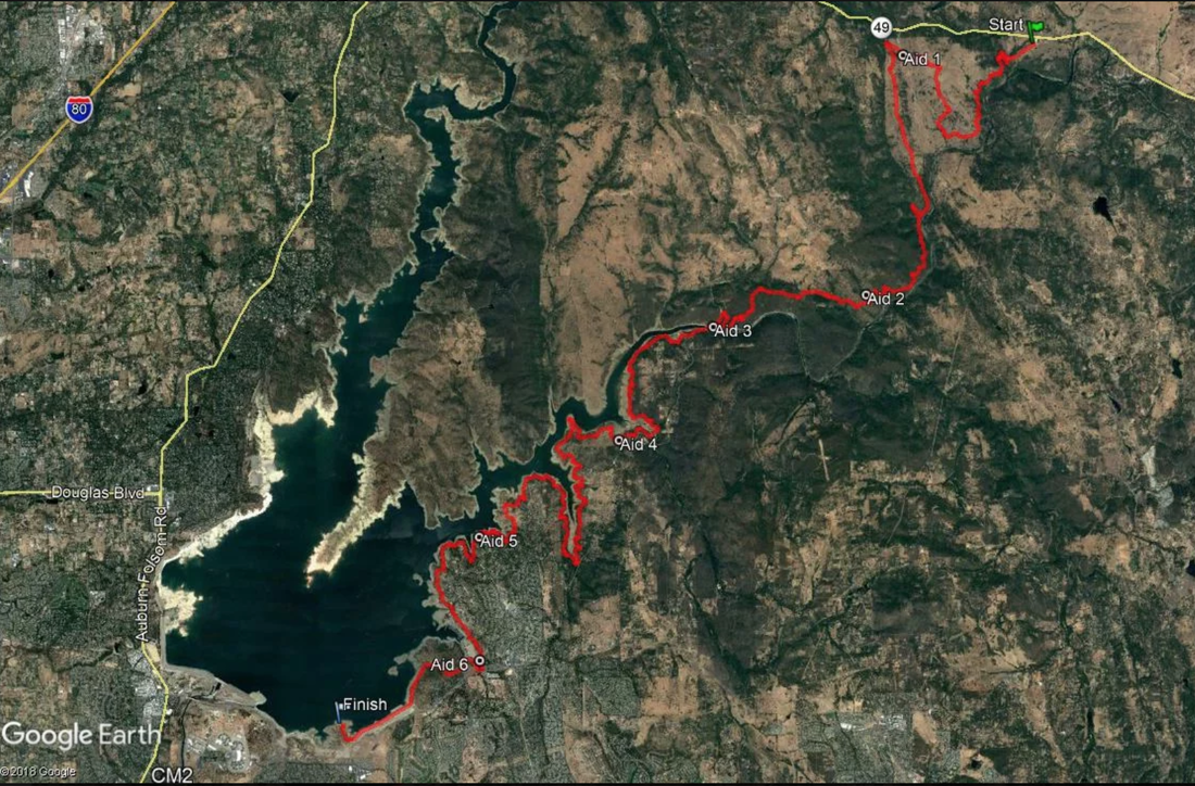
Comment periods for public actions are many times a formality. But Tahoe National Forest's Pines to Mines Trail Environmental Assessment (EA) comment period was upended by the last minute addition of e-bikes on a non-motorized trail by the Tahoe National Forest Supervisor.

One of the many excellent comment letters objecting to Tahoe National Forest's attempt to add electric motorized bikes to non-motorized trails through the Pines to Mines Trail Project EA was submitted by Back Country Horsemen of America (BCHA) and Back Country Horsemen of California (BCHC). It specifies the policies and laws that are being violated by including motorized E-bikes in the Pines to Mines Trail EA.

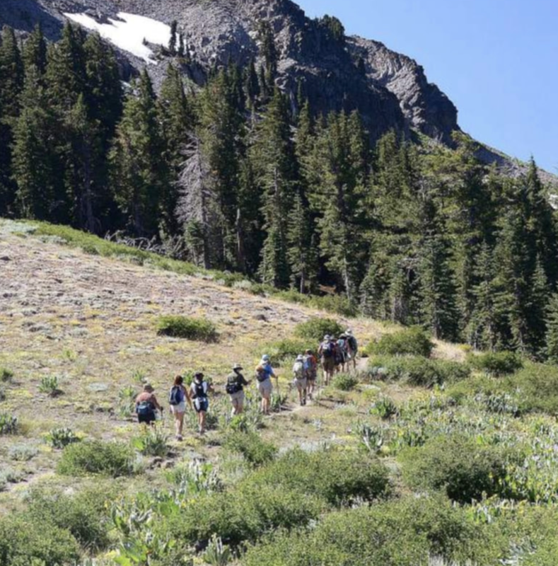
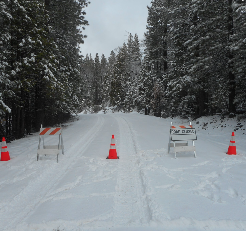
Gold Country Trails Council, BCHC, BCHA, Sierra Foothills Audubon Society, Sierra Club Mother Lode, Loomis Basin Horsemen, Emigrant Trail Conservancy, and Mother Lode Trails have submitted comments, and all agree that E-bikes do not belong on non-motorized trails. Period. There are thousands of miles of motorized trails for them on public lands in California. CLICK ON THIS PICTURE to find out why through this excellent letter.
Picture

Feb. 24, 2022: last 24 hours to make comments/objections to Tahoe National Forest considering e-bikes on Pines to Mines trail

2/24/2022

 
Picture
The public was given 30 DAYS in which to comment or object. From TFN: "To assure your comments are fully considered during the scoping phase of this proposal please submit them within 30 days." The 30 days is up tomorrow.

TO COMMENT or OBJECT TO THE PINES TO MINES TRAIL PROJECT:
<https://cara.ecosystem-management.org/Public//CommentInput?Project=61221>


CONTROVERSY OVER MOTORIZED USE
Trail users' representatives have been working on this trail for years as a designated non-motorized trail. Public support and money raised for the Pines to Mine Trail project specified it was to be a "non-motorized" trail. There are many trail easements and a grant given that designate the Pioneer Trail a non-motorized trail.  The Pioneer Trail will comprise the majority of the trail. The controversy started at the August 2021 Nevada County Board of Supervisors meeting to approve funding. Tahoe National Forest Supervisor Eli Llano included into request for funding the environmental report the use of motorized e-bikes. The trail-using public and then the Nevada County Board of Supervisors objected and said they were not appraised of this change and would not provide the funding promised for the environmental report if e-bikes were allowed. Here is the article:
"Nevada Co Board of Supes approves funding for non-motorized Pines to Mines Trail without the addition of motorized e-bikes"

LETTER OF SUPPORT FROM NEVADA CO BOARD OF SUPERVISORS
"The Nevada County Board of Supervisors would like to express their support for the proposed Pines To Mines Trail, a multi use, non-motorized trail connection between the Nevada County municipalities of Truckee and Nevada City. The trail will be suitable for use by hikers, equestrians, and mountain bikers."
Complete letter CLICK HERE.

REGARDLESS OF OBJECTIONS, E-BIKES MENTIONED AS AN ALLOWABLE USE IN PUBLIC DOCUMENTS
The e-bike inclusion is now in the public documents posted online. It is up to the public to object over the inclusion of allowable use of motorized e-bikes on the Pines to Mines non-motorized trail.

Here are the specific paragraphs in the Pines to Mines Trail public documents mentioning
e-bikes:


1. IN THE PINES TO MINE DRAFT OF PROPOSED ACTION
"Designation of allowable use – Designate the allowable uses of the proposed Pines to Mines Recreational Trails system. Forest Plan direction and Agency regulations, including the 2005 Travel Management Rule if applicable, along with different use scenarios and public input, will be assessed to determine the allowable uses. Potential uses include hiking/walking, running, mountain biking (including pedal-assist Class 1 EBike), and equestrian riding."
The trail map was cut off to not show the legend that specifies "non-motorized" trail, but the other links on the website include the trail map and do show the legend.

2. IN THE LEGAL NOTICE:
Designating the allowable uses of the proposed Pines to Mines Recreational Trails system. Forest Plan direction and Agency regulations, along with different use scenarios and public input, will be assessed to determine the allowable uses. Potential uses include hiking/walking, running, mountain biking (including pedal-assist Class 1 E-Bike), and equestrian riding.

3. IN THE PINES TO MINES SCOPING NOTICE
The project’s proposed actions include: Constructing approximately 16-18 miles of new, native surface, single-track trail from Eagle Lakes to Donner Summit connecting the existing Grouse Ridge and Hole in the Ground trails; Designating all, or portions of, approximately 50 miles of identified existing Forest Service System trails as part of the new Pines to Mines Recreational Trail system including Donner Lake Rim (15E75), Grouse Ridge (13E28), Hole in the Ground (14E25), Pioneer (09E11), and Spaulding Lake (12E40); and Designating the allowable uses of the proposed Pines to Mines Recreational Trails system. Forest Plan direction and Agency regulations, along with different use scenarios and public input, will be assessed to determine the allowable uses. Potential uses include hiking/walking, running, mountain biking (including pedal-assist Class 1 E-Bike), and equestrian riding.

4. ON THE MAPS
On each legend, trails are designated "non-motorized", but the new trail is not designated as such.

Copy of the email the public received today:

---------------- Begin Forwarded Message ----------------
Subject: Notice of Public Scoping
Date Sent: Thursday, January 27, 2022 4:00 PM
From: Brokaw, John - FS <john.brokaw@usda.gov>

Dear Interested Party:
The Tahoe National Forest is initiating scoping for the proposed Pines to Mines Trail Project for the development of a multi-use native surface trail system connecting Nevada City, CA to Truckee, CA.

The proposed trail system would be approximately 68 miles in length and would include all, or parts, of existing Forest Service network trails, as well as some new trail construction.

The proposal will serve to promote safe and sustainable recreation opportunities on public lands while continuing to meet our responsibilities to protect and preserve public resources.

We encourage you to review the attached information and follow the instructions provided to submit comments about the project. To assure your comments are fully considered during the scoping phase of this proposal please submit them within 30 days. Detailed information about the proposed action is posted on the Tahoe National Forest website at:

https://www.fs.usda.gov/project/?project=61221

Thank you for your participation.

John I Brokaw
Environmental Coordinator
Forest Service
Tahoe National Forest, Yuba Ranger District
p: 530-265-4531
f: 530-478-6109
john.brokaw@usda.gov
<mailto:john.brokaw@usda.gov>

631 Coyote Street
Nevada City, CA 95959-2250
www.fs.fed.us
​<https://www.fs.fed.us>
<https://usda.gov/>
[Forest Service Twitter]<https://twitter.com/forestservice>
[USDA Facebook]<https://www.facebook.com/pages/US-Forest-Service/1431984283714112>
Caring for the land and serving people

====

TO COMMENT or OBJECT TO PROJECT:
<https://cara.ecosystem-management.org/Public//CommentInput?Project=61221>


Tahoe National Forest (TNF) made the Pines to Mines Trail public documents available 
 
CLICK HERE TO FIND THE PUBLIC DOCUMENTS. 


Webber Lake camping reservations open March 1, 2022

2/24/2022

 
Picture
Webber Lake Campground Reservations Open March 1
Mark your calendars – Webber Lake Campground reservations for July 1 through Oct. 15 open on March 1 at 8 a.m. As the season draws closer, additional dates in June may also become available, depending on snow melt.

Webber Lake is the headwaters of the Little Truckee River, the largest single tributary of the Truckee River. Webber Lake is also a landscape rich in history.

In October 2012, the Truckee Donner Land Trust acquired the 3,000 acre property from its longtime owners, Clif and Barbara Johnson. Webber Lake had been in the Johnson Family since the 1870s. Until the Land Trust's acquisition, the property had been closed to the public for decades. The property consists of Webber Lake and two large meadows, Lower Lacey Meadow and Upper Lacey Meadow. Lacey Creek meanders through both meadows and feeds Webber Lake. Dr. David Webber’s hotel, built in 1860, is the last standing stagecoach hotel (out of about 30) on the historic Henness Pass Road.

What to do
Camping, fishing, hiking, kayaking and boating, paddle boarding, running, mountain biking, swimming and doing nothing all make it very easy to spend a week at Webber Lake.

Camping: Webber Lake offers a great camping experience between Truckee and Sierraville. Webber Lake Campground's 46  sites are open when conditions permit in the spring until October 15, or when winter weather shuts us down. All sites are spacious, well shaded and come with a table, fire pit and bear box.  Sorry, hook-ups and a dump station are not available. We love dogs but they must be leashed in the campground. Reservations are strongly suggested, walk-ins are not guaranteed.
Boating: Watercraft of all kind are welcome, but there is a 5-mph speed limit. Due to concern about aquatic invasive species (AIS) your craft is likely to be inspected.  A boat ramp and trailer parking are available. Sierra Country requires an AIS form be completed before launching that you download here.
Fishing: Webber Lake is legendary for anglers and arguably the birthplace of sport fishing in the Sierra when Dr. Webber first stocked the lake in 1860. Conventional gear fishing and fly fishing are permitted. Fishing is regulated by the California Department of Fish and Wildlife’s Sierra District General regulations. 
Hiking: The Lacey Valley Trail, about six miles roundtrip, offers an easy and memorable hike. The meadows offer spectacular wildflowers in spring and summer and are host to over one hundred species of birds, including rare and endangered species. Download a wildflower field guide provided by Ann Penfield. The trail begins at trailhead at the west end of the lake. (Signs will direct you.) There is not a bridge across Lacey Creek and for most of the summer your feet will get wet. The trail is wide and mostly flat with an uphill section between Lower and Lacey Meadows. The hike ends where the trail meets the Meadow Lake Road. Return the same way you came.
Day Use: Parking and picnic tables are available at no charge.
​
For information about Webber Lake Campgrounds, you can reach the campground hosts directly at (530) 587-2267 (CAMP).

CLICK HERE to see this article in the Truckee Donner Land Trust newsletter.

Heads up! Salmon Falls 50k Endurance Run this weekend

2/23/2022

 
Picture
Salmon Falls 50k starts Saturday 2/26/2022 at 7:30am from the Magnolia Parking Lot.
The race will begin at the Magnolia Ranch Trail Head parking lot off Hwy 49 in Pilot Hill and run through Cronan Ranch to the West Ridge Trail. Then a long descend ending near the South Fork of the American River. Coming off the overlook runners will begin descending to the Salmon Falls parking area. The route continues on from Salmon Falls until Browns Ravine Marina area. Runners will end the race by running across the top of Dike Eight to finish at Folsom Point recreation area.

If you are not an active participant in this race, you may want to use other trails on Saturday.

Webpage:
https://www.salmonfalls50k.com/


Facebook page:
https://www.facebook.com/SalmonFalls50K/
Picture

Placer Parks Commission approves recommendation for Parks and Trails Master Plan

2/17/2022

 
Picture
The Placer County Parks Commission approved recommending the Parks and Trails Master Plan to the Board of Supervisors on Feb. 10.
The plan is a culmination of a five-year process to reflect the recreational needs of Placer communities, including sports in Granite Bay and Loomis, a connected trail system and indoor recreation for eastern Placer during the winter.
Placer County Parks Administrator Andy Fisher and Stephanie Grigsby, project manager with Design Workshop, provided the commission with an overview of the master plan, including changes to the plan since December due to public comment. According to Fisher’s presentation, those changes include:
  • Revising the description and graphic for Trail #23 to clarify the intent to “connect the trail system in the Hidden Falls/expansion properties to (Highway) 49 where it could then connect to other trails in Meadow Vista, Auburn and beyond.”
  • Prioritization of the Interstate 80 corridor trail reflected in the county’s capital improvement plan.
  • Updating maps to be consistent with trail naming and alignments made by Tahoe National Forest.
  • Adding the 24-mile single-track motorized trail being constructed to connect Sugar Pine’s Loop 5 Trail, near China Wall, to the Western States Trail.
The presentation noted comments that have been acknowledged but implemented no change to the plan include allowing or restricting e-bikes on trails, opposing mountain bikes in open spaces, more bike paths and trails in Granite Bay and how the county plans to prevent illegal parking and trespassing.
According to Fisher, these changes will be implemented in a final draft of the master plan before going to the Board of Supervisors.
The Parks Commission unanimously approved to provide the board with a recommendation to approve the Parks and Trails Master Plan with the noted changes. The board is tentatively scheduled to review the plan in March.

https://goldcountrymedia.com/news/214746/placer-parks-commission-approves-recommendation-for-parks-and-trails-master-plan/

You Really Need to Replace Your Bike Helmet

2/13/2022

 
Picture
You should always replace a helmet after a crash, but there are several other key reasons to replace an old helmet - from Consumer Reports
There are plenty of great reasons to hop on a bike, whether you are training for a race, trying to make your commute to work healthier, or just trying to get out for some fresh air. No matter why you are riding, you should always be wearing a helmet.

But if it has been stashed on a basement or garage shelf for a while, you may wonder whether you need to replace your helmet, and if it’s still as protective as it was when you first brought it home from the bike shop.
Helmet-wearing is associated with almost a 70 percent lower risk of serious head injury in bicycling crashes, but helmets aren’t indestructible.

One thing experts agree on is that after a crash, you need to replace your bike helmet as soon as possible.

“A helmet can look fine after a crash,” says Rich Handel, a test project leader at Consumer Reports, who has been involved with CR’s bike helmet testing. The outer plastic shell on the helmet may bounce back to a normal appearance, even if the interior foam has been damaged in a way you can’t detect.
“Once that foam is compressed, you are reducing the safety margin you have,” he says. “That’s not going to protect you.”
Crashes aside, many bike helmet manufacturers recommend replacing your helmet every three to five years. But there’s no universally agreed upon standard for how often you should replace your bike helmet.
The Consumer Product Safety Commission, for example, advises that unless manufacturers recommend otherwise, you should get a new helmet every five to 10 years. The Snell Foundation, a standard-setting body that’s known to be one of the strictest in terms of helmet safety, says that normal wear-and-tear is enough to recommend helmet replacement every five years or so, though this is a judgment call, and wouldn’t apply, for example, to an unused helmet stored in good condition. CR experts recommend replacing your well-used bike helmet after five years, “out of an abundance of caution,” Handel says.
But if you really like your old helmet and it’s in good condition, holding on to it for longer isn’t necessarily going to put you at significant risk, according to Randy Swart, director of the nonprofit Bicycle Helmet Safety Institute, and former vice chairman of the helmet and headgear subcommittee for ASTM-International, a nonprofit, voluntary standard setting organization. “My own personal helmet is much older than that,” Swart says, though he adds that there may be other good reasons to get a new helmet, such as more protective technology included in some newer models.
Here’s why CR recommends generally replacing your bike helmet every five years, and what to know if you hold on to one for longer than that.
How Often to Replace Your HelmetCR recommends following manufacturer recommendations or getting a new helmet every five years or so because of the ways a helmet can get beat up over time, according to Handel. A heavily used helmet is going to be exposed to ultraviolet light from the sun, and it might be repeatedly tossed into a locker or a car, where summer temperatures can top 120 degrees Fahrenheit.
A beat-up, worn-out helmet will protect you better than not wearing one, according to Handel, but eventually, you’ll want to replace it.
Depending on where and how it is used, a helmet will be exposed to different levels of wear and tear, plus different environments, including varying degrees of heat and humidity, says Barry Miller, PhD, director of outreach at the Helmet Lab at Virginia Tech, which tests helmets for a variety of sports and conducts research into how helmets can reduce risks for brain injury.
“We would all assume performance degrades a bit over time,” says Miller.
But “the more important reason to upgrade your helmet is due to the technology advances,” he says. Newer helmets may fit better and be more comfortable, and they are more likely to come with technologies designed to reduce what are known as rotational forces, which contribute to concussions. (See CR’s explainer on rotational force mitigation in bike helmets.)
If your helmet has been through the wringer, or if you just want the latest in safety technology, a new helmet may be in order.
The Case for Hanging on to a Helmet LongerWhile you might want a new helmet for stylistic reasons, ventilation, or newer technology, you don’t necessarily need to replace a well cared for helmet for safety reasons alone, according to Swart. That recommendation is largely based on research conducted by engineering firm MEA Forensic, which found in tests of hundreds of helmets that age did not significantly affect the performance of the protective foam in helmets up to 26 years old.
But while the foam in a helmet doesn’t necessarily wear out, other aspects could, including the straps, the adjusters that help you tighten the helmet, or the hard plastic exterior shell. Many of those features are essential for ensuring a secure fit. If the colors have started to fade from sun exposure, that’s likely a sign that the exterior could have been weakened by sun exposure over time, says Swart.
If your helmet is still in good condition and you are concerned about sustainability, Swart points out that there are millions of bike helmets sold every year—potentially meaning that millions are making their way into landfills every year. If you have a reason to get a new helmet, you should, he says, but if you want to hold on to yours a bit longer and it’s in good shape, it should still offer reasonable protection.

​https://www.consumerreports.org/bike-helmets/when-you-really-need-to-replace-your-bike-helmet-a5593905789/

11th Annual Resolve2Run is a go after it was postponed after the massive snow storm

2/9/2022

 
Picture
The Resolve2Run race is finally a go this Saturday, Feb. 12, 2022, after December’s storm forced the postponement of the New Year’s Day run.

“It was the first time we had bad weather on January 1,” said Sue Ramey, course director. “It was postponed twice. We expected to run it the following weekend, but there were still downed power poles and trees … and there still some repair vehicles along the course route, so it was unsafe for the racers.”

This will be the 11th annual Resolve2Run competition, which also includes walkers and will comprise all ages. Medals will be presented to first, second and third place finishers for men and women in each age group, staring with 12 and under, 13 to 19, then each decade from 20s to 80s.

The race begins at at 10 a.m. at Chicago Park School, 15725 Mount Olive Road. Over 170 people had signed up as of Monday, though registration is still possible on race day. Those planning to register on Saturday should arrive by 9 a.m.

Competitors also can register online at resolve2run.com/registration. The cost is $20 for adults, and $10 for youth.

Runners are not required to wear masks, as all activities are outdoors.

The weather is forecast to be in the 70s.

“You could not get a better day. It’ll be beautiful, and cool enough for running,” said Ramey. “The course goes through back roads known for its orchards and rural setting and crosses the old Emigrant Trail.”

Signs will be posted about the old Emigrant Trail, as well as the Narrow Gauge Railroad berm, an 1800s ranch homestead and a pear packing shed when Peardale and Chicago Park were the largest pear producers in the nation.

“We have water stations along the course,” said Ramey. “And it’s organized by the Peardale/Chicago Park Firefighter Association, Chicago Park School PTA, and the Chicago Park 4-H Club.”

Firefighters will direct runners and intervene with first aid if any emergency should arise.
“We give a huge shout out to all our sponsors,” said Ramey. “We’ve had the most we ever had — way beyond our dreams. There were 55 sponsors. Just amazing and such a generous community.”


No wheeled objects EXCEPT strollers are allowed. This includes shopping carts, floats, rollerblades, skateboards, bicycles, unicyles, or other wheeled objects. They are a safety issue in a crowded race.
No animals – for their safety as well as for the safety of all our participants.
No headphones or ear buds for your own safety.
Ramey said race results will be published after the competition on http://www.resolve2run.com.

CLICK HERE to see the original article in The Union newspaper.


Tahoe National Forest still has road and trail closures

2/7/2022

 
Picture
Recreation enthusiasts looking to travel to both the Tahoe National Forest and the Lake Tahoe Basin Management Unit (LTBMU) are being asked to keep safety practices in mind over the coming weeks while winter weather conditions remain.

Motorists are reminded to abide by all Forest Road and motorized trail closures. Many roads contain variable conditions of ice, snow, frozen ground, or mud, and may be hazardous to drivers. Additionally, roads may be blocked and impassable due to downed trees and forest litter. Forest litter may also block culverts. Drivers should never drive through running or standing water without investigating it first. Culverts may be washed out and roadbeds may be compromised.

Those planning on ice skating, fishing, or trekking onto frozen lakes, ponds or reservoir surfaces are reminded to exercise caution. Due to daily temperature changes, areas that may have been solid and supportive under freezing conditions may have thawed and become impassible. Traveling and recreating on frozen lakes, ponds and rivers may be hazardous, is not recommended and is at your own risk. Consider visiting an indoor skating facility as a safer alternative.

Please use caution when traveling in the backcountry. Have a plan, notify others of your travel itinerary, avoid routes over frozen lakes, steep side-slopes, or other natural hazards.

A good practice is to check  road, trail, and ice conditions the morning of any and all travel and recreation plans.

Road closures will be noted online via the Tahoe NF and LTBMU websites.
Many popular road and trail status updates are listed below.
Trails
  • Burlington Motorcycle Trail System – Open/Closed status based on existing soil moisture.  Currently closed due to snow. Call 530-478-6253 ext. 243 for current status message updates.
  • Sugar Pine OHV Trail System – Open/Closed status based on existing soil moisture.  Currently closed due to snow drifts and scattered overly saturated conditions. Call 530-478-6254 ext. 228 for current status message updates.

Roads
If the specific roads listed below are not being managed as snowmobile trails due to insufficient snow, then they will be open to wheeled vehicles:
  • To find out if wheeled vehicles are restricted during winter on the 07 (Fiberboard) Road call 530-994-3401
  • To find out if wheeled vehicles are restricted during winter on the 18 (Bowman) or 93 (Gold Valley) Roads call 530-288-3231 ext. 243
  • To find out if wheeled vehicles are restricted during winter on the 96 (Mosquito Ridge) Road call 530-367-2224 ext. 228

CLICK HERE to see this post on the Tahoe National Forest website.

Most of Empire Mine SHP trails open after tree clearing

2/7/2022

 
Picture
Photo: Little Wolf Creek Bridge.
​

Several hikers and equestrians have reported this past week that the Penn Gate equestrian parking area and most of the trails are now open at Empire Mine SHP. The maintenance workers have been working most days since the big storm to clear downed trees and opening trails once they are determined safe.

The trail that follows the south fence line off of Hardrock is not open.
The Stacey Lane Trail is still blocked.

Unfortunately, the scenic bridge over Little Wolf Creek is still under repair. 

The American River 50 endurance run is ON!

2/3/2022

 
Picture
Auburn, CA /ENDURANCE SPORTSWIRE/ – American River 50-Mile Endurance Run (AR50), presented by Altra, the iconic, historic and second-largest 50-mile endurance run in the United States is returning for its 43rd year. The prestigious race event brings together veterans, first-timers, and runners traveling from out of the country.

Taking place on Saturday, April 2, 2022, the event features two epic races on Folsom’s most scenic trails. In addition to the AR50, the event will also feature a 25-mile event, AR25, beginning at Beal’s Point and finishing in Auburn.

“Whether you are attempting your first 50 miler or simply seeking a personal best, this race is for you,” said Julie Fingar, race director. “We are incredibly grateful for our continued partnership with the City of Folsom as our start line and hospitality host, as well as our generous sponsors and heartfelt volunteers. These events would not be possible without your support!”

AR50 begins at Folsom Point at the Folsom Lake State Recreation Area in the Sierra Nevada foothills. Athletes will attempt their fastest race with the Folsom Lake sparkling in the background as they begin their 50-mile journey on single track trails. The course travels over the Lake Natoma Crossing bridge, reaches the American River Bike Trail and up to Hazel Bluffs.

At Beal’s Point, the 25-milers will start their portion of the race and the 50-milers will continue to push through the second half of their race.

Runners will continue to test their physical and mental abilities from Granite Bay State Park, (home of the Pioneer Express Trail) and to Dowdin’s Post, where the trail travels to the infamous “Dam Wall.” Runners begin the dramatic climb to the summit and are greeted by the “Party at Last Gasp.”
Runners reach the home stretch with motivational mile marker signs, the sounds of congratulatory cow bells and energetic cheerleaders while they run their 2.5 victory miles to cross the finish line in Auburn.

To RSVP for the second largest endurance run in the United States, visit: 
https://raceroster.com/events/2022/55361/american-river-50 
or contact Julie Fingar
 Julie@norcalultras.com
916.765.6021
julie@norcalultras.com
www.ar50mile.com

<<Previous

    Archives

    March 2023
    February 2023
    January 2023
    December 2022
    November 2022
    October 2022
    September 2022
    August 2022
    July 2022
    June 2022
    May 2022
    April 2022
    March 2022
    February 2022
    January 2022
    December 2021
    November 2021
    October 2021
    September 2021
    August 2021
    July 2021
    June 2021
    May 2021
    April 2021
    March 2021
    February 2021
    January 2021
    December 2020
    November 2020
    October 2020
    September 2020
    August 2020
    July 2020
    June 2020
    May 2020
    April 2020
    March 2020
    February 2020
    January 2020
    December 2019
    November 2019
    October 2019
    September 2019
    August 2019
    July 2019
    June 2019
    May 2019
    April 2019
    March 2019
    February 2019
    January 2019
    December 2018
    November 2018
    October 2018
    September 2018
    August 2018
    July 2018
    June 2018
    May 2018
    April 2018
    March 2018
    February 2018
    January 2018
    December 2017
    November 2017
    October 2017
    September 2017
    August 2017
    July 2017
    June 2017
    May 2017
    April 2017
    March 2017
    February 2017
    January 2017
    December 2016
    November 2016
    October 2016
    September 2016
    August 2016
    July 2016
    June 2016
    May 2016
    April 2016
    March 2016
    February 2016
    January 2016
    December 2015
    November 2015
    October 2015
    September 2015
    August 2015
    July 2015

    Categories

    All

    RSS Feed

Home
Contact
 Mother Lode Trails is YOUR local volunteer-run trail information and resource website. Here you can find
up-to-the minute information on trail alerts, links and trail news for Placer,  Yuba, and Nevada counties.
Mother Lode Trails is trademarked.