MOTHER LODE TRAILS
  • Home
  • About
  • Contact
  • Volunteer
  • Links
    • Law Enforcement Emergency
    • Federal, State, County Districts Parks & Trails
    • Running Clubs
    • Equestrian Clubs
    • Mt. Bike Clubs
    • Hiking Clubs
    • Trail Advocacy Organizations
    • Phone Numbers State & Federal Parks, Trails & Lands
    • Lost & Found on the Trails
    • Where to Eat on the Trails
  • News
  • Alerts

NID restricts campfires in Scotts Flat, Rollins, Jackson Meadows, Bowman Lake to reduce wildfire risk

8/28/2020

 
Picture
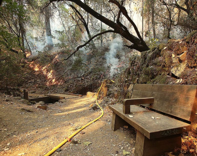
Because of hot weather and dry conditions, campfires are now prohibited on recreational facilities owned and operated by the Nevada Irrigation District (NID).
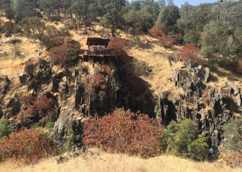
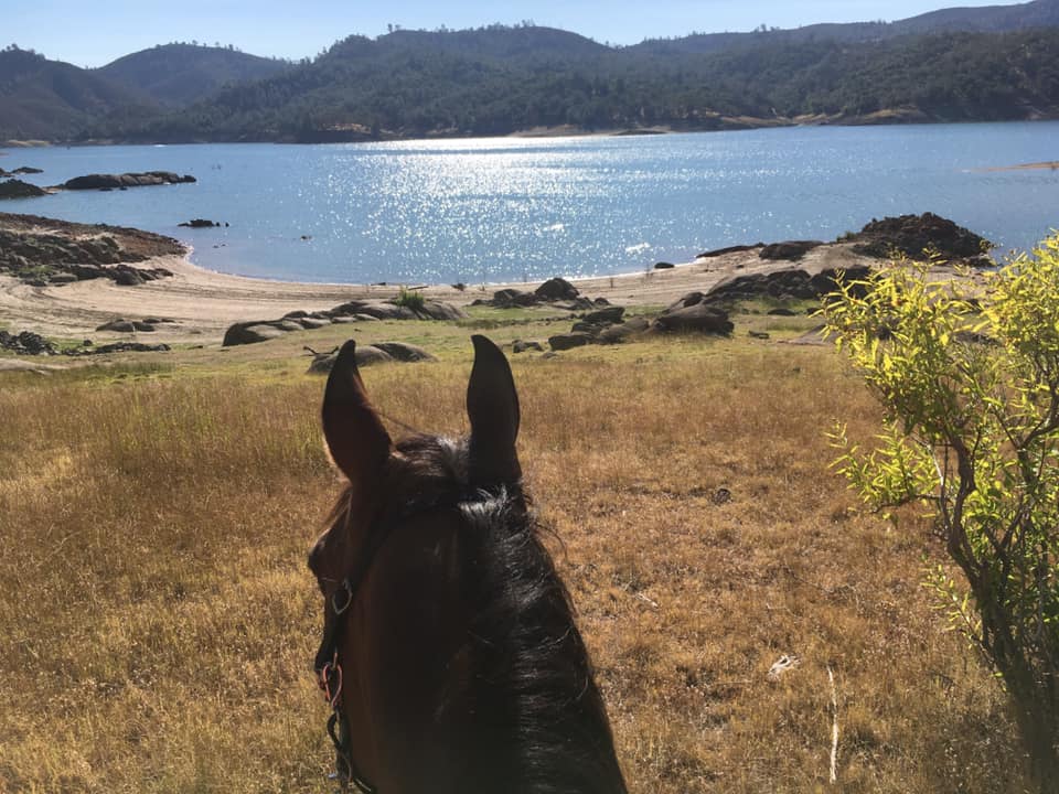
The ban includes developed campgrounds around Scotts Flat Reservoir and Rollins Reservoir, as well as dispersed camping and recreational facilities in the higher elevations around the Jackson Meadows – Bowman Lake areas.
Under the new rules, campfires and open fires fueled by wood or charcoal are prohibited. Portable cooking stoves, lanterns that use liquefied or bottled fuel and propane-fueled portable fires are permitted because they can be instantly switched off.

“NID thanks the community, campers and recreationists for understanding the need for these restrictions,” said NID Recreation Manager Monica Reyes. “With the current dry, hot conditions fires caused by abandoned or escaped campfires pose a greater threat to our community, firefighters and the forest.”
Please note: campfires are still allowed in campgrounds at East Meadows, Pass Creek, Woodcamp and Fir Top up at Jackson Meadows, which are operated by Nevada Irrigation District in cooperation with the Tahoe National Forest.

CLICK HERE to see the original article in Yubanet.com


UPDATE: Empire Mine SHP opens Penn Gate

8/22/2020

 
Picture
8/22/2020 UPDATE: Parking areas closed, except Penn Gate.
In response to resources allocated to the Jones Fire, and in the interest of public health and safety, all parking areas within Empire Mine State Historic Park are closed, with the exception of the Penn Gate Parking Area.
(When you can see smoke, be  aware any exercise for you and your pets is dangerous and can cause permanent lung damage. - MLT)
CLICK HERE FOR MORE INFORMATION:
https://www.parks.ca.gov/?page_id=499

----------------------------------------
Park Closure due to Jones Fire (8/19/2020):

A Full Closure is in place immediately for the entire park due to the Jones Fire and resources dedicated to this emergency response.

CLICK HERE FOR MORE INFORMATION:
https://www.parks.ca.gov/?page_id=499

How in the heck to you ride and hike and run and wear a mask?? Bill Nye tells us.

8/21/2020

 
Picture
Bill Nye Has Strong Feelings About Wearing a Mask While Hiking and Biking
The Science Guy on why and when we need to be masking up—and where he's planning to travel when the pandemic is under control.  August 20, 2020

Bill Nye is frustrated. "The science is so well understood for what to do during a pandemic," he says. "It's so well figured out, and we're ignoring it all. It's not working for me." So, he's doing something about it, collaborating with Airband on a collection of science-themed washable, reusable masks with filters, and sending the proceeds to the University of Washington’s Institute for Health Metrics and Evaluation, which is working on strategies to combat the COVID-19 pandemic.We sat down to check in with Nye and hear him break down—in the elementary terms he's so known for—why we should be wearing masks, when he's wearing them and when he's not, and where he dreams of traveling when the pandemic is finally under control. (Which would be sooner, he says, if we all just wore a dang mask.)

For those who may still be hesitant to mask up, can you explain how masks work and why they're so important in this moment?
Masks keep a great many particles from your breath from getting into the air, and they keep a great many particles in the air from getting into your nasal passages. They're a filter, like a coffee filter only for particles. But the thing that I want everybody to keep in mind is it literally works both ways—and when I use the expression literally, I mean literally, actually, for real. So you want to keep particles carried on water droplets from the breath of people who are sick around you from getting into your lungs. And you don't want particles from you getting into the air of the people around you. This is what people generally call public health. It's what my parents would call common sense, right? But as they often pointed out, common sense is not that common.

People are leaving their homes much more often than they were in late spring and early summer to get outside, walk, bike, and even go to the beach. I'm going to throw a few scenarios at you so you can let us know how we should be approaching mask-wearing. You are going on a hike and it's a fairly empty trail. When are you wearing your mask?
All you have to do is wear it when you see somebody approaching, like when they get within, say, 30 feet. I recommend you tie a string—a piece of cord or even a shoelace—to the ear straps of your mask, so that you can let it hang around your neck to carry it and easily put it on when you see someone.

If you were doing the same thing on a busier trail or you arrived and the trail was much busier than you expected, what would your advice be?
Wear it the whole time. And if you’re finding it hard to breathe, slow down. Dying is a big price to pay for trying to keep up with what you might call scout's pace.

If you were biking around in a city, where you may get near pedestrians or other bikers, what’s your advice?
Let's talk about me. I am an old man hurtling toward death, so when I'm biking on the flat of Ventura Boulevard here in Los Angeles, where all these cars are parked and people are constantly coming out of restaurants with takeout food, I wear the mask the whole time. Then, when I turn and go on Coldwater Canyon, there's a long line of houses, maybe three L.A. city blocks, and I still wear the mask the whole time. But then it breaks into a kind of rural area right within the city limits of Los Angeles, with coyotes and deer everywhere. I let the mask drop. Last night, I caught up with a guy on the Coldwater hill—it's like 1,000 vertical feet or something—and I pulled over, put my mask on, passed him, and when I got about 100 feet ahead of him, I took my mask back off. And when I say take it off, it hangs around my neck. I’ve got a string that hooks on my helmet so I can pull the mask up and drop it down easily. When I got to the stoplight at the top of the hill, right at Mulholland Drive, just like in the movies, I put the mask back on because the car next to me had its windows down. I'm very aware of that. So the answers with biking is that it absolutely depends.

Talk to me about this string contraption.
I bought some nylon cord in tons of different colors—gray, black, red. I use a sheet bend knot. I recommend it to everyone. It’s like a square knot with a little cross to connect the two ends. I tied cords onto all of my Airband masks. I have a few, because they’re washable up to 50 times, so seven will just about get you through a year.

At this point, we have pretty well-established COVID-19 routines, like mask-wearing, hand-washing, prioritizing the outdoors, and social distancing. What do you hope sticks around, post-vaccine?
In many cities in Asia, when people are feeling sick, they put on a mask. So I hope that we learn to wear masks any time we're sick. And I hope a tradition emerges that when you're sick, you don't go to work—and I hope employers acknowledge that. It's really in everybody's best interest not to make everybody else sick. These habits work in our favor—especially hand washing.
As we say in science, your enemies are not lions and tigers and bears. They, of course, are troublesome. Sure, they're spectacular. A shark attack is spectacular. A bear attack is noteworthy. But your real enemies are germs and parasites. That's what's gonna kill you.

Read the complete story in Conde Nast Traveler CLICK HERE.


Impacts of Jones Fire on the Independence Trail in South Yuba River State Park, "I can't believe it's gone."

8/21/2020

 
Picture
Nevada County, Calif. August 20, 2020 – The Jones Fire continues to burn in Nevada County while several agencies work jointly to combat the fire, protect life and property, and assess damages. California State Parks Department Resources Team is in the area of the burn today to assess damages to natural, cultural, and recreational resources while collaborating with CAL FIRE to develop a rehabilitation plan. Until further notice, a District Superintendent Order is in effect, closing all parking areas within South Yuba State Park, including the parking lots at the HWY 49 crossing, Independence Trail and Bridgeport. This includes all State Park’s lands, west of Highway 49, south of the South Yuba River, including Jones Bar Road. Restrooms will remain open.

The Independence Trail within South Yuba River State Park has been closed since earlier this spring due to landslides and bridge instability. The portion of the trail west of Highway 49 was severely impacted by the Jones Fire, resulting in the loss of several wooden flumes, and bridges. As such, the entirety of the Independence Trail on both sides of Highway 49 will be closed to public access until further notice. California State Parks and CAL FIRE will work in close partnership to rehabilitate damaged areas. California State Parks will also partner with the Bear Yuba Land Trust to survey and make plans for future repairs to the historic flumes and bridges.

The Independence Trail follows the route of the historic Excelsior Ditch. Started in 1855, the Excelsior Ditch was constructed by the Excelsior Canal Company serving as a water transport ditch for mining, and later irrigation, covering 35 miles and terminating at the South Yuba River. The ditch operated until it was abandoned in 1961. A portion of the ditch on land under the jurisdiction of the Bureau of Land Management was found eligible for listing in the National Register of Historic Places in 1982. California State Parks owns the length of the Excelsior Ditch between Highway 49 to approximately 3 miles to the west. The Independence Trail, developed by Sequoya Challenge as a nature trail for wheelchair access during the 1970’s, includes three miles of the Excelsior Ditch. Remnants of the ditch are still evident along the trail in the form of dirt line ditches, reconstructed wooden flumes and bridges, and rock walls. Most of the wooden flumes were rebuilt in the 1970s-80s and again after they burned during the 1988 “49er Fire”.
​

Portions of the wooden flumes that burned during the recent Jones Fire dated to the 1970s-1990s. Though they were not original historic fabric, the loss of these features not only prohibits access to some of the trail’s most spectacular features, but also diminishes the sense of history engrained in the trail’s origin. State Parks intends to reconstruct the flumes following Secretary of Interior Standards for Reconstruction and looks forward to reopening the trail for future generations of Californians to enjoy.

See the complete article in Yubanet.com CLICK HERE.

-----------------------------
‘I can’t believe it’s gone’: Independence Trail ramp, flumes destroyed in Jones Fire (VIDEO/PHOTO GALLERY)
--from The Union Newspaper
All Independence Trail flumes within the Jones Fire’s perimeter, including the iconic ramp up to Rush Creek and the largest Rush Creek ramp flume, have been destroyed, California State Parks confirmed Thursday.

Matt Green, acting Sierra District superintendent for California State Parks, said surveys to determine a damage percentage for the western portion of the trail were ongoing as of Thursday. The entire trail is currently under a closure order, as is the South Yuba River State Park west of Highway 49 and south of the river.

“There’s a lot of work to be done in there,” said Green, adding that Cal Fire personnel are working with State Parks to perform extensive rehabilitation to the area, including re-contouring parts of the hillside to prevent future damage.

“(Cal Fire brings) crews and works really well with our environmental scientists to try to make it so it’s going to be sustainable,” said Green. “We get heavy rains and other episodic events that have taken out portions of the Independence Trail in the past, so they’re trying to do preventative measures now.”
“It was an example that anyone could use of how to get people from different walks of life together to work on a project — that’s what the Independence Trail was.”Alden Olmsted, son of John Olmsted
Green said Cal Fire has done an amazing job this week while working to save the South Yuba River State Park and its resources, and that State Parks will also be working with the Bear Yuba Land Trust — which owns parts of the trail — to form a plan to rebuild once the damage has been assessed in more detail.

“I can’t believe it’s gone,” said Erin Tarr, co-executive director of Bear Yuba Land Trust.

Tarr said that some of the affected areas of the trail had undergone closures, an extensive funding process, and restoration since BYLT acquired the property in 2012, including the Rush Creek flume which has been destroyed.
“We want to rebuild it, certainly that’s our goal, but it was such an endeavor. And it was such a special place,” she said.

‘IT SPEAKS TO PEOPLE’S HEARTS’
The Independence Trail, the United States’ first wheelchair-accessible wilderness trail as of the 1980s, was founded by John Olmsted. Built in the 1970s, the trail represented his mission of making the outdoors accessible to all.

“It speaks to people’s hearts to have a place to feel safe in the outdoors,” said Linda Chaplin, who worked in a conservation nonprofit called Sequoya Challenge, founded by Sallie and John Olmsted, for around 25 years.

“I think kids that came out in school groups from 20 years ago still have memories of doing that, and it’s a very vivid experience that sticks with you the rest of your life,” said Chaplin.
“In Nevada County, to have a flat trail is pretty unique, because most of the country is not flat,” said Chaplin. She said John Olmsted was motivated in his work not only by a love for the outdoors but by a drive to help increase accessibility, sparked by a push in the 1960s and ’70s to help veterans of the Vietnam War who had returned home with disabilities causing mobility issues.

She said Olmsted, who died in 2011, was a “grassroots person” and one of the first in Nevada County to gather groups of volunteers geared toward natural preservation and education, something which is now a well represented cause in the area.
Alden Olmsted, the son of John Olmsted, said he had avoided the news since noticing on a map that the Jones Fire’s perimeter had reached the trail, knowing it was likely to be destroyed. “It’s incredibly sad,” he said.
He recalled his late father having gone to the site of the trail during the 49er Fire in 1988, borrowing a hard hat in order to blend in among fire personnel, and using a Rush Creek pay phone to instruct helicopters overhead.
“It’s not just my dad, hundreds or maybe thousands of other people have worked on it, picked up garbage, and rebuilt parts of it,” said Olmsted. “It was an example that anyone could use of how to get people from different walks of life together to work on a project — that’s what the Independence Trail was.”

A CONTINUED EFFORT
As of Thursday evening, the Jones Fire had burned 705 acres and was at 10% containment, Cal Fire reports, with five structures destroyed and one damaged. Lightning has officially been determined to have caused the fire.

In an afternoon update, Cal Fire battalion chief Steve Mueller said crews have made good progress in keeping the fire within containment lines. He said the objective going forward will be to keep the fire south of the Yuba River, west of Highway 49, north of Newtown Road, and east of Jones Bar Road, as well as continue ongoing mop-up efforts on the perimeter.

The Nevada County Office of Emergency Services reported Thursday 15,541 residents previously under evacuation orders or warnings have been cleared to return, leaving 700 affected by the only remaining evacuation order.
​

PHOTO GALLERY from The Union newspaper CLICK HERE.
Picture

Due to Jones Fire, CA State Parks closing Malakoff Diggins, Bridgeport State Park, Empire Mine State Historic Park

8/19/2020

 
Picture
Due to the recent fires and, especially, the air quality situation here in Nevada County, State Parks is temporarily closing the Empire Mine, Malakoff Diggins and South Yuba River/ Bridgeport State Parks effective immediately. The Parks will be closed at least through this coming Sunday, August 23rd, 2020.

Read all the Jone Fire information here on Yubanet.net.

Jones Fire closes Independence Trail, south fork Yuba area

8/18/2020

 
Picture
Video update this morning: https://www.facebook.com/CALFIRENEU/videos/339004400460276

The fire just northwest of Grass Valley has spread to 340 acres, threatening more structures and triggering evacuations of 1,500 people. To keep updated CAL FIRE NEU - https://www.facebook.com/CALFIRENEU

Text JONES to 797979 for the latest updates on the Jones Fire.

​Jones Bar Road and Newtown Road in Nevada County.
Update from Incident Commander Division Chief Jim Mathias. 340 acres 0% contained.


Highway 49 closed from Newtown Rd to Reader Ranch due to fire activity. Please avoid the area.

Tahoe National Forest Loyalton fire now 44,000 acres

8/18/2020

 
Picture
Loyalton Fire Morning Update 8-19-2020
https://inciweb.nwcg.gov/incident/article/6975/53403/

Current Situation: As of 6:30 a.m., no additional structures have been damaged or destroyed by the fire.
The fire was considerably quieter overnight than it has been for the last few days. Activity was visible behind Bug Station on the east side of Highway 395, but the flare up was within the burn perimeter, and firefighters quickly extinguished it. While line along the top of the fire continues to hold well, unburned islands of vegetation continue to ignite and burn.
Crews worked overnight to attack the fire directly on its southeastern edge, working into Balls Canyon as possible with dozers and hand crews. They continued to build and strengthen indirect line (built away from the fire) on the southern edge. The priority today is to complete this line in advance of today’s predicted winds. The fire remained active in this area overnight.
At 8 p.m. yesterday evening, the nationwide Planning Level was increased to Planning Level 5, indicating that Potential for emerging significant wildland fires is high and expected to remain high in multiple geographic areas. With multiple fires in California and nationwide, this means that firefighting resources are in high demand across the country.
Weather: A Red Flag Warning is in effect today for high temperatures and strong, gusty, winds.
A downloadable version of this update and maps are available at https://inciweb.nwcg.gov/incident/6975.
Evacuations
·       All evacuations for Sierra Brooks have been lifted
·       All evacuations for the areas of Cold Springs and Bordertown have been lifted.
·       Mandatory Evacuation Orders remain in effect for Balls Canyon Road, Long Valley Road, and Copperfield.
·       Evacuation Advisory for the City of Loyalton and homes on the south side of Highway 49 west of Loyalton to Lombardi Point 
·       Evacuation advisories remain in effect for the areas of Chilcoot and Vinton.
·       Evacuation advisories remain in effect for the area of Hwy 49 and 70 south to Loyalton, and to the east side of Hwy 49.
·       All Evacuation in Lassen County have been lifted. Residents are allowed to return to their homes.
Road Closures
·       Hwy 49 is currently open.
·       Hwy 395 is currently open.
·       Hwy 70 is currently open.
Forest Closures
A Forest Closure for the Dog Valley area was issued on the Humboldt Toiyabe National Forest due to the fire’s southern spread. Find the closure order at https://inciweb.nwcg.gov/incident/article/6975/53327/
Go to www.fs.usda.gov/tahoe.
Join the conversation by following us on Twitter at twitter.com/Tahoe_NF and Facebook at www.facebook.com/TahoeNF.

UPDATE: Hidden Falls Regional Park closure extended Aug. 15-19 due to extreme fire weather conditions

8/14/2020

 
Picture
UPDATE TODAY
Hidden Falls Regional Park’s closure has been extended from Aug. 15 to Aug. 19 due to extreme fire weather conditions. Visitors with reservations during closure days will be given credit for the purchase price of their reservation. Thank you for your understanding. Stay safe out there. Learn more:
https://www.placer.ca.gov/6765/Hidden-Falls-Park-closed-Aug-15-19

====================================================

PREVIOUSLY POSTED
AUBURN, Calif. August 13, 2020 – Hidden Falls Regional Park in North Auburn will be closed Aug. 15-16 due to extreme fire weather conditions.
“Wildfire prevention is at the top of our priority list,” said Placer County Parks Administrator Andy Fisher. “We truly appreciate everyone’s patience and understanding about the decision to close the park for a couple of days due to extreme fire weather conditions.”
Visitors with reservations during closure days will be given credit for the purchase price of their reservation towards a future date.
Extreme fire weather days are determined in consultation with weather and fire officials and generally coincide with conditions that prompt ‘red flag’ and ‘extreme heat’ warnings.
While the park will be open most days, visitors should anticipate periodic closures through the fall on days when fire risk is driven to extremes by high temperatures, high winds and low humidity.
Park closure notices are given as far in advance as possible but may be as short as 12 hours before closure the following day.

To read original article CLICK HERE to access YubaNet.com 

FROM PLACER COUNTY PARKS:
Due to excessive heat, we will not be taking any reservations this weekend, August 15 - August 16. Please call our office at (530) 886-4901 if you have any questions or concerns. You can visit 
https://www.placer.ca.gov/6106/Hidden-Falls-Regional-Park

HIDDEN FALLS REGIONAL PARK TO CLOSE ON DAYS OF EXTREME FIRE WEATHERAs part of our land stewardship and commitment to reduce wildfire risk, beginning July 1, Hidden Falls Regional Park will begin closing the park to public access during days that are determined to be extreme fire weather.  Notice will be given as far in advance of closure days as possible but may be as short as 12 hours’ notice before closure the following day.  Please check status immediately before leaving on your visit to Hidden Falls this summer.  Visitors with reservations during closure days will be given credit for the purchase price of their reservation to be used for a future visit.  Thank you for your understanding in helping to keep Hidden Falls and its neighbors safe from wildfire.

FAQ’s
WHERE CAN I CHECK CLOSURE STATUS BEFORE MY VISIT TO HIDDEN FALLS?
​Notifications will be posted to the following website:
https://www.placer.ca.gov/6106/Hidden-Falls-Regional-Park 
or by calling (530) 886-4901. You may also check our social media sites for updates.
HOW WILL CLOSURE DAYS BE DETERMINED?
Staff will determine extreme fire weather days in consultation with weather and fire officials and would generally coincide with conditions that prompt Red Flag and Excessive Heat warnings.

Seven Placer County trail rescues in one day...public not prepared for trail conditions

8/4/2020

 
Picture
First responders are reminding the public to be prepared for trail conditions after conducting seven rescues from 10 a.m. to 1:30 p.m. Saturday.
Mary Eldridge, public information officer for Cal Fire, said the rescues were “all over,” with two taking place at Upper Lake Clementine, one on River View Trail near Auburn, one on Western States Trail near Foresthill, one on Pioneer Express Trail near Auburn, one on Steven’s Trail in Colfax and the last incident at Hidden Falls Regional Park on South Legacy Trail.
Six incidents involved individuals who were unprepared for the trail conditions, according to Eldridge. One such incident involved a 17-year-old female who became ill from the heat during her hike on Steven’s Trail and had to be transported by helicopter to an ambulance. According to Eldridge, Steven’s Trail is a 9-mile hike with an abundance of sun exposure.
The last incident involved an individual who sustained an ankle injury.
“These are not easy hikes people are attempting,” Eldridge said.
According to Eldridge, this volume of incidents due to being unprepared for trail conditions is uncommon and may be due to an influx of visitors who may have seen the trail in a social media post and wanted to get outside during the COVID-19 restrictions. This increase in incidents results in an increase on the need for a range of rescues and resources.
“Those visitors are not used to the conditions of the trail,” Eldridge said. “Our trails aren’t paved. Wilderness trails are not your common, paved urban trail.”
Eldridge recommends staying hydrated and bringing water on the hike. Hikers should start hydrating the day before and avoid caffeine. Starting the day with caffeine, Eldridge said, leaves you already dehydrated and by 10 a.m., temperatures are reaching the point of taking resources out of you.
Eldridge also recommends researching the trail beyond the social media post.
“Please learn a little bit about the trail,” she said. “Really know how long the trail is and the conditions of the trail.”
The final piece of advice Eldridge offers to hikers is to remember you can stop along the trail. Hikers should find shade, rest and drink water if needed.

CLICK HERE to see original article and photo in Gold Country Media.

Folsom Lake SRA Beach trail above water

8/1/2020

 
Picture
According to the Sterling Pointe docents, the beach trail from Sterling Pointe south is no longer under water. For those of you on horses, be careful of the bogs - you CAN get stuck there, just like quicksand. Be sure to follow other sets of hooves below Mile Marker 40 and you should be safe.​
Photo credit: Majestik Mirage

    Archives

    January 2023
    December 2022
    November 2022
    October 2022
    September 2022
    August 2022
    July 2022
    June 2022
    May 2022
    April 2022
    March 2022
    February 2022
    January 2022
    December 2021
    November 2021
    October 2021
    September 2021
    August 2021
    July 2021
    June 2021
    May 2021
    April 2021
    March 2021
    February 2021
    January 2021
    December 2020
    November 2020
    October 2020
    September 2020
    August 2020
    July 2020
    June 2020
    May 2020
    April 2020
    March 2020
    February 2020
    January 2020
    December 2019
    November 2019
    October 2019
    September 2019
    August 2019
    July 2019
    June 2019
    May 2019
    April 2019
    March 2019
    February 2019
    January 2019
    December 2018
    November 2018
    October 2018
    September 2018
    August 2018
    July 2018
    June 2018
    May 2018
    April 2018
    March 2018
    February 2018
    January 2018
    December 2017
    November 2017
    October 2017
    September 2017
    August 2017
    July 2017
    June 2017
    May 2017
    April 2017
    March 2017
    February 2017
    January 2017
    December 2016
    November 2016
    October 2016
    September 2016
    August 2016
    July 2016
    June 2016
    May 2016
    April 2016
    March 2016
    February 2016
    January 2016
    December 2015
    November 2015
    October 2015
    September 2015
    August 2015
    July 2015

    Categories

    All

    RSS Feed

Home
Contact
 Mother Lode Trails is YOUR local volunteer-run trail information and resource website. Here you can find
up-to-the minute information on trail alerts, links and trail news for Placer,  Yuba, and Nevada counties.
Mother Lode Trails is trademarked.