MOTHER LODE TRAILS
  • Home
  • About
  • Contact
  • Volunteer
  • Links
    • Law Enforcement Emergency
    • Federal, State, County Districts Parks & Trails
    • Running Clubs
    • Equestrian Clubs
    • Mt. Bike Clubs
    • Hiking Clubs
    • Trail Advocacy Organizations
    • Phone Numbers State & Federal Parks, Trails & Lands
    • Lost & Found on the Trails
    • Where to Eat on the Trails
  • News
  • Alerts

BYLT: Say ‘no to mud’ on trails this season

1/26/2018

 
Picture
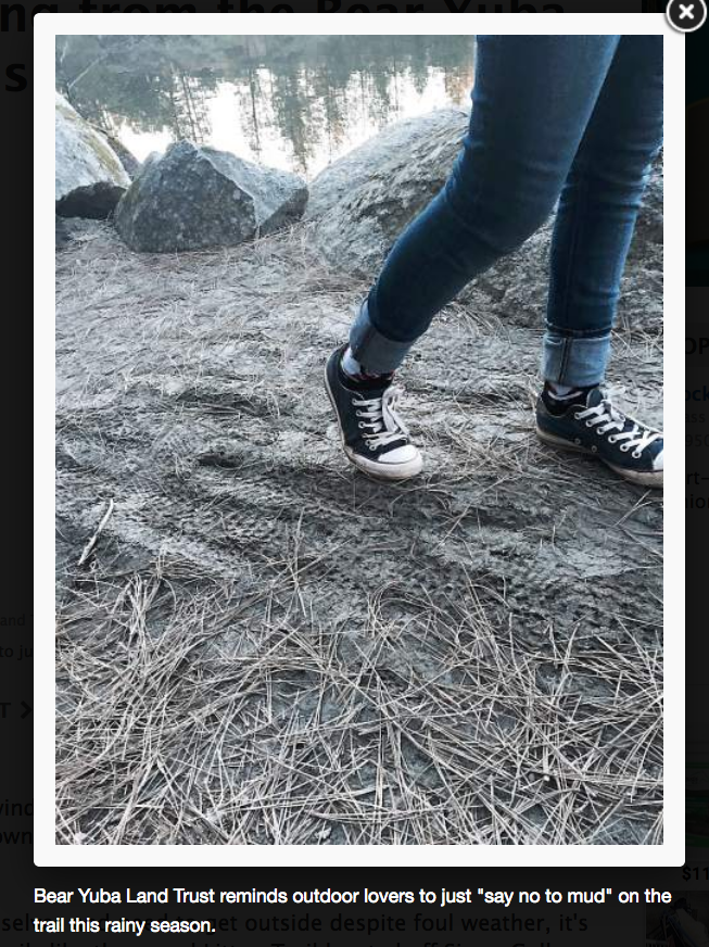
Winter storms in the Sierra Nevada foothills can leave local trails a mucky mess. To avoid trail widening, unnecessary erosion, soil damage, higher maintenance costs and labor demands, the trails crew at Bear Yuba Land Trust asks the community to be responsible trail users when the ground is water logged and muddy.

Bikes and horses can cause the most damage, but foot traffic is also destructive when the ground is wet.

"If people must go out, we want them to stay on the trails. Please avoid walking around puddles because it damages vegetation and creates trail widening," said Land Access Manager Shaun Clarke.

Clarke recommends hikers reschedule an outing when storms hit because windy conditions can be dangerous. Tree roots can lose their footing, rocks can tumble down slopes and high winds can break branches and topple trees.
For folks who just can't help themselves and need to get outside despite foul weather, it's recommended to use alternative trails like the paved Litton Trail located off Sierra College Drive.

Trails can take a week or two to dry out depending on the slope, elevation, and soil type. Look for south facing trails and trails at lower elevations that dry out more quickly. Water is the number one enemy of the trail. Bear Yuba Land Trust uses federal trail building standards designed to minimize water impacts and endure a beating.

"The idea is that if a trail is built right the first time then it won't need much maintenance if trail users follow the rules and stay on the trail," said Clarke.

More from MLT:
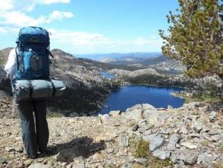
There are some excellent trails farther down the hill that dry out quicker than others, and can get you back in nature sooner:
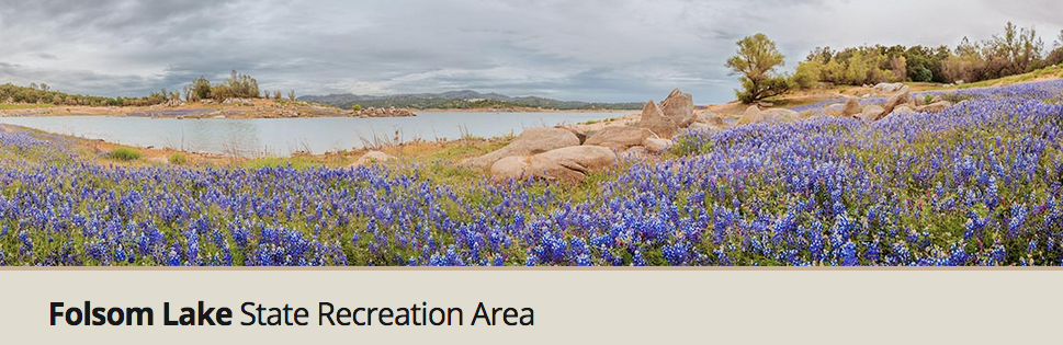
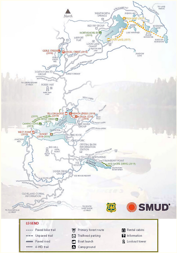
Folsom Lake SRA decomposed granite trails
Hidden Falls ranch roads
American River Parkway bike trail

To see the complete article in The Union newspaper, CLICK HERE.


Important new trail rules, bike speed limits, e-bike restrictions in Folsom Lake SRA

1/14/2018

 
Picture
Picture
Picture
Picture
Picture
This new order is a change in how Folsom Lake will enforce usage on its trails - essentially this brings FLSRA into line with the rest of the state recreation areas. From this point forward, all trails are open to hikers but closed to others unless the trail is signed as "open" to equestrians and/or bikes.
As for speed limits on bikes:
"No person shall operate a bicycle in such a way as to endanger hikers, equestrians or others using State Park property, or in such a way as to damage park resources. No person shall operate a bicycle within Folsom sector of the Gold Fields District at a greater speed than is reasonable and prudent, nor in any event in excess of 15 MPH. No person shall operate a bicycle in excess of 5 MPH when passing hikers or equestrians, or when approaching and negotiating a blind turn. Blind turn is defined as not being able to see oncoming traffic from a distance of 100 feet or less."
Also, "The use of Class 2 and Class 3 e-bikes are prohibited on all trails."
To see the original order on the Folsom SRA website, CLICK HERE.

Folsom SRA 2018 hours of operation for lands and facilities

1/14/2018

 
Picture
Picture
Operation hours for Folsom SRA, updated January 1, 2018. To see the original Order, CLICK HERE.

Folsom SRA nesting area closures Mississippi Bar, Anderson Island.

1/14/2018

 
Picture
Nesting area closures for Folsom Lake, to see original Order, CLICK HERE.

New Folsom SRA Order on Equestrian Use

1/14/2018

 
Picture
This new Order was signed by District Superintendent, Jason De Wall, and clarifies equestrian usage on roads, camps, beaches and trails. To see the original order on their webpage, CLICK HERE.
Picture

Conquer the Sierra: Register for Tahoe Rim Trail hikes

1/13/2018

 
Picture

With a new year comes a new lineup on the Tahoe Rim Trail with guided thru and segment hikes along the 170 mile rim of the Tahoe Basin, guided full moon snowshoe hikes, backcountry camps for youth, wilderness first aid training, panel discussions, snow camping and more. (Photo courtesy of the Tahoe Rim Association)

The Tahoe Rim Trail is a world-class long distance multi-use trail destination that attracts over 400,000 users every year. The Tahoe Rim Trail Association, in partnership with the US Forest Service and Nevada State Parks, built the trail that passes through California and Nevada, six counties, one state park, four National Forests, and three wilderness areas.

“The topography varies as it rises from the lakeshore and climbs gently through forests and meadows to ridges that tower over 8,000 feet. The trail offers solitude and disconnect from the world and a true backcountry experience but also provides the ease and access to the frontcountry,” said Justine Lentz, operations and marketing manager for Tahoe Rim Trail Association.

HIKING THROUGH TAHOE
 Lake Tahoe is the largest alpine lake in North America. In recent years, the demand to secure a spot for the guided hikes on the Tahoe Rim Trail has surged as the 165 Mile Club becomes more coveted. Space is limited to 22 hikers for weekly guided segment hikes and 24 hikers for the guided thru hike.Last year, the segment hike program sold out in 31 minutes and the thru hike program sold out in four minutes. Segment hikes total 11 guided day hikes throughout the season.
Potential applicants must fill out a medical and hiking experience questionnaire to ensure the physically demanding program is the right fit for them. The programs are designed for intermediate to experienced hikers who are ready to take things to the next level with assistance or don’t yet feel confident enough to go alone.

All participants are expected to hike an average of 2.5 miles an hour — upwards of 25 miles a day. Thru hikers will hike more than 170 miles in 14 days with significant altitude gain and upwards of 30 pounds in their pack. The highest peak on the trail is Relay Peak at 10,338 feet.
Investing in the expense of guided outings provides security for some — shuttle transportation, knowledge of the trail, food and water drops, and other logistics will be taken care of.
Participants are still required to carry their own gear, set up their tents and cook their meals. The bucket list trips have attracted people from as far away as Switzerland and Jamaica.
“Hiking around Lake Tahoe in its entirety is a quintessential Tahoe experience. Immersing yourself in nature with 14 like-minded people allows a hierarchy of connection unlike anything you’ve experienced during a typical vacation. The bonds and camaraderie that is formed is lasting,” said Lentz.
All the proceeds go back into protecting the trail and enhancing user experiences.
For those looking to tackle the Tahoe Rim Trail piece-by-piece, shorter distance guided day hikes are available each month featuring history, iconic landmarks, breathtaking views, and blooming wildflowers.
This June, Tahoe Rim Trail Association will host a Backpacking 101 course.
Learn more and register for hikes and outdoor skills classes at tahoerimtrail.org.

TO SEE THE COMPLETE ARTICLE AND PHOTOS BY LAURA PETERSON IN THE SIERRA SUN NEWSPAPER, CLICK HERE.

Crystal Basin Recreation Area Campground/Trails Renovations and Closures

1/12/2018

 
Picture
Eldorado Forest will be making improvements to recreation sites associated with the Sacramento Municipal Utility District’s Upper American River Project in El Dorado County. Campgrounds and facilities associated with the Sacramento Municipal Utility District’s Upper American River Project in El Dorado County will be undergoing renovations over the next few years. Many of these facilities will be upgraded and several new features added for your future enjoyment. The work will require some sites to be temporarily or completely closed during construction within the time frames below.
Schedule of improvements and temporary closures:
  • Schedule and Map (pdf)
2017
  • Loon Lake Boat Launch (after Labor Day)
  • New restrooms at Pleasant Campground
  • Upgrade trails between Loon Lake, Buck Island Reservoir and Rubicon Reservoir (open during renovations)
2018
  • Azalea Cove Campground (May – June)
  • Wench Creek Campground (May – June)
  • Angel Creek Day use area (July – August)
  • Gerle Creek Campground (after Labor Day)
  • West Point Boat Launch (after Labor Day)
  • Yellowjacket Boat Launch (after Labor Day)
  • Sunset Campground
2019
  • Sunset Campground continued.
  • Northshore RV Campground
  • North Union Valley Road 
  • Lakeshore Drive (Ice House northshore)
  • Camino Cove Campground 
  • Wolf Creek Campground 
  • Slab Creek Reservoir (Not on map)
  • Union Valley Bike Trail: Wench Creek to Yellowjacket Connector (open for use in 2020).
Notes
  • Closures are subject to change.
  • Please check with the U.S. Forest Service for updates.
This is the schedule as currently planned and will be subject to change as the project progresses. Please check our website for current information before making your trip plans. Information is available at fs.usda.gov/goto/enf/facilityrenovations or contact the Pacific Ranger District at (530) 644-2349.
To stay updated on forest related information visitors can follow us on Twitter at twitter.com/eldoradonf  and “Like” us on Facebook at facebook.com/EldoradoNF .

To see complete Eldorado Forest (USDA) press release CLICK HERE.


BLM day use fees in observance of Jan. 15, Martin Luther King, Jr. Day

1/11/2018

 
Picture
WASHINGTON – In order to increase recreational access to public land, the Bureau of Land Management will waive recreation-related fees for visitors to public lands on Martin Luther King, Jr. Day, January 15, 2018. 

"On Monday, to honor the legacy of Dr. Martin Luther King, Jr., the BLM invites families to spend the day together enjoying America's rich public lands heritage," said Brain Steed, BLM Deputy Director.  "Most of these lands are just a short drive from your community. Our fee-free days are a way to encourage our neighbors to enjoy a family outing while reflecting on the American values that have made America great."

Site-specific standard amenity and individual day-use fees at BLM-managed recreation sites and areas will be waived for the day.  Other fees, such as overnight camping, cabin rentals, group day use and use of special areas, will remain in effect.
BLM-managed public lands offer more recreational opportunities than any other federal agency, including camping, hunting, fishing and horseback riding, to boating, whitewater rafting, off-highway vehicle driving and many more activities.  About 67 million visits are made annually to BLM-managed lands and waters, supporting more than 48,000 jobs nationwide and contributing almost $7 billion to the country’s economy.

The BLM will waive recreation-related fees for visitors to public lands on four additional occasions this year— Presidents Day (February 19), National Get Outdoors Day (June 9), National Public Lands Day (September 22) and Veterans Day (November 11).

CLICK for more information on the BLM website.


Jan. 8 is the last day for public comments on Auburn State Recreation Area trails and future

1/7/2018

 
Picture
For all information regarding the General Plan, visit the California State Parks website for ASRA:
http://www.parks.ca.gov/?page_id=24325
Auburn State Recreation Area (ASRA) is comprised of about 30,000 acres with forty miles of river canyon along the North and Middle Forks of the American River. California State Parks is collaborating with the U.S. Bureau of Reclamation (Reclamation) to prepare a joint General Plan/Resource Management Plan (GP/RMP) for ASRA. California State Parks manages ASRA through a Managing Partner Agreement (MPA) with Reclamation.

You can still write public comments about Auburn SRA General Plan/Resource Management Plan the  and submit to:

Cheryl Essex
Northern Service Center Project Lead

One Capitol Mall, Suite 410
Sacramento, CA 95814
plan.general@parks.ca.gov
916-445-8814

Gold Fields District Superintendent
7806 Folsom Auburn Road
Folsom, CA 95630

Mike Howard, Auburn Sector Superintendent
501 El Dorado
Auburn, CA 95604
530-885-4527

Jim Micheaels
Gold Fields District Project Lead

California State Parks
Gold Fields District
7806 Folsom-Auburn Road
Folsom, CA 95630

HELP PLAN THE FUTURE OF AUBURN STATE RECREATION AREA!
SIGN UP FOR ASRA PLANNING NEWS BY SENDING YOUR NAME AND EMAIL ADDRESS TO: PLAN.GENERAL@PARKS.CA.GOV

LOTSA INFORMATION BELOW!

Even if you missed the meetings, you can still submit your planning comments online through January 8, 2018, here:
Online Alternatives Questionnaire
Estimate to complete is about 30 minutes. 
OR COMMENTS SUBMITTED VIA POST:
Cheryl Essex
Northern Service Center Project Lead

ASRA General Plan/Resource Management Plan (GP/RMP) COMMENTS
One Capitol Mall, Suite 410
Sacramento, CA 95814

Alternatives and CEQA Scoping Open House Documents
  • Newsletter - English
  • Newsletter - Spanish
  • Draft Unit Purpose and Vision, Land Use Designation and Alternative Theme Summary
  • Alternative Maps -
    • No Action Alternative,
    • Resource Management Emphasis,
    • Increased Recreation and Resource Management,
    • Recreation Emphasis
  • Key Proposed Actions and Guidelines for Each Alternative
  • Notice of Preparation. Environmental review scoping comments will be accepted through January 5, 2018.
  • Fact Sheets -- 
    • Boundary Corrections
    • Whitewater Management Program

Overview
Auburn State Recreation Area (ASRA) is comprised of about 30,000 acres with forty miles of river canyon along the North and Middle Forks of the American River . California State Parks is collaborating with the U.S. Bureau of Reclamation (Reclamation) to prepare a joint General Plan/Resource Management Plan (GP/RMP) for ASRA. California State Parks manages ASRA through a Managing Partner Agreement (MPA) with Reclamation.

Why a General Plan/Resource Management Plan is important

The GP/RMP will define a long term vision for the park unit, provide guidelines for the protection and management of natural and cultural resources, determine management of many recreation activities which will occur here, and identify any additional facility improvements. An Environmental Impact Report/Environmental Impact Statement (EIR/EIS) will be prepared as part of this project, to describe potential GP/RMP environmental effects.

The GP/RMP is a programmatic document that will outline broad goals and guidelines for management of Auburn SRA and will provide the basis for developing future focused management plans, specific project plans, and other proposals which implement the GP/RMP goals. However, the GP/RMP will not define detailed methods, plans or designs for fulfilling these goals.

How to get involved in the planning process
If you would like to be kept updated on public workshops and plan development, please submit your name and email address to Plan.General@parks.ca.gov. As allowed by law, email addresses will be kept confidential and only used in connection with ASRA issues, but your name and your comments will become public information.

Public participation schedule

If you would like to be added to the mailing list to receive notification of future workshops and planning updates, please contact Project Lead Cheryl Essex at plan.general@parks.ca.gov or 916-445-8814. If you need special accommodations to participate effectively, please contact Cheryl at least 48 hours in advance.
Picture
Meeting Documents

Meeting # 1
November 12, 2015 at Skyridge Elementary School in Auburn

ASRA GP/RMP Newsletter #1. November 2015.

Powerpoint Presentation
Recreation Activities and Facilities Map 1
Recreation Activities and Facilities Map 2
Recreation Activities and Facilities Map 3
Recreation Activities and Facilities Map 4
Public Comments submitted as of December 1, 2015

Environmental Notices

Notice of Preparation
Notice of Intent (Coming soon)

Past Planning
The existing planning document that provides guidance for the management of ASRA is a AUBURN SRA INTERIM RESOURCE MANAGEMENT PLAN 1992. This plan is outdated and does not adequately address the current types and levels of use at ASRA and other management needs. In recognition of the need for a new guidance document for ASRA, from 2005-2008 State Parks and Reclamation initiated a process to develop a new GP/RMP. Several public workshops and stakeholder meeting were held. This planning process was suspended in 2010 due to the uncertainty regarding the future management of ASRA. In 2012 Reclamation and State Parks entered into a new 25-year MPA for the federal lands at both ASRA and Folsom Lake SRA. With the future management of public use and recreation secured through the MPA, the two agencies both want to re-initiate a process to complete the GP/RMP. While this current process is not dependent on the documents or information developed in the 2005-2008 planning, that information will be used to help inform the current planning effort.

CONTACTS FOR FURTHER INFORMATION:
Gold Fields District Superintendent
7806 Folsom Auburn Road
Folsom, CA 95630

Mike Howard, Auburn Sector SuperintendenT
501 El Dorado
Auburn, CA 95604
530-885-4527

Cheryl Essex
Northern Service Center Project Lead

One Capitol Mall, Suite 410
Sacramento, CA 95814
plan.general@parks.ca.gov
916-445-8814

Jim Micheaels
Gold Fields District Project Lead

California State Parks
Gold Fields District
7806 Folsom-Auburn Road
Folsom, CA 95630


Other Relevant Documents
Park web page

    Archives

    January 2023
    December 2022
    November 2022
    October 2022
    September 2022
    August 2022
    July 2022
    June 2022
    May 2022
    April 2022
    March 2022
    February 2022
    January 2022
    December 2021
    November 2021
    October 2021
    September 2021
    August 2021
    July 2021
    June 2021
    May 2021
    April 2021
    March 2021
    February 2021
    January 2021
    December 2020
    November 2020
    October 2020
    September 2020
    August 2020
    July 2020
    June 2020
    May 2020
    April 2020
    March 2020
    February 2020
    January 2020
    December 2019
    November 2019
    October 2019
    September 2019
    August 2019
    July 2019
    June 2019
    May 2019
    April 2019
    March 2019
    February 2019
    January 2019
    December 2018
    November 2018
    October 2018
    September 2018
    August 2018
    July 2018
    June 2018
    May 2018
    April 2018
    March 2018
    February 2018
    January 2018
    December 2017
    November 2017
    October 2017
    September 2017
    August 2017
    July 2017
    June 2017
    May 2017
    April 2017
    March 2017
    February 2017
    January 2017
    December 2016
    November 2016
    October 2016
    September 2016
    August 2016
    July 2016
    June 2016
    May 2016
    April 2016
    March 2016
    February 2016
    January 2016
    December 2015
    November 2015
    October 2015
    September 2015
    August 2015
    July 2015

    Categories

    All

    RSS Feed

Home
Contact
 Mother Lode Trails is YOUR local volunteer-run trail information and resource website. Here you can find
up-to-the minute information on trail alerts, links and trail news for Placer,  Yuba, and Nevada counties.
Mother Lode Trails is trademarked.