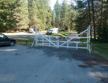
 California State Parks Ranger Greg Sherr advises us that Penn Gate staging parking areas at Empire Mine SHP will be closed February 14 for tree felling. A combination of PGE subcontractors (Utility Tree Service, ArborWorks and ArborMetrics) will finally fall the two dead pines next to Penn Gate parking lot Tuesday, February 14th.
It appears there may be a break in the weather on that day in order for them to safely do this work. This will necessitate the full closure of the parking lot including the equestrian lot for safety reasons and to allow the contractors' vehicles and equipment to stage there. 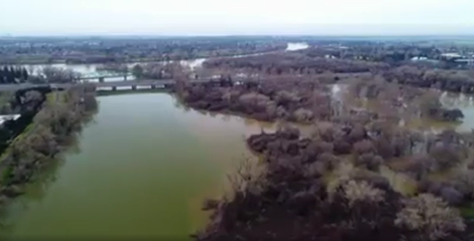 As runoff gushes into Folsom and Shasta lakes, officials have increased flows down the American and Sacramento rivers, prompting safety warnings for those using the waterways for recreation. As of 10 a.m. Thursday, the amount of water from Folsom Dam was at 70,000 cubic feet of water per second, according to the bureau. That’s the highest rate of water released this season, based on state data. High river levels prompted the closure Thursday of all American River Parkway vehicle access points, according to county spokeswoman Kim Nava. Pedestrian access points will close Friday as well, and it remains to be seen when they will reopen. “People recreating in or along the lower American River downstream of Folsom Dam to the confluence of the American and Sacramento rivers can expect river levels to increase and should take appropriate safety precautions,” the U.S. Bureau of Reclamation said in a news release. In about two days, Folsom lake level has climbed 230,000 acre feet. Folsom Lake, with a capacity of 977,000 acre feet, was around 696,000 acre feet Thursday morning. A strong storm on Thursday was expected to drop an inch or two of rain in Sacramento and perhaps four inches in the foothills. The warm nature of the storm has resulted in heavy runoff from the Sierra. While 70,000 cfs was going out of Folsom Lake on Thursday, 114,000 was flowing into the reservoir. The American River is expected to reach depths of 37.6 feet at the H Street Bridge – the highest it has been since the floods of 1997. It will remain about four feet below flood stage. Several access points along the swollen American River are closed. Discovery Park is flooded. Water releases are also increasing on the Sacramento River. The bureau said water from Shasta Lake into the Sacramento River would go up incrementally through the weekend. Releases are expected to reach 50,000 cfs on Friday, 60,000 cfs on Saturday and 70,000 cfs on Sunday. The releases are needed to meet flood space regulations in Shasta Lake. Shasta Lake is 10 miles north of Redding. Those downriver should prepare for increased flows. Due to increased releases, the Sacramento River will rise even higher than it did following storms last month. It is expected to reach depths Thursday at Tower Bridge of 30.4 feet – the same depth as in the floods of 1997, state and federal figures show. The river will still be about three feet below flood stage at the Tower Bridge. Lake Oroville added about 200,000 acre-feet of water in the 24 hours before 11 a.m. Thursday. The lake sat about 20 feet below the level where it reaches an emergency spillway at 11 a.m., and it was gaining about a foot of depth every two hours, state figures show. Meanwhile, close to Sacramento, gates on the Sacramento Weir were reopened at 11 p.m. Wednesday. As of 11:06 a.m. Thursday, 25 gates were opened, according to the California Department of Water Resources. The Sacramento Weir is the only manually operated weir on the Sacramento River system. The 1,920-foot-long Sacramento Weir consists of 48 gates that must be opened with a long hooked pole. After a deluge of heavy rains, crews on Jan. 10 lifted the gates on the flood release structure near downtown Sacramento. It was the first time since 2006 that the river rose high enough to open the structure. The weir gates were then closed after the area dried out some, before reopening again with the oncoming storm expected Thursday. The weir acts as a flood-release valve to flush excess water from the Sacramento River system into the Yolo Bypass floodplain, keeping Sacramento and towns along the river from getting swamped. CLICK HERE to read complete story and see video and photos in the Sacramento Bee newspaper. 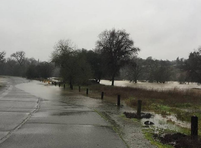 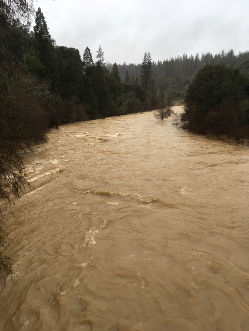 Rain soaked trails usually pose little danger to trail users, but this winter that has changed. The amount of rain has caused sinkholes, slides, downed trees, erosion and high creek crossings that have made almost all the trails in our area not suitable for use. Some are downright dangerous. This photo shows the Bear River yesterday - the trail normally on the right is completely under water. All the rivers and creeks are at or above their banks and running so high and swift that governmental land managers have warned the public to stay away. Do not bike or ride horses on any trails until they are dried out or damage caused on fragile trails could close them. Hikers can get out between the rains, but realize that trees are down, some trail beds are destroyed and the trails may be not passable. 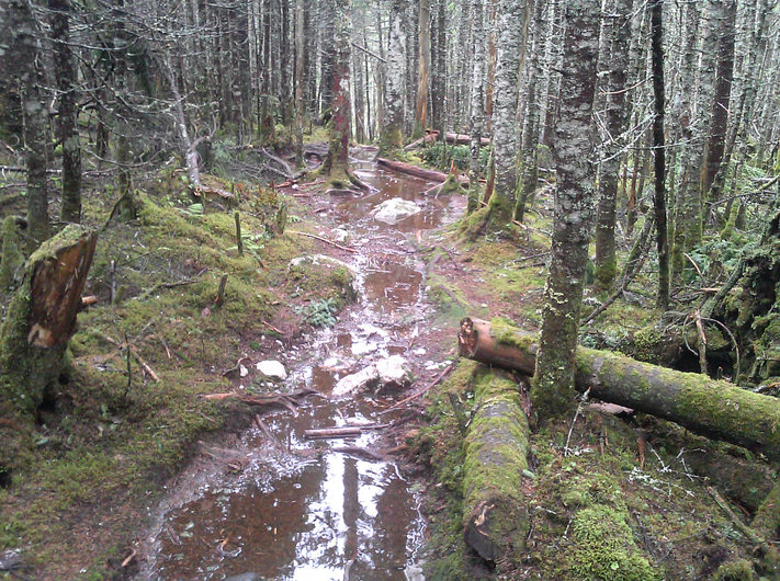 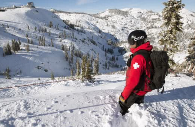 Avalanche Advisory published on February 9, 2017 @ 7:00 am
This advisory is valid for 24 hours Issued by Andy Anderson - Tahoe National Forest The avalanche danger will rise to CONSIDERABLE today at all elevations as hurricane force winds and heavy precipitation impact the region. Human triggered wind slab avalanches and wet loose avalanches will become likely today. As snow levels lower this afternoon and evening, wind slabs will become more widespread and larger and loose wet snow instabilities will become smaller and more isolated. Natural avalanches will become possible this afternoon and during the night as more snow accumulates. Another storm has arrived over the region with hurricane force southwest winds along the Sierra Crest. The winds will become stronger and more widespread today as this storm builds. Even winds at lower elevations could reach into the 40 to 60 mph range with gusts to 100 mph. At the upper elevations expect to see sustained wind speeds in the 60 to 80 mph range with gusts to145 mph. Winds should start to decrease some after midnight and into tomorrow. Rain and snow will increase over the region today with periods of heavy precipitation from midday onward. Most of today's precipitation should fall as 1 to 2 inches of rain below 8000 ft. due to snow levels that remain between 8000 and 8500 ft. for much of the day. Temperatures should start to cool this afternoon and evening and the forecast calls for snow levels to drop to around 7000 ft. tonight allowing for 6 to 12 inches of snow to accumulate. By tomorrow this storm should start to wind down and colder air should push into the region. Expect another 3 to 6 inches of snow tomorrow with snow levels at or below Lake Level. DisclaimerThis avalanche advisory is provided through a partnership between the Tahoe National Forest and the Sierra Avalanche Center. This advisory covers the Central Sierra Nevada Mountains between Yuba Pass on the north and Ebbetts Pass on the south. Click here for a map of the forecast area. This advisory applies only to backcountry areas outside established ski area boundaries. This advisory describes general avalanche conditions and local variations always occur. This advisory expires 24 hours after the posted time unless otherwise noted. The information in this advisory is provided by the USDA Forest Service who is solely responsible for its content. For a recorded version of the Avalanche Advisory call (530) 587-3558 x258 Closure of the Old 49’er Bridge State Park and Independence Trail due to massive slide activity2/7/2017
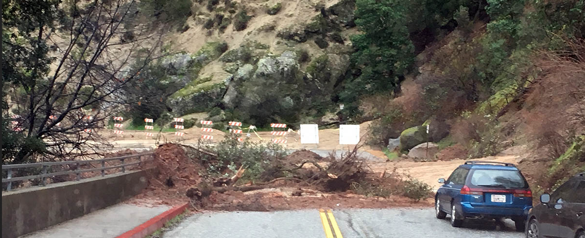 Access to the old 49’er bridge and the parking lot adjacent to the State Park is now closed to all vehicles and pedestrians.
Several landslides from previous storms have started to move again and a new massive slide is blocking the access road. State Park Chief Ranger Matt Green has issued the closure order for the area and stated that anyone found in the area is subject to a fine of up to $1,000 – but most importantly they put their life at risk. “The area is highly unstable and we expect further slides,” Green said. Access to the river is impossible and the very high flows – carrying trees and huge boulders – present a hazard situation. The eastern portion of the Independence Trail is affected by one of the slides as well. Green has State Park personnel out there now assessing the extent of the damage. At the latest report, the Trail will be closed as it is compromised by the slide. The short break in weather will be used to work with Caltrans and other cooperators to clear the existing slides and assess the weakened slopes, Green stated. From Bear Yuba Land Trust website: Independence Trail West NOTE: Rush Creek Ramp is UNSAFE and CLOSED." Independence Trail East NOTE: Closed indefinitely due to landslides, fallen trees and infrastructure damages. For your own safety, stay away from the bridge, river and trails at this time. Photo courtesy Boyd Johnson, NSJFD CLICK HERE for complete information and photos at Yubanet.net  Quincy, CA – February 3, 2017 – A section of the Wyandotte Campground in the Plumas National Forest is temporarily closed to protect a bald eagle nesting territory in the vicinity of Little Grass Valley Reservoir, 50 miles northeast of Oroville in Plumas County. The remainder of the campground and other nearby campgrounds are not affected by this closure.
The temporary closure has been enacted for the past 18 years and has helped a bald eagle pair to successfully nest and raise young, contributing to the sustained recovery for this species. Bald eagles are particularly sensitive to disturbances during their nesting phase. The closure area includes the north loops of the Wyandotte Campground (accessed by Forest Service roads #22N57YA & B), on the southern section of the reservoir. The closure is in effect until August 31, 2017. For more information, please contact the Feather River Ranger District, (530) 532-7467 and go to the forest website at: www.fs.usda.gov/plumas for the corresponding Forest Order (11-17-01) and map. |
Archives
April 2024
Categories |
 RSS Feed